New Energy & Minerals Interactive Web Applications
by Gabriela St. Pierre and Christian Hardwick
The western U.S. holds vast untapped energy and mineral potential. The availability of high-quality, centralized data is fundamental to reducing (“de-risking”) the financial and technical obstacles that industry currently faces regarding energy and minerals development. Development of these resources could be greatly enhanced by the consolidation of geological, geophysical, and geochemical datasets currently scattered across various state agencies, private companies, and universities in inconsistent formats. Integrating and standardizing formats of diverse geologic datasets ensures that different computer systems and applications can securely and accurately exchange data with minimal intervention. This interoperability enables seamless data integration and mapping, and facilitates understanding the complex geological controls on energy and mineral systems that can be regional in scope, in some cases spanning state boundaries.
The Utah Geological Survey (UGS) has invested in upgrading our data infrastructure to accelerate energy and mineral development across Utah by addressing this critical barrier of fragmented and inaccessible data. Taking advantage of technological advancements, many UGS web applications, like the ones highlighted in this article, have been upgraded to load faster, accommodate more data, integrate batch downloading, and implement new custom tools. These upgrades increase the accessibility of geologic datasets, enabling UGS staff and external users to spend more time exploring energy and mineral resources. Check out the full library of UGS interactive maps and web applications.
The Carbon Storage Portal is a tool for the public, scientists, and industry professionals that integrates over 20 years of carbon storage studies, which can inform a wide range of subsurface exploration and research. The application provides access to geologic and spatial data and technical evaluations to support site selection, prospective subsurface storage assessments, and project planning. The interactive visualization is intended to assist stakeholders in evaluating geologic carbon storage options and make informed decisions based on current information. The application includes tools for complex search functions and filtering of subsurface data, allowing the user to display geophysical log information, available cores and cuttings from the Utah Core Research Center, and a new dataset of reservoir characteristics (e.g., porosity, permeability, and salinity). For example, users can search the statewide wells database by unique identifiers, filter by cores/cuttings availability, and select specific geologic formations. Additional supporting layers include geological information such as surface geology and the location of faults, infrastructure information such as pipelines and transmission lines, and sensitive land use areas that might be “off limits” for carbon storage.
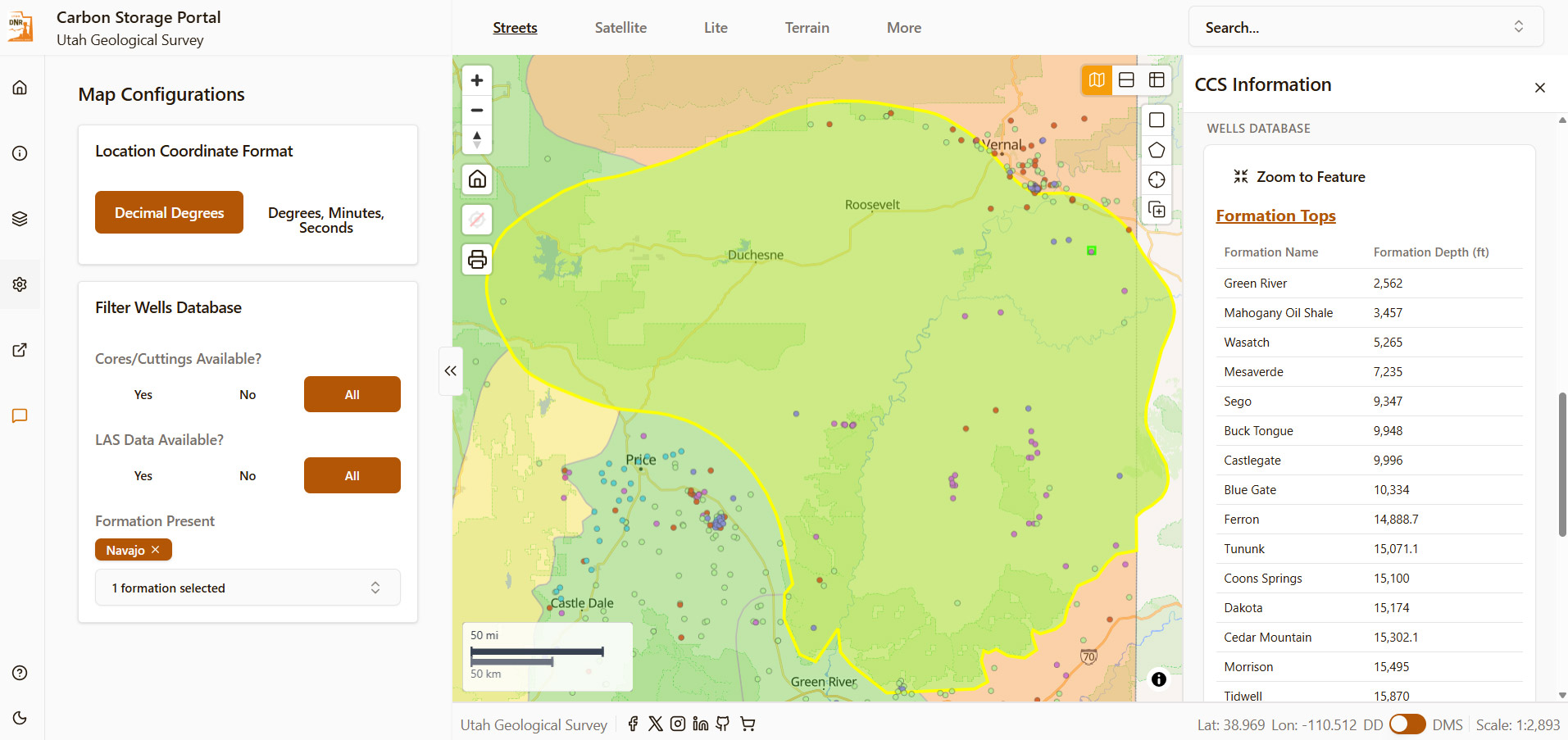
Screenshot of the Carbon Storage Portal web application showing key data layers filtered by wells that have the Nugget/Navajo Sandstone, digital log files, and core/cuttings availability over the Uinta Basin. The web app has filtering options on the left, and highlights descriptions of selected data layers on the right, including depths of formations from a single well.
The Carbon Storage Portal, funded by the Department of Energy in 2024, includes new assessments of the geologic carbon storage potential across the state of Utah. These new studies were completed at the statewide level, as well as smaller geologic regions (e.g., San Rafael Swell, Uinta Basin), and include injection cost estimates per ton of CO2 and potential CO2 storage resource estimates. Within the application, these regional and statewide studies highlight essential subsurface data available for wide-ranging exploration, providing a useful digital resource for those interested in exploring Utah’s subsurface landscape.
The Geothermal and Geophysical Data Portal web application serves as a comprehensive digital resource for the public, scientists, and industry professionals exploring Utah’s geothermal and geophysical datasets. By providing centralized access to a wide array of spatial data and technical resources, this interactive web application supports informed decision-making, facilitates resource characterization and development, and facilitates both current and future research initiatives. Funding for this project, which aggregates subsurface exploration data to evaluate new geothermal potential, was provided via the state of Utah’s “Operation Gigawatt” initiative.
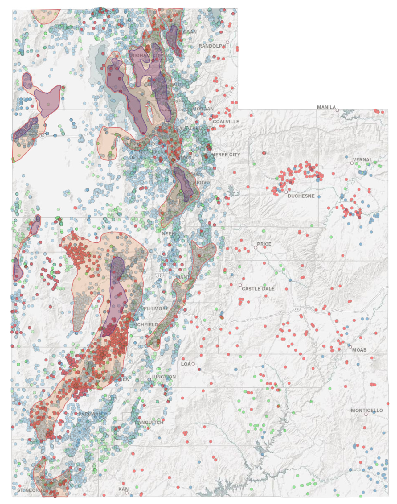
Screenshot of the Geothermal and Geophysical Data Portal showing an example of spatial coverage of data in Utah.
The data is organized into several key thematic categories, beginning with extensive geophysical measurements curated by the UGS. Users can access modern and legacy gravity station data, including complete Bouguer gravity anomalies that highlight subsurface density variations. Furthermore, the web application provides specialized electromagnetic data, such as transient electromagnetics and magnetotelluric data, which measure electrical conductivity at various depths to infer subsurface structures. These datasets are essential for identifying the structural architecture required to host viable geothermal systems.
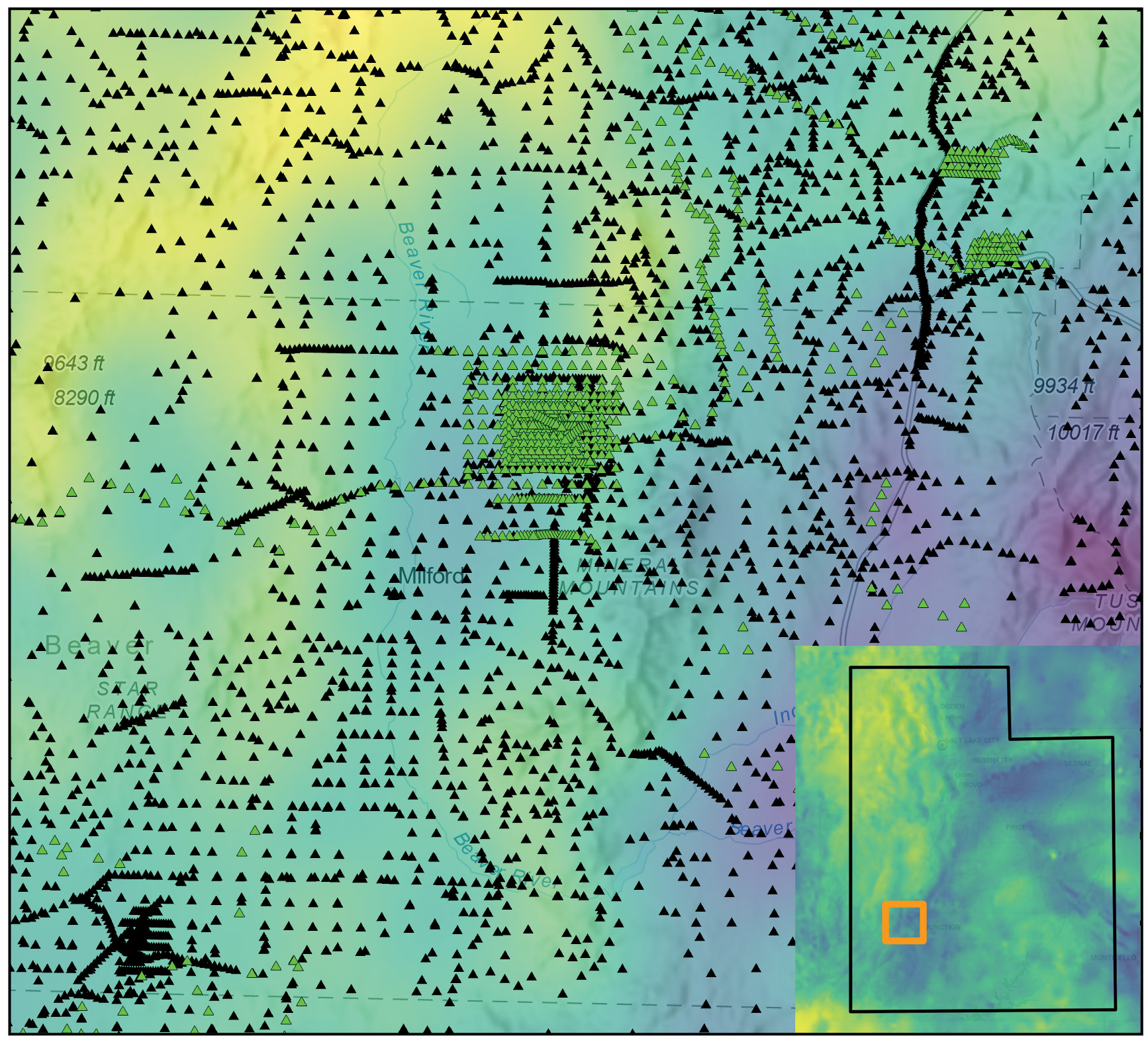
Statewide gravity anomaly data overlain by modern and legacy gravity stations in central Utah from the Geophysical and Geothermal Data Portal.
In addition to raw geophysics, the application highlights specific geothermal indicators and resource areas across the state. This includes data on existing geothermal uses ranging from power plants to aquaculture and detailed inventories of geothermal wells and springs. The application also maps critical indicators like heat flow and identifies deep sedimentary basins where thick sediment acts as an “insulating blanket” over elevated subsurface temperatures. By combining these factors with geological information, such as Quaternary-age fault locations and land ownership data, the application outlines potential resource areas with a high probability for successful geothermal development. In providing these applications, the UGS is creating readily accessible information to expand Utah’s energy portfolio.