Landslide Current Events

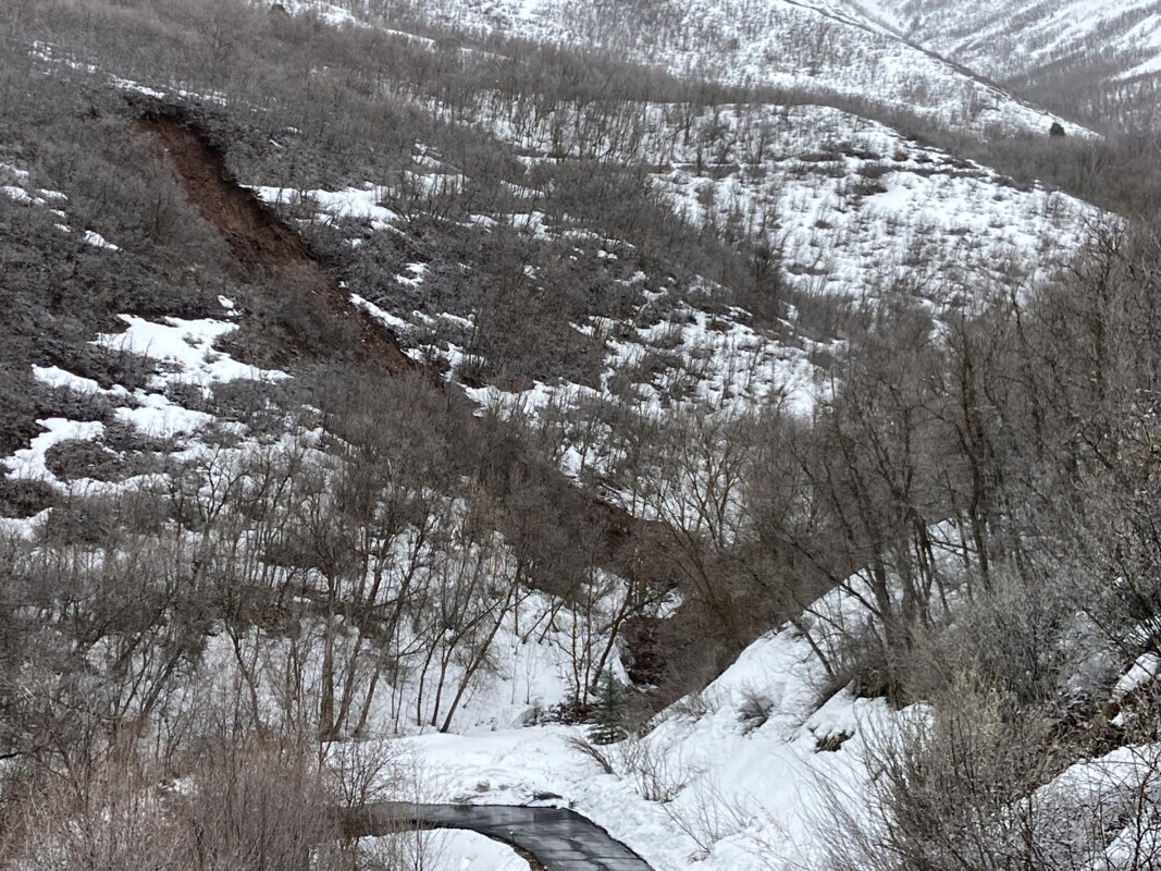
2023 Pioneer Gulch Landslide, Emigration Canyon, Salt Lake County, Utah. Photographer: Leon Berrett, Salt Lake County Public Works
In Utah, most landslides move slowly, but some move quickly with devastating results. Landslides can be naturally occurring or human-caused. Landslides can result from a rise in groundwater levels caused by increased precipitation, rapid snowmelt, or by human causes, such as excessive landscape irrigation or leakage from reservoirs, ponds, pipelines, etc.
This year, record snowfall and a relatively fast-melting snowpack has increased the possibility of landslide occurrence throughout Utah in landslide-prone areas. As of June 2023, more than 200 landslides have been inventoried by the UGS Hazards Program. This page is dedicated to providing updated geologic information on highlighted landslide events in Utah which include landslides that caused significant or imminent damages to homes, infrastructure, people, or bodies of water, and non-destructive landslides that are large-scale and noteworthy based on the area’s geologic history. Information is subject to update as landslide conditions change and more information becomes available. For emergencies, see emergency information and resources below.
Landslide Current Events
Select an event for more details.
When a Landslide Occurs, What is the Role of the UGS?
The UGS Geologic Hazards Program is non-regulatory and provides support to those impacted by geologic hazards, including landslides. Support includes assisting concerned homeowners, landowners, and city and county officials by providing information on the hazard. Additionally, the UGS performs periodic reconnaissance or monitoring at approximately 100 landslide locations across the state. Once snow melts and landslides become accessible, our geologists use a variety of tools, including stakes and GPS instruments to monitor movement, historical aerial photos that show what the site has looked like over time, and other methods.
After an event, the UGS is often contacted by affected landowners or local government officials to provide relevant geologic information on the hazard. Our response may involve a site visit to document the hazard and its impact to the surrounding area. We may also provide scientific recommendations and assist in working to a solution.
In addition, UGS geologists respond to geologic-related emergency events by assisting the Utah Division of Emergency Management and other local, state, and federal government agencies and emergency responders to provide clear, unbiased scientific information related to the initial safety of the site, how to potentially deal with the hazard, and future land use and management issues.
In addition, UGS geologists respond to geologic-related emergency events by assisting the Utah Division of Emergency Management and other local, state, and federal government agencies and emergency responders to provide clear, unbiased scientific information related to the initial safety of the site, how to potentially deal with the hazard, and future land use and management issues.
Emergency Information – Know the Signs!
Landslides generally happen in areas where they have occurred in the historical or geological past. You may be able to learn about your area’s risk by checking available landslide hazard and susceptibility maps in the UGS’ Utah Geologic Hazards Portal.
KNOW THE SIGNS:
- Cracks in soil
- Tilted or bent trees
- Increased spring activity or newly wet ground
- Recently distorted, lumpy, or uneven terrain
- Sagging or taut utility lines
- Sunken or broken road beds
- Movement of soil away from foundations
- Leaking or broken water pipes
- The presence of a previous landslide is one of the biggest and most obvious risk factors.
Landslide in Cedar Highlands Subdivision, 2019
Emergency Information and Resources
If you suspect active landslide movement, evacuate and contact your local fire, police, emergency manager, or public works department. If conditions pose an immediate threat to life or limb, call 9-1-1.
Preparedness information for various hazards can be found at Be Ready Utah.
2023 Landslide Gallery
View photos of Utah’s recent landslides! Photos are from ground and air reconnaissance conducted by Utah Geological Survey geologists.
View more photos and videos of 2023 landslides in the GeoData Archive System.


