Community Velocity Model (CVM) and Other Geophysical Data
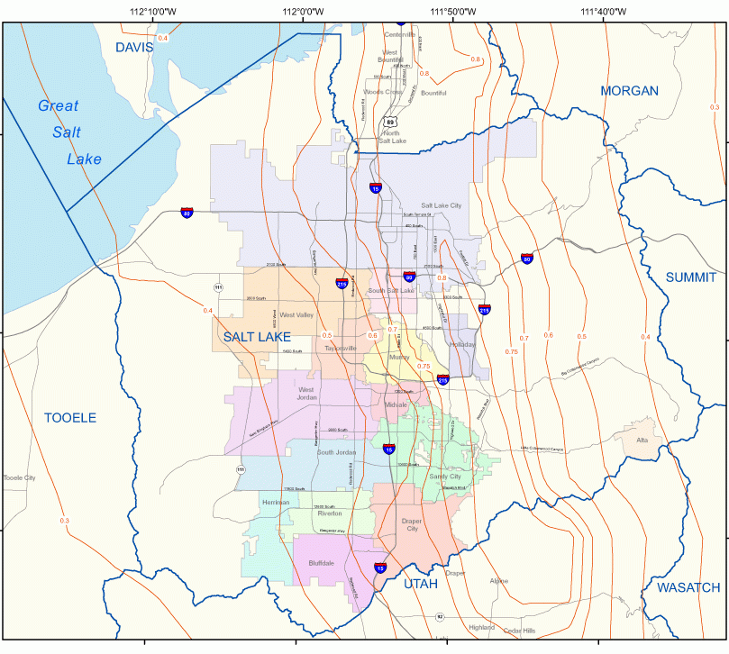
The Utah Geological Survey (UGS) and U.S. Geological Survey (USGS) have a cooperative agreement to study earthquake hazards in Utah with an ultimate goal of producing detailed earthquake hazards maps. This goal includes large-scale ground-shaking maps along the densely populated Wasatch Front urban corridor.
An important component of the ground-shaking maps is developing a three-dimensional model of the subsurface, a Wasatch Front Community Velocity Model (CVM), that incorporates shallow shear-wave velocity (Vs), deep-basin structure, and other effects. To aid in producing these maps, the UGS has compiled well logs, databases of Vs, and deep-basin geophysical data.
Geophysical Data Donations
The UGS accepts geophysical data donations, including deep borehole logs, geophysical data, and shear-wave profiles, that may be included in our databases and used for future updates to site-conditions maps and the CVM. The data are made available to, and intended to benefit, the geotechnical community and the general public. For additional information or to submit data, contact Greg McDonald at 801-537-3383, email: gregmcdonald@utah.gov.
Community Velocity Model (CVM)
A three-dimensional Community Velocity Model (CVM) was developed to provide a framework for simulating ground motion expected during an earthquake on the highly urbanized part of the Wasatch fault zone. The CVM provides researchers a unified subsurface velocity model to simulate effects including strong motion, seismicity location, and tomographic velocity. Elements that populate the CVM include: soil classes, basin geometry, basin-sediment interfaces, crustal tomography, and the Moho.
The Wasatch Front CVM was developed by Harold Magistrale of San Diego State University and is based on earlier models developed by the Southern California Earthquake Center (SCEC). The CVM is periodically updated as more data become available and as additional analyses of existing data allow improvement to model elements. Important in refining the CVM are geophysical and borehole data that enhance our understanding of basin structure and velocities of various soil and rock types.
Presently, the CVM includes Cache, Weber/Davis, Salt Lake, and Utah basins. Future versions will expand the CVM to Tooele and Rush Valleys, Great Salt Lake Basin west of Antelope Island, and Wasatch Range back valleys.
The downloadable CVM version 3d includes Fortran 77 code with associated files that must be compiled (using a Fortran compiler on the users specific computer platform) and run locally. The CVM has been successfully compiled in Windows, using the g95 complier and MinGW. Input files must include latitude, longitude, and depth. The model returns Vp, Vs, and density for each input location.
While the Utah Geological Survey (UGS) provides the CVM to the public, the UGS does not provide support related to the CVM. Support related questions should be forwarded to Harold Magistrale, email harold.magistrale@fmglobal.com.
References
Magistrale, H, Olsen, KB, Pechmann, JC (2008) Construction and verification of a Wasatch front community velocity model. Technical report no. HQGR.060012, 14 pp. Reston, VA: US Geological Survey.

Shallow Shear-Wave-Velocity Data
The shear-wave-velocity (Vs) database was originally compiled for the site-response map of Salt Lake Valley (Ashland and Rollins, 1999) and later updated for the shear-wave-velocity/site-conditions map of the Wasatch Front urban corridor (McDonald and Ashland, 2008).
Mean Vs calculated for the upper 30 m (Vs30) of a profile is used to define soil site classes by the International Building Code (IBC). We expanded the Vs30 database beyond Salt Lake County to include data along the rest of the Wasatch Front, although data outside Salt Lake County are sparse.
The database includes shear-wave-velocity measurements only to depths of 30 meters or greater, measured directly using downhole, cone penetrometer (CPT), and Rayleigh-wave inversion/SASW (spectral analysis of surface waves) methods. No data shallower than 30 meters, standard-penetration tests (SPT), or undrained shear-strength conversions are included. A database summary table includes Vs30 values calculated using Equation 16-40 in the 2006 IBC.
The summary table of the database is downloadable as an Excel spreadsheet that contains general location and source information as well as Vs30, engineering-geologic unit, and IBC site-class information keyed to the McDonald and Ashland (2008) site-conditions map.
In many cases, location coordinates are not precise and may represent a general site locality rather than individual test locations. Shear-wave-velocity data for individual tests are available as downloadable scans in Adobe PDF format of graphic and/or tabulated logs and supplemental information, including lithologic logs and geotechnical laboratory testing data where available.
References
Ashland, F.X., and Rollins, K., 1999, Seismic zonation using geotechnical site-response mapping, Salt Lake Valley, Utah: Unpublished Final Technical Report to the U.S. Geological Survey, NEHRP Contract No. 1434-HQ-97-GR-03126, 31 p.
McDonald, G.N., and Ashland, F.X., 2008, Earthquake site conditions in the Wasatch Front urban corridor, Utah: Utah Geological Survey Special Study 125, 1 pl. scale 1:50,000, 41 p., CD.
Deep-Basin-Structure Data
The deep-basin-structure database includes selected logs of deep-water wells and oil and gas/geothermal exploration boreholes, and deep seismic reflection and refraction sections. We included only logs of boreholes and wells that encountered bedrock or are near wells that encountered bedrock in Wasatch Front valleys from Weber County, south to Utah County. Two good-quality lithologic logs west of Brigham City in Box Elder County are included, although no other logs for that area have been compiled yet. Deep geophysical data consist mostly of publicly available oil exploration seismic sections and are limited to Salt Lake Valley, Great Salt Lake, and the eastern shore area of Great Salt Lake.
The deep-basin well data are summarized in an Excel spreadsheet that contains general location, source, and depth information. Individual logs are available as Adobe PDF format scans of delimited text files or graphic logs. The data were plotted from coordinates or figures in referenced reports, and in many cases locations are not precise and are limited by original map scales. Most of the water-well locations were supplied by the Utah Division of Water Rights (UDWR) as a GIS shapefile. The locations are not precise and have not been verified. In many cases, location coordinates may represent a general site locality rather than individual test locations.
For Salt Lake Valley, borehole and well logs are from a variety of sources, including data compiled by Radkins (1990) for Salt Lake County; logs from Case (1985); logs from various deeper geothermal, oil, and gas exploration wells (Murphy and Gwynn, 1979a, 1979b; Glenn and others, 1980; Davis and Cook, 1983; Meiiji Resource Consultants, 1983); and data from USGS and Utah Department of Natural Resources basic-data reports (Feth and others, 1966). Many logs from these sources are from the UDWR well-drilling database. Outside of Salt Lake Valley, the wells were selected mainly from the UDWR database and include only those that encountered bedrock or are near those that encountered bedrock, and deep wells in areas where few data exist.
Seismic reflection/refraction data from published references are few and limited to surveys performed in Salt Lake and Utah Valleys and Great Salt Lake. The data consist of several deep seismic-reflection lines in Great Salt Lake and the east shore area (McNeil and Smith, 1992), two good-quality seismic-reflection lines in northern Salt Lake Valley (Radkins and others, 1989), two unreversed seismic-refraction profiles in western and southern Salt Lake Valley (Bashore, 1982), a short seismic-refraction survey near the mouth of Little Cottonwood Canyon (Schuster, 2003), and several recent high-resolution surveys by the USGS (Stephensen and others, 2007). Seismic data are downloadable as Adobe PDF format scans of seismic sections found in the referenced material.
References
Bashore, W.M., 1982, Upper crustal structure of the Salt Lake Valley and the Wasatch fault from seismic modeling: Salt Lake City, unpublished University of Utah M.S. Thesis, 95 p.
Case, W.F., 1985, Significant drill holes of the Wasatch Front valleys including Cache Valley and Tooele Valley: Utah Geological and Mineral Survey Open-File Report No. 82, 181 p.
Davis, D.A., and Cook, K.L., 1983, Evaluation of low-temperature geothermal potential in Utah and Goshen Valleys and adjacent areas, Utah, part I – gravity survey: Utah Geological and Mineral Survey Report of Investigation 179, 138 p., 2 plates, various scales.
Feth, J.H., Barker, D.A., Moore, L.G., Brown, R.J., and Veirs, C.E., 1966, Lake Bonneville – geology and hydrology of the Weber Delta district, including Ogden, Utah: U.S. Geological Survey Professional Paper 518, 76 p., 11 plates, various scales.
Glenn, W. E., Chapman, D.S., Foley, D., Capuano, R.M., Cole, D., Sibbett, B., and Ward, S.H., 1980, Geothermal exploration program, Hill Air Force Base, Weber County, Utah: Salt Lake City, University of Utah, DOE/ET/28392-42, ESL-34, 7 p., 2 plates, various scales.
International Code Council, 2006, International building code: Country Club Hills, Illinois, International Code Council, 664 p.
McNeil, B.R., and Smith, R.B., 1992, Upper crustal structure of the northern Wasatch Front, Utah, from seismic reflection and gravity data: Utah Geological Survey Contract Report 92-7, 62 p.
Meiiji Resource Consultants, 1983, Gravity based interpretive bedrock geology of Jordan Valley, Salt Lake County, Utah: Utah Geological and Mineral Survey Open-File Report 38, 21 p., 4 plates, various scales.
Murphy, P.J., and Gwynn, J.W., 1979a, Geothermal investigations at Crystal Hot Springs, Salt Lake County, Utah: Utah Geological and Mineral Survey Report of Investigation 139, 86 p.
Murphy, P., and Gwynn, J.W, 1979b, Geothermal investigations at selected thermal systems of the northern Wasatch Front, Weber and Box Elder Counties, Utah: Utah Geological and Mineral Survey Report of Investigation 141, 45 p.
Radkins, H.C., 1990, Bedrock topography of the Salt Lake Valley, Utah, from constrained inversion of gravity data: Salt Lake City, unpublished University of Utah M.S. Thesis, 59 p.
Radkins, H.C., Murphy, M., and Schuster, G.T., 1989, Subsurface map and seismic risk analysis of the Salt Lake Valley: Utah Geological and Mineral Survey Open-File Report 152, 82 p., 4 plates.
Schuster, G.T., 2003, Forward-reverse refraction survey at Metropolitan water plant: Salt Lake City, unpublished University of Utah report, 14 p.
Stephenson, W.J., Williams, R.A., Odum, J.K., and Worley, D.M., 2007, Miscellaneous high-resolution seismic imaging investigations in Salt Lake and Utah Valleys for earthquake hazards: U.S. Geological Survey Open-File Report 2007-1152, 34 p.
Utah Division of Water Rights, 2009, Points of diversion database (well information program “WELLVIEW”): Online, http://www.waterrights.utah.gov/gisinfo.wrcover.asp (shapefile) and http://www.waterrights.utah.gov/cgi-bin/wellview.exe?Startup(WELLVIEW program).