
Health and Restoration
The U.S. Fish and Wildlife Service estimates that Utah lost 30% of its wetland area from the 1780s to the 1980s. Wetland loss results from a variety of activities including water diversions, artificial drainage, and conversion of wetlands to agricultural or developed lands. Wetland loss can be further exacerbated by declining water levels in periods of prolonged drought. Remaining wetlands are frequently exposed to a number of stressors that can impact wetlands and their ability to provide the functions and values we rely on. It is therefore critical that we monitor and assess wetland health and implement sound restoration practices to protect these important resources.


Wetland Assessment
Monitoring and assessment data are vital for understanding Utah’s wetlands and supporting conservation efforts. Wetland assessments provide information on the type and distribution of wetlands, their health, potential functions and values, and disturbances that may be impacting them. Assessments can be conducted at the landscape scale using spatial data and remotely sensed data or in the field by evaluating soil, water, plants, wildlife, and other features of interest. Wetland monitoring typically involves repeated sampling at the same sites to evaluate whether characteristics are changing over time, such as a decrease in noxious plant species following a weed treatment or declining water levels due to nearby water diversions.

UGS researchers examine a soil pit to look for hydric indicators to help characterize hydrologic conditions at a wetland at the Inland Sea Shorebird Reserve.
The UGS has developed the field-based Utah Rapid Assessment Protocol (URAP) to provide a general understanding of the condition and potential function of Utah’s wetlands using simple, observable metrics that reflect more complex processes. The protocol evaluates wetland condition using a series of metrics organized into five categories (landscape context, hydrologic condition, physical structure, vegetation structure, and vegetation composition) and also entails the collection of functional attributes, plant community, water quality, soil profile, and stressor data. The UGS has applied URAP to wetlands in the Jordan, Bear, and Weber River watersheds, Snake Valley, and the north slope of the Uinta Mountains and continues to work on calibrating and validating the protocol. The UGS also conducts long-term monitoring to track changes in surface water levels at wetlands of special concern. Shallow wells, called piezometers, equipped with pressure sensors have been installed in Snake Valley and Tule Valley in Utah’s west desert and at two wetland complexes in Juab County. Data on year-round water levels collected by these sensors can be used to better understand natural and artificial water fluctuations and ensure that wetlands maintain adequate water for sensitive species.
Many other organizations in Utah are involved in wetland monitoring and assessment, including the U.S. Forest Service, the U.S. Bureau of Land Management, and the Utah Division of Water Quality.


Common Wetland Stressors
Landscape Fragmentation
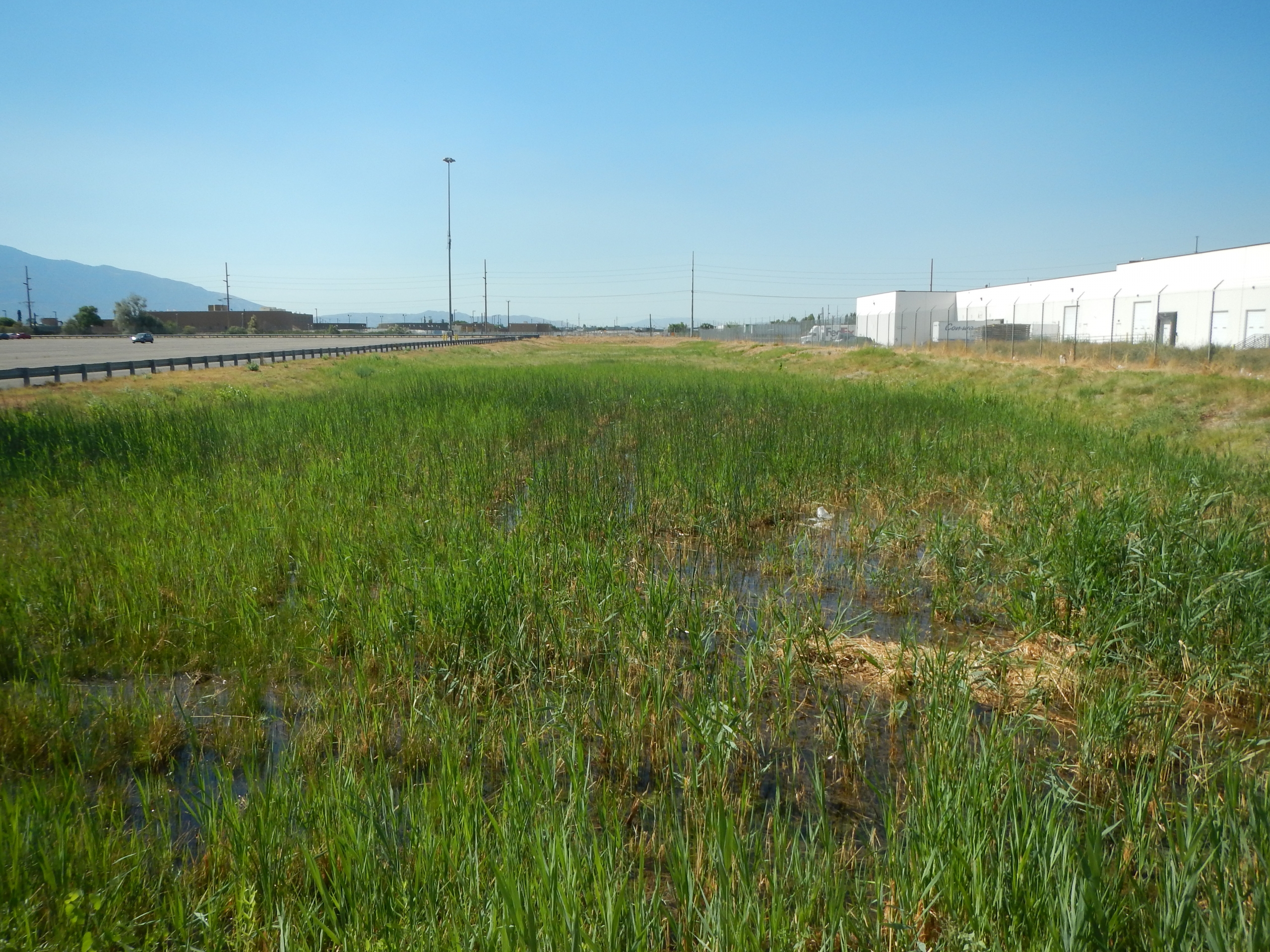
Landscape Fragmentation
Wide, undisturbed areas adjacent to wetlands protect wildlife from disturbance, provide more storage for floodwaters, and reduce the number of pollutants reaching wetlands. Unfortunately, roads, urban sprawl, and other development have fragmented the landscape around wetlands and reduced their ability to provide these functions. Landscape fragmentation is particularly severe in areas of the state with the most development, such as along the Wasatch Front and in montane valleys.
Noxious Weeds/Non-Native Plants
 Noxious Weeds/Non-Native Plants
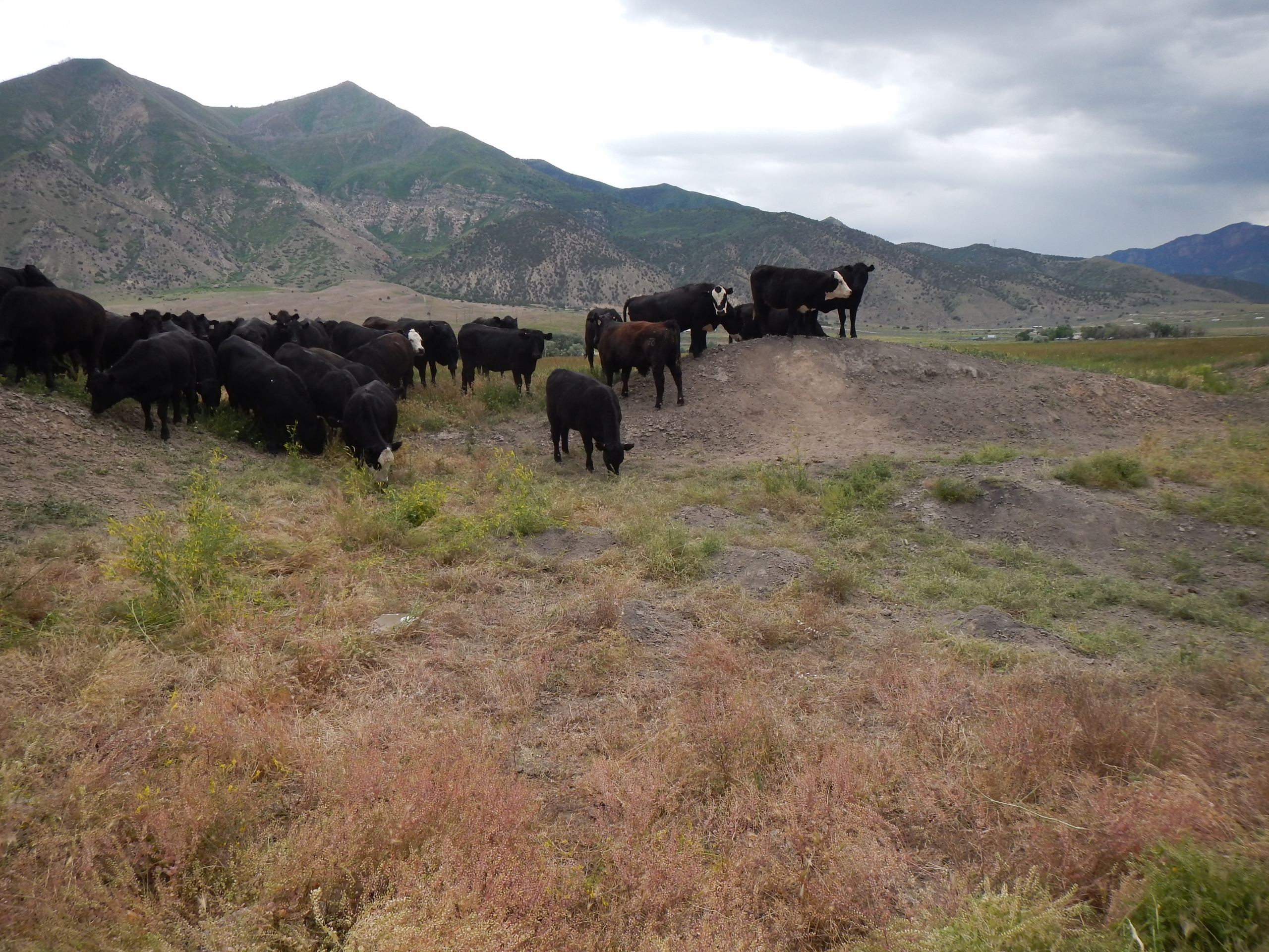
Overgrazing

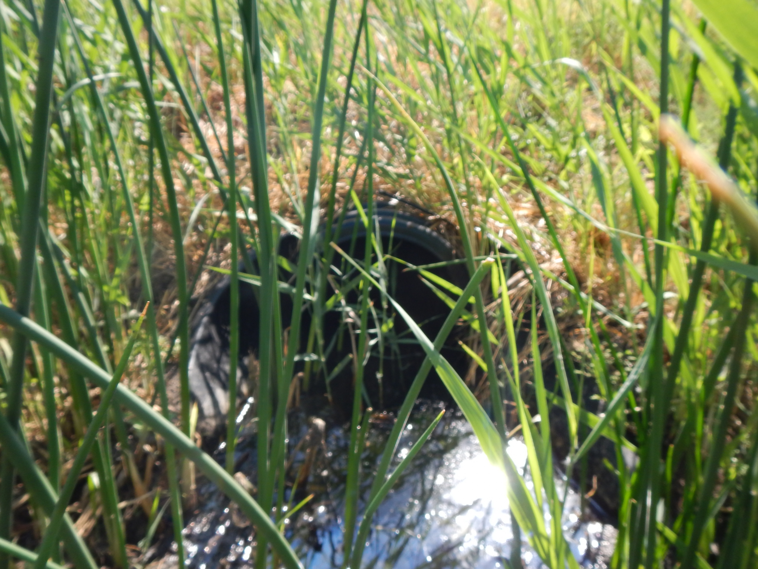
Water Loss
Water Quality

Altered Hydrology
Wetland Restoration, Creation, and Enhancement and BMPs
Utah has lost many wetlands, but private and governmental organizations are working together to restore, create, and enhance wetlands throughout the state. Restoration, which in some cases can be as simple as plugging a ditch to restore hydrology, returns a former or degraded wetland to its pre-existing condition. Wetland creation involves creating a wetland from a non-wetland; wetlands are often created to help treat urban runoff. Wetland enhancement improves the functions of an existing wetland through actions such as removing noxious weeds, improving wildlife habitat, and improving water quality in natural rivers and wetlands. Unfortunately, restoration and creation efforts often fail to restore wetland functions, underscoring the need for conservation of our existing wetlands.
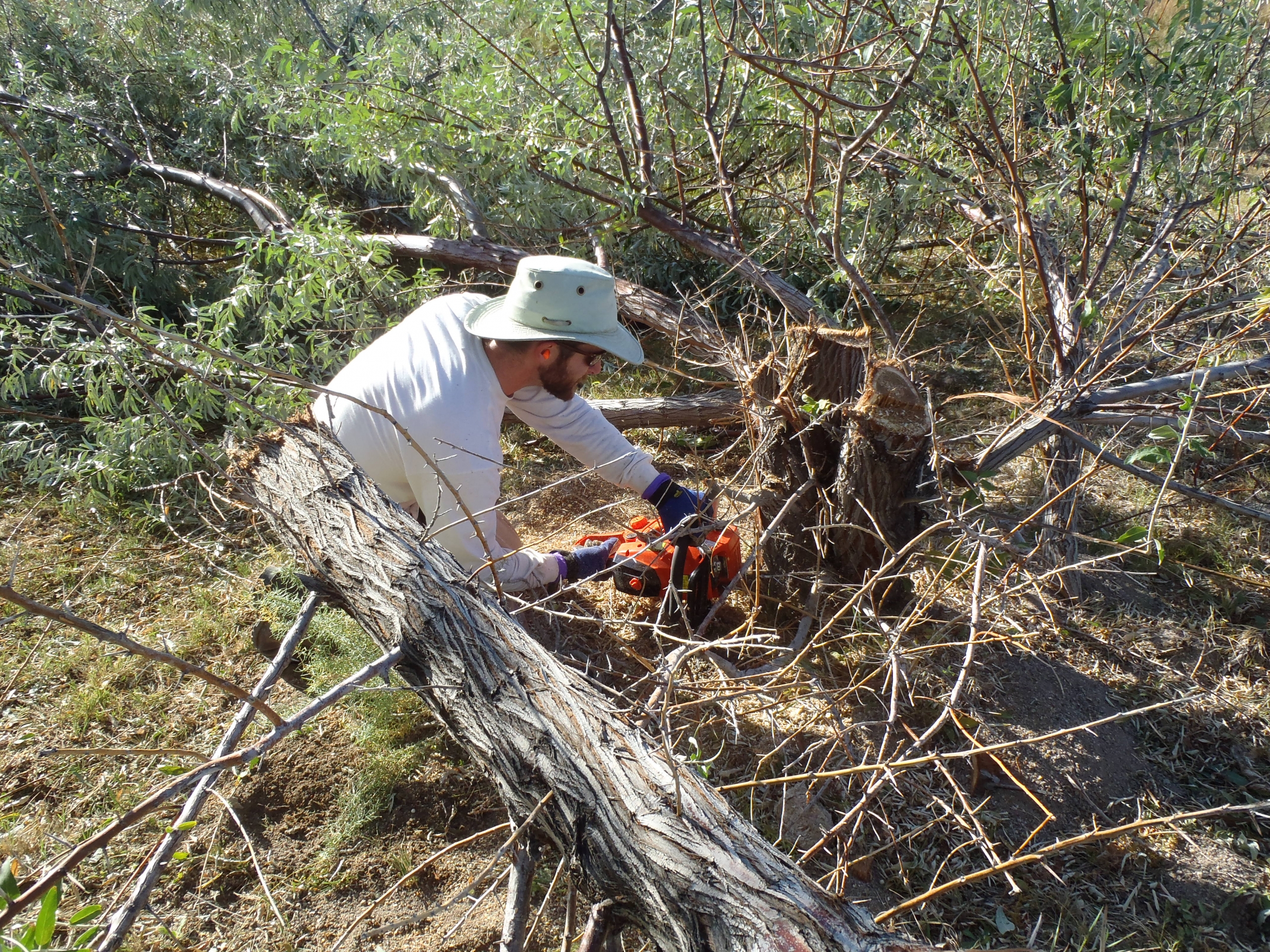
Removal of non-native woody vegetation from wetland habitat on private land in Snake Valley increased springflow and improved habitat for native wetland vegetation, Columbia spotted frog, least chub, and several species of spring snails endemic to Utah. Photo credit: DNR Watershed Restoration Initiative
If you are interested in learning how to minimize and mitigate damage to wetlands or water quality on your property, farm, neighborhood, or watershed, there are many resources outlining Best Management Practices (BMPs) in different settings. Even if you do not have any wetlands on your property, your actions may affect wetlands downstream. The UGS has developed some suggestions for improving wetlands in the Weber watershed that are more broadly applicable, and the Utah State University extension has BMPs for agricultural, urban, and forested areas.
If you are interested in wetland restoration, creation, or enhancement, there are many technical and financial resources available to help guide and support your efforts. The Association of State Wetland Managers maintains a web page containing a wealth of information on a variety of topics related to restoration. Financial assistance is available to support work in wetlands from a variety of federal and state programs. In Utah, successful partnerships between private landowners and local and state organizations have led to cleaner water and improved wildlife habitat.
Highlighted Scientific Publications
Open-File Report 740
Trait Data for Utah’s Central Basin and Range Wetland Plants
Report of Investigation 278
Validation of a Rapid Wetland Assessment Protocol for Utah: Testing Inter-Observer and Intra-Season Variability
Report of Investigation 274
Assessment of Wetland Condition and Wetland Mapping Accuracy in Upper Blacks Fork and Smiths Fork, Uinta Mountains, Utah
Open-File Report 738
Central Basin and Range Ecoregion Wetland Assessment and Landscape Analysis
Report of Investigation 277
Validation of a Rapid Wetand Assessment Protocol for Utah: Evaluation of Survey Methods and Temporal and Observer Variability in Vegetation Data
Wetland Condition in the Weber River WatershedPublic Information
Series 99

Or Browse the Wetland Document Collection
A compilation of documents on wetland management, restoration, and wildlife, as well as unpublished reports and presentations.
Public Interest Articles
| Title | Topic | Year |
|---|---|---|
| Glad You Asked: How is the UGS Helping Manage Invasive Phragmites? | Phragmites | 2026 |
| Mapping and Modeling Phragmites at the Bear River Migratory Bird Refuge | Wetlands | 2025 |
| The Hydrogeology and Ecology of the Matheson Wetlands Preserve: A Connected Story | Groundwater and wetlands | 2025 |
| Where is the Wildlife? Improving Key Aquatic Habitats in the Updated Utah Wildlife Action Plan | Wetland Habitats | 2024 |
| IN-LIEU FEE WETLAND MITIGATION: A Boring Name For an Exciting Idea | Wetlands | 2023 |
| New, Novel, and Updated! Wetland Mapping Improves Across Utah | Wetland Mapping | 2022 |
| Is There a Wetland on Your Property? Identification and Next Steps | Wetlands | 2020 |
| Mapping Wetlands in the Upper Bear River Watershed | Wetlands | 2017 |
| Wetland Condition in the Weber River Watershed | Wetlands | 2016 |
| Wetland Monitoring in Snake Valley | Wetlands | 2014 |
| New Classification Scheme – Great Salt Lake Wetlands | Great Salt Lake | 2011 |
| Tooele Valley Wetlands- A Valuable but Potentially Endangered Resource | Wetlands | 2006 |
Wetlands Articles: 12
External Links
Utah’s Wetland Program Plan is a document authored by the UGS and the Utah Division of Water Quality to guide the direction of state activities related to wetlands. The overall goal of the plan is to increase the amount and availability of scientific data on Utah’s wetlands by continuing to build and deploy scientifically-based tools to assess wetland health and to afford greater protection by determining wetland-specific beneficial uses and criteria to protect those uses.Utah’s Wetland Program Plan 2018-2023