Geologic History
Today, Utah is a land of great geologic diversity and scenery. Many factors have determined the evolution the state has undergone through time. In a sense, it could be said that Utah has had many different faces.
Through geologic time, what is now Utah has been covered by oceans and inland seas as well as completely dry land. The elevation of the land surface has changed as well, ranging from sea level to over two miles above sea level. There have been periods where the topography has been relatively flat and also periods of mountain building and valley formation.

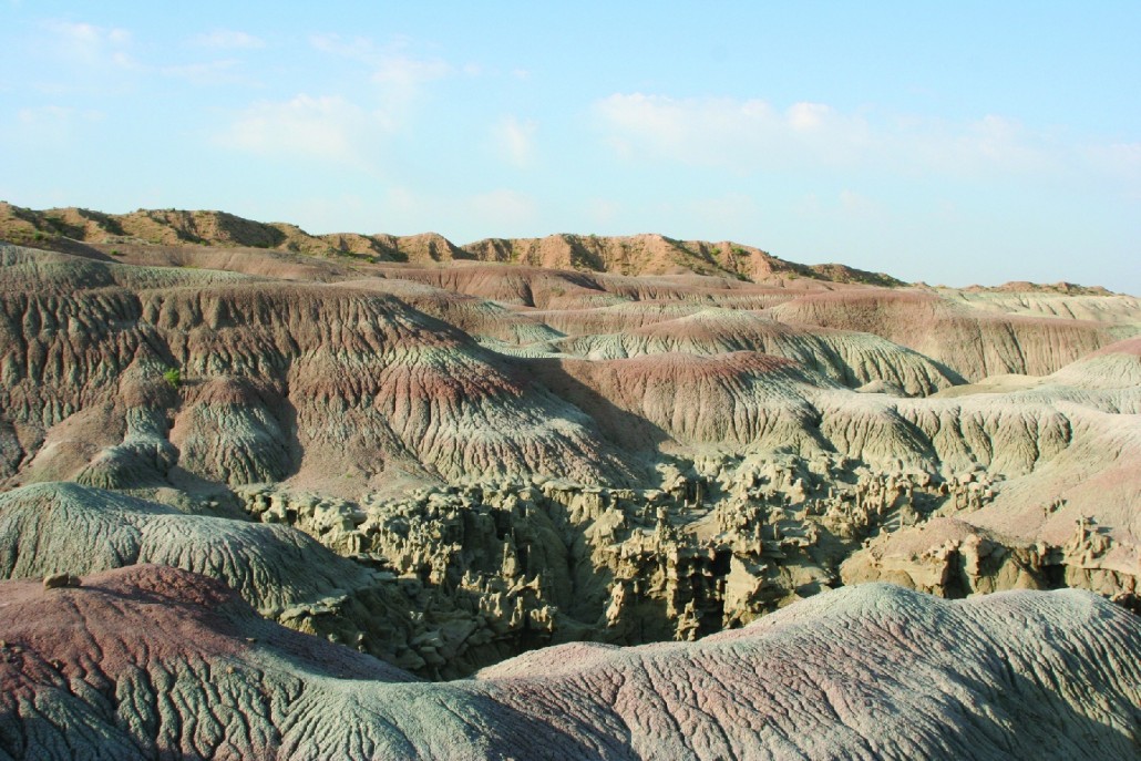


Utah has not always had the seasonal climate that it has today. There have been wet tropical periods, dry dusty desert environments, and cold times that caused alpine glaciers.
The geographic position of Utah has changed through time as well. Due to plate tectonics, the state has moved from a position on the equator to its present location. In doing so, Utah has rotated nearly 90 degrees from an east-west orientation to its present north-south position.
We don’t know as much about the first 3 billion years of Utah’s geologic history as we know about the 540 million years of the Phanerozoic Eon that followed, but 2.5-billion- to 540-million-year-old rocks are exposed in the Raft River Range, Uinta Mountains, and parts of the Wasatch Range, as well as several other smaller areas of the state. These older rocks give clues to the formation of the continent (including Utah), metamorphism, igneous intrusion, erosion of several miles of sediment, and a variety of environments, including oceans, tidal flats, rivers, streams, lakes, and continental glaciers.
Utah’s Geologic History: A Timeline

Paleozoic Era
541–252 million years ago
The Early Years: During the Paleozoic era, Utah was at the western edge of North America. The eastern part of the state was a low plain with little relief at about sea level. The sediment that reached the ocean was well-washed quartz sand. Coral reefs, now exposed as thick limestone rocks in the Wasatch Range, are evidence of shallow seas that led to deep oceans in the west.

Early Jurassic Period
201–174 million years ago
Wind Deposited Sands: Cut off from moisture-laden ocean winds by rising mountains to the west, desert-forming sand-sized sediments were blown into Utah from the north and northwest. These blowing sands formed dunes which eventually turned into rock and are preserved in what is now called the Navajo Sandstone. These ancient dunes are well exposed at Checkerboard Mesa in Zion National Park and on the San Rafael Swell.

Late Jurassic Period
164–145 million years ago
Famous Dinosaurs: At this time Utah was a hot, swampy lowland with mountains and volcanoes to the west and northwest. Meandering rivers and lakes abounded, while dinosaurs roamed the land. Their fossilized bones are preserved and can be seen at famous sites such as the Cleveland-Lloyd Dinosaur Quarry and Dinosaur National Monument.

Late Cretaceous Period
101–66 million years ago
Coal Formations: Pressure from continental collisions with the Pacific Plate to the west produced high mountains in western Utah. The eastern part of the state was covered by an inland sea that stretched from the Gulf of Mexico to the Arctic. The coastal plain between these two areas advanced and retreated as sediment filled the sea and the basin sank. Coal swamps formed behind barrier islands while dinosaurs continued to rule.

Paleocene Epoch
66–56 million years ago
Utah Starts to Come Up in the World: Erosion wore down the mountains to the west and sediments filled the inland sea to the east. Continued pressure from the Pacific Plate caused both the Uinta Mountains and the Colorado Plateau to uplift. The Colorado Plateau warped as it rose, making the beginning of predominate swells and depressions now found in Utah (such as the San Rafael Swell). A large freshwater body, called Lake Flagstaff, occupied a depression in what is now central Utah.

Eocene Epoch
56–34 million years ago
Oil Shale and Fossil Fish: After spending nearly 500 million years near sea level, Utah continued its rise to nearly a mile high in elevation. Continued warping of the Colorado Plateau produced basins for lakes such as Lake Uinta. Organic-rich accumulations in the bottom sediments include well-preserved fish fossils and oil shales. The western mountains were reduced to relics.

Oligocene Epoch
34–23 million years ago
Uplift and Volcanics: On the Colorado Plateau the lake basins were filled in and broad plains separated mountain uplifts. The beginning of modern rivers ran across these plains. The continental divide passed through northeastern Utah so the Green River in Wyoming drained to the Mississippi River. With the beginning of extension in western Utah, which would eventually lead to the Basin and Range Province, extensive volcanic activity started to occur.

Miocene Epoch
23–5 million years ago
Precious Metals Emplaced: Whereas previous compression had moved the site of San Francisco closer to Salt Lake City, extension was now moving the two apart. This extension separated uplifted mountain blocks from down-dropped basins forming the Basin and Range. Volcanic activity continued forming three great metallic mineral belts. From north to south they are: Park City-Oquirrh, Deer Creek-Tintic, and Wah Wah-Tushar. The Colorado Plateau continued to rise and tilt northeastward.

Pleistocene Epoch
2.6–.01 million years ago
Water and Ice: The geography of Utah was very close to what it is now. Mountains, canyons, and rivers were all well in place. The climate at this time was wetter and colder and as a result glacial activity took place. Canyons were carved and expanded in the Uinta Mountains as well as in several other mountain ranges throughout the state. A giant fresh-water body called Lake Bonneville also formed, stretching from the Wasatch Range to Nevada and from the Utah-Idaho border nearly down to Cedar City in southern Utah.

Present day
These are the Places: The geologic history of Utah has left an indelible mark on the state. It explains why the rocks to the east are brightly colorful whereas those to the west have somber colors, why there are spectacularly massive canyons on the Colorado Plateau, why much of the Basin and Range has no external drainage, and why a high mountain chain, the Wasatch, runs down the middle of the state. This history determines the location of settlements, industry, and recreation sites.
Expand the tabs below for more in-depth information on changing climate and environments through Utah’s geologic history.
Cenozoic Era
Cenozoic Era66 million years ago to the present |
|||
|---|---|---|---|
| Period | Epoch | Millions of Years Ago |
Description of Events |
| Quaternary | Holocene | .01 | Current erosional and depositional processes dominate. Basin-and-range extensional faults continue to be active. Volcanic eruptions continue in western Utah, as recently as 660 years ago. Great Salt Lake, a remnant of Lake Bonneville, diminishes and accumulates a vast quantity of salt. Great Salt Lake information |
| Pleistocene | 2.6 | Glaciers blanket the Uinta Mountains, the Wasatch Range, and mountains of the Colorado Plateau. Lake Bonneville, a large fresh-water lake, covers many northern and western Utah valleys. Sand and gravel is deposited along the shoreline. Humans first appear in Utah near the end of this epoch, which ended 11,700 years ago. Ice Age wildlife and glaciers; Lake Bonneville |
|
| Tertiary | Pliocene | 5.3 | Volcanism continues in southwestern Utah. Basin-and-range extensional faulting and regional uplift continues. |
| Miocene | 23 | Igneous intrusions continue to form in the Henry and Abajo Mountains. Igneous activity similar to that in the Oligocene continues until approximately 15 million years ago. Basalt flows and volcanic cones form in southwestern Utah. Basin-and-range extensional faulting in western Utah creates mountain-valley-mountain topography and the Wasatch fault zone. Regional uplift rejuvenates major river systems in the Rocky Mountains and the Colorado Plateau. The carving of the canyonlands begins. | |
| Oligocene | 34 | The igneous rocks that form the Henry, La Sal, and Abajo Mountains in southern Utah begin to intrude. Igneous activity produces intrusive rocks in northern Utah and volcanos in southwestern Utah. The majority of Utah’s copper is probably associated with an Oligocene-age intrusion in the Bingham mining district, west of Salt Lake City. | |
| Eocene | 56 | Lake Uinta, part of a larger Green River Lake system in Wyoming and Colorado, forms in northeastern Utah. The lake gradually contracts and is replaced by a river system. In the Uinta Basin thousands of feet of sediment are deposited. Granitic intrusions and volcanic flows occur in northwestern Utah during the late Eocene. Eocene-age reservoir rocks contain sizable amounts of oil and gas. | |
| Paleocene | 66 | Eroding highlands prevail in western Utah. The Uinta Mountains, smaller uplifts, and the Uinta Basin, become prominent features in eastern Utah. Lake Flagstaff forms in central and northeastern Utah and possibly extends into southwestern Utah. Mammals flourish. | |
Mesozoic Era
Mesozoic Era240 to 66 million years ago |
||
|---|---|---|
| Articles on dinosaurs and fossils from the Mesozoic Era | ||
| Period | Millions of Years Ago |
Description of Events |
| Cretaceous | 145 | Lake and river systems gradually decline. Sediments from highlands near the Utah-Nevada border spread eastward. In eastern Utah, seas invade from the east. Western Utah rises due to thrust faulting and folding generated by east-west-directed compressional forces. Dinosaurs and reptiles wander through major coal-forming swamps and marshes near the coastline that gradually retreats from central Utah eastward. Dinosaurs disappear at the end of this period. |
| Jurassic | 201 | A large, sandy desert covers most of Utah during the Early Jurassic. The resulting rocks now create some of the most spectacular scenery in Utah’s national parks. Later, shallow seaways from the north invade Utah twice. In central Utah, the Arapien basin develops and receives over 6,000 feet of sediment including large amounts of gypsum and salt. In the Late Jurassic, dinosaurs roam within extensive lake and shifting river systems. Granitic intrusions form in western Utah. Jurassic-age host rocks contain large uranium deposits located in the Colorado Plateau and extensive oil and gas reserves in northern Utah. The first birds evolve. |
| Triassic | 252 | Shallow seas from the west spread across northern and western Utah and occasionally overlap with eastern and southern mudflats that are crisscrossed by reptiles and amphibians. After a period of erosion, river and lake systems dominate. Some of these sediments now contain large quantities of petrified wood. Currently uranium is found in Triassic-age rocks of the Colorado Plateau. Dinosaurs and primitive mammals appear. |
Paleozoic Era
Paleozoic Era570 to 240 million years ago |
||
|---|---|---|
| Period | Millions of Years Ago |
Description of Events |
| Permian | 299 | Deposition continues in the Oquirrh and Paradox basins. Red rocks form in the Paradox basin of sediments shed from the Uncompahgre highland. |
| Pennsylvanian | 323 | Seas containing fusulinids, brachiopods, and conodonts cover most of Utah. Sediments continue to accumulate in the Oquirrh basin. The Paradox basin and the adjacent Uncompahgre highland develop in southeastern Utah. Salt, potash, and organic-rich shale accumulate in the shallow, restricted Paradox basin. Pennsylvanian-age reservoir rocks contain large volumes of oil and gas. Reptiles originate during this period. |
| Mississippian | 359 | Warm, shallow seas rich with life cover Utah for most of this period. The Oquirrh basin develops in northwestern Utah. Large quantities of limestone are deposited. Mississippian-age reservoir rocks hold an abundant amount of oil and gas. |
| Devonian | 419 | Shallow, temporary seas in eastern Utah, and deeper seas in the west contain primitive fish, corals, brachiopods, and conodonts. The Stansbury uplift in north-central Utah develops into a prominent ridge above sea level during the Late Devonian. Amphibians appear. |
| Silurian | 444 | Shallow seas containing corals and brachiopods blanket Utah. Dolomite is the predominant rock being formed. |
| Ordovician | 485 | New life forms prosper in fluctuating seas of western Utah while eastern Utah remains above sea level. The first vertebrates, primitive armored fish, evolve. |
| Cambrian | 541 | Subsidence of western Utah continues. Trilobites thrive in the deep seas of western Utah, while shallow, oscillating seas cover eastern Utah. |