GeoSights: Hole-in-the-Ground, Snake Valley, Millard County, Utah
by Mark Milligan
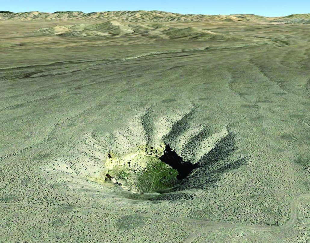
Hole-in-the-Ground is just that, a sinkhole created by the roof collapse of a buried limestone cavern. It is massive. A hole that measures over 250 feet wide and up to 110 feet deep on an otherwise flat valley floor is an impressive sight to see.
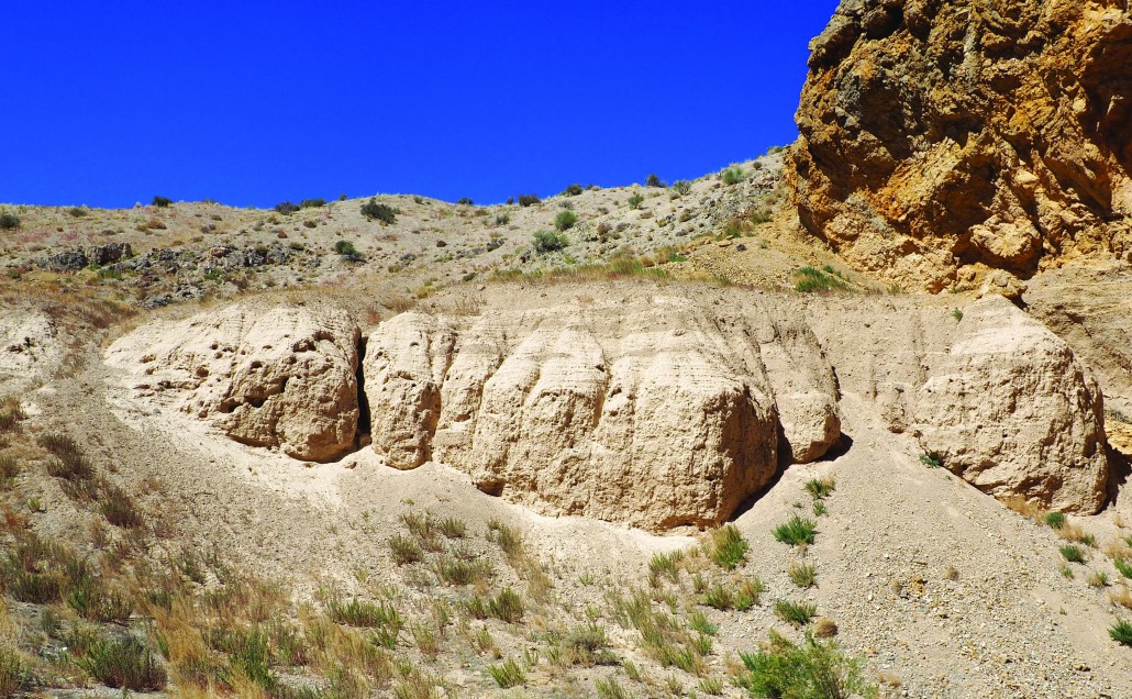
North-south-trending mountain ranges separated by broad and flat valleys characterize the Basin and Range physiographic province, which extends from the Wasatch Range across western Utah and westward to the Sierra Nevada in California. The valleys typically contain thousands of feet of sediment shed from their bounding ranges. However, this sediment does not always have a consistent thickness across a valley. Some locations have seemingly isolated rock outcrops of low-lying hills away from a range front. Nonetheless, when standing on a valley floor you tend to assume solid rock lies a great distance below your feet. Hole-in-the-Ground creates a portal into the subsurface that shows these assumptions and generalizations can be wrong. The walls of this sinkhole expose approximately 320-million-year-old (Mississippian- to Pennsylvanian-age) bedrock of the Ely Limestone a mere 30 to 40 feet below the surface. A buried fault is thought to have elevated the shallow bedrock.
Sinkholes form by dissolution of underlying limestone bedrock, a process in which acidic groundwater dissolves part of the limestone and carries it away in solution. This creates a cavity which can continue to grow until the roof is unable to support its own weight and that of the overlying sediment. The collapse may occur as a single catastrophic event or a progressive series of smaller failures.
Whereas sinkholes in places like Florida and Kentucky pose a threat and sometimes swallow houses or the National Corvette Museum (a sad story, look it up), Hole-in-the-Ground is over 5 miles from Eskdale, the nearest settlement, and thus poses no risk to any structures. Even cattle are protected by an enclosing wire fence. Furthermore, the timing of this sinkhole is unknown. Collapse may have started as long ago as a million years.
Hole-in-the-Ground lies within Snake Valley, which was flooded by ancient Lake Bonneville approximately 18,000 years ago during the most recent Ice Age. The rim of the sinkhole lies roughly 550 feet east of and 20 feet above the ancient lake’s highest shoreline, named the Bonneville Shoreline. Thus, the bottom of the hole, being over 75 feet below ancient lake level, would have likely been a swimming hole filled with shallow groundwater related to the lake. Additionally, Lake Bonneville deposited impressive V-shaped sand spits, the closest of which lies less than half a mile to the southwest of the sinkhole.
How to Get There

The sinkhole is located on land administered by the U.S. Bureau of Land Management about 6 miles northeast of the small unincorporated community of Eskdale in western Millard County. This area is remote, so please plan accordingly. Eskdale has no services; the closest gas is available in Baker, Nevada, about 15 miles to the southwest.
From the Wasatch Front, head south on I-15 towards Nephi. Take exit 225 and turn right onto Utah State Route 132 (100 North). After 34 miles, turn left onto U.S. Route 6. After 16 miles, turn right onto U.S. Route 6/50. After 84.6 miles, turn right onto the paved two-way road towards Eskdale. There are no road signs beyond this point. Continue by using GPS navigation or the indicated mileage, beginning where you leave U.S. Route 6/50:
3.7 miles Turn RIGHT at the T-intersection.
0.4 miles Turn LEFT.
0.9 miles Turn RIGHT. (Pavement ends in Eskdale.)
0.6 miles Road curves to the left.
0.2 miles Continue straight/north at junction.
4.5 miles Turn RIGHT onto the unimproved two-track dirt road, which is passible in moderate to high-clearance vehicles. Proceed with caution or walk in.
0.7 miles End at sinkhole. The hole is surrounded by a wire fence, presumably to keep cattle out. The southwest corner of the fence has a stile for access.
Coordinates: 39.175017°, -113.902319°.
The sinkhole is located on the Hole-in-the-Ground 7.5-minute quadrangle map.
Survey Notes, v. 51 no. 1, January 2019


