Hydrologic Cycle
The hydrologic cycle is the continuous circulation of water among the oceans, continents, and atmosphere. It can be thought of as a machine endlessly in motion, powered by the sun’s energy and assisted by gravity. Essentially the same water has been circulating in this machine since the first clouds formed and the first rains fell on Earth; very little is ever lost or gained.


The continents contain about 2.5 percent of our planet’s water, mainly in the polar ice caps and groundwater. The atmosphere accounts for only about 0.0001 percent. The oceans hold the remaining 97.5 percent of our planet’s water. About 90 percent of the water entering oceans is in the form of precipitation—rain and snow falling directly on the oceans. Runoff from the land accounts for the remaining 10 percent. The only significant outlet for ocean water is evaporation via the sun’s energy (heat).
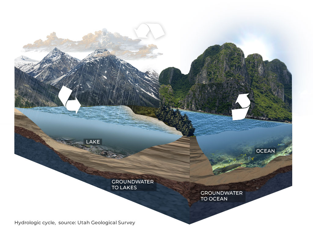 Water evaporated into the atmosphere remains an average of only 10 days before being dropped as rain, snow, or condensation back into the oceans or onto the land. In general, water precipitated onto land can
- infiltrate into the ground,
- flow across the surface in a system of streams and lakes which eventually flows to the sea, or
- become glacial ice, eventually flowing to the sea.
Water that infiltrates into the ground may be used by plants, flow to nearby streams or lakes, or flow down to the water table where it becomes groundwater. Although we use the term “flow” to describe the motion of both groundwater and stream water, they have different characteristics. Groundwater flow occurs through pore spaces and fractures in sediment and rock, and is much slower and more dispersed than stream flow.
Read more about Groundwater and Aquifers
Of course, this is a simple description of a complex system and not all water travels completely through the cycle every time. Some water evaporates from streams and lakes, and even glacial ice, before reaching the sea, and plants use a relatively large amount of water and transfer it directly back to the atmosphere by a process called transpiration. While the system as a whole does not lose or gain water, the distribution in various parts of the cycle over different areas of the globe can change, causing floods and droughts.
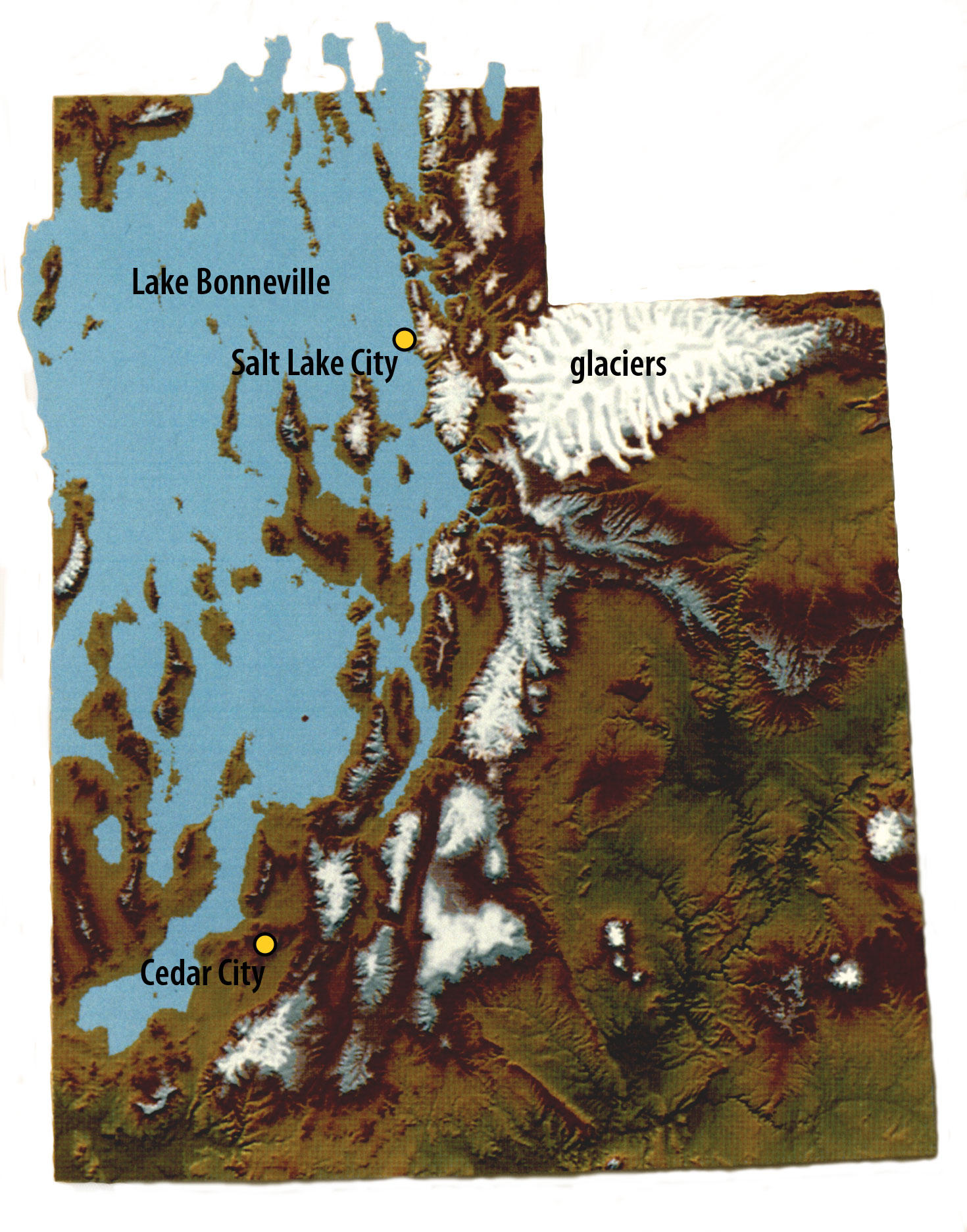
Great Salt Lake, Wasatch Front, and Great Basin
Great Salt Lake, Wasatch Front, and Great Basin
Great Salt Lake, the Wasatch Front, and most of western Utah are in the Great Basin, a hydrologic region in the western U.S. that also includes most of Nevada and small parts of Idaho, Wyoming, Oregon, and California. In the Great Basin, surface water flows to land-locked basins—in other words, no streams flow to the oceans. Storm tracks coming primarily from the Pacific Ocean provide summer rainfall and winter snowfall that supply water to streams and lakes, but this water does not return to the Pacific Ocean unless it evaporates and falls directly on the ocean or as precipitation onto basins that drain to the ocean.
Great Salt Lake and the Wasatch Front create or have a hydrologic sub-cycle that contains many complexities and feedback loops. Great Salt Lake, through a process called “lake effect,” can increase precipitation along the Wasatch Front. At least two major phenomena control lake-effect precipitation: added moisture to the air due to evaporation from the lake’s surface, and atmospheric instability caused by the temperature contrast between the air and lake water. Evaporation from Great Salt Lake increases the moisture content of storms moving in from the Pacific Ocean. When these storms hit the Wasatch Range, the moisture moves upward and cools, causing precipitation (orographic effect). This combination of lake effect and orographic effect contributes to “the Greatest Snow on Earth” at the ski resorts in the Cottonwood Canyons and along the Wasatch Front.

Antelope Island & Farmington Bay, Great Salt Lake, Davis County, Utah
Photographer: Ken Krahulec; © 2012