
Current Program Projects
The UGS Geologic Hazard Program is focused on reducing Utah’s life safety, property, and economic risk by responding to, investigating, and providing unbiased scientific information about geologic hazards. Program engineering and geologic hazard geologists work on a variety of investigation, mapping, and applied research projects, along with public outreach activities, to raise awareness, educate, and inform others to help reduce Utah’s risk from geologic hazards.
Comprehensive Geologic Hazard Mapping
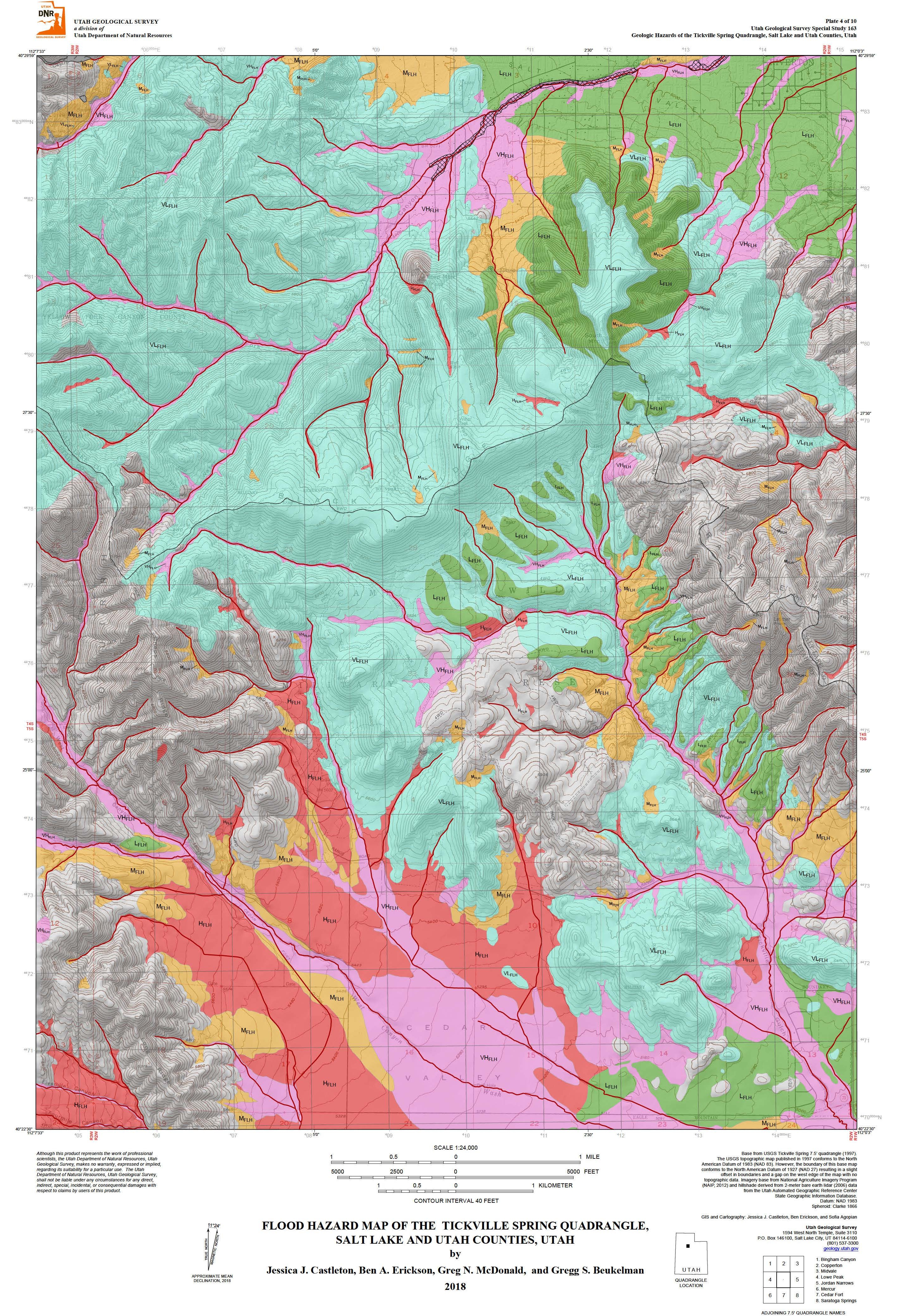
Flood Hazard Map of the Tickville Spring Quadrangle, Salt Lake and Utah Counties (SS-163).
Comprehensive Geologic Hazard Mapping
- Cedar City Quadrangle
- Cedar Fort Quadrangle
- Baileys Lake Quadrangle
- Jordan Narrows Quadrangle
- Lehi Quadrangle
- Saratoga Springs Quadrangle
- Portions of the Glen Canyon National Recreation Area
Recent Publications
Specific Hazard Mapping
Urban Geologic mapping to Support Geologic Hazard Mapping
 Allens Ranch Quadrangle
Geologic Data
 2018 State of Utah Lidar Elevation Data Acquisition