
GEOLOGIC MAPS
Geologic maps use a combination of colors, lines, and symbols to depict the relative age, composition, and relationships among rocks and sediments at and near the earth’s surface. Explore the map below by clicking to highlight areas of interest. Utah geologic maps are also available through the Natural Resources Map & Bookstore and UGS Library Catalog. To learn more about map terms or how to use geologic maps, see Geologic maps – what are you standing on? and Practical uses of geologic maps for more information.
Select an area of interest. Highlighted selection includes links to download map (PDF), purchase map, or download zip file with GIS data (if available).
Browse Directory of UGS Geologic Maps
| Quadrangle/Area | Date | Map Name | Author(s) | Series # | Publication & Data | Purchase | Map Scale | Keywords |
|---|
Statewide Geologic Maps of Utah
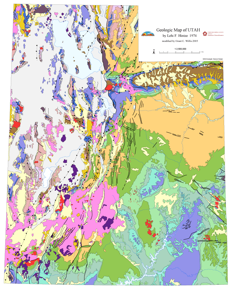
Simplified Geologic Map of Utah, 1:2,500,000-scale.
Geologic Map Portal
Zoom in to different parts of the state to explore detailed geologic maps where available. View, create, save, and print custom maps, find out about geologic formations, and download GIS data.
Digital Geologic Map of Utah
1:500,000-scale, ideal for poster-size prints. Site-specific geologic maps can be found in the Geologic Map Portal.
- Download geologic map (pdf)
- Download geologic map GIS data (zip)
Simplified Geologic Maps of Utah
1:2,500,000-scale, ideal for 8 1/2″ x11″ presentations.
- Version 1 (pdf). Full map — with labels, roads, towns, and full explanation.
- Version 2 (pdf). Map units and faults only — no labels, roads, towns, or explanation.
- Version 3 (pdf). Map units only — no labels, roads, towns, explanation, or faults.
Postcard Geologic Map of Utah
Provides a good overview of the geology of the state, but necessarily simplifies or omits many fine details.
- Download Postcard (pdf)
NEW! Geologic Map of Utah Coloring Page
Simplified geologic map of Utah, optimized for coloring. Includes unit labels and a color guide.
- Download Coloring Page (pdf)
Postcard and Simplified Geologic Maps
Simplified geologic maps of many of Utah’s favorite parks and recreation areas. These maps provide a good overview of the geology of a region, but necessarily simplify or omit many fine details.


