
Wetlands
A wetland is land that is flooded or has a high water table during the growing season on a permanent or seasonal basis. Wetland hydrology is highly variable—wetlands may only be wet some years during all or part of the growing season, including spring flooding from snowmelt or late summer flooding from monsoonal rains. In general, wetlands are wet long enough to have distinct soils and vegetation. Wetlands provide habitats for many plants and animals in Utah, perform important functions to help keep our water clean, and support recreational activities such as bird watching and waterfowl hunting. Because of their importance, wetlands are protected by federal regulations, and many agencies and individuals are interested in conserving and restoring wetlands in Utah.


There is no standard definition of a wetland. The U.S. Fish and Wildlife Service (USFWS), the agency that manages the nationwide spatial data on wetlands, includes both unvegetated areas, such as playas and mudflats, and areas without true soils, such as aquatic beds, in its definition of wetlands. In contrast, the U.S. Army Corps of Engineers (Army Corps), the primary regulatory body for wetlands in Utah, classifies areas as wetlands only if they have evidence of three wetland indicators—hydrology, soils, and vegetation—though the Army Corps regulates many non-wetland aquatic features as well. The Utah Geological Survey works with wetlands that fall within the broader USFWS definition.
Interactive Maps and Other Resources

Utah Wetlands

Wetland Plant Application

Wetland Mapping Storymap
Utah’s Montane Ecoregion Wetlands
Wetland Data Explorer
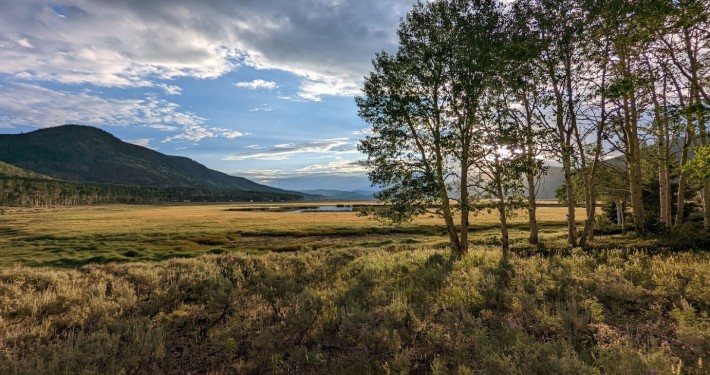
Where do Wetlands Form?
Wetlands typically occur in particular places on the landscape. Some wetlands occur along the floodplains of streams and rivers, including in oxbows and old channel scars and in areas flooded by beaver dams. These wetlands receive water from overbank flooding or from subsurface connections with the water table. Other wetlands occur along lake edges where water levels rise and fall with changing lake levels. Wetlands can form in depressions on the landscape where water accumulates from rain, snowmelt, or surface run-off. Wetlands are also commonly found in locations of groundwater discharge including large spring complexes and small springs and seeps. Many wetlands in Utah are formed or supported by people. This includes large shallow wetland impoundments managed for waterfowl and other birds at state waterfowl management areas and federal refuges and wet meadows in the former floodplains of rivers that are now primarily supported by irrigation and used as pasture.

Generalized hydrologic setting of wetlands in the three major ecoregions of Utah. Source: U.S. Geological Survey

The UGS has compiled a collection of documents on topics such as wetland management, wetland restoration, and wetlands and wildlife relevant to Utah. This collection also includes unpublished UGS wetlands reports and presentations from the wetland conference hosted by the UGS in Salt Lake City in 2013.
Wetland Basics
Hydrology
Wetland Hydrology
Wetland hydrology is the most important defining feature of wetlands. Wetlands are typically wet for at least some of the growing season and usually, it’s the time of the year between spring and fall when soil temperatures support biologic activity. The hydroperiod is the frequency and duration of time that a wetland is wet. Hydroperiods can differ considerably between different types of wetlands and within a wetland in different years. For example, a groundwater-fed wetland may have saturated soils all year long and experience only a small decline in the water level in the spring due to water loss from evapotranspiration. A wetland that receives overbank flooding from a river may have several inches of surface water in the spring and be completely dry by the fall; that same wetland may be dry some years when runoff from snowmelt is low.

Hydrograph showing the diversity of wetland hydrology present in Snake Valley, Utah. Wetlands that fall into Regime 1 have surface water almost year round, whereas most other regimes have a large decrease in water levels in the summer and fall.
In Utah, many wetlands have changes in their hydroperiod driven by irrigation practices, with reduced water levels in the summer due to nearby groundwater pumping and increased water levels in the fall when pumping declines. Inter-annual, seasonal, episodic, and daily water level fluctuations are all important drivers of wetland function, including their ability to support particular plants and animals. The UGS uses shallow wells called piezometers to monitor water levels in important wetlands in Utah.
Plants
Soils


