
This warmer weather has our sights on southern Utah red rock day dreams!

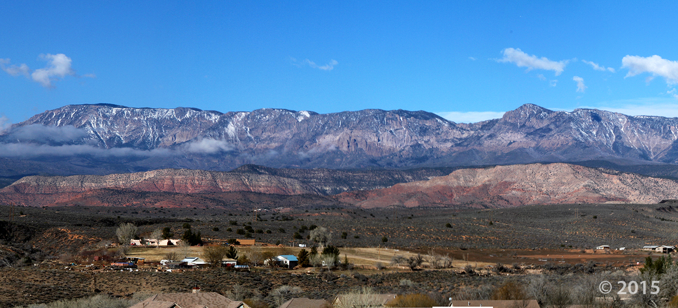
The Red Mountains and the city of Santa Clara, Washington County, Utah
Photographer: J. Lucy Jordan; © 2015
This warmer weather has our sights on southern Utah red rock day dreams!
The Red Mountains and the city of Santa Clara, Washington County, Utah
Photographer: J. Lucy Jordan; © 2015
Any of our friends in southern Utah feel the earthquake over the weekend? A minor earthquake occurred about 13 miles outside of Enterprise, UT, on Saturday afternoon.
sltrib.com
A small earthquake shook Washington County on Saturday afternoon.
See the official earthquake report provided by the University of Utah Seismograph Stations HERE


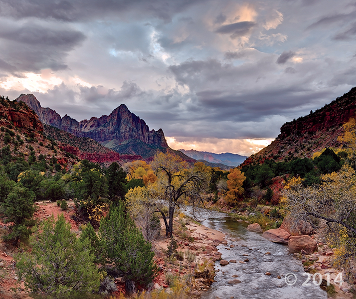
Zion National Park, Washington County, Utah
Photographer: Adam McKean; © 2015
The setting sun illuminates the Jurassic-age Navajo Sandstone cliffs of Cougar Mountain (right) and South Guardian Angel (left) as viewed from Kolob Reservoir Road. Here, the road travels on top of the 220,000- to 310,000-year-old Grapevine Wash lava flow (dark rocks in middle ground).

Pine Valley Mountains, Washington County, Utah
Photographer: Nikki Simon; © 2015
A sad event after a group of people fell victim to a powerful flash flood in southern Utah. Heavy rains in Washington County swept a road away, taking their cars along with it.
As always, please exercise the utmost caution around flash floods, and areas prone to flooding after any amount of rain fall.
sltrib.com
Eight people had died and five remained missing Tuesday morning, the day after an SUV and a van were washed off a road during a flash flood in this polygamous Utah-Arizona border community.


Washington County, Utah
Photographer: Mark Milligan; © 2014
Petroglyphs carved into desert varnish-covered sandstone near Ivins, Washington County.

Zion National Park, Washington County, Utah
Photographer: Gregg Beukelman; © 2014
The Watchman (6,545 feet), composed of Jurassic-age Navajo Sandstone, stands guard over the southern entrance to Zion Canyon. The canyon has been carved by the North Fork Virgin River, which has eroded downward thousands of feet through the Navajo and underlying Kayenta and Moenave Formations.

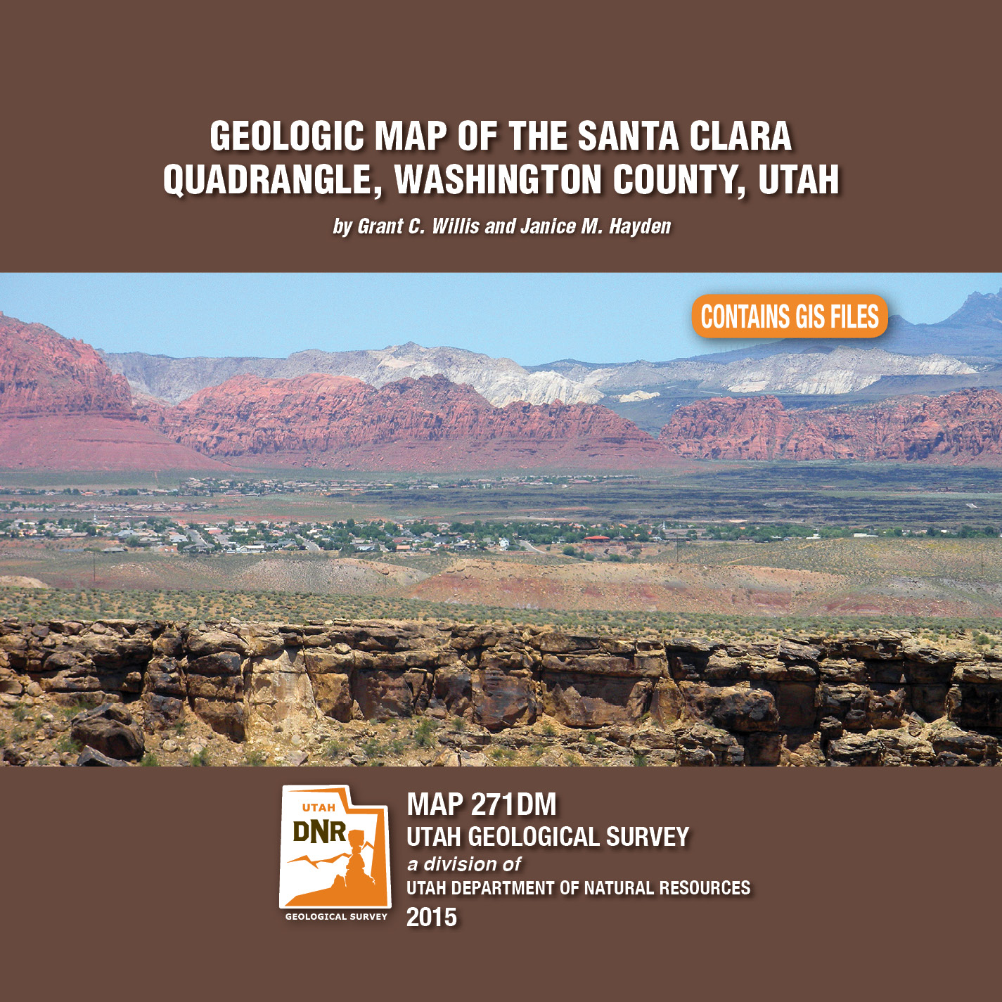
By: Grant C. Willis and Janice M. Hayden
The Santa Clara 7.5′ quadrangle is in the northwestern part of the St. George basin in southwestern Utah, and includes Santa Clara and Ivins Cities, and colorful Red Mountain and Snow Canyon State Park. Movement on an underlying thrust fault created a variety of faults, joints, deformation shear bands, and brecciated rock in Triassic and Jurassic strata in many areas. Remnants of six Quaternary basalt flows cap ridges and benches, forming classic inverted valleys, and form lava cascades in Snow Canyon State Park. The young Santa Clara flow cascaded through Snow Canyon and flooded across broad benches, forming scenic black terrain that contrasts sharply with red-brown to near-white sandstone cliffs. Landslides, rock falls, swelling clays, and other geology and related flooding and debris flow hazards have caused extensive damage in recent years and present increasing challenges as growth and development continue. “Blue Clay” of the Chinle Formation has been at the root of significant damage to roads, buildings, and infrastructure.

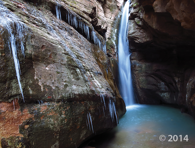
Zion National Park, Washington County, Utah
Photographer: Tyler Knudsen; © 2014
One of numerous slot canyons carved into Jurassic-age Navajo Sandstone in Zion National Park, Bear Trap Canyon is particularly dark and narrow. With little sunlight penetrating to the canyon floor, snow and ice often linger well into spring.
 Incised petroglyphs, Canaan Gap, Washington County, Utah
Photographer: Tyler Knudsen; © 2013
![]()
The Utah Geological Survey (UGS) is a division of the Utah Department of Natural Resources. Several specialized programs comprise the UGS: Data Management, Energy & Minerals, Geologic Hazards, Geologic Information & Outreach, Geologic Mapping, Groundwater & Wetlands, and Paleontology.