Tag Archive for: Utah Geological Survey

Media Contact
Vicky Clarke
801-537-3330
vickyclarke@utah.gov

2018 Calendar of Utah Geology is the Best Yet!

The Utah Geological Survey (UGS) recently released the 12th edition of its popular Calendar of Utah Geology. The 2018 calendar features inspiring photographs by UGS staff of Utah’s geologic wonders with a brief explanation of how and when they formed.

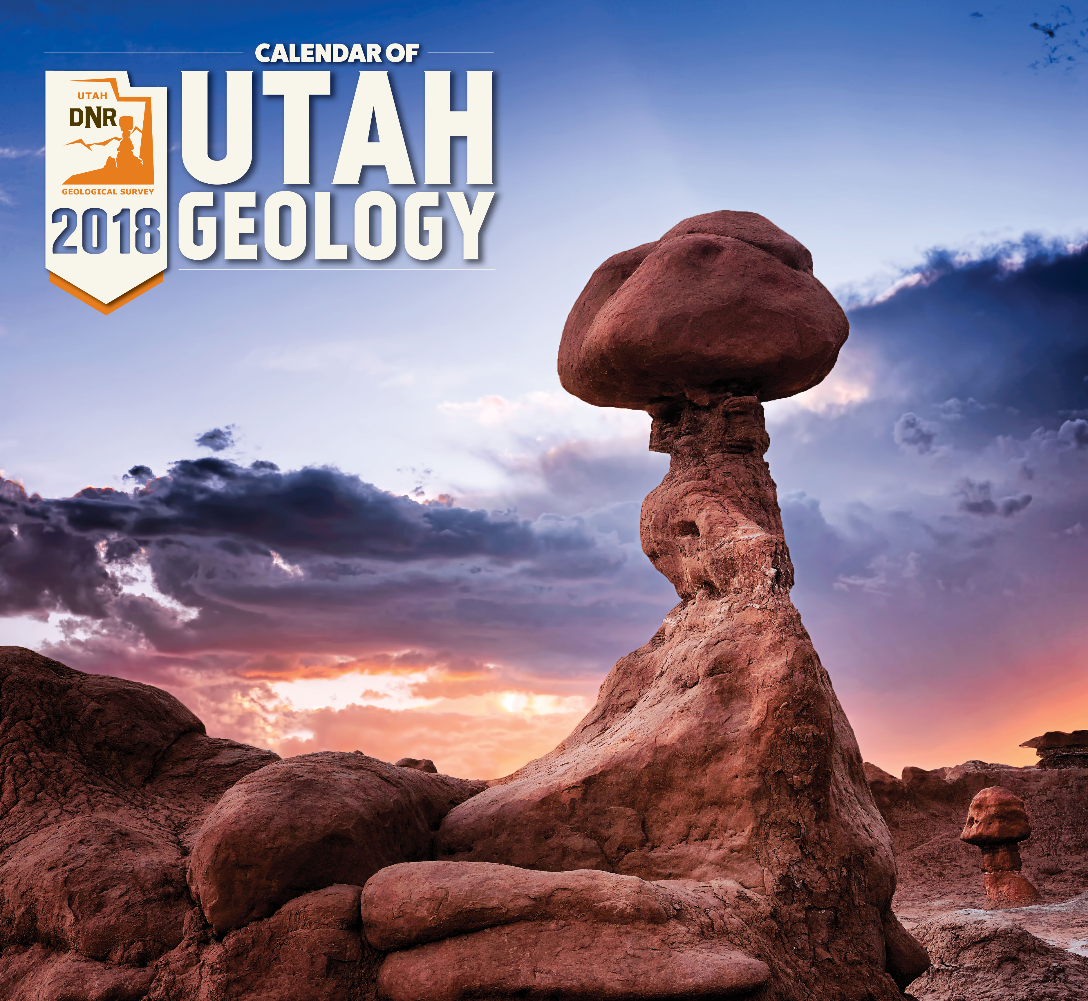
Weathering and erosion of the Jurassic-age Entrada Sandstone forms a fantastic array of stone structures locally referred to as “goblins.” Goblin Valley State Park, Emery County. Photographed by Gregg Beukelman.

Eight years ago Gregg Beukelman, whose photograph was selected for the calendar’s cover, moved to Utah from Idaho when he landed his current job as a geologist with UGS’s Geologic Hazards Program. After the move Beukelman found himself with free time in what he describes as “hands down the most beautiful state in the nation.”

Beukelman previously had a passing interest in photography, but it was Utah’s incredible landscapes and vistas that stoked his passion. He now spends many of his off-work hours traveling across Utah searching out vistas and awaiting lighting conditions that allow him to create his stunning images.  Like other employees whose photographs have been featured in the calendar, Beukelman’s have transformed from nice landscape shots to true works of art.

Beukelman is not alone in his path from geology to photography. The calendar has featured more than 40 UGS geologists. Other staff members have taken an opposite tack and were previously artists who sought employment with UGS because of their love of the outdoors and curiosity about geology. UGS graphic designer John Good and Natural Resources Map & Bookstore clerk Andy Cvar are both featured in this year’s calendar.

Both the artists who have turned to geology and the geologists who have turned to art have contributed to a tradition of growing excellence to create what proves to be the best Calendar of Utah Geology to date!

The 2018 Calendar of Utah Geology is the same price as last year, $4.95 each or $4.25 for orders of 10 or more, and is available at the Natural Resources Map & Bookstore, 1594 West North Temple, Salt Lake City, (801) 537-3320 or 1-888-UTAHMAP. They may also be purchased online.

The Utah Geological Survey provides timely scientific information about Utah’s geologic environment, resources, and hazards. It is one of seven divisions within the Utah Department of Natural Resources.

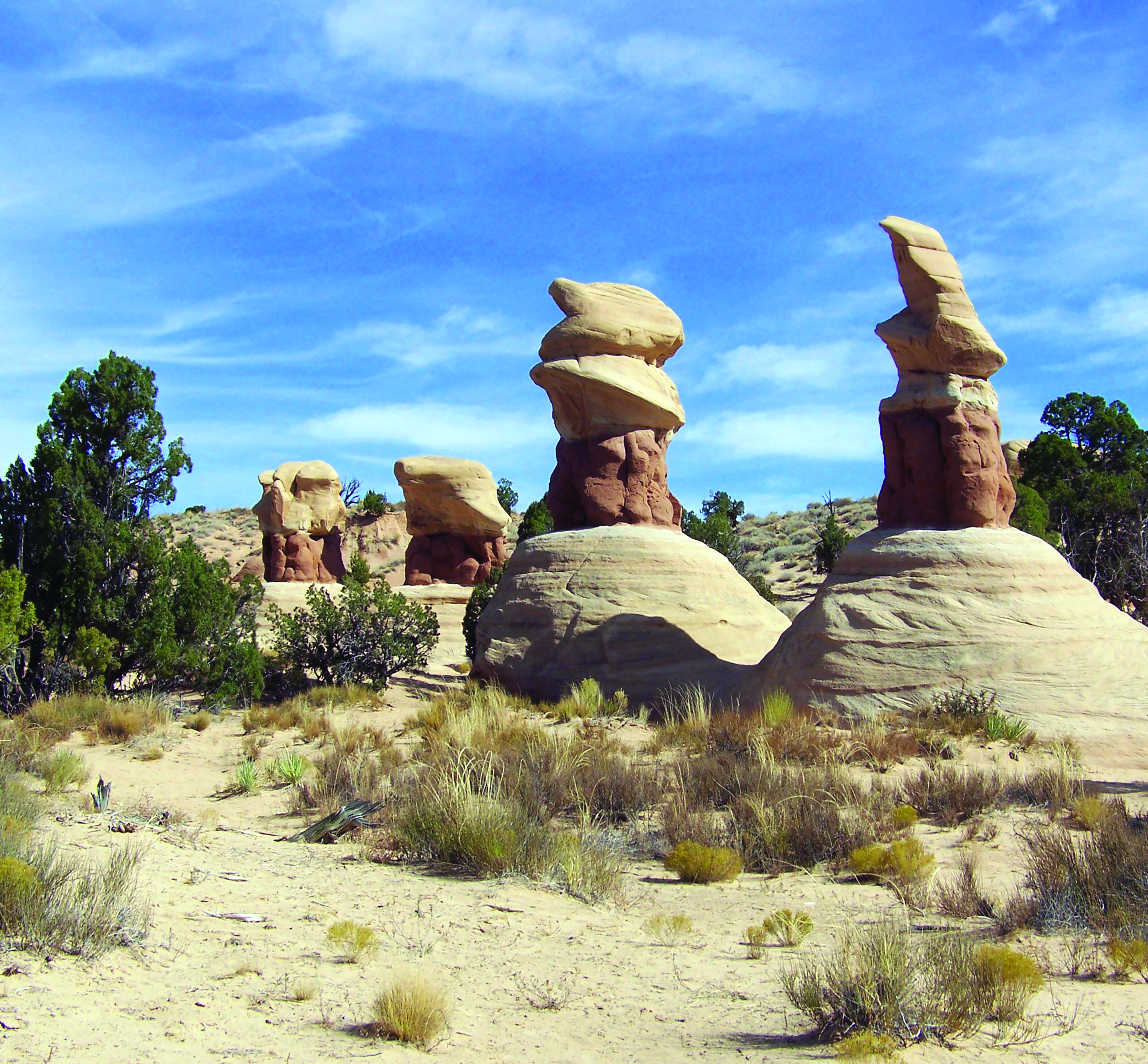
The hoodoos of Devils Garden, Grand Staircase–Escalante National Monument, Garfield County. Photographed by John Good.

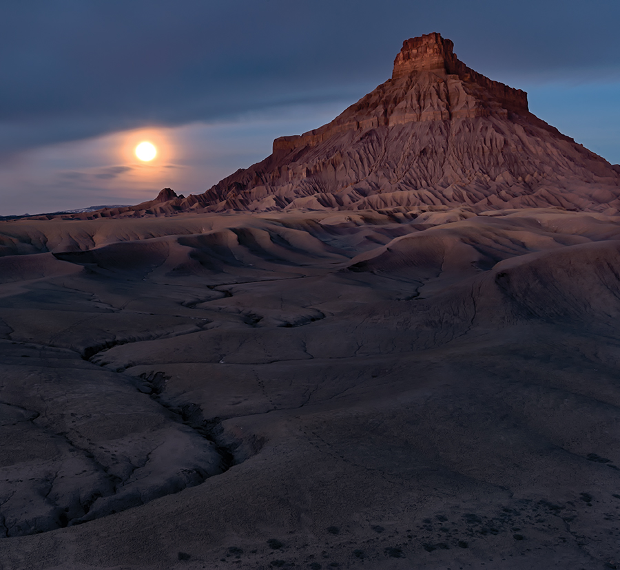
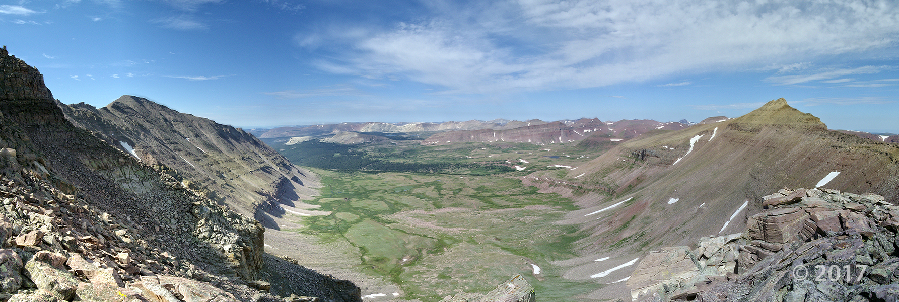
Morning glow and moonset over the Cretaceous-age Mancos Formation of Factory Butte, Wayne County. Photographed by Gregg Beukelman.

Reduced and oxidized mudstone of the Triassic-age Chinle Formation in the San Rafael Swell, Emery County. Photographed by Natural Resources Map and Bookstore clerk Andy Cvar.


Media Contacts

Faults
Steve Bowman (UGS)
801-537-3304
stevebowman@utah.gov

Earthquakes
Walter Arabasz (UUSS)
801-581-7410
arabasz@seis.utah.edu

Emergency Response
Robert Carey (UDEM)
801-538-3784
bcarey@utah.gov

New Map of Utah Earthquakes and Faults Now Available

Salt Lake City (Sept. 21, 2017) – The Utah Geological Survey (UGS), University of Utah Seismograph Stations (UUSS), and Utah Division of Emergency Management (UDEM) recently published the Utah Earthquakes (1850–2016) and Quaternary Fault Map (UGS Map 277). The new map shows earthquakes within and surrounding Utah from 1850 to 2016, and faults considered to be sources of large earthquakes.

The faults shown on the map are considered geologically active, have been sources of large earthquakes (about magnitude 6.5 and greater) during the Quaternary Period (past 2.6 million years), and are the most likely sources of large earthquakes in the future. Most of the small to moderate-sized earthquakes on the map are “background” earthquakes not readily associated with known faults and too small to have triggered surface faulting (under about magnitude 6.5).

There is a 57% probability (over 1 in 2 chance) that a magnitude 6.0 or greater earthquake will occur in the Wasatch Front region in the next 50 years. To address this threat, the Utah Earthquake Program (https://ussc.utah.gov/pages/help.php?section=Utah+Earthquake+Program) consisting of the UGS, UUSS, and the UDEM, developed the map so the public could more fully understand the hazard from earthquakes and faults, as well as the resulting risk to property, infrastructure, and life safety in Utah. Users of the map will be able to determine past earthquake locations and relative magnitudes (size), along with the locations of active faults and the timing of their most recent movement.

Printed copies of the map are available for $15 at the Utah Department of Natural Resources Map & Bookstore (http://mapstore.utah.gov). The map is also available as a PDF download at https://ugspub.nr.utah.gov/publications/maps/m-277.pdf (44 by 62 inches in size) and can be printed on a wide-format printer.

Additional information on the hazard and resulting risk from earthquakes is available at https://geology.utah.gov/hazards/earthquakes-faults/, from the Utah Seismic Safety Commission at https://ussc.utah.gov, and at the agency websites:

UGS: https://geology.utah.gov
UUSS: http://quake.utah.edu
UDEM: https://dem.utah.gov/

The Utah Geological Survey provides timely scientific information about Utah’s geologic environment, resources, and hazards. It is one of seven divisions within the Utah Department of Natural Resources.

NEW PUBLICATION

The Gothic Shale of the Pennsylvanian Paradox Formation, Greater Aneth Field (Aneth Unit), Southeastern Utah: Seal for Hydrocarbons and Carbon Dioxide
By: Jason E. Heath, Thomas A. Dewers, Thomas C. Chidsey, Jr., Stephanie M. Carney, and S. Robert Bereskin

Greater Aneth oil field, Utah’s largest oil producer, has produced over 483 million barrels of oil. Located in the Paradox Basin of southeastern Utah, Greater Aneth is a stratigraphic trap producing from the Pennsylvanian Paradox Formation. Because Greater Aneth is a mature, major oil field in the western U.S., and has a large carbonate reservoir, it was selected to demonstrate combined enhanced oil recovery and carbon dioxide (CO2) storage. The Gothic shale seals the underlying Desert Creek oil reservoir, both in the Paradox Formation. Within the Aneth Unit in the northwestern part of the field, the Gothic is remarkably uniform, consisting of 7 to 26 feet (2–8 m) of black to gray, laminated to thin-bedded, dolomitic marine shale.

This 31-page Miscellaneous Publication is a detailed evaluation of the Gothic seal in the Aneth Unit and its effectiveness at supporting large CO2 and hydrocarbon columns in the Desert Creek reservoir below. This study includes geochemical, petrological, petrophysical, and geomechanical analyses that determined (1) the geologic controls on sealing effeciency, (2) effects of pressure changes on the seal due to CO2 injection and storage, and (3) possible chemical interaction between CO2 and the seal at its contact with the reservoir through time.

GET IT HERE: 

Spring Inventory and Preliminary Groundwater Dependent Ecosystems Assesment of Manti-La Sal National Forest, Wasatch Plateau, Utah
By Paul Inkenbrandt, Richard Emerson, Janae Wallace, J. Lucy Jordan, and Stefan Kirby

GET IT HERE

In cooperation with the U.S. Forest Service, the Utah Geological Survey mapped springs and groundwater dependent ecosystems on the Wasatch Plateau. Using remote sensing, GIS, and field checking, more than 400 points were compiled and plotted for use by the Forest Service.

Yellowstone Basin, Uinta Mountains, Duchesne County

Photographer: Rich Emerson © 2017


FIELD REVIEW INVITATION

Geologic Map of the Tooele 30′ x 60′ Quadrangle,
Tooele, Salt Lake, Davis Counties, Utah

led by Donald L. Clark (UGS Geologist) and Charles G. Oviatt (Emeritus, Kansas State Univ.; Lake Bonneville specialist)

May 9-10, 2017

Day 1 (May 9), meet at Department of Natural Resources building (1594 W. North Temple, SLC, south side of building); gather at 7:00 am, depart at 7:30 am sharp. Review of the eastern part of map area, and return to SLC.

Day 2 (May 10), meet at DNR at 7:00 am, depart at 7:30 am sharp. Review of the western part of map area, and return to SLC.

You are invited to attend a field review highlighting updated geologic mapping of the area west of Salt Lake City. The purpose of the mapping is to accurately describe the stratigraphy, geologic structure, geologic resources, and geologic hazards of the area. These maps are used for land management planning, geologic hazard evaluation, resource assessment and development, and education, as well as by the weekend hobbyist. The trip will be geared to cover a broad audience including geologists, government officials, and the general public.

Highlights

  • Quaternary geology, Lake Bonneville levels and chronology
  • Quaternary fault zones/Basin and Range structure
  • Tertiary sedimentary and volcanic rocks
  • Mesozoic, Paleozoic, Proterozoic stratigraphy
  • Tooele arch, Stansbury uplift, Uinta-Cottonwood arch (western extension)
  • Sevier fold-thrust belt architecture
  • Subsurface and geophysical data
  • Geologic hazards
  • Geologic resources

Information

  • There is no charge; please circulate this notice among your colleagues.
  • For planning purposes, we ask that you RSVP to the UGS (starrsoliz@utah.gov or 801-537-3300); trip questions to donclark@utah.gov or 801-537-3344.
  • Some stops will involve a few short, strenuous hikes.
  • A high-clearance vehicle is preferable; roads become difficult in wet weather; full fuel tank.
  • Please bring your own food, water, boots, hat, field clothes, and warm waterproof jacket.
  • If severe weather threatens, please call the UGS office on day before to see if rescheduled.
  • A signed liability and consent form is required for trip attendance.

This project was funded through the National Cooperative Geologic Mapping Program supported by the Utah Geological Survey and the U.S. Geological Survey.

Print Consent Form


Needles District, Canyonlands National Park, San Juan County
Photographer: J. Lucy Jordan © 2017

sltrib.com

Few places on earth offer geology as interesting as that found in Utah. From the Colorado Plateau to the basin and range of the West Desert to the Wasatch Front, the earth on display is almost unmatched in its variety.

READ MORE

View east from Jackson Bottom along the Colorado River, Grand County.
Photographer: Brian Butler © 2017

Arches National Park, Grand County
Photographer: Gregg Beukelman © 2017

Defying gravity, an estimated 3500-ton sandstone boulder of Jurassic-age Entrada Formation perches atop a pedestal of less resistant sandstone of the Dewey Bridge Member of the Carmel Formation and forms Balanced Rock at Arches National Park. Snow-capped peaks in the background are the La Sal Mountains, a Tertiary-age laccolith.