Last week the Utah FORGE project completed a two- and three-dimensional seismic surveys to further characterize the project area’s buried granite reservoir. Specifically, the survey may help to identify any buried faults that might be zones of fluid flow.

Seismic surveys create subsurface images by generating, recording, and analyzing sound waves that travel through the Earth (such waves are also called seismic waves). Density changes between rock or soil layers reflect the waves back to the surface, and how quickly and strongly the waves are reflected back indicates what lies below.

For the Utah FORGE survey, vehicle-mounted vibrator plates (called vibroseis trucks) generated the source waves and a grid of geophones recorded them. The survey included two 2D surveys that were 2.5 miles long and included approximately 160 source points and geophone receivers each, and a 3D survey that covered 7 square miles and included 1,100 source points and 1,700 geophone receivers. The data is now being processed to generate a three-dimensional map of the subsurface reservoir.

For more a more information on seismic surveys see https://geology.utah.gov/map-pub/survey-notes/glad-you-asked/what-are-seismic-surveys/

Vibroseis truck with geophones (black cases) in the foreground.


Vibroseis truck with pickup and workman for scale.


Vibroseis trucks in action, pads down producing seismic waves.


Media Contact
Vicky Clarke
801-537-3330
vickyclarke@utah.gov

2018 Calendar of Utah Geology is the Best Yet!

The Utah Geological Survey (UGS) recently released the 12th edition of its popular Calendar of Utah Geology. The 2018 calendar features inspiring photographs by UGS staff of Utah’s geologic wonders with a brief explanation of how and when they formed.

Weathering and erosion of the Jurassic-age Entrada Sandstone forms a fantastic array of stone structures locally referred to as “goblins.” Goblin Valley State Park, Emery County. Photographed by Gregg Beukelman.

Eight years ago Gregg Beukelman, whose photograph was selected for the calendar’s cover, moved to Utah from Idaho when he landed his current job as a geologist with UGS’s Geologic Hazards Program. After the move Beukelman found himself with free time in what he describes as “hands down the most beautiful state in the nation.”

Beukelman previously had a passing interest in photography, but it was Utah’s incredible landscapes and vistas that stoked his passion. He now spends many of his off-work hours traveling across Utah searching out vistas and awaiting lighting conditions that allow him to create his stunning images.  Like other employees whose photographs have been featured in the calendar, Beukelman’s have transformed from nice landscape shots to true works of art.

Beukelman is not alone in his path from geology to photography. The calendar has featured more than 40 UGS geologists. Other staff members have taken an opposite tack and were previously artists who sought employment with UGS because of their love of the outdoors and curiosity about geology. UGS graphic designer John Good and Natural Resources Map & Bookstore clerk Andy Cvar are both featured in this year’s calendar.

Both the artists who have turned to geology and the geologists who have turned to art have contributed to a tradition of growing excellence to create what proves to be the best Calendar of Utah Geology to date!

The 2018 Calendar of Utah Geology is the same price as last year, $4.95 each or $4.25 for orders of 10 or more, and is available at the Natural Resources Map & Bookstore, 1594 West North Temple, Salt Lake City, (801) 537-3320 or 1-888-UTAHMAP. They may also be purchased online.

The Utah Geological Survey provides timely scientific information about Utah’s geologic environment, resources, and hazards. It is one of seven divisions within the Utah Department of Natural Resources.

The hoodoos of Devils Garden, Grand Staircase–Escalante National Monument, Garfield County. Photographed by John Good.

Morning glow and moonset over the Cretaceous-age Mancos Formation of Factory Butte, Wayne County. Photographed by Gregg Beukelman.

Reduced and oxidized mudstone of the Triassic-age Chinle Formation in the San Rafael Swell, Emery County. Photographed by Natural Resources Map and Bookstore clerk Andy Cvar.


Media Contacts

Faults
Steve Bowman (UGS)
801-537-3304
stevebowman@utah.gov

Earthquakes
Walter Arabasz (UUSS)
801-581-7410
arabasz@seis.utah.edu

Emergency Response
Robert Carey (UDEM)
801-538-3784
bcarey@utah.gov

New Map of Utah Earthquakes and Faults Now Available

Salt Lake City (Sept. 21, 2017) – The Utah Geological Survey (UGS), University of Utah Seismograph Stations (UUSS), and Utah Division of Emergency Management (UDEM) recently published the Utah Earthquakes (1850–2016) and Quaternary Fault Map (UGS Map 277). The new map shows earthquakes within and surrounding Utah from 1850 to 2016, and faults considered to be sources of large earthquakes.

The faults shown on the map are considered geologically active, have been sources of large earthquakes (about magnitude 6.5 and greater) during the Quaternary Period (past 2.6 million years), and are the most likely sources of large earthquakes in the future. Most of the small to moderate-sized earthquakes on the map are “background” earthquakes not readily associated with known faults and too small to have triggered surface faulting (under about magnitude 6.5).

There is a 57% probability (over 1 in 2 chance) that a magnitude 6.0 or greater earthquake will occur in the Wasatch Front region in the next 50 years. To address this threat, the Utah Earthquake Program (https://ussc.utah.gov/pages/help.php?section=Utah+Earthquake+Program) consisting of the UGS, UUSS, and the UDEM, developed the map so the public could more fully understand the hazard from earthquakes and faults, as well as the resulting risk to property, infrastructure, and life safety in Utah. Users of the map will be able to determine past earthquake locations and relative magnitudes (size), along with the locations of active faults and the timing of their most recent movement.

Printed copies of the map are available for $15 at the Utah Department of Natural Resources Map & Bookstore (http://mapstore.utah.gov). The map is also available as a PDF download at https://ugspub.nr.utah.gov/publications/maps/m-277.pdf (44 by 62 inches in size) and can be printed on a wide-format printer.

Additional information on the hazard and resulting risk from earthquakes is available at https://geology.utah.gov/hazards/earthquakes-faults/, from the Utah Seismic Safety Commission at https://ussc.utah.gov, and at the agency websites:

UGS: https://geology.utah.gov
UUSS: http://quake.utah.edu
UDEM: https://dem.utah.gov/

The Utah Geological Survey provides timely scientific information about Utah’s geologic environment, resources, and hazards. It is one of seven divisions within the Utah Department of Natural Resources.

How does geoscience affect Utah?
The American Geosciences Institute (AGI) is currently releasing State Geoscience Information factsheets that show the role geoscience plays in powering our state’s economy. The Geoscience and Utah Factsheet highlights information from many Utah geoscience areas including, employment, water, minerals, energy and hazards.
Below is page 1 of the Utah factsheet showing an overview of the economic contributions that geology and geoscience bring to Utah.

AGI’s Geoscience Policy team created State Geoscience Information factsheets to inform geoscientists and decision makers on how geoscience impacts their state.

Download the Utah Geoscience Information factsheet

FIELD REVIEW INVITATION

Geologic Map of the Tooele 30′ x 60′ Quadrangle,
Tooele, Salt Lake, Davis Counties, Utah

led by Donald L. Clark (UGS Geologist) and Charles G. Oviatt (Emeritus, Kansas State Univ.; Lake Bonneville specialist)

May 9-10, 2017

Day 1 (May 9), meet at Department of Natural Resources building (1594 W. North Temple, SLC, south side of building); gather at 7:00 am, depart at 7:30 am sharp. Review of the eastern part of map area, and return to SLC.

Day 2 (May 10), meet at DNR at 7:00 am, depart at 7:30 am sharp. Review of the western part of map area, and return to SLC.

You are invited to attend a field review highlighting updated geologic mapping of the area west of Salt Lake City. The purpose of the mapping is to accurately describe the stratigraphy, geologic structure, geologic resources, and geologic hazards of the area. These maps are used for land management planning, geologic hazard evaluation, resource assessment and development, and education, as well as by the weekend hobbyist. The trip will be geared to cover a broad audience including geologists, government officials, and the general public.

Highlights

  • Quaternary geology, Lake Bonneville levels and chronology
  • Quaternary fault zones/Basin and Range structure
  • Tertiary sedimentary and volcanic rocks
  • Mesozoic, Paleozoic, Proterozoic stratigraphy
  • Tooele arch, Stansbury uplift, Uinta-Cottonwood arch (western extension)
  • Sevier fold-thrust belt architecture
  • Subsurface and geophysical data
  • Geologic hazards
  • Geologic resources

Information

  • There is no charge; please circulate this notice among your colleagues.
  • For planning purposes, we ask that you RSVP to the UGS (starrsoliz@utah.gov or 801-537-3300); trip questions to donclark@utah.gov or 801-537-3344.
  • Some stops will involve a few short, strenuous hikes.
  • A high-clearance vehicle is preferable; roads become difficult in wet weather; full fuel tank.
  • Please bring your own food, water, boots, hat, field clothes, and warm waterproof jacket.
  • If severe weather threatens, please call the UGS office on day before to see if rescheduled.
  • A signed liability and consent form is required for trip attendance.

This project was funded through the National Cooperative Geologic Mapping Program supported by the Utah Geological Survey and the U.S. Geological Survey.

Print Consent Form


The Utah Geological Survey (UGS) is proud to announce a major donation of cores from Greater Aneth field in the Paradox Basin of southeastern Utah. This massive and scientifically significant collection of cores (from over 125 wells) was generously donated to the UGS by the field operator, Resolute Energy Corporation of Denver, Colorado. Greater Aneth is Utah’s largest field having produced over 480 million BO and 437 BCFG from oolitic and phylloid-algal limestones and dolomites of the Pennsylvanian Paradox Formation. The UGS and Resolute invite you to attend a special core workshop designed to introduce this amazing collection to the geologic community (industry, universities, consultants, etc.).

  • Sponsors: The Utah Geological Survey and Resolute Energy Corporation
  • Cost: none
  • Date and Time: Tuesday, May 16, 2017, 8:30 A.M.–4:30 P.M.
  • Location: UGS’s Utah Core Research Center (UCRC), 240 North Redwood Road, Salt Lake City, Utah (Ph.: 801/537-3359)
  • Lunch: provided compliments of Resolute
  • Workshop Notes and Handouts: provided compliments of the UGS


Please RSVP

Registration (limited to 40 attendees): Cheryl Gustin, UGS

Ph. – (801) 537-3360; email – cherylgustin@utah.gov

For more information contact: Tom Chidsey, UGS
Ph. – (801) 537-3364; email – tomchidsey@utah.gov

Preliminary Agenda

Welcome and Overview of the UGS’s Core Research Center – Peter Nielsen, UGS Core Center Curator

Lecture Session

Reservoir Properties and Carbonate Petrography of the Aneth Unit, Greater Aneth Field – Tom Chidsey, UGS Geologist, and Dave Eby, Eby Petrography & Consulting, Inc.

Resolute’s Aneth Field Development Program, 2006–Present (Horizontal Drilling and CO2 Injection) – Steve Hoppe, Resolute Engineer

A Quick Note on Desert Creek Nomenclature – Jason Burris, Resolute Geologist

Core Examination Sessions

Core Examination Session I: Dave Eby

Core Examination Session II: Dr. Scott M. Ritter (professor) and graduate students, Brigham Young University Department of Geological Sciences

Roundtable Discussion Session on Research Opportunities/Recommendations – Tom Chidsey, Jason Burris, Scott Ritter, Dave Eby, and Peter Nielsen, Moderators

Closing Remarks/Wrap up – Tom Chidsey

Save

UGS_PRESS-RELEASE-HEADER


Media Contact

Utah Geological Survey
Tom Chidsey
801-537-3364
tomchidsey@utah.gov


New Report Provides Information and Maps to Help Keep Utah “The Place” to Find Oil

Salt Lake City (Jan. 18, 2017) — A new study by the Utah Geological Survey (UGS), Major Oil Plays in Utah and Vicinity, contains the critical maps, data and information to help Utah remain a significant petroleum contributor to the nation while reaping major benefits to the State’s economy for years to come.

The study comes at time of low drilling activity in Utah, and elsewhere, due to current low oil prices. However, oil prices change depending on the economics of global market supply and demand. History has shown that oil prices always rebound and are predicted to rise soon. The UGS study will help petroleum companies, both those already operating in Utah and others considering operations in the state, determine land-acquisition, new exploration, and field-development strategies.

It will also help pipeline companies better plan future facilities and routes. Additionally, landowners, bankers and investors, economists, utility companies, county planners, and numerous government resource management agencies now have the additional data, information, and maps they need to assist with the decisions and evaluations they face.

“One of the benefits of Utah’s diverse geology is a wealth of petroleum resources,” said UGS geologist Tom Chidsey. “Utah’s proven oil reserves have risen significantly to more than 812 million barrels, indicating significant oil remains to be discovered and produced. This study will help increase recoverable oil reserves from existing fields and encourage new discoveries while reducing risk.”

Utah oil fields have produced about 1.6 billion barrels since production began in the late 1940s. Among oil-producing states, Utah ranks eleventh in domestic oil production, having over 150 active oil fields. The 2004 discovery of Covenant oil field in central Utah, a region that had never produced oil or gas, has yielded over 23 million barrels of oil.

Three major oil-producing provinces exist in Utah—the thrust belt, Uinta Basin, and Paradox Basin, in the northern and central, eastern, and southeastern parts of the state, respectively. Utah produces oil from eight major “plays” within these provinces. The UGS study provides “stand alone” play portfolios that describe concisely these major oil plays.

The play portfolios include oil reservoir thickness and rock types; type of oil traps; rock properties; oil and gas chemical and physical characteristics; oil and gas source rocks; exploration and production history; case-study oil fields and exploration potential and trends. Maps of each of the play and sub-play areas are also included.

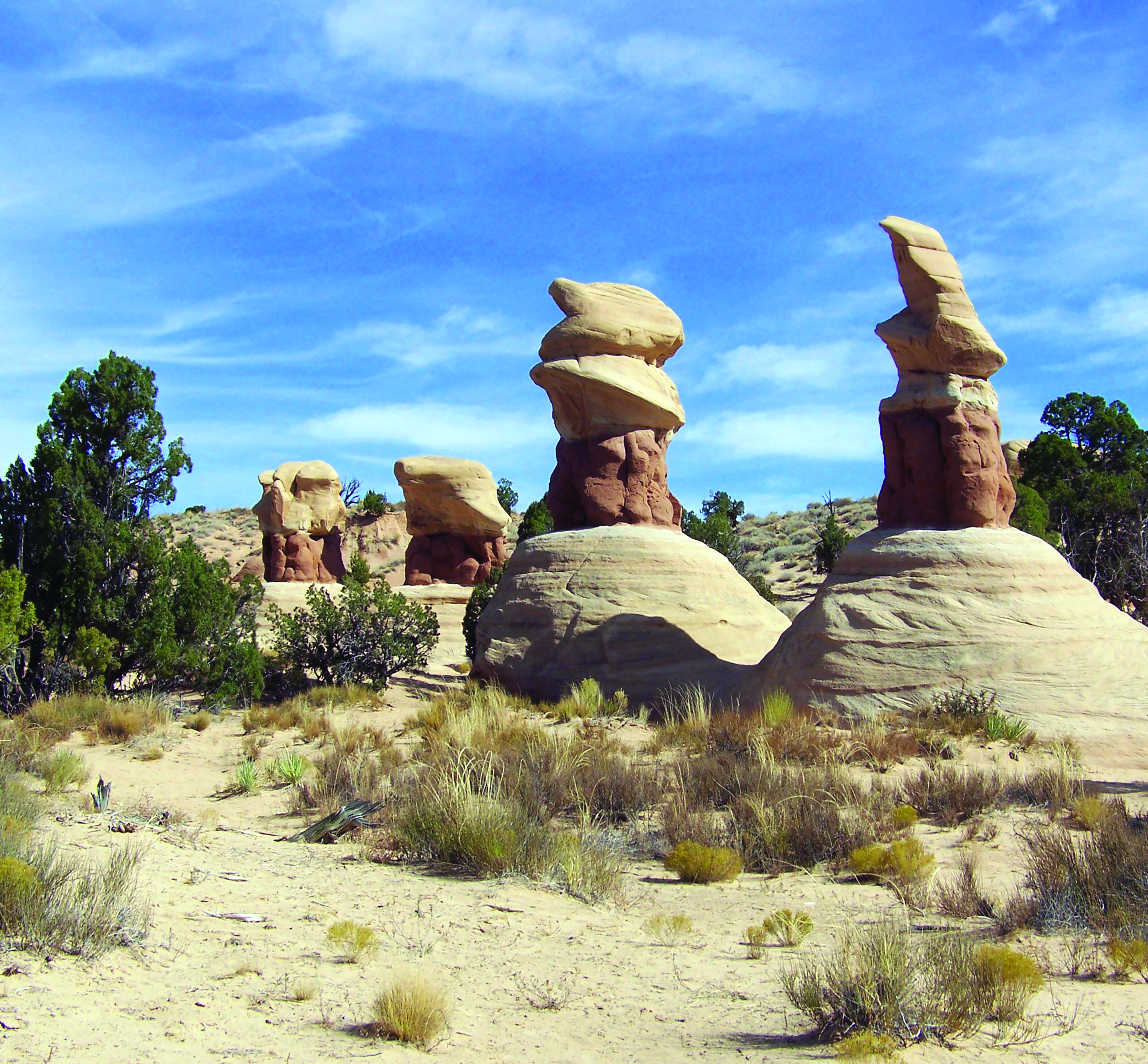
The study also includes descriptions of Utah’s rock outcrops that are analogs for the producing underground reservoirs. Utah’s incredible exposures of the same rocks that produce from deep in the subsurface provide templates to better understand how to produce oil here and from similar reservoirs throughout the world.

The 293-page Utah Geological Survey Bulletin 137, Major Oil Plays in Utah and Vicinity, is available (PDF) for free download from the UGS website at http://ugspub.nr.utah.gov/publications/bulletins/b-137.pdf. Print-on-demand copies are available for purchase from the Utah Department of Natural Resources Map and Bookstore, 1-888-UTAHMAP, www.mapstore.utah.gov. This research was funded by a grant from the U.S. Department of Energy, National Energy Technology Laboratory under the Preferred Upstream Management Program with additional support from the Utah Geological Survey. The Utah Geological Survey, a division of the Utah Department of Natural Resources, provides timely scientific information about Utah’s geologic environment, resources, and hazards.

For more information about major oil plays in Utah, please contact:

Utah Geological Survey
Tom Chidsey
801-537-3364
tomchidsey@utah.gov

Map from the new Utah Geological Survey study showing various oil play areas and major oil and gas fields in the Uinta Basin of eastern Utah. 


deseretnews.com

The Utah Geological Survey has released the 11th edition of its popular calendar of Utah geology.

READ MORE

cover-1024x942

Here’s a feature on our recently released 2017 Calendar of Utah Geology. If you haven’t looked yet, check it out!

stgeorgeutah.com

The Utah Geological Survey has recently released the 11th edition of its popular Calendar of Utah Geology. The 2017 calendar features numerous geological wonders in Utah, including some otherworldly landscapes, with a brief explanation of how and when they formed.

READ MORE

cover-1024x942


Media Contact
Utah Geological Survey
Vicky Clarke
801-573-3330
vickyclarke@utah.gov

2017 Calendar of Utah Geology Showcases Utah’s Otherworldly Landscapes

Salt Lake City (October 17, 2016) — The Utah Geological Survey (UGS) has recently released the 11th edition of its popular Calendar of Utah Geology. “We published the first calendar in 2007 as a fun way to showcase cool photos taken by our geologists when working in the field,” said Vicky Clarke, UGS Publications Manager. The 2017 calendar features numerous geological wonders in Utah, including some otherworldly landscapes, with a brief explanation of how and when they formed.

Competition has grown among the staff (and not just the geologists) to get pictures in the calendar. This year, UGS staff submitted 232 photos for consideration, including some first-time submissions from UGS staff in the Natural Resources Map and Bookstore, who share with the geologists a love of the outdoors and curiosity about Utah’s landscapes. The cover photo of Great Salt Lake mudflats was taken by bookstore clerk Andy Cvar, who noted that “near-record low water levels reveal a landscape that feels like another planet.”

vicky-1

The calendar contains many other photos that can be described as otherworldly. For example, January presents a photo of a surrealistic rock face mottled with a vibrant purple mineral called fluorite. “I see a lot of rock, a lot of scenery and so tend to be drawn to anything I find unusual. Utah is world famous for its red rock, but electric purple? That catches my eye,” said geologist Mark Milligan, who took the photo. Other photos include a boulder on the San Rafael Swell covered with 150 million year old clam fossils, a scene of salt-encrusted mounds in Great Salt Lake, convolute patterns eroded into the blue-gray badlands of North Caineville Mesa, and the multi-hued Gingham Skirts Butte in Kane County.

vicky-8

The 2017 Calendar of Utah Geology is the same price as last year, $4.95 each or $4.25 for orders of 10 or more, and is available at the Natural Resources Map & Bookstore, 1594 West North Temple, Salt Lake City, (801) 537-3320 or 1-888-UTAHMAP. They may also be purchased online at http://www.mapstore.utah.gov. Bookstore manager Brian Butler suggests to “shop early, as these calendars have sold out in previous years.”

The Utah Geological Survey provides timely scientific information about Utah’s geologic environment, resources, and hazards. It is one of seven divisions within the Utah Department of Natural Resources.