sltrib.com
Alongside centuries-old petroglyphs of a bear, a coyote and a bighorn sheep stand the newly etched words “DALLAS TX.”
sltrib.com
Alongside centuries-old petroglyphs of a bear, a coyote and a bighorn sheep stand the newly etched words “DALLAS TX.”
Media Contacts
Utah Geological Survey
Mark Milligan
801-537-3326
MarkMilligan@utah.gov
Utah Geological Survey
Michael D. Vanden Berg, P.G.
801-538-5419
MichaelVandenBerg@utah.gov
Energy is one of Utah’s four cornerstones for success, and the development of clean, secure, low-cost energy is one of the Governor’s top priorities. Energy use and development is a topic of great interest to many Utah residents. Energy is vital to our modern way of life, and energy education is required before citizens can engage in thoughtful dialogue. The Utah Geological Survey’s (UGS) newly updated Utah’s Energy Landscape is a booklet designed to assist Utah residents and others on becoming more familiar with Utah’s diverse energy portfolio.
Two recent events have dominated Utah’s energy scene in the past few years: 1) the collapse of crude oil prices due to a worldwide oversupply, and 2) the exponential increase in both utility-scale and residential PV (photovoltaic) solar capacity. First, Utah’s crude oil price dropped from a high of about $100 per barrel in the summer of 2014 to a low of about $30 in late 2015, with prices dipping to $20 a barrel in early 2016. Consequently, the number of drilling rigs in Utah decreased from about 23 in late 2014, down to 3 rigs in late 2015, and finally down to zero in early March 2016. Since new oil wells are not being drilled to make up for production declines at existing wells, crude oil production in the state decreased nearly 10% in 2015 and is projected to continue to decline as long as prices remain low and rigs remain idled. Similarly, natural gas prices (down 43%) and production (down 7%) have also decreased due to oversupply from the country’s prolific shale reservoirs. Second, in 2015, 166 MW of new utility-scale solar capacity was installed in southwestern Utah and nearly 680 MW is currently under construction or in development. By 2017, nearly 850 MW of new solar capacity will be online, more than wind, hydroelectric, geothermal, and biomass combined. This surge in solar was also seen in the residential sector; the total number of renewable energy tax credits filed in Utah has grown exponentially in the past 6 years, from only 153 in 2009 to 3,061 in 2015, of which 94% were for residential PV.
The state of Utah is fortunate to have abundant and diverse energy resources including large reserves of conventional fossil fuels, several areas suitable for renewable resource development, and vast quantities of untapped unconventional oil shale and oil sands resources. This publication, now in its fourth edition, provides balanced facts on each resource, including maps, graphs, helpful explanations, and photographs. For those interested in obtaining the numbers behind the graphs, each page includes a reference to available historical data located on the UGS’s Utah Energy and Mineral Statistics website.
Printed versions of this publication are available for free at the Natural Resources Map & Bookstore located at 1594 West North Temple, Salt Lake City (801-537-3320, or 1-888-UTAHMAP; geostore@utah.
The Utah Geological Survey provides timely scientific information about Utah’s geologic environment, resources and hazards.
Utah’s crude oil wellhead price hit an all-time, inflation-adjusted high of $95.31 per barrel in 2008. After a recession-related drop in 2009 and 2010, prices rebounded back into the low-$80s between 2011 and 2014 before plunging 49% to $40.69 per barrel in 2015. The value of Utah’s crude oil reached a peak of $3.2 billion in 2014 as a result of high prices and near record production, but retreated to $1.5 billion in 2015.
Due to low prices, no drill rigs were operating in Utah in early March 2016, a situation not seen in the last 50 years (2 rigs were running in April 2016). The previous low was 1 rig running for one week in March 1987. As recently as May 2012, Utah had 42 operating rigs and 22 in September of 2014.
The recent reduction was almost exclusively rigs drilling for crude oil.
The number of renewable energy tax credits processed by the State of Utah has increased exponentially in the past few years, from 153 tax credits processed in 2009 to 3,174 tax credits processed in 2015. The vast majority of these tax credits (94% in 2015) are for residential solar photovoltaic (PV) systems. Also of note, the average size (capacity) of residential solar PV systems has nearly doubled in the past 5 years from 3.3 kW in 2010 to 6.4 kW in 2015. It is thought that this increase is due to decreasing installation and equipment costs as well as a shift towards the desire to cover nearly 100% of a household’s electricity usage. Total solar capacity for the commercial and residential sector in Utah is estimated at about 55 M
As of April 2016, 166 MW of new solar generating capacity has come online in southwestern Utah. In addition, approximately 600 MW of capacity are currently under construction and roughly 80 MW of capacity are under development and should be completed by the end of the year. By 2017, Utah’s utility-scale solar capacity will total 847 MW, more than wind, geothermal, biomass, and hydroelectric combined.
In the first comprehensive study of its kind for Utah, Earthquake Probabilities for the Wasatch Front Region in Utah, Idaho, and Wyoming forecasts the chances for damaging earthquakes in the Wasatch Front region. In the next 50 years there is a 43 percent chance, or nearly 1-out-of-2 odds, of at least one large earthquake of magnitude 6.75 or greater. For a moderate quake of magnitude 5 or greater the probability is 93 percent, or greater than 9-out-of-10 odds.
See images for full press release.
Find the Publication HERE
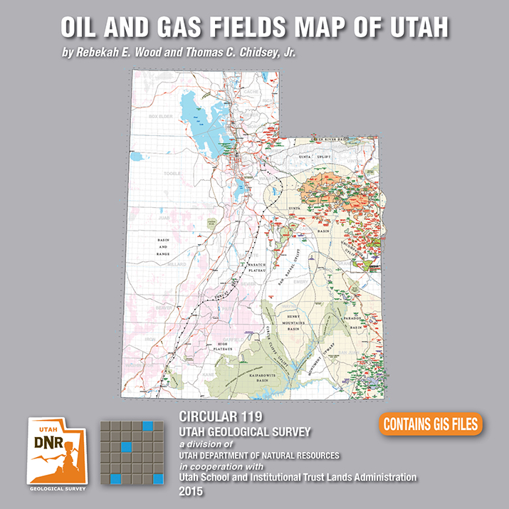
Utah is an important source of crude oil and natural gas, and is currently ranked 11th in United States production. Driven by a decadal long increase in Utah’s oil and gas production, the Utah Geological Survey (UGS) recently released an updated Oil and Gas Fields Map of Utah that shows where most drilling activity has occurred, namely within the Uinta and Paradox Basins in eastern and southeastern Utah, respectively.
This updated map displays Utah’s oil, gas, and carbon dioxide reservoirs; major pipelines; and gas storage fields. In addition to easily identifying areas of current production and potential exploration, the map also shows areas that will not be developed such as national parks and monuments, recreation areas, historic sites, and rock units not expected to contain oil and gas resources. It is beneficial for geologists, engineers, landowners and other stakeholders, as well as state, federal, and county government officials.
The UGS and State of Utah School and Institutional Trust Lands Administration funded this map with the intent to provide an up-to-date quick reference for Utah’s oil and gas resources, production, transportation, and processing. The map, UGS Circular 119, is available for purchase on CD with GIS files, or as a print-on-demand map at the Utah Department of Natural Resources Map and Bookstore, 1-888-UTAHMAP, http://www.mapstore.utah.gov/.
For more information about this map, please contact Rebekah Wood at rwood@utah.gov or 801-537-3378.
Media Contact
Nathan Schwebach
801-538-7303
nathanschwebach@utah.gov
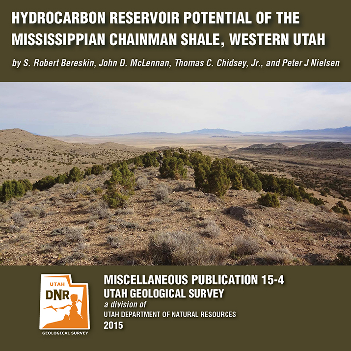
A recently released study by the Utah Geological Survey (UGS), reveals untapped potential oil and gas resources in western Utah and eastern Nevada. Petroleum companies conducting oil exploration in the region can use the study to help evaluate oil and gas potential on federal and state lands, and identify possible drilling targets.
Landowners, government regulators and planners, investors, and other stakeholders will also find.
The UGS study focusses on the rock types, paleoenvironments, mechanical properties (critical for oil and gas production), and chemical characteristics of a 1500-foot-thick Chainman Shale outcrop exposed in the central Confusion Range of western Millard County. The Chainman Shale is an organic-rich geologic formation that was deposited in an ancient sea over 350 million years ago. Additionally, based on the surface samples, the study includes a hypothetical assessment of how much oil and gas the Chainman Shale may contain elsewhere in the region.
The report, UGS Miscellaneous Publication 15-4, is available for purchase in digital format (on CD) from the Utah Department of Natural Resources Map and Bookstore, 1-888-UTAHMAP, http://www.mapstore.utah.gov/. A PDF of a summary poster, which was presented during the 2013 American Association of Petroleum Geologists Rocky Mountain Section meeting in Salt Lake City, is also available on the UGS webpage: http://geology.utah.gov/docs/pdf/chainman_poster_aapg-rms2013.pdf.
For more information about the report or the Chainman Shale, contact Thomas C. Chidsey, Jr., at 801-537-3364 or tomchidsey@utah.org.
Media Contact
Nathan Schwebach
801-538-7303
nathanschwebach@utah.gov
March 17, 2015
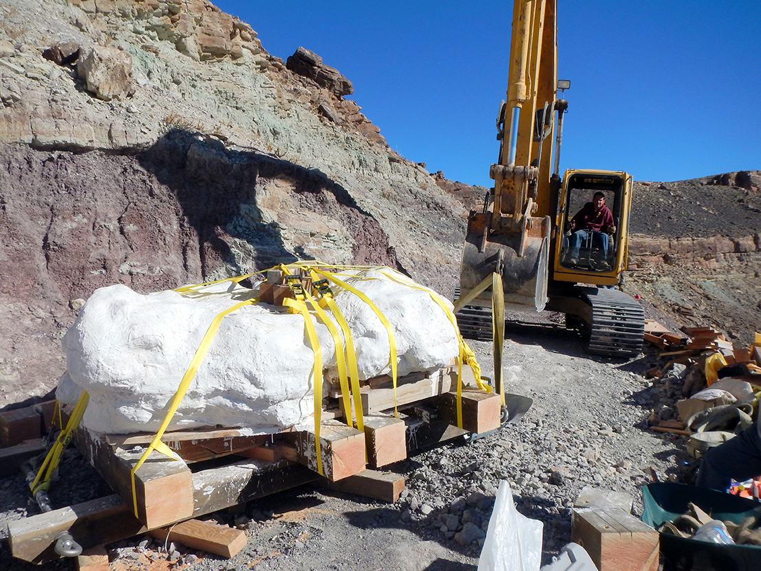
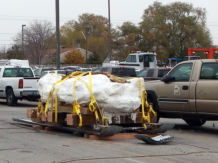
Salt Lake City – March 17, 2015 – The Utah Geological Survey (UGS) has signed an agreement with Thanksgiving Point Institute to extract and prepare the fossils of a pack of Utahraptors encased in a nine-ton sandstone block.
Utahraptors are the oldest known dromaeosaurids, or bird-like therapod dinosaurs. They resemble Steven Spielberg’s Velociraptor from the movie Jurassic Park, but are much larger and believed to be a more ferocious predator.
On Wednesday, March 18th, Cross Marine Projects of American Fork will generously donate their services to relocate the sandstone block from the Utah Department of Natural Resources (DNR) in Salt Lake City to Thanksgiving Point’s Museum of Ancient Life in Lehi. Upon securing the necessary funding, one of the world’s top micropreparators, UGS geologist Scott Madsen, and his colleagues may spend up to five years preparing the fossils in the museum’s paleo lab, begining as early as May.
The museum’s paleo lab has a public observation room and will be equipped with video microscopes to feed video footage into the museum. This public access will give museum visitors an educational opportunity to see firsthand the extensive detail and care paleontologists use to prepare fossils.
“This will allow museum guests to see real science happening in real time,” stated Rick Hunter, Thanksgiving Point paleontologist. “We fully expect to learn much more about raptor behavior and the growth stages from juvenile to adult in Utahraptor. This is going to be huge for paleontology.”
“Thanksgiving Point has the only paleo lab in the region suitable to work on such a large block,” said James Kirkland, UGS State Paleontologist. “This discovery has the best preserved and most complete Utahraptor skeletons ever found. Normally we’d break a large discovery like this into smaller blocks. But this one is so rich with intertwined skeletal remains that we couldn’t split it without hitting skeleton.”
Preliminary analysis of the 125 million year old sandstone indicates the block contains the remains of at least six, and possibly many more, Utahraptors, including one adult, four juveniles, and one baby. Preservation within the block appears exceptional, lending to the hope that details such as feather impressions may be preserved. Bones of at least two iguanodont dinosaurs were also discovered within the sandstone block, leading Utah paleontologists to believe the Utahraptors were hunting when they became mired in quicksand, buried, preserved, and fossilized.
UGS paleontologists originally extracted the mega-block from the Stikes Quarry, which is located on Utah State land in east-central Utah, north of Arches National Park. Matt Stikes, a former graduate student at Northern Arizona University, discovered the site and reported it to the UGS in 2004. Last year Cross Marine Projects donated their services to recover the nine-ton block from its steep hillside location and move it to DNR. All fossils within the block are owned by the State of Utah and after preparation, their final repository will be with the Natural History Museum of Utah.
Media Contact
Mark Milligan
Utah Geological Survey
801-537-3326 (office)
markmilligan@utah.gov
February 19, 2015
Groundwater Levels in Western Juab and Millard Counties are Declining; Additional Pumping Will Accelerate Depletion and Hurt Sensitive-species Habitat and Vegetation
Salt Lake City – A seven year hydrogeologic study to monitor groundwater in Utah’s Snake Valley was recently released by the Utah Geological Survey (UGS), a division of Utah’s Department of Natural Resources. The study shows potential groundwater development in Nevada and Utah would lower groundwater levels and reduce spring flow in west-central Utah used to support agriculture, habitat of sensitive-species and vegetation for grazing.
“The time and resources committed to this study delineates groundwater levels, flow and chemistry in Snake Valley and adjacent basins to a much greater degree than was previously possible,” said Hugh Hurlow, senior scientist for the UGS Groundwater and Paleontology Program. “With pressure to develop groundwater in west-central Utah and east-central Nevada likely to continue, we needed to understand how future development and groundwater use was going to impact Utah residents and natural resources.”
The report, Hydrogeologic Studies and Groundwater Monitoring in Snake Valley and Adjacent Hydropgraphic Areas, West-central Utah and East-central Nevada, closely tested and monitored groundwater in Snake Valley, Tule Valley and Fish Springs in Millard and Juab counties.
Monitoring by UGS revealed that current groundwater use in Snake Valley is slowly depleting the basin-fill aquifer. Present pumping rates will continue to lower groundwater levels and reduce spring flow.
The study also shows future water development and increased pumping in Nevada or Utah would significantly increase the rate and area of groundwater level decline. Additional pumping for local agriculture use, or export from the area would harm springs and shallow groundwater that supports habitat of sensitive-species and vegetation used for grazing.
Additionally, researchers found that shallow basin-fill and deep carbonate-rock aquifers are interconnected. Increased pumping could also cause drawdown from both, which in turn could impact valleys beyond Snake Valley.
“Groundwater pumping would affect environmental conditions and current and future groundwater use in Snake Valley,” Hurlow said. “Taken together, the proposals for groundwater development in the region exceed the groundwater available for development. The current ecosystem would be negatively impacted by all but small levels of additional pumping.”
The UGS study was funded by the Utah Legislature in 2007, primarily to evaluate the impacts of a proposed project by the Southern Nevada Water Authority (SNWA) to pump groundwater from several basins in east-central Nevada for use in Las Vegas. SNWA’s project includes wells in Snake Valley, within five miles of Utah.
SNWA’s original plan requested over 50,000 acre-feet of water per year (AFY) in Snake Valley and over 90,000 AFY in Spring Valley, immediately west of Snake Valley in Nevada. The Nevada State Engineer approved about two-thirds of SNWA’s request for Spring Valley, and has not considered the application for Snake Valley. Legal challenges to the Nevada State Engineer’s award have delayed the project indefinitely.
To complete the hydrogeologic study and groundwater monitoring, UGS developed a monitoring network that includes wells at agricultural areas, springs and remote sites. In all, 76 wells record water levels hourly, and new spring-flow gages are in place at six sites. Data from the study is available on the UGS Groundwater Monitoring Data Portal. Data collection is planned to continue for the foreseeable future.
The report is available for purchase from the Utah Department of Natural Resources Map and Bookstore, 1-888-UTAHMAP, GET IT HERE. A PDF version of the report is also available on the UGS webpage.
Media Contact
Nathan Schwebach
Public Information Officer, DNR
801-440-9094
nathanschwebach@utah.gov
We’ve got our latest publication on the hydrogeologic studies done in Snake Valley hot off the press. Check out the press releases below.
edited by Hugh Hurlow
This report (269 p. 4Pl.) presents hydrogeologic, groundwater-monitoring, and hydrochemical studies by the Utah Geological Survey (UGS) in Snake Valley, Tule Valley, and Fish Springs Flat in Millard and Juab Counties, west-central Utah. Data From the newly established UGS groundwater-monitoring network establish current baseline conditions, and will help quantify the effects of future variations in climate and groundwater pumping. New hydrochemical data show that groundwater quality is generally good, major-solute chemistry varies systematically from recharge to discharge areas, and suggest that most groundwater was recharged over one thousand years ago, implying low recharge rates and/or long or slow flow paths. Two aquifer tests yield estimates of transmissivity and storativity for the carbonate-rock and basin-fill aquifers. Variations in the potentiometric surface, hydrogeology, and hydrochemistry are consistent with the hypothesis of regional groundwater flow from Snake Valley northeast to Tule Valley and Fish Springs. Collectively, our work delineates groundwater levels, flow, and chemistry in Snake Valley and adjacent basins to a much greater degree than previously possible, and emphasizes the sensitivity of the groundwater system to possible increases in groundwater pumping.
Check out some news releases online as well!
deseretnews.com
Study: Snake Valley groundwater development unsustainable
VIEW HERE
kcsg.com
Report highlights impacts to Utah’s Snake Valley if development proceeds
VIEW HERE
If you haven’t heard yet, our latest Calendar of Utah Geology is out and on the shelves. Check out this press release for more information! The calendars are on sale for $4.95 each or $4.25 for orders of 10 or more at the Utah Natural Resources Map & Bookstore, 1594 West North Temple in Salt Lake City. Buy it online HERE.
The photos are taken by staff members who are often on assignment in some of the most intriguing areas of the state.
kcsg.com
The Utah Geological Survey (UGS) is now selling the 9th edition of its popular calendar.
kcsg.com
The Utah Geological Survey (UGS) has released a publication containing 10 geologic-hazard maps for an area of western Salt Lake Valley that includes portions of the rapidly developing cities of Herriman, West Jordan, and South Jordan. The maps address hazards associated with earthquakes, landslides, flooding, debris flows, indoor radon, shallow groundwater, rock fall, shallow bedrock, and problem soil and rock (collapsible and expansive soils). The maps present a comprehensive hazard assessment and were prepared by compiling scientific and field data.