The latest issue of Survey Notes is here!
Find articles on re-mapping the Wasatch Fault using airborne lidar data, mapping geologic hazards in Utah and more among our regular featured columns.
View the latest issue
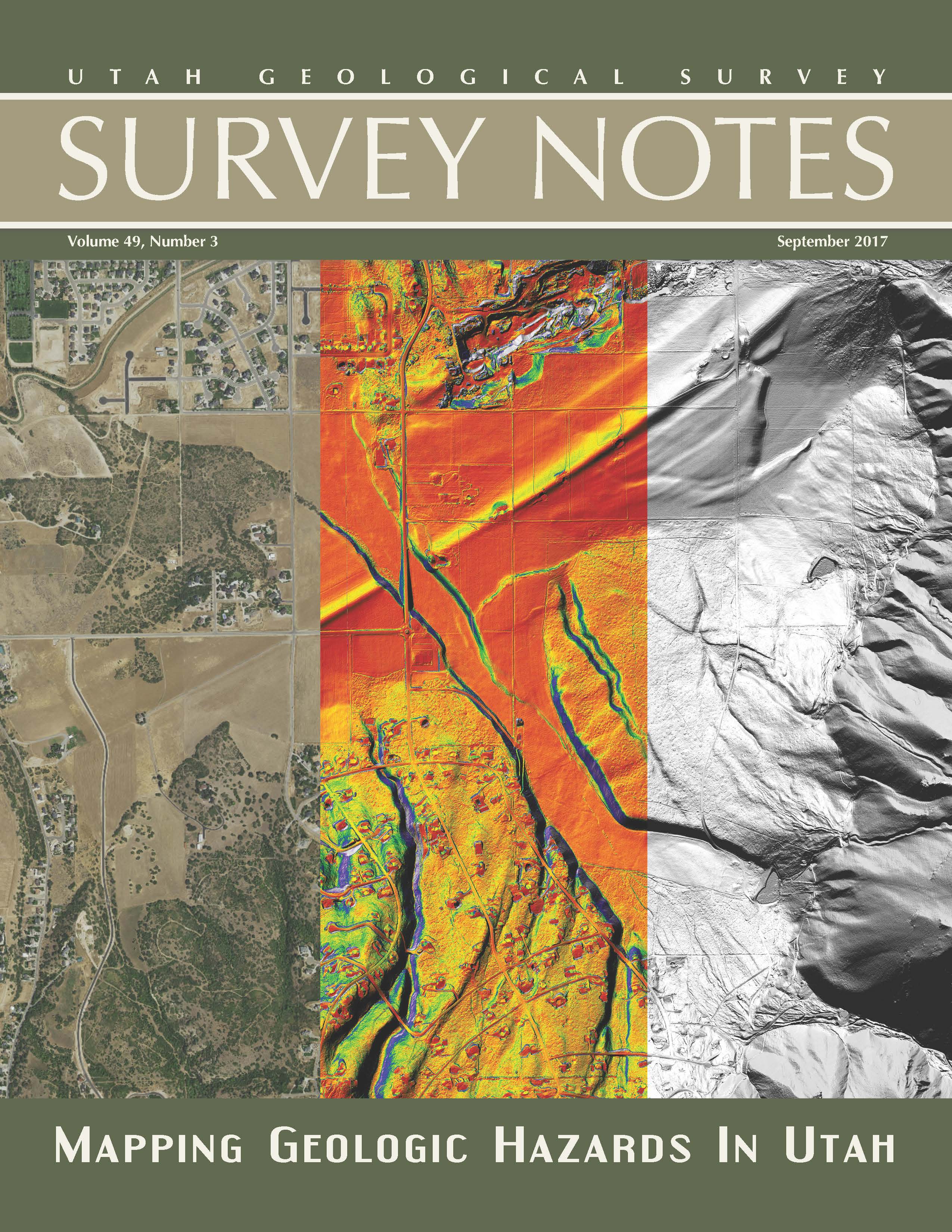
Find articles on re-mapping the Wasatch Fault using airborne lidar data, mapping geologic hazards in Utah and more among our regular featured columns.
View the latest issue

The Utah Geological Survey (UGS) is a division of the Utah Department of Natural Resources. Several specialized programs comprise the UGS: Data Management, Energy & Minerals, Geologic Hazards, Geologic Information & Outreach, Geologic Mapping, Groundwater & Wetlands, and Paleontology.
1594 West North Temple, Suite 3110
Salt Lake City, Utah 84116
801-537-3300 (phone)
801-537-3400 (fax)
Mailing Address:
PO BOX 146100
Salt Lake City, Utah 84114
Monday through Friday,
8 a.m. to 5 p.m.
![]()
