Tag Archive for: Survey Notes


Find articles on the investigation and research of landslides and other geologic hazards in Utah.
View Survey Notes here: https://geology.utah.gov/map-pub/survey-notes/
The latest issue of Survey Notes is now available!
Learn more about the mysteries of the Uinta Mountains and the ancient volcanoes of the Central Wasatch Range.

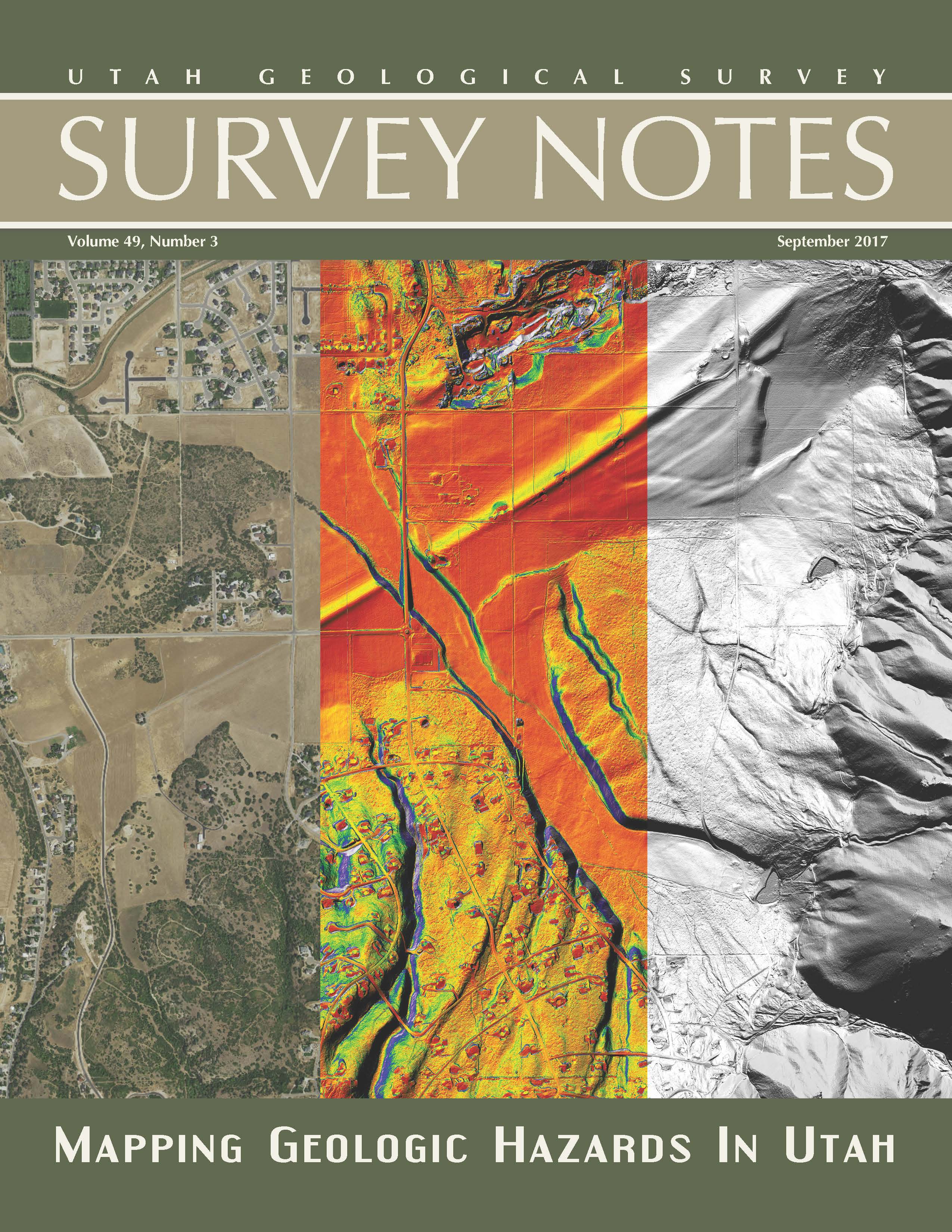
Find articles on re-mapping the Wasatch Fault using airborne lidar data, mapping geologic hazards in Utah and more among our regular featured columns.
View the latest issue
Our latest issue of Survey Notes is here!
Find articles on the Tooele 30’x 60′ quadrangle geologic map and practical uses of geologic maps, along with our regular featured columns.

Our latest issue of Survey Notes is here! Find articles on mapping Utah wetlands & UGS’s role in contributing water-quality data to the National Ground-Water Monitoring Network, and more among our regular featured columns.

Our latest issue of Survey Notes is here!
Find articles on the salt crust on Great Salt Lake’s north arm, the geothermal project near Milford, Utah and more among our regular featured columns.


Our latest issue of Survey Notes is here! Find articles on the new Ogden 30′ x 60′ geological map, the Markagunt Gravity Slide, and more among our regular feature columns.
Tag Archive for: Survey Notes
Find articles on the investigation and research of landslides and other geologic hazards in Utah.
View Survey Notes here: https://geology.utah.gov/map-pub/survey-notes/
The latest issue of Survey Notes is now available!
Learn more about the mysteries of the Uinta Mountains and the ancient volcanoes of the Central Wasatch Range.
Find articles on re-mapping the Wasatch Fault using airborne lidar data, mapping geologic hazards in Utah and more among our regular featured columns.
View the latest issue
Our latest issue of Survey Notes is here!
Find articles on the Tooele 30’x 60′ quadrangle geologic map and practical uses of geologic maps, along with our regular featured columns.
Our latest issue of Survey Notes is here! Find articles on mapping Utah wetlands & UGS’s role in contributing water-quality data to the National Ground-Water Monitoring Network, and more among our regular featured columns.
Our latest issue of Survey Notes is here!
Find articles on the salt crust on Great Salt Lake’s north arm, the geothermal project near Milford, Utah and more among our regular featured columns.
Our latest issue of Survey Notes is here! Find articles on the new Ogden 30′ x 60′ geological map, the Markagunt Gravity Slide, and more among our regular feature columns.
LEARN MORE ABOUT THE UTAH GEOLOGICAL SURVEY
![]()
The Utah Geological Survey (UGS) is a division of the Utah Department of Natural Resources. Several specialized programs comprise the UGS: Data Management, Energy & Minerals, Geologic Hazards, Geologic Information & Outreach, Geologic Mapping, Groundwater & Wetlands, and Paleontology.
QUICK LINKS
CONTACT INFORMATION
Staff Directory1594 West North Temple, Suite 3110
Salt Lake City, Utah 84116
801-537-3300 (phone)
801-537-3400 (fax)
Mailing Address:
PO BOX 146100
Salt Lake City, Utah 84114
HOURS
Monday through Friday,8 a.m. to 5 p.m.