Tag Archive for: utah

sciencefriday.com

When artist Robert Smithson was looking for a location to create his latest earthwork in the late 1960s, he hoped to find a place with red water. He came upon Rozel Point, a remote area in the north arm of Utah’s Great Salt Lake that blooms in pinks and oranges, thanks to an ever-fluctuating community of microbes in the salty waters.

READ MORE

For a more descriptive reasoning of Great Salt Lake’s occasional red coloring, READ MORE HERE.

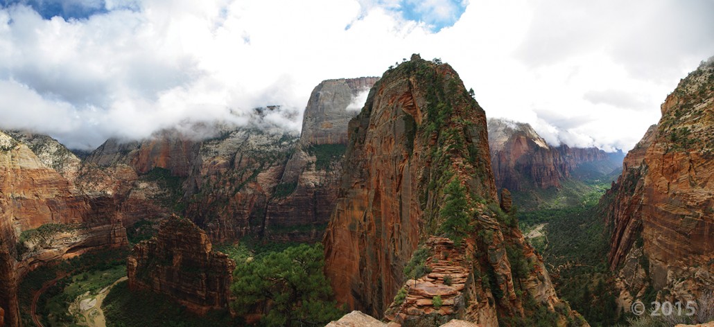
Towering 1,488 feet above the canyon floor, Angels Landing is a joint-controlled resistant fin of Jurassic-age Navajo Sandstone, carved out by the incised North Fork Virgin River. A popular, but steep and exposed, hiking trail guides park visitors along the sheer fin to inspiring views of Zion Canyon. Zion National Park, Washington County, Utah Photographer: Adam McKean; © 2015

POTD 3-15-16 Angels Landing Zion National Park

Zion National Park, Washington County, Utah
Photographer: Adam McKean; © 2015

Towering 1,488 feet above the canyon floor, Angels Landing is a joint-controlled resistant fin of Jurassic-age Navajo Sandstone, carved out by the incised North Fork Virgin River. A popular, but steep and exposed, hiking trail guides park visitors along the sheer fin to inspiring views of Zion Canyon.

The weekend is here and its looking like southern Utah will be enjoying some wonderful fair weather—take a tour of Utah’s National Parks!

www.nationalgeographic.com

This multiday adventure on remote byways is a journey through the slickrock heart of the American West, linking Utah’s “Mighty Five” national parks—Zion, Bryce Canyon, Capitol Reef, Arches, and Canyonlands—with the diverse state parks and nameless vistas of Southern Utah. Each park showcases the iconic landscape of the Colorado Plateau, much of it an ancient Sahara now turned to stone. The surreal tableau of arches, alcoves, hoodoos, and epic canyons is so otherworldly, you may wonder what planet you’re on.

READ MORE

What places in Utah do you love? Check out this little video highlighting one of our favorites—Arches National Park.

sltrib.com

People from around the world come to southern Utah’s Arches National Park to see its iconic imagery that is “always beautiful.”

READ MORE

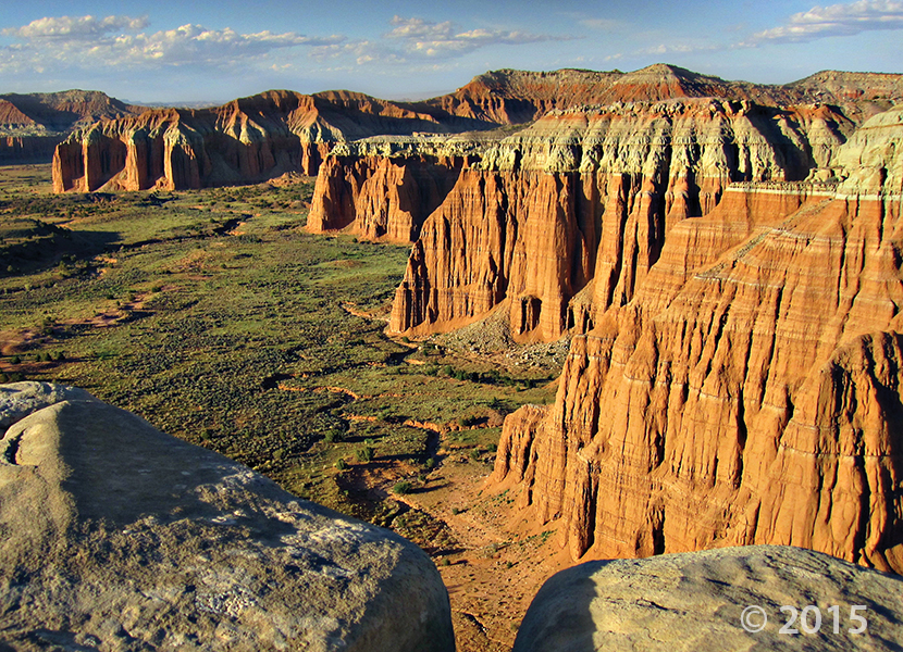
Fluted crimson walls of Jurassic-age Entrada Sandstone rim Cathedral Valley in the remote northern part of Capitol Reef National Park. The near-vertical Entrada walls owe their existence to the overlying white Curtis Formation that serves as a protective cap rock. Capitol Reef National Park, Wayne County, Utah Photographer: Tyler Knudsen; © 2015

Wishing our Tuesday was spent out there! The weather just gets nicer and nicer by the day. What Utah places do you want to explore this year?

POTD 3-8-16 Capitol Reef National Park, WAyne County

Capitol Reef National Park, Wayne County, Utah
Photographer: Tyler Knudsen; © 2015

Fluted crimson walls of Jurassic-age Entrada Sandstone rim Cathedral Valley in the remote northern part of Capitol Reef National Park. The near-vertical Entrada walls owe their existence to the overlying white Curtis Formation that serves as a protective cap rock.

With a little imagination, some fairy tale characters do exist! Utah’s geologic backyard—where some of the wild things are!

kutv.com

Looking for some outdoor adventure, but tired of the crowded parks at the same old locations? Take a step outside the box, and into Emery County, to discover some exciting places many Utahns don’t even know about. From the spectacular geography at Goblin Valley State Park, to the world-class OHV trails and slot canyons, there are countless new adventures to have and memories to make in Emery County.

READ MORE

fox13now.com

Did you feel it? A Magnitude 4.0 earthquake, that has since been downgraded to 3.82, shook southeastern Utah with the epicenter about 43 miles south of Hanksville, Utah, Tuesday.

READ MORE

Find the University of Utah Seismograph Station report HERE

Wasatch Range from northern Goshen Valley, Utah County, Utah Photographer: J. Lucy Jordan; © 2015

POTD 3-1-16 Wasatch Goshen Valley

Wasatch Range from northern Goshen Valley, Utah County, Utah
Photographer: J. Lucy Jordan; © 2015

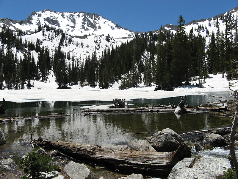
Lower Red Pine Lake occupies part of a cirque basin below White Baldy (11,321 feet). Pleistocene glaciers carved the Tertiary-age granitic bedrock of the Little Cottonwood Stock into a variety of alpine landforms including cirques, arêtes, and horns. Little Cottonwood Canyon, Wasatch Range, Salt Lake County, Utah. Photographer: Taylor Boden; © 2015

POTD 2-23-16 Little Cottonwood Canyon, Wasatch Range

Little Cottonwood Canyon, Wasatch Range, Salt Lake County, Utah
Photographer: Taylor Boden; © 2015

Lower Red Pine Lake occupies part of a cirque basin below White Baldy (11,321 feet). Pleistocene glaciers carved the Tertiary-age granitic bedrock of the Little Cottonwood Stock into a variety of alpine landforms including cirques, arêtes, and horns.

The Red Mountains and the city of Santa Clara, Washington County, Utah Photographer: J. Lucy Jordan; © 2015

This warmer weather has our sights on southern Utah red rock day dreams!

POTD 2-16-16 Santa clara, Washington County

The Red Mountains and the city of Santa Clara, Washington County, Utah
Photographer: J. Lucy Jordan; © 2015