Media Inquiry:
Mark Milligan, Geologist, Utah Geological Survey, (801) 537-3326 – MarkMilligan@utah.gov
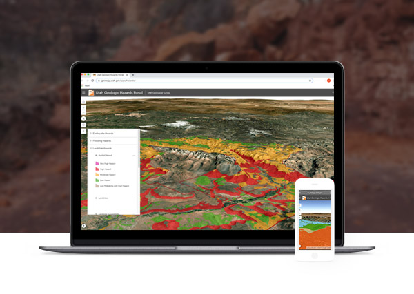
Press Release: New Utah Geologic Hazards Portal allows general public the ability to search and find geologic hazards in their area
Salt Lake City (May 20, 2020) — The Utah Geological Survey (UGS) recently released the Utah Geologic Hazards Portal, an online mapping application that provides information on the type, location, and relative susceptibility of geologic hazards.
Users of the new app can zoom in to their location or search by address to find geologically active faults, landslides, and a host of other geologic hazards in selected areas. The app also includes a report generator designed to provide a summary of information for specific sites.
“Information is power, and this hazards app is full of good information. It’s a simple, but powerful tool that can be used in conjunction with UGS geologic hazard investigation guidelines to help protect Utahns from death, injury, and economic and financial loss,” said UGS Hazards Geologist Jessica Castleton. The app contains post-2008 UGS geologic hazard map data and data from other sources for parts of Utah. Available mapping is at a scale large enough for users to see details such as individual buildings and lots.
The app does not eliminate the need for detailed geologic hazard investigations by Utah-licensed professionals, which further define hazards at specific sites and provide recommendations to mitigate them to safe, acceptable levels.
“While we recommend site-specific hazard investigations prior to building, it’s up to local agencies to regulate development in areas with geologic hazards,” said UGS Hazards Geologist Greg McDonald.
The Utah Geologic Hazards Portal includes recently released detailed mapping of ground surface rupturing faults capable of causing significant damage along the Wasatch Front. The app also delineates special study zones, where site-specific fault investigations are recommended, around the mapped traces of the Wasatch and associated faults. This mapping provides crucial information for reducing earthquake risk in the state’s most densely populated and rapidly developing areas.
Information on geologically active faults, earthquake ground shaking, and landslides are available statewide. Comprehensive geologic hazards data, including multiple hazards related to earthquakes, floods, landslides, and problem soils and rocks, are currently available for the west side of the Salt Lake Valley, St. George, Cedar City (in final review), Moab, the State Route 9 corridor, and the heavily visited areas of Zion National Park and the Glen Canyon National Recreation Area.
Areas shown with completed detailed mapping were prioritized by the availability of funding and need, with rapidly developing areas with multiple previously unmapped hazards completed first. It takes an incredible amount of resources to conduct a thorough investigation and map the suite of geologic hazards that threaten various parts of Utah. Additional mapping is ongoing and currently prioritized for and underway in northern Utah County and Bryce Canyon National Park. Mapping will continue to be added to the app as it is completed.
The Utah Geologic Hazards Portal can be accessed from the UGS website at https://geology.utah.gov/apps/


