Core Center News: Cores from Greater Aneth Oil Field: A Trip Back in Time to Utah’s “Bahama Islands” and “Florida Keys”
By Thomas C. Chidsey, Jr.
Time machines—Homer Simpson made one out of a toaster and Mr. Peabody and his pet boy, Sherman, invented the “Wayback Machine.” If you were to take one of these time machines to southeastern Utah near the Four Corners area and set the dial to 308 million years ago—the middle of the Pennsylvanian Period—transporting you back in time, the region would look very different from the desert landscape of today.
Back then, southeastern Utah was covered by a warm, shallow-marine sea that at times was very salty. Shoals of ooids—rounded sand-size grains composed of concentric layers of calcium carbonate—formed in a high-wave-energy environment on the shallow, lime-mud seafloor or along the beach swash zones. Banks of broken shells, corals, and other skeletal debris also accumulated as coarse sands in the shallows. Currents removed most of the mud from these skeletal and ooid deposits, leaving open pore space between the grains.
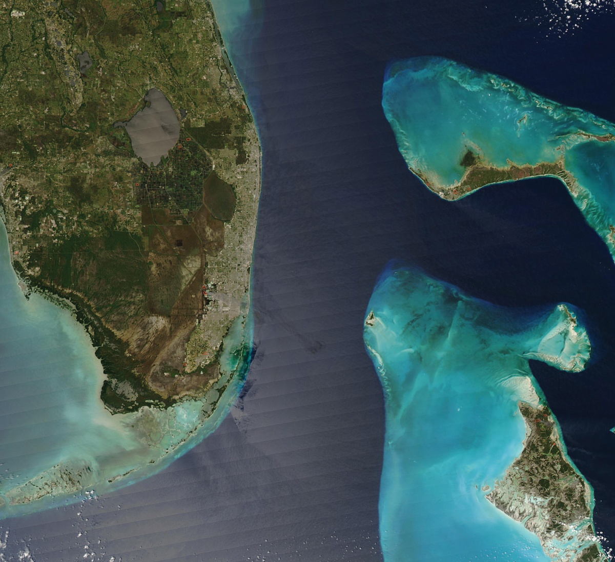
Additionally, patches of leafy, seaweed-like algae, called Ivanovia and Kansasphyllum, built up from the sea bottom to the surface in well-circulated, moderate- to low-energy environments, and were occasionally exposed to the atmosphere. These algal buildups or “mounds” can be likened to giant piles of potato chips, each “chip” being an algal leaf or plate, and spaces between the chips being pores. These same types of deposits—ooid shoals, skeletal banks, and algal mounds—can be found today around the Bahama Islands and along the Florida Keys, no time machine required!
So what happened to these marine deposits in Utah since Pennsylvanian time? A lot! They were (1) sealed, top and bottom, by organic-rich marine muds and layers of evaporites (anhydrite and/or salt); (2) lithified (compressed and cemented into the carbonate rock limestone) and preserved as layers in southeastern Utah’s Paradox Formation; (3) buried thousands of feet below sea level and heated for millions of years, causing the contained organic material to “cook” into oil and migrate into the pores that still existed between the ooids, skeletal grains, and algal plates, where it became trapped and stored; and (4) uplifted back up thousands of feet to their current depth (from 7,000 feet below the ground to surface outcrops seen along the San Juan River Canyon).
Along the way, some of the rocks and pores within them underwent changes called diagenesis. Mineral-bearing fluids altered some limestone to a rock called dolomite (a magnesium-calcium carbonate). In other instances, pores were plugged with various minerals and tar-like “dead” oil called bitumen, whereas new pores were created by fresh water dissolving ooids, skeletal grains, and algal plates.
Why is this all so important? Sixty years ago Texaco Inc. drilled a wildcat well in southeastern San Juan County, the No. 1 Navajo C, into the porous, marine limestone rocks of the Paradox Formation and discovered Greater Aneth oil field—the largest oil field ever found in Utah. Greater Aneth has produced over 479 million barrels of oil as of January 1, 2016. The field still has 445 active wells, which produce over 11,000 barrels of oil per day, and should continue to be a major contributor to Utah’s oil production for many years to come. Dozens of similar but smaller fields have since been discovered and produce oil throughout this region of Utah referred to as the Paradox Basin.
The Utah Core Research Center (UCRC) has an incredible collection of cores taken from wells in Greater Aneth and surrounding fields that produce from the Paradox Formation, generously donated by the various oil field operators and petroleum exploration companies over the years. Once slabbed (cut in half), these cores show, up close and personal, all the various environments of deposition (ooid shoals, skeletal banks, algal mounds, etc.) that existed during Pennsylvanian time in southeastern Utah. They also show the diagenetic changes that have occurred over the millions of years since and how those events affect oil production. Additionally, the rocks in cores indicate sea level fluctuations and cyclicity, important factors in understanding differences in oil production from one well to another and identifying new drilling locations.
The characteristics of the Paradox Formation observed in the Aneth field cores provide outstanding teaching tools for geology students. Professional industry geologists also use these cores to help search for potential new oil fields in Utah or better understand how to recover more oil from existing fields. The cores are also used to help explore for similar fields elsewhere in the world, especially where cores are not available.
For example, Greater Aneth cores have been used in several major Utah Geological Survey (UGS) studies designed to increase production from other nearby fields, reduce drilling risks, and lead to new discoveries. Greater Aneth was also a focus of a major UGS field characterization project to enhance oil production from this very mature field by injecting carbon dioxide gas into the porous rocks to force remaining oil out, thus extending the life of the field (see article titled “Geological Sequestration of Carbon Dioxide and Enhanced Oil Recovery— the Utah Geological Survey’s Efforts to Reduce Global Warming While Increasing Oil Production,” 2007 Survey Notes, v. 39, no. 2, p. 4–7).
The great British geologist, Sir Charles Lyell, in his three-volume Principles of Geology, published in 1830–33, popularized one of the first concepts of modern geologic thought, “The present is the key to the past.” I would add that the Paradox Formation cores at the UCRC from Aneth and other fields are keys to understanding Utah’s geological past.
To see the Greater Aneth oil field core set or schedule a workshop at the UCRC, contact Peter Nielsen, Curator (801-537-3359, peternielsen@utah.gov).
Survey Notes, v. 48 no. 3, September 2016


