
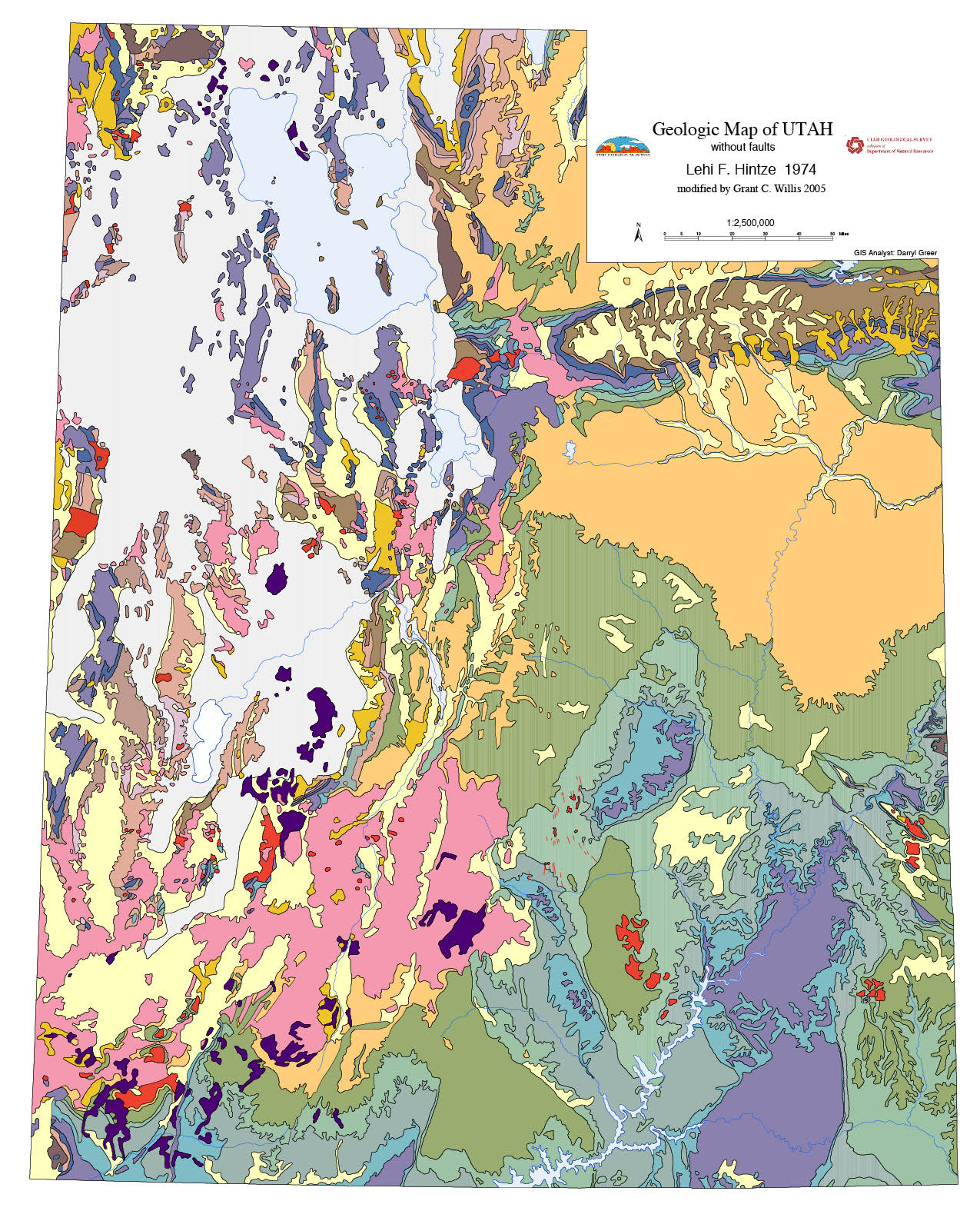
Simplified Geologic Map of Utah, 1:2,500,000-scale.
The Utah Geological Survey has an active project to improve the Geologic Map of Utah. This project will improve the GIS database; update and add detail to formation names, ages, and descriptions; and make limited improvements to the geology.
Even though it is now 40 years old, it still is a good map. However, we are aware that it has room for improvement, such as missing contacts and faults, lumped units that are not logical, polygons that are mislabeled, unit names that are out of date, and changes due to new research and detailed mapping in some areas.
This is where you come in. If you have ever stumbled across any problem on this map, we would like to hear about it. Please send an email, and a screen capture if it would be helpful, explaining the problem to grantwillis@utah.gov.
Please note that our goal is not to add more detail to this map. A state map at 1:500,000 scale was never meant to be detailed. We have other maps for that purpose.
You can view this map in the Geologic Map Portal on the homepage of the UGS website at geology.utah.gov. And while you are on our website, check out all the new or improved tools to help you find the geologic maps you need.


