If you missed it a couple of weeks ago, here is an article outlining the paleoseismic study some of our UGS geologists helped with on a trench.

nextcity.org

Not far from I-215 in Salt Lake City, near the airport, a deep trench cuts through the earth. Though it looks like a sewer repair project, there’s nothing down here but dirt. And dirt, to the trained eye, can reveal quite a bit about a city’s future.

READ MORE

UGS geologists conducting a trench investigation to gather fault and earthquake data.

Take a quick minute today on your afternoon break to think about earthquake preparedness. What have you done around your home to help relieve potential damage from a large earthquake? Have you talked to your family and friends, do you have an action plan if an earthquake occurs?

A team of geologists, including some of our very own Utah Geological Survey geologists, have been studying the Taylorsville-West Valley City fault over the last couple of weeks. They hope to gain a better understanding of the fault’s ability to produce large earthquakes, and if that fault tends to rupture with or without the Wasatch Fault. Below are a couple of articles outlining all of their hard work and findings!

deseretnews.com

Geologists sample Taylorsville-West Valley fault line to study earthquake risk

A team of geologists has dug a 150-foot trench by the Salt Lake City International Airport to study the Taylorsville-West Valley City fault, and its rock samples will help scientists forecast when the next major earthquake could erupt along the Wasatch fault.

READ MORE


ksl.com

Utahns ‘lulled into a false sense of security’ in earthquake prep

A team of geologists has dug a 150-foot trench by the Salt Lake City International Airport to study the Taylorsville-West Valley City fault, and its rock samples will help scientists forecast when the next major earthquake could erupt along the Wasatch fault.

READ MORE

UGS geologists conducting a trench investigation to gather fault and earthquake data.

We hope you all had an enjoyable and safe long Labor Day weekend! Here’s a little story for the Tuesday morning catchup. A research team, including some of our UGS geologists, are studying a portion of the Taylorsville-West Valley City Fault to gain a better sense of past earthquakes on the fault. Read more!

fox13now.com

A research team is digging up a portion of the Taylorsville-West Valley City Fault out by the Salt Lake City International Airport, and their goal is to get a better sense of the danger from that fault and how big of an earthquake it could create.

READ MORE

C-119 Insert

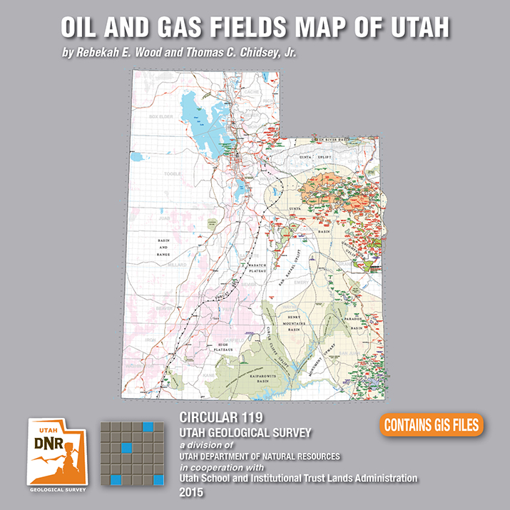
Utah is an important source of crude oil and natural gas, and is currently ranked 11th in United States production. Driven by a decadal long increase in Utah’s oil and gas production, the Utah Geological Survey (UGS) recently released an updated Oil and Gas Fields Map of Utah that shows where most drilling activity has occurred, namely within the Uinta and Paradox Basins in eastern and southeastern Utah, respectively.

This updated map displays Utah’s oil, gas, and carbon dioxide reservoirs; major pipelines; and gas storage fields. In addition to easily identifying areas of current production and potential exploration, the map also shows areas that will not be developed such as national parks and monuments, recreation areas, historic sites, and rock units not expected to contain oil and gas resources. It is beneficial for geologists, engineers, landowners and other stakeholders, as well as state, federal, and county government officials.

The UGS and State of Utah School and Institutional Trust Lands Administration funded this map with the intent to provide an up-to-date quick reference for Utah’s oil and gas resources, production, transportation, and processing. The map, UGS Circular 119, is available for purchase on CD with GIS files, or as a print-on-demand map at the Utah Department of Natural Resources Map and Bookstore, 1-888-UTAHMAP, http://www.mapstore.utah.gov/.

For more information about this map, please contact Rebekah Wood at rwood@utah.gov or 801-537-3378.


Media Contact
Nathan Schwebach
801-538-7303
nathanschwebach@utah.gov

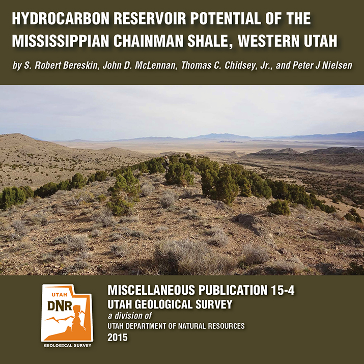
MP 15-4 Insert Hydrocarbon Chainman Shale

A recently released study by the Utah Geological Survey (UGS), reveals untapped potential oil and gas resources in western Utah and eastern Nevada. Petroleum companies conducting oil exploration in the region can use the study to help evaluate oil and gas potential on federal and state lands, and identify possible drilling targets.

Landowners, government regulators and planners, investors, and other stakeholders will also find.

The UGS study focusses on the rock types, paleoenvironments, mechanical properties (critical for oil and gas production), and chemical characteristics of a 1500-foot-thick Chainman Shale outcrop exposed in the central Confusion Range of western Millard County. The Chainman Shale is an organic-rich geologic formation that was deposited in an ancient sea over 350 million years ago. Additionally, based on the surface samples, the study includes a hypothetical assessment of how much oil and gas the Chainman Shale may contain elsewhere in the region.

The report, UGS Miscellaneous Publication 15-4, is available for purchase in digital format (on CD) from the Utah Department of Natural Resources Map and Bookstore, 1-888-UTAHMAP, http://www.mapstore.utah.gov/. A PDF of a summary poster, which was presented during the 2013 American Association of Petroleum Geologists Rocky Mountain Section meeting in Salt Lake City, is also available on the UGS webpage: http://geology.utah.gov/docs/pdf/chainman_poster_aapg-rms2013.pdf.

For more information about the report or the Chainman Shale, contact Thomas C. Chidsey, Jr., at 801-537-3364 or tomchidsey@utah.org.

Media Contact
Nathan Schwebach
801-538-7303
nathanschwebach@utah.gov

Bill Lund, one of our senior scientists here at the Utah Geological Survey, weighs in on the issues surrounding groundwater mining and its effects in Iron County.

kuer.org

We can’t see aquifers, but these underground water reservoirs make life possible in the West. As we continue our series on Utah’s Uncertain Water Future, we explore the consequences of mining groundwater in Utah’s Cedar Valley.

READ MORE

Happy Friday! Take a minute to enjoy Discovery Canada’s short on our Paleontologists here at the Utah Geological Survey and their work on the nearly 9-ton fossil block containing a family of Utahraptor. See James Kirkland, Scott Madsen, Don DeBlieux, and help from others as they unravel their Utahraptor puzzle.

discovery.ca

SEE IT HERE

kutv.com

A 125-million-year-old fossil was delivered to Thanksgiving Point’s Museum of Ancient Life in Lehi, nearly 15 years after a graduate student discovered the dinosaur site.

READ MORE

standard.net

State scientists have weighed in on Summit’s controversial pump test, and appear to have some positive implications for the ski resort owners.

READ MORE

Here’s a read covering the issues in Iron County surrounding the declining underground water levels, and its effects up above.

ironcountytoday.com

Since at least the 1960s, more water has been removed from Cedar Valley’s underground water supply than has been replenished, and that problem is only getting worse.

READ MORE