kutv.com
(KUTV) — On Sunday afternoon, two visitors were injured by a rockfall at Zion National Park.
kutv.com
(KUTV) — On Sunday afternoon, two visitors were injured by a rockfall at Zion National Park.

The Natural Resources Map & Bookstore is the place to research your next outdoor adventure. It specializes in maps and guides for outdoor recreation including hiking, off-highway vehicles, rockhounding, hunting, fishing, and other activities. It’s the state’s official source for more than 1,500 USGS topographic maps, and can print on demand any of the more than 55,000 topographic maps for the entire United States.
There is also unique collection of Utah-centric books on history and folklore, birds, flowers, outdoor survival, treasure hunting, wild game and outdoor cooking, petroglyphs, and more. Come browse through the large selection of maps and books for all Utah outdoor enthusiasts published by DNR divisions as well as private publishers.
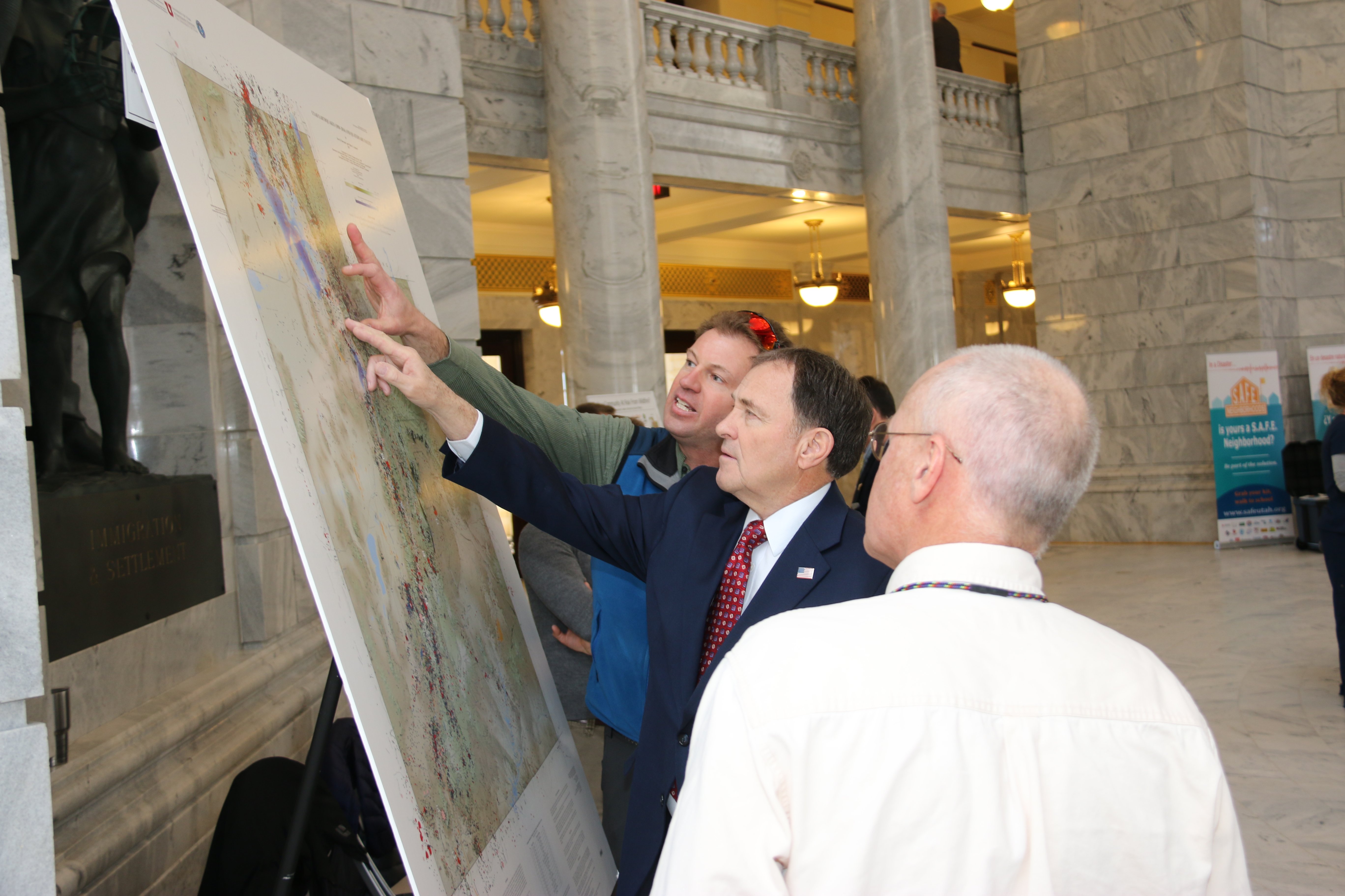
UGS geologists participated in the Preparedness on the Hill event yesterday at the State Capitol. Governor Herbert stopped by and discussed earthquake hazards in Utah, and Steve Bowman explained the newly released “Utah Earthquakes (1850–2016) and Quaternary Faults” map. Photo courtesy of the Division of Emergency Management.
In August, the Utah FORGE project took a big leap forward with the drilling of a 7,000-foot deep geothermal scientific well. As part of our continuing effort to keep all stakeholders engaged and up to date, Utah FORGE conducted a field visit for stakeholders on August 23rd.
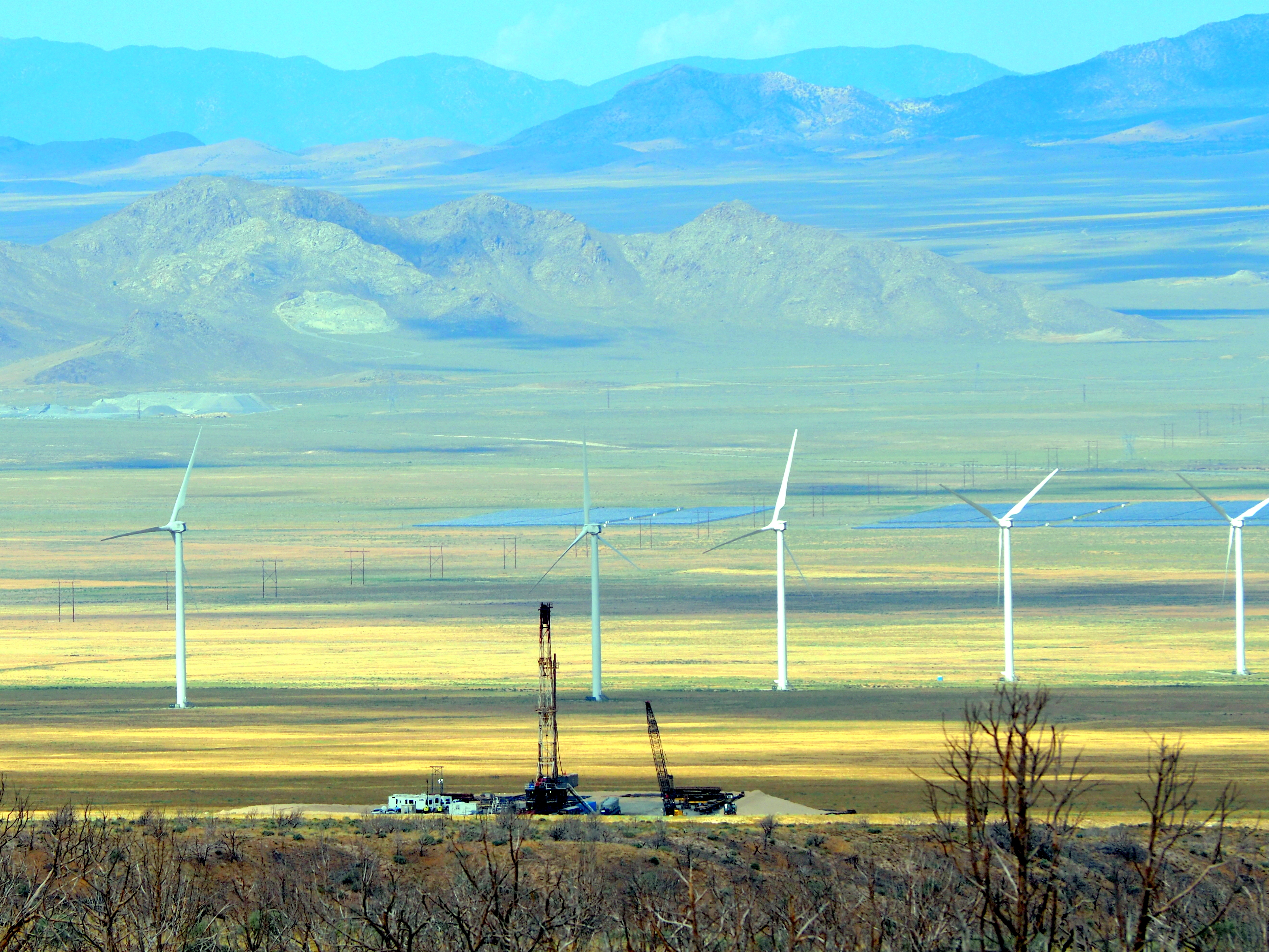
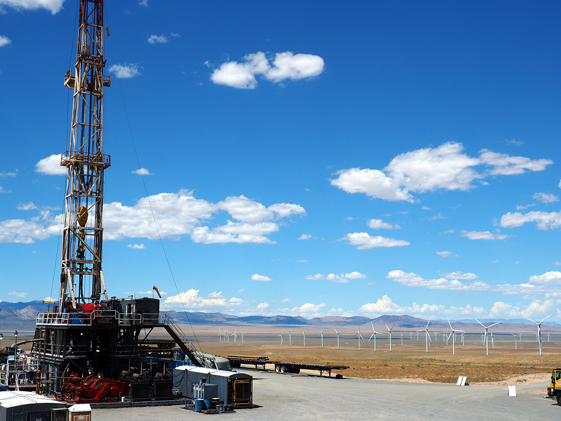
The Utah Forge site lies within an established renewable energy hub and energy corridor. View looking west showing the Utah FORGE drill rig, wind farm and blue solar panels in the distance.
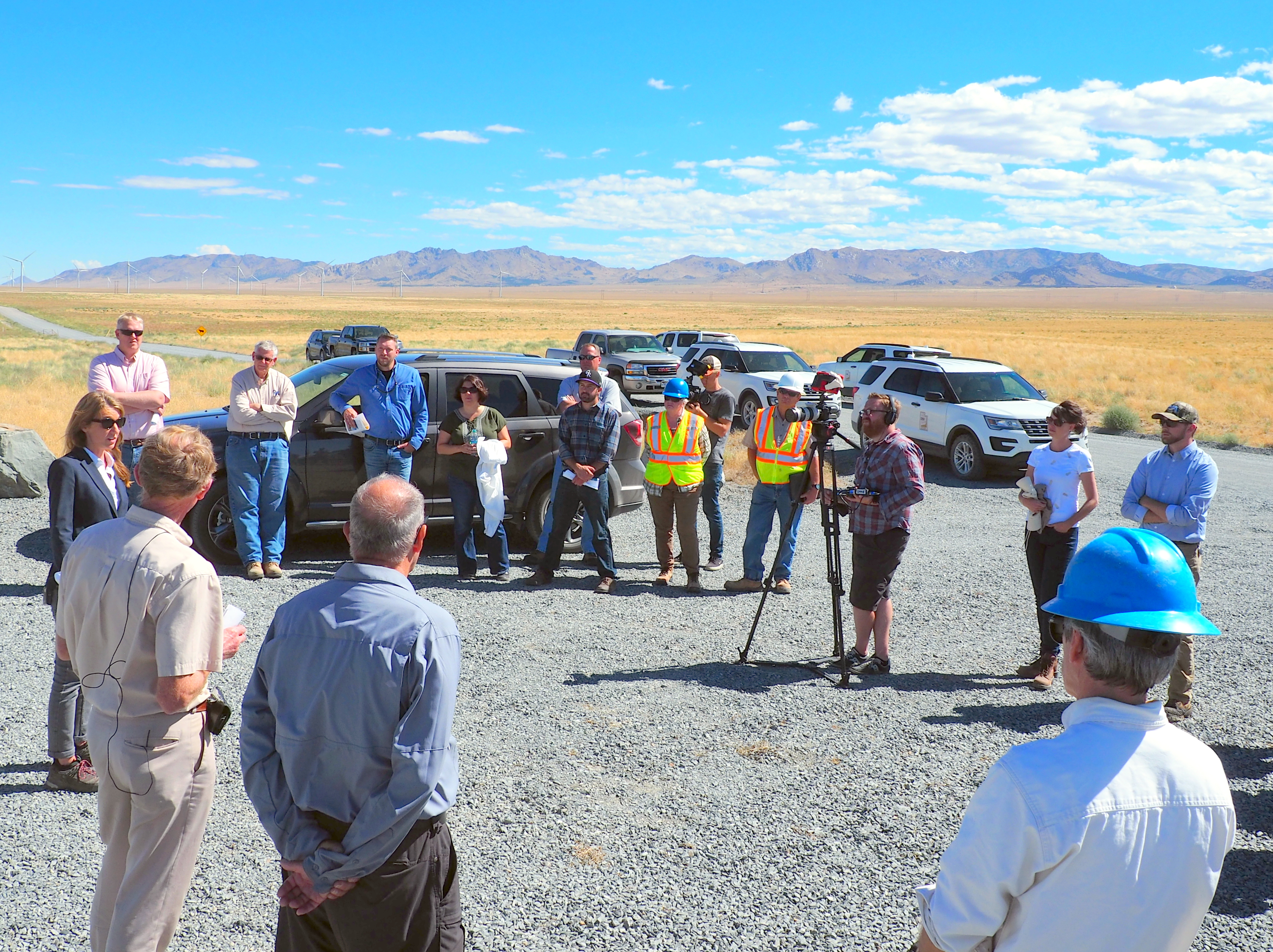
The field trip was well attended and included representatives from the Utah Division of Water Rights, Rocky Mountain Power, Utah School and Institutional Trust Lands Administration (SITLA), Bureau of Land Management (BLM), Utah Division of Water Quality (DWQ), Utah Governor’s Office of Energy Development (OED), U.S. Department of Energy Geothermal Technologies Office (DOE), Hot Rock MS, Beaver City Government, Beaver County Commission, Beaver County Government, Sun Edison, Energy and Geoscience Institute (EGI), Utah Geological Survey (UGS), Idaho National Laboratory (INL), Kenai Drilling, Sinclair Well Products and Services, and West Coast Geologic.

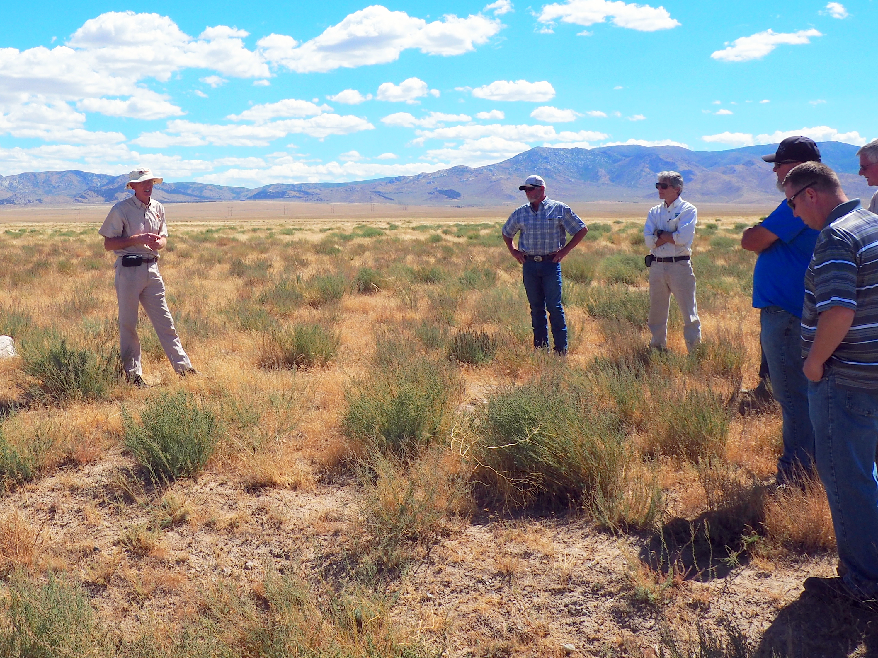
STOP 1. Participants met about 4 miles southwest of the drill site at the First Wind information kiosks, which displays signs about the area’s geology, archaeology, history, and wind power generation. At this stop introductions were made and the U.S. DOE Enhanced Geothermal System Manager Lauren Boyd gave an overview of the FORGE program. For more information on enhanced geothermal systems and the DOE’s FORGE program, see https://energy.gov/eere/forge/forge-home.

Lauren Boyd, speaking to the group about FORGE and enhanced geothermal systems.
STOP 2. Future site of the Utah FORGE project office where stakeholders were updated about the project. The well pads, infrastructure, and office site will be located on Smithfield Foods and SITLA lands. The site and facilities will be easily accessible to future researchers and the public. Dr. Rick Allis, far left, is the State Geologist and one of the Utah FORGE co-Principal Investigators.
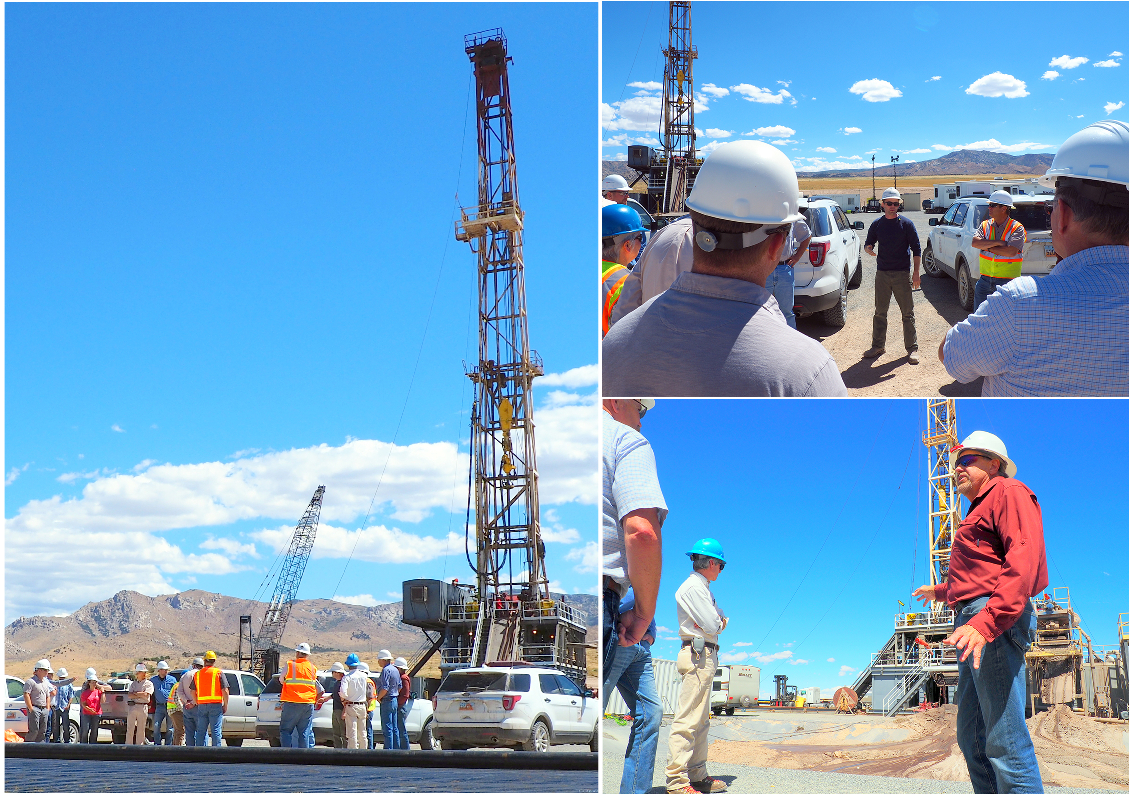
STOP 3. Left photo. The drill rig! The well is being drilled to provide information on temperature, rock type, permeability, and stresses within the rocks that will ultimately form the geothermal reservoir. The well will reach an anticipated depth of 7000 feet where temperatures will exceed 350 Fahrenheit. Upper right. The mud logger is giving a safety presentation to the group. Lower right. View looking across the mud pit. Drilling fluid (mud) is circulated down the well during drilling to remove rock cuttings and keep the bit cool. Drilling fluid no longer suitable for use is pumped into the mud pit to avoid contaminating the environment. The dark material in the center of the picture is wet drilling fluid Continuous drilling with cooled drilling fluid means the true temperature at the bottom of the hole has yet to be determined.
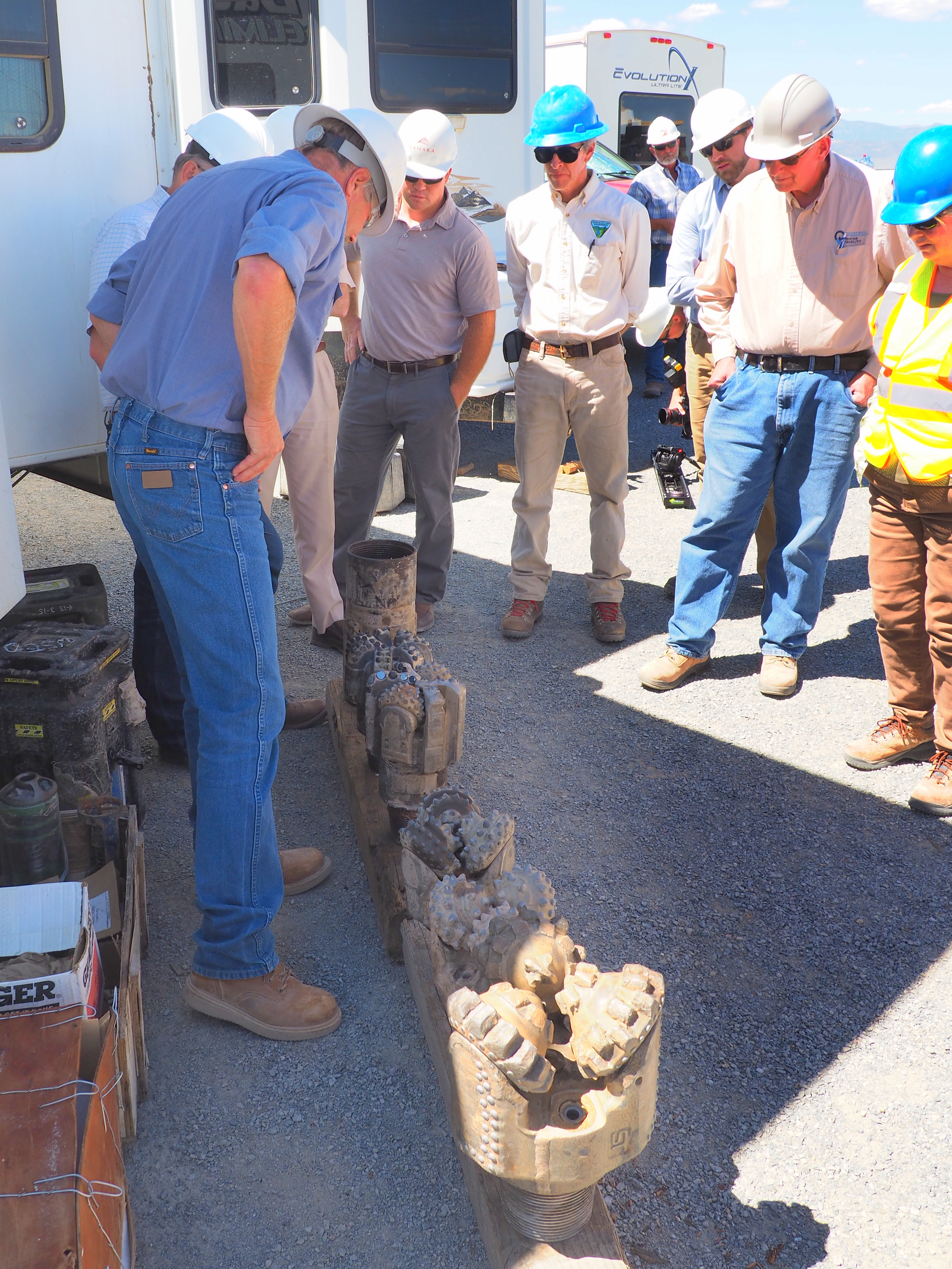
Granitic bedrock was predicted to lie at a depth of 2100 feet. The drillers encountered it at 2090 feet! Different types and sizes of drill bits are used, depending on well diameter and downhole conditions. The granite is very hard and drilling is slow, typically 8 to 13 feet per hour. Bits last 40-50 hours in the granite.

Cuttings samples are collected every 10 feet during drilling. The cuttings are studied to determine the rock types encountered in the well and the extent of past fluid-rock interactions. Core samples will also be taken to evaluate the rock’s physical properties and degree of fracturing.

Several varieties of granitic rocks have been encountered in the well. This is a broken piece of core from a nearby well. Most of the granitic rocks are light colored.
The stakeholders departed at the end of the two-hour site visit better informed and enthusiastic about the Utah FORGE project’s progress.

led by Donald L. Clark (UGS Geologist) and Charles G. Oviatt (Emeritus, Kansas State Univ.; Lake Bonneville specialist)
Day 1 (May 9), meet at Department of Natural Resources building (1594 W. North Temple, SLC, south side of building); gather at 7:00 am, depart at 7:30 am sharp. Review of the eastern part of map area, and return to SLC.
Day 2 (May 10), meet at DNR at 7:00 am, depart at 7:30 am sharp. Review of the western part of map area, and return to SLC.
You are invited to attend a field review highlighting updated geologic mapping of the area west of Salt Lake City. The purpose of the mapping is to accurately describe the stratigraphy, geologic structure, geologic resources, and geologic hazards of the area. These maps are used for land management planning, geologic hazard evaluation, resource assessment and development, and education, as well as by the weekend hobbyist. The trip will be geared to cover a broad audience including geologists, government officials, and the general public.
This project was funded through the National Cooperative Geologic Mapping Program supported by the Utah Geological Survey and the U.S. Geological Survey.

forgeutah.com
Stephen Potter, a graduate student at the University of Utah, presented this poster at the annual meeting of the Seismological Society of America in Denver on April 19. Stephen has been analyzing the historic seismicity around Milford, the Roosevelt Hot Spring system, and the FORGE site. No seismicity has been detected at the FORGE site.

kutv.com
CEDAR CITY, Utah — (AP) The University of Utah Seismograph Stations has reported a minor earthquake in the southwestern part of the state.
ksl.com
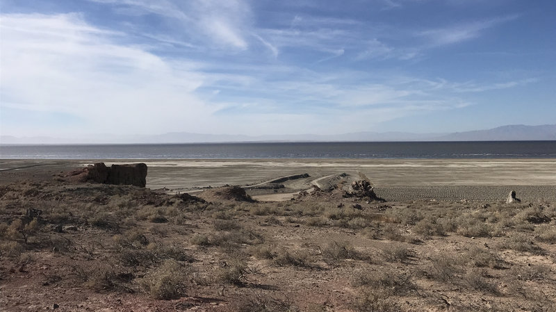
SALT LAKE CITY — Lawmakers took note of the desolate beauty that surrounds the Spiral Jetty as they considered designating the artificial formation to be the official state work of art.
geosociety.org

Don’t miss this upcoming field forum: Catastrophic mega-scale landslide failure of large volcanic fields
September 16-22, 2017, Cedar City and Bryce Canyon City, Utah
CONVENERS
Robert F. Biek—Utah Geological Survey, Salt Lake City, Utah, USA, bobbiek@utah.gov
David B. Hacker—Department of Geology, Kent State University, Kent, Ohio, USA, dhacker@kent.edu
Peter D. Rowley—Geologic Mapping Inc., New Harmony, Utah, USA, pdrowley@rushisp.com
A 6-day field forum designed to investigate the concept of exceptionally large catastrophic collapse of volcanic fields using the distinguishing characteristics and geologic implications of the gigantic Markagunt gravity slide and Marysvale volcanic field, southwest Utah.
Application deadline: January 31, 2017

The Utah Geological Survey (UGS) is a division of the Utah Department of Natural Resources. Several specialized programs comprise the UGS: Data Management, Energy & Minerals, Geologic Hazards, Geologic Information & Outreach, Geologic Mapping, Groundwater & Wetlands, and Paleontology.
1594 West North Temple, Suite 3110
Salt Lake City, Utah 84116
801-537-3300 (phone)
801-537-3400 (fax)
Mailing Address:
PO BOX 146100
Salt Lake City, Utah 84114
Monday through Friday,
8 a.m. to 5 p.m.
![]()