Last week the Utah FORGE project completed a two- and three-dimensional seismic surveys to further characterize the project area’s buried granite reservoir. Specifically, the survey may help to identify any buried faults that might be zones of fluid flow.

Seismic surveys create subsurface images by generating, recording, and analyzing sound waves that travel through the Earth (such waves are also called seismic waves). Density changes between rock or soil layers reflect the waves back to the surface, and how quickly and strongly the waves are reflected back indicates what lies below.

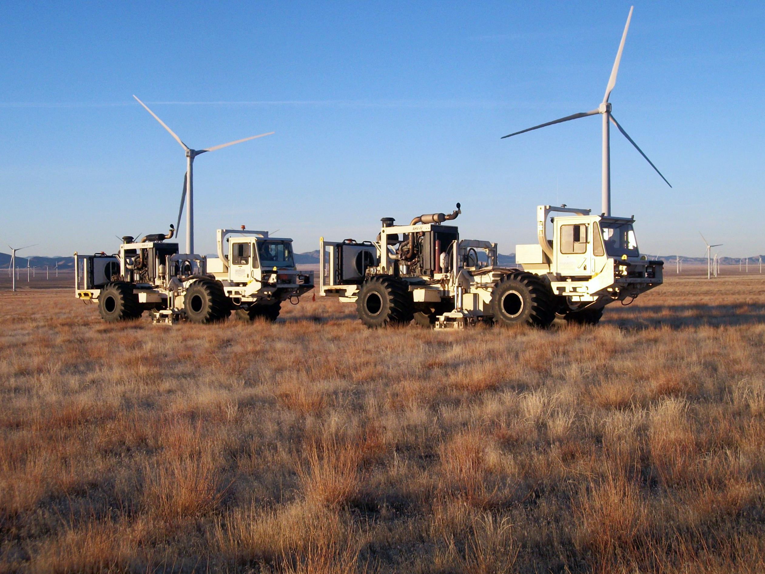
For the Utah FORGE survey, vehicle-mounted vibrator plates (called vibroseis trucks) generated the source waves and a grid of geophones recorded them. The survey included two 2D surveys that were 2.5 miles long and included approximately 160 source points and geophone receivers each, and a 3D survey that covered 7 square miles and included 1,100 source points and 1,700 geophone receivers. The data is now being processed to generate a three-dimensional map of the subsurface reservoir.

For more a more information on seismic surveys see https://geology.utah.gov/map-pub/survey-notes/glad-you-asked/what-are-seismic-surveys/

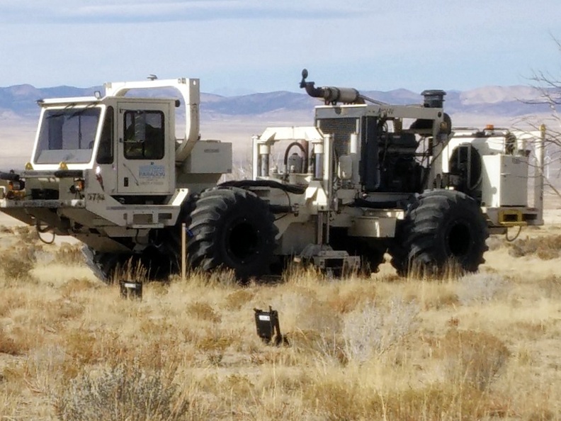
Vibroseis truck with geophones (black cases) in the foreground.


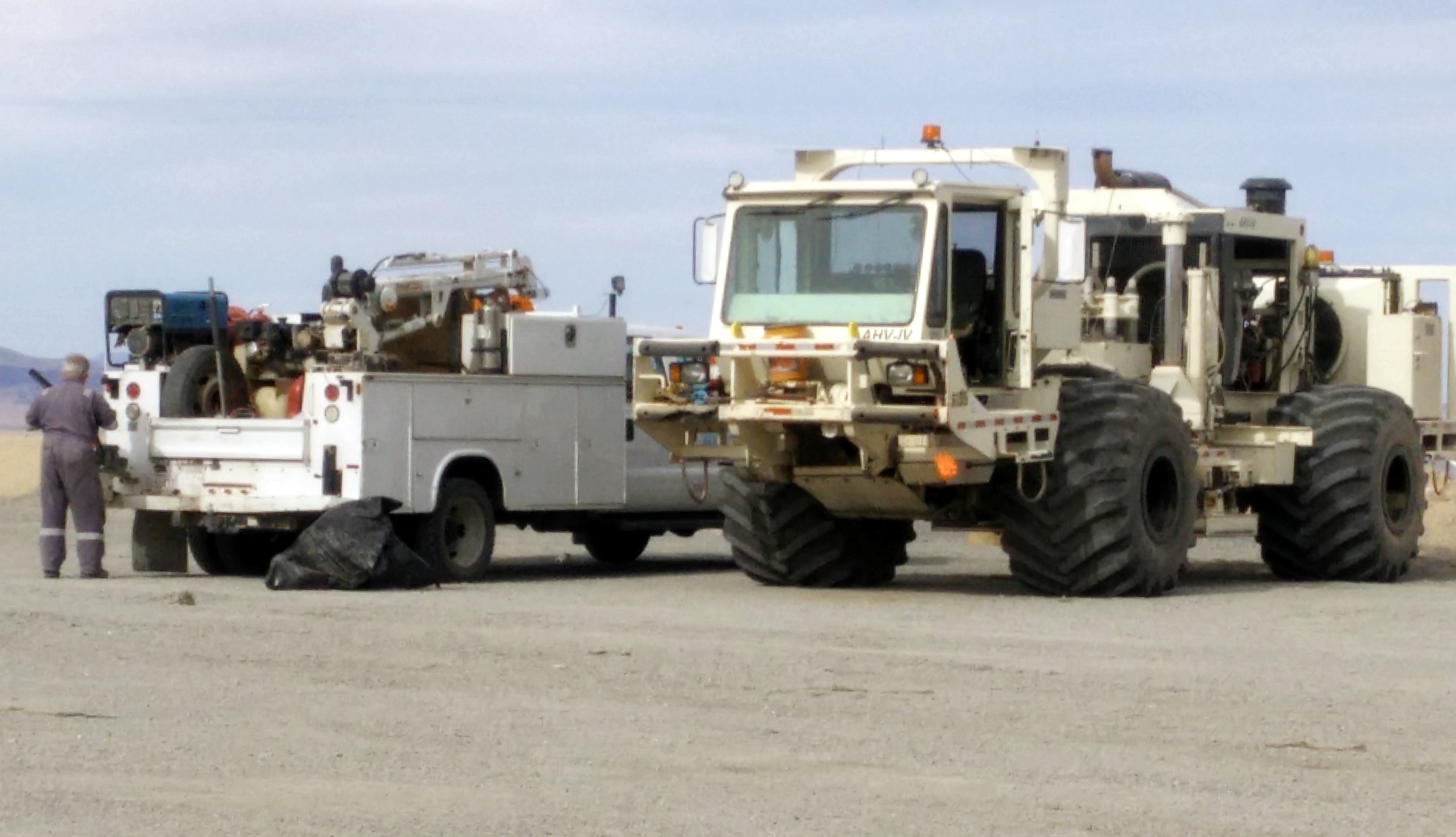
Vibroseis truck with pickup and workman for scale.


Vibroseis trucks in action, pads down producing seismic waves.


Congratulations to John Good who was named the 2017 UGS Employee of the Year. John is a Graphic Arts Specialist with the Editorial Section and has worked for the Department of Natural Resources for 15 years, including the last three years with the UGS. His creative talent and commitment to produce high-quality publications has contributed to a positive UGS image to both the public and other government agencies. John has developed an excellent working relationship with authors and editors, understands their requests, and is always willing to research and find solutions to new and challenging publishing issues. His excellent work, productivity, positive attitude, and friendly sense of humor make John an outstanding employee and a deserving recipient of this special award and recognition.

Reporters Leia Larsen and Benjamin Zack sat down with James Kirkland to find out what Utah looked like 100 million years ago and learn about the discovery boom happening right now.

VIEW PODCAST

www.standard.net

James Kirkland, the state paleontologist with the Utah Geological Survey, goes through the bones of a Mierasaurus on Nov. 21, 2017, at his lab in Salt Lake City. The fossils were recently found in Southern Utah and belong to a species of dinosaur that was previously thought to only live in what is now Europe.

Cedar Mesa, San Juan County
Photographer: Tyler Knudsen © 2017
An overhanging ledge of Permian-age Cedar Mesa Sandstone protects ancestral Puebloan ruins in Road Canyon. The informally named “Fallen Roof” ruin owes its name to the prominent spalling and collapse of thin sandstone slabs from the overhang’s ceiling.