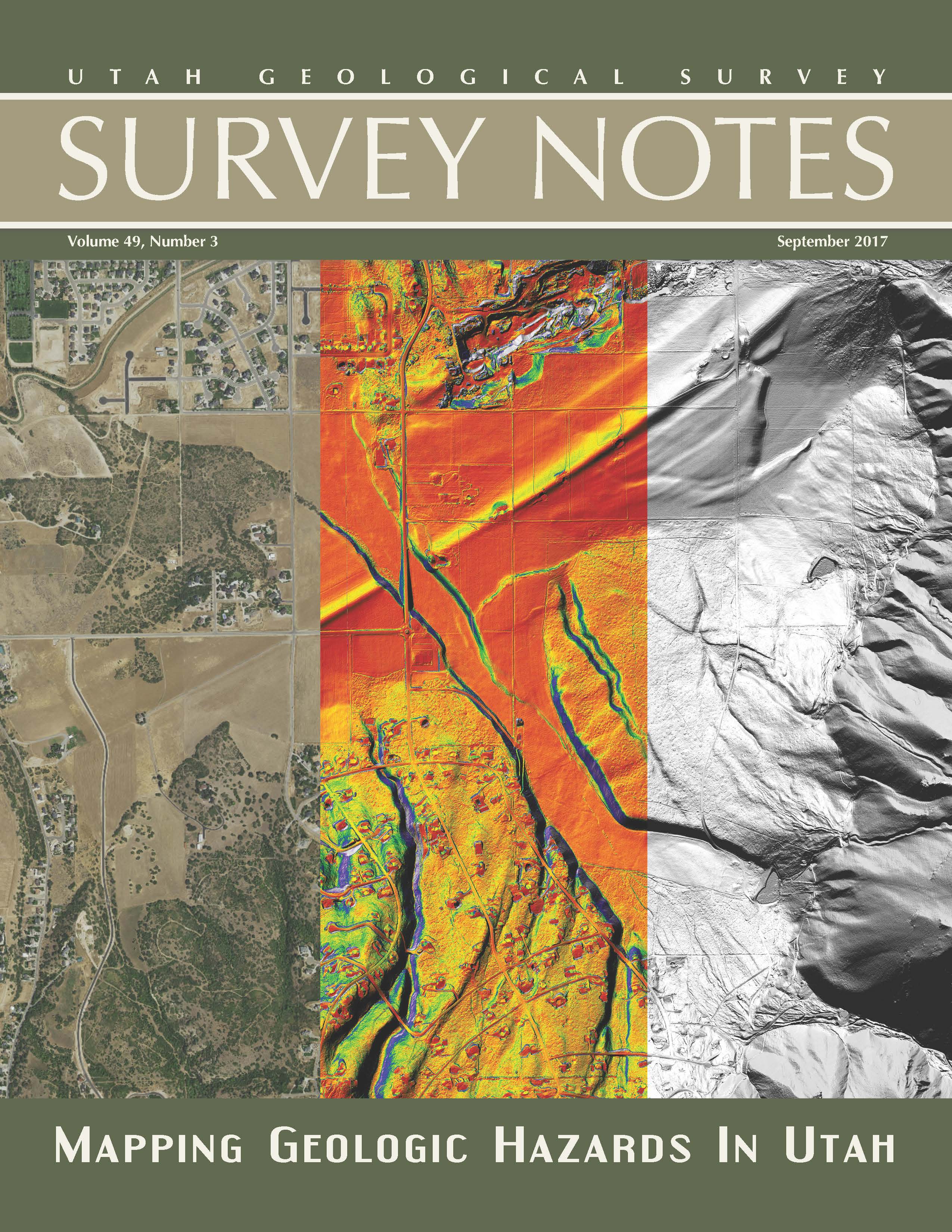
Find articles on re-mapping the Wasatch Fault using airborne lidar data, mapping geologic hazards in Utah and more among our regular featured columns.
View the latest issue
Find articles on re-mapping the Wasatch Fault using airborne lidar data, mapping geologic hazards in Utah and more among our regular featured columns.
View the latest issue
Western Garfield County
Photographer: Bob Biek © 2017
Basaltic lava flows produce stark, bouldery slopes near Panguitch Lake. The rugged, blocky lava flows are among the youngest in Utah, and erupted from nearby Miller Knoll cinder cone and adjacent vents.

Faults
Steve Bowman (UGS)
801-537-3304
stevebowman@utah.gov
Earthquakes
Walter Arabasz (UUSS)
801-581-7410
arabasz@seis.utah.edu
Emergency Response
Robert Carey (UDEM)
801-538-3784
bcarey@utah.gov
Salt Lake City (Sept. 21, 2017) – The Utah Geological Survey (UGS), University of Utah Seismograph Stations (UUSS), and Utah Division of Emergency Management (UDEM) recently published the Utah Earthquakes (1850–2016) and Quaternary Fault Map (UGS Map 277). The new map shows earthquakes within and surrounding Utah from 1850 to 2016, and faults considered to be sources of large earthquakes.
The faults shown on the map are considered geologically active, have been sources of large earthquakes (about magnitude 6.5 and greater) during the Quaternary Period (past 2.6 million years), and are the most likely sources of large earthquakes in the future. Most of the small to moderate-sized earthquakes on the map are “background” earthquakes not readily associated with known faults and too small to have triggered surface faulting (under about magnitude 6.5).
There is a 57% probability (over 1 in 2 chance) that a magnitude 6.0 or greater earthquake will occur in the Wasatch Front region in the next 50 years. To address this threat, the Utah Earthquake Program (https://ussc.utah.gov/pages/help.php?section=Utah+Earthquake+Program) consisting of the UGS, UUSS, and the UDEM, developed the map so the public could more fully understand the hazard from earthquakes and faults, as well as the resulting risk to property, infrastructure, and life safety in Utah. Users of the map will be able to determine past earthquake locations and relative magnitudes (size), along with the locations of active faults and the timing of their most recent movement.
Printed copies of the map are available for $15 at the Utah Department of Natural Resources Map & Bookstore (http://mapstore.utah.gov). The map is also available as a PDF download at https://ugspub.nr.utah.gov/publications/maps/m-277.pdf (44 by 62 inches in size) and can be printed on a wide-format printer.
Additional information on the hazard and resulting risk from earthquakes is available at https://geology.utah.gov/hazards/earthquakes-faults/, from the Utah Seismic Safety Commission at https://ussc.utah.gov, and at the agency websites:
UGS: https://geology.utah.gov
UUSS: http://quake.utah.edu
UDEM: https://dem.utah.gov/
The Utah Geological Survey provides timely scientific information about Utah’s geologic environment, resources, and hazards. It is one of seven divisions within the Utah Department of Natural Resources.
POTD September 12, 2017: Goblin Valley State Park, Emery County
Photographer: Paul Inkenbrandt © 2017

In August, the Utah FORGE project took a big leap forward with the drilling of a 7,000-foot deep geothermal scientific well. As part of our continuing effort to keep all stakeholders engaged and up to date, Utah FORGE conducted a field visit for stakeholders on August 23rd.
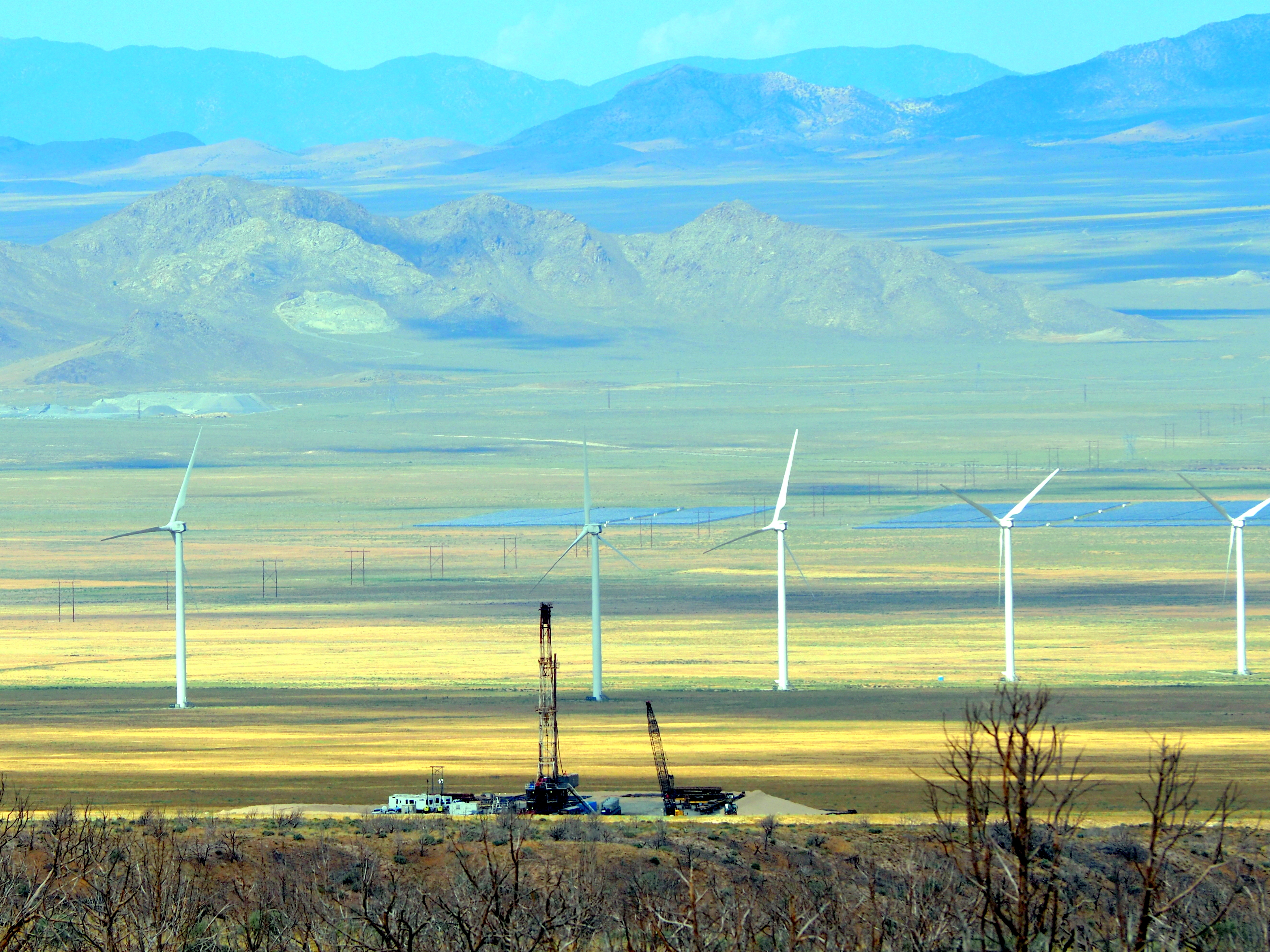
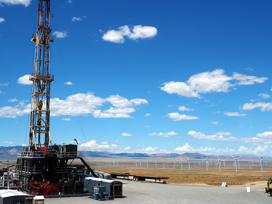
The Utah Forge site lies within an established renewable energy hub and energy corridor. View looking west showing the Utah FORGE drill rig, wind farm and blue solar panels in the distance.
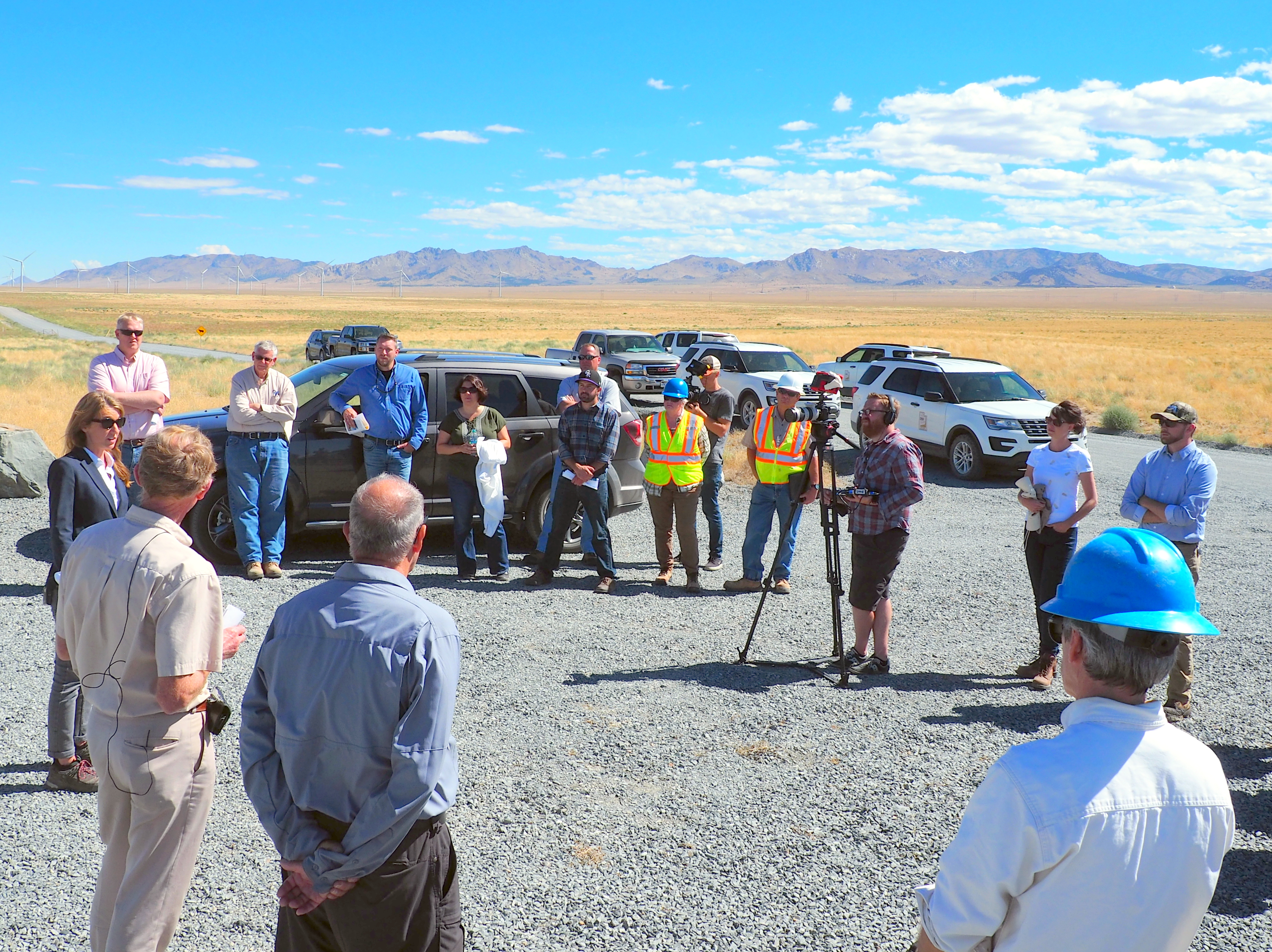
The field trip was well attended and included representatives from the Utah Division of Water Rights, Rocky Mountain Power, Utah School and Institutional Trust Lands Administration (SITLA), Bureau of Land Management (BLM), Utah Division of Water Quality (DWQ), Utah Governor’s Office of Energy Development (OED), U.S. Department of Energy Geothermal Technologies Office (DOE), Hot Rock MS, Beaver City Government, Beaver County Commission, Beaver County Government, Sun Edison, Energy and Geoscience Institute (EGI), Utah Geological Survey (UGS), Idaho National Laboratory (INL), Kenai Drilling, Sinclair Well Products and Services, and West Coast Geologic.

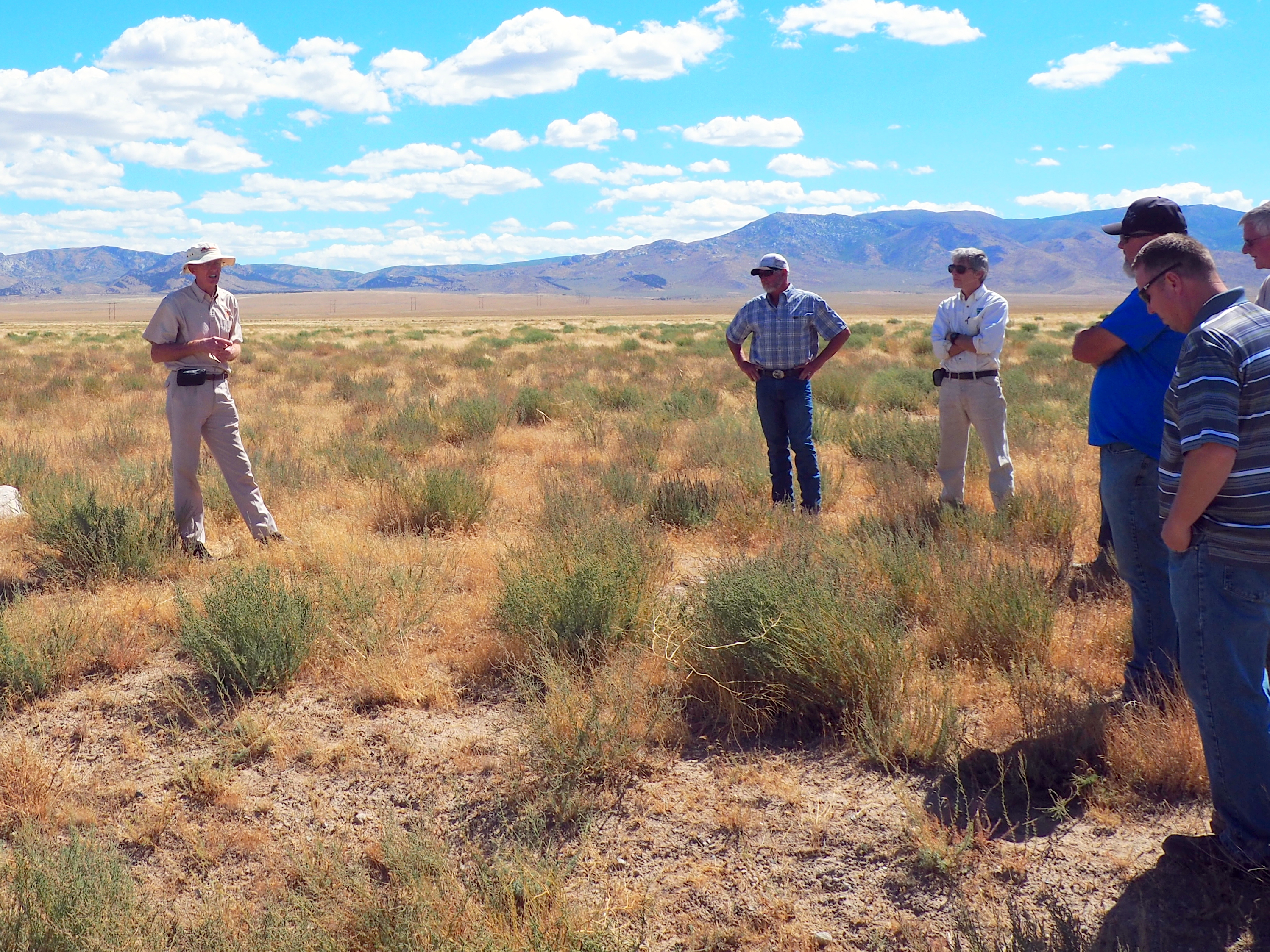
STOP 1. Participants met about 4 miles southwest of the drill site at the First Wind information kiosks, which displays signs about the area’s geology, archaeology, history, and wind power generation. At this stop introductions were made and the U.S. DOE Enhanced Geothermal System Manager Lauren Boyd gave an overview of the FORGE program. For more information on enhanced geothermal systems and the DOE’s FORGE program, see https://energy.gov/eere/forge/forge-home.

Lauren Boyd, speaking to the group about FORGE and enhanced geothermal systems.
STOP 2. Future site of the Utah FORGE project office where stakeholders were updated about the project. The well pads, infrastructure, and office site will be located on Smithfield Foods and SITLA lands. The site and facilities will be easily accessible to future researchers and the public. Dr. Rick Allis, far left, is the State Geologist and one of the Utah FORGE co-Principal Investigators.
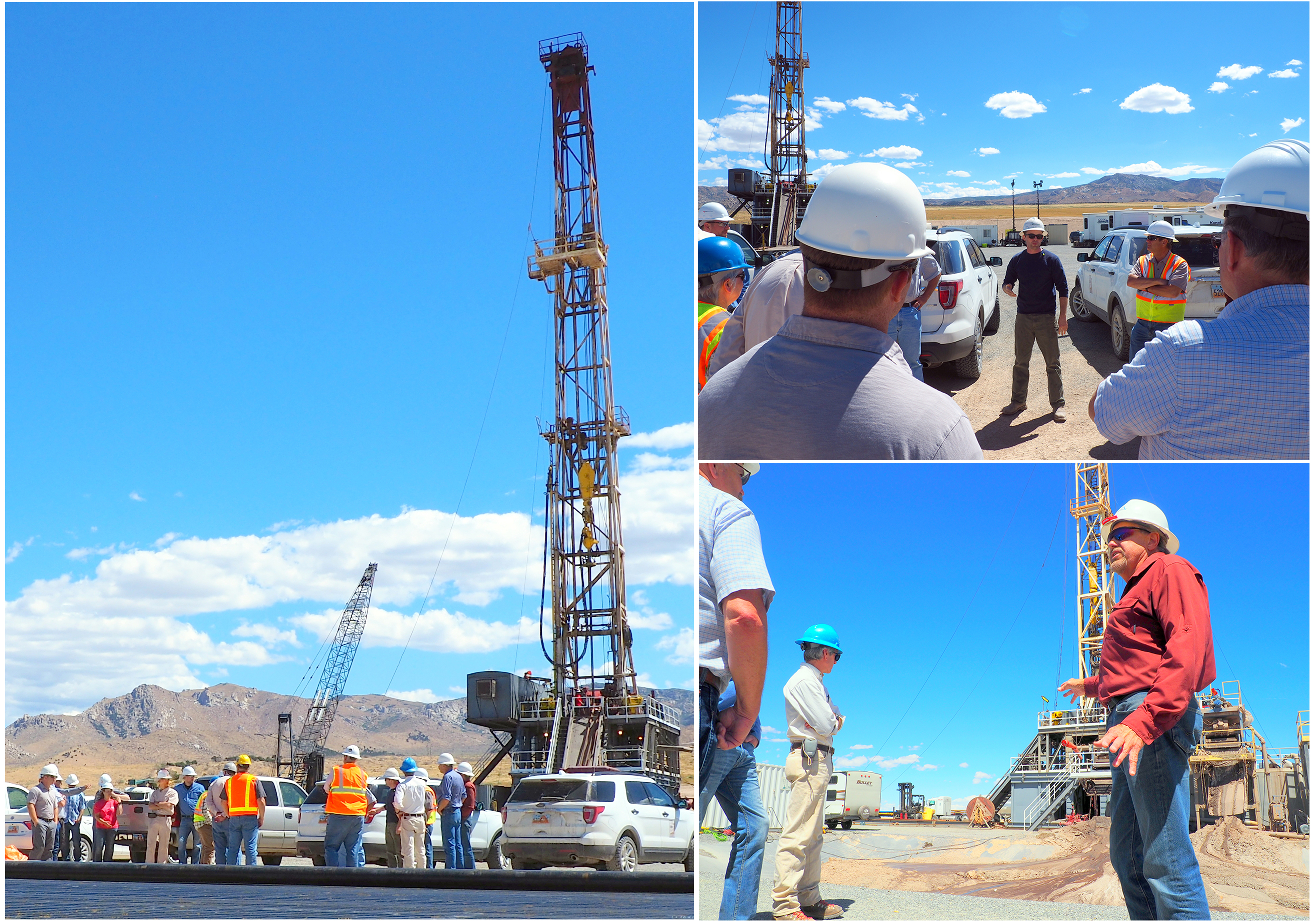
STOP 3. Left photo. The drill rig! The well is being drilled to provide information on temperature, rock type, permeability, and stresses within the rocks that will ultimately form the geothermal reservoir. The well will reach an anticipated depth of 7000 feet where temperatures will exceed 350 Fahrenheit. Upper right. The mud logger is giving a safety presentation to the group. Lower right. View looking across the mud pit. Drilling fluid (mud) is circulated down the well during drilling to remove rock cuttings and keep the bit cool. Drilling fluid no longer suitable for use is pumped into the mud pit to avoid contaminating the environment. The dark material in the center of the picture is wet drilling fluid Continuous drilling with cooled drilling fluid means the true temperature at the bottom of the hole has yet to be determined.
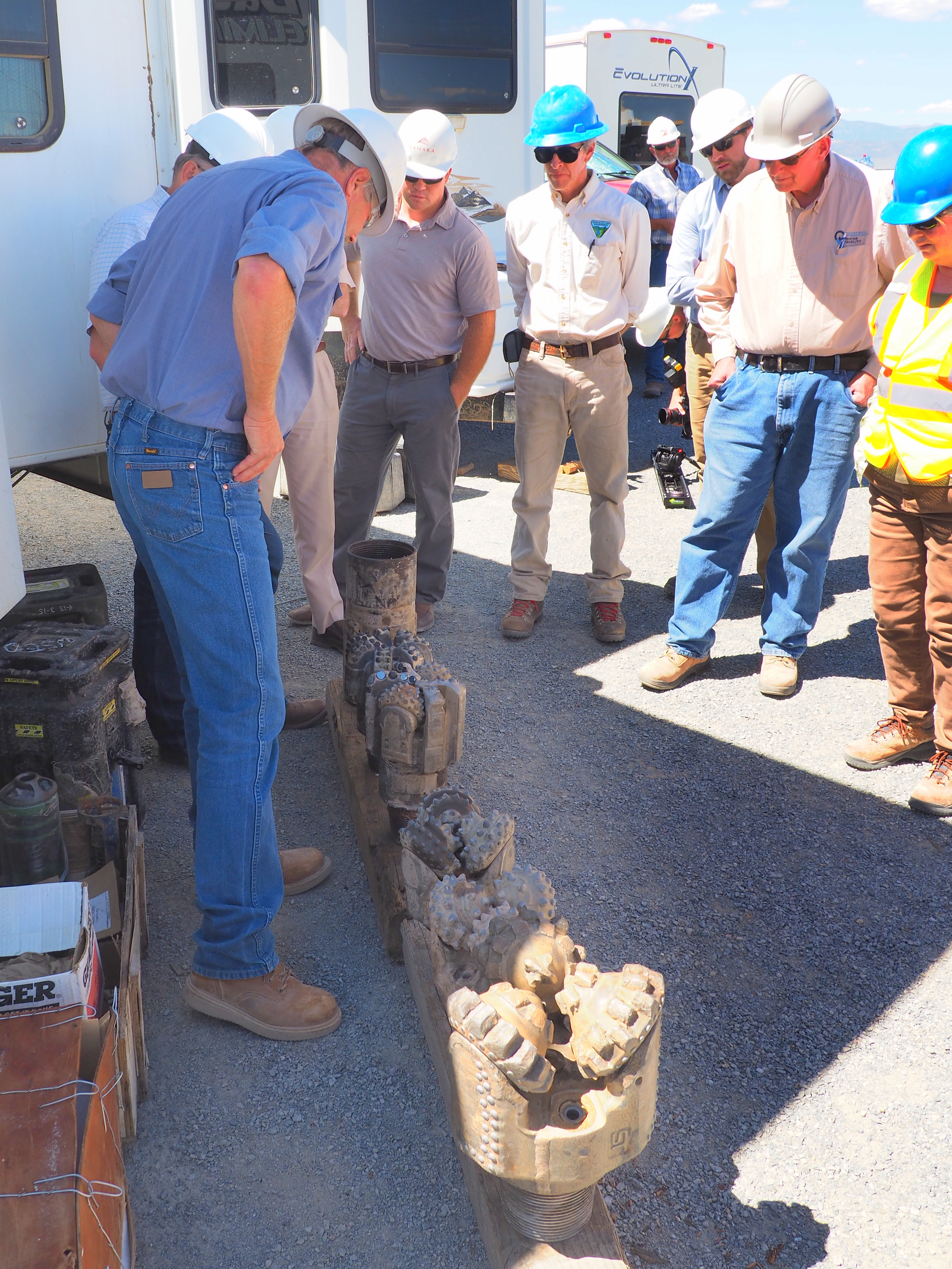
Granitic bedrock was predicted to lie at a depth of 2100 feet. The drillers encountered it at 2090 feet! Different types and sizes of drill bits are used, depending on well diameter and downhole conditions. The granite is very hard and drilling is slow, typically 8 to 13 feet per hour. Bits last 40-50 hours in the granite.

Cuttings samples are collected every 10 feet during drilling. The cuttings are studied to determine the rock types encountered in the well and the extent of past fluid-rock interactions. Core samples will also be taken to evaluate the rock’s physical properties and degree of fracturing.

Several varieties of granitic rocks have been encountered in the well. This is a broken piece of core from a nearby well. Most of the granitic rocks are light colored.
The stakeholders departed at the end of the two-hour site visit better informed and enthusiastic about the Utah FORGE project’s progress.
![]()
The Utah Geological Survey (UGS) is a division of the Utah Department of Natural Resources. Several specialized programs comprise the UGS: Data Management, Energy & Minerals, Geologic Hazards, Geologic Information & Outreach, Geologic Mapping, Groundwater & Wetlands, and Paleontology.