How does geoscience affect Utah?
The American Geosciences Institute (AGI) is currently releasing State Geoscience Information factsheets that show the role geoscience plays in powering our state’s economy. The Geoscience and Utah Factsheet highlights information from many Utah geoscience areas including, employment, water, minerals, energy and hazards.
Below is page 1 of the Utah factsheet showing an overview of the economic contributions that geology and geoscience bring to Utah.

AGI’s Geoscience Policy team created State Geoscience Information factsheets to inform geoscientists and decision makers on how geoscience impacts their state.

Download the Utah Geoscience Information factsheet

Glen Canyon National Recreation Area
Photographer: Grant Willis © 2017
Padres Butte towers over Lake Powell’s Padre Bay, both named for the Dominguez-Escalante Expedition, which crossed the Colorado River near this site in 1776. Padres and the other buttes in this area are composed of Entrada Sandstone, one of several geologic formations that form the sandstone “slickrock” that typifies much of southern Utah’s landscape.

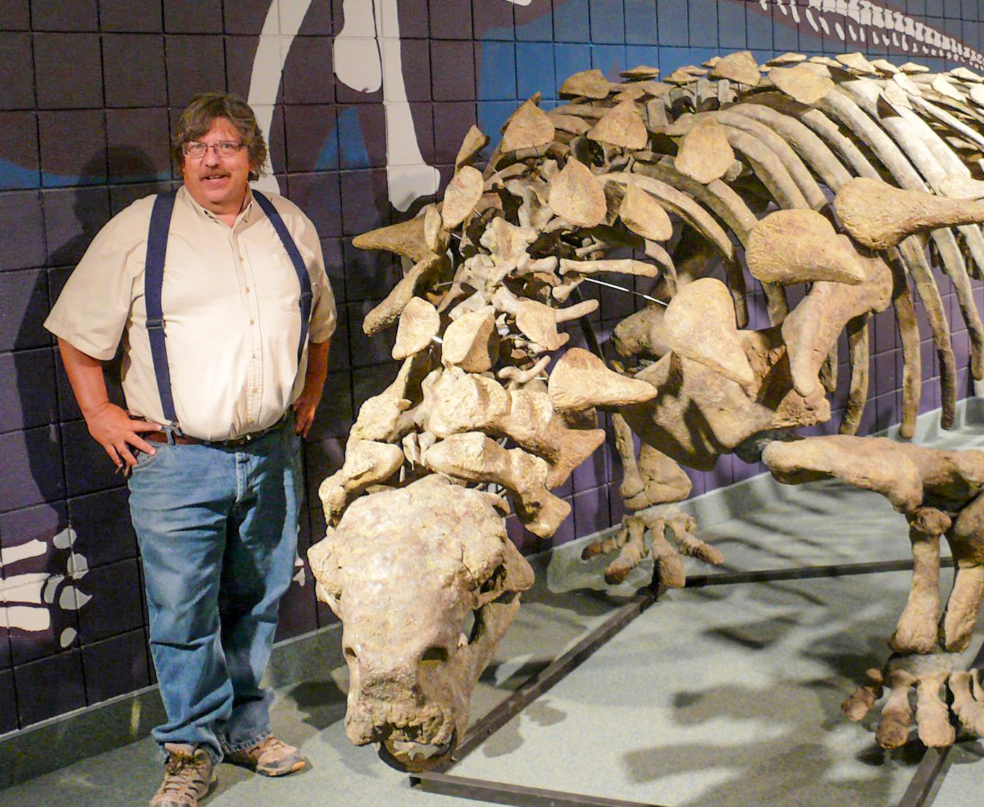
The prestigious 2017 Crawford Award was presented to State Paleontologist James Kirkland in recognition of his work in “The Lower Cretaceous in East-Central Utah—The Cedar Mountain Formation and its Bounding Strata”, from Geology of the Intermountain West, Volume 3, Utah Geological Association.

Most think of Utah as the “real Jurassic Park” because of the important dinosaur collections excavated from the Late Jurassic Morrison Formation. However, the number of new and existing dinosaurs that Jim has discovered, excavated, and described from the Cedar Mountain Formation rivals the Morrison. His contributions demonstrate that the Early Cretaceous Cedar Mountain Formation is as productive and important to understanding dinosaur diversity and evolution. He has put Utah on the map for Early Cretaceous dinosaur research. Because of his work, Jim is recognized throughout the world as the expert on the Cedar Mountain Formation, its stratigraphy, and dinosaur fauna. This publication is the culmination of a career of studying this formation and the vertebrate fossils it contains; it is the quintessential reference on the Cedar Mountain. It solidifies the regional understanding of the Cedar Mountain lithostratigraphy, biostratigraphy, and environments of deposition. It also formalizes the member names, which he and a co-worker first applied a decade ago. It is well written and well organized with many annotated photographs and detailed illustrations.

The Crawford Award recognizes outstanding achievement, accomplishments, or contributions by a current UGS scientist to the understanding of some aspect of Utah geology or Earth science. The award is named in honor of Arthur L. Crawford, first director of the UGS.

Fremont petroglyphs
Photographer: Charles Bishop © 2017
At the mouth of Cottonwood Canyon, Fremont petroglyphs in the Northern San Rafael Style depict a hunting scene. The figures are etched into sandstone of the Green River Formation, and derive their contrast from the dark, weathered patina developed on the light-colored rock.

good4utah.com

The Good4Utah Road Tour rolled into Vernal Wednesday. In this town, you can find something to do rain or shine. At the indoor Utah Field House Museum, you’ll find amazing state history, but when the sun is shining, Red Fleet State Park is the place to be.

READ MORE

good4utah.com

The Good4Utah Road Tour heads to eastern Utah and sets up shop in Vernal! The Utah Field House State Park strives to keep collectibles local and give you a glimpse back to prehistoric times.

READ MORE

Wilson Springs, Tooele County
Photographer: Ryhan Sempler © 2017

Gandy Salt Marsh, Millard County
Photographer: Rich Emerson © 2017
With the Deep Creek Mountains on the horizon, lush vegetation thrives in spring-fed wetlands that create an oasis in the middle of arid Snake Valley. Hundreds of springs and seeps in the valley provide habitat for many unique species of plants and animals.