ksl.com
ST. GEORGE — An earthquake rattled Wayne County Tuesday.
The temblor, measuring 3.5 magnitude, was centered about 2.5 miles west northwest of Loa and occurred at 2:26 p.m. No damage or injuries were reported.
ksl.com
ST. GEORGE — An earthquake rattled Wayne County Tuesday.
The temblor, measuring 3.5 magnitude, was centered about 2.5 miles west northwest of Loa and occurred at 2:26 p.m. No damage or injuries were reported.
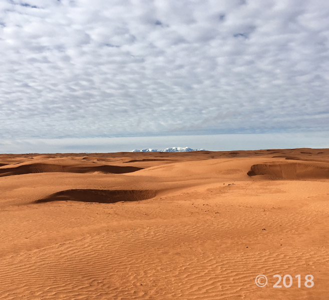
San Rafael Desert, Wayne County
Photographer: Nathan Payne © 2018
Eolian ripples and dunes composed of sand weathered from Jurassic-age Carmel Formation and Entrada Sandstone provide a sharp contrast to the snowy peaks of the Oligocene-age Henry Mountains laccolith on the horizon.
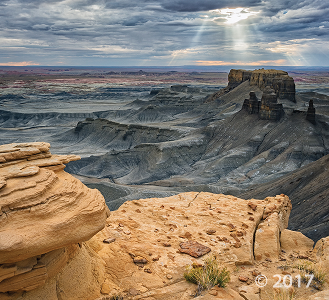
Blue Hills Overlook, Wayne County
Photographer: Gregg Beukelman © 2017
Early morning light spotlights a mesa in a typical badland landscape composed of easily eroded shaly siltstone and mudstone of the Tununk Shale Member of the Cretaceous-age Mancos Shale. The Ferron Sandstone, also a member of the Mancos Shale, is in the foreground.
Notom Badlands Wayne County.
Photographer: Gregg Beukelman © 2017
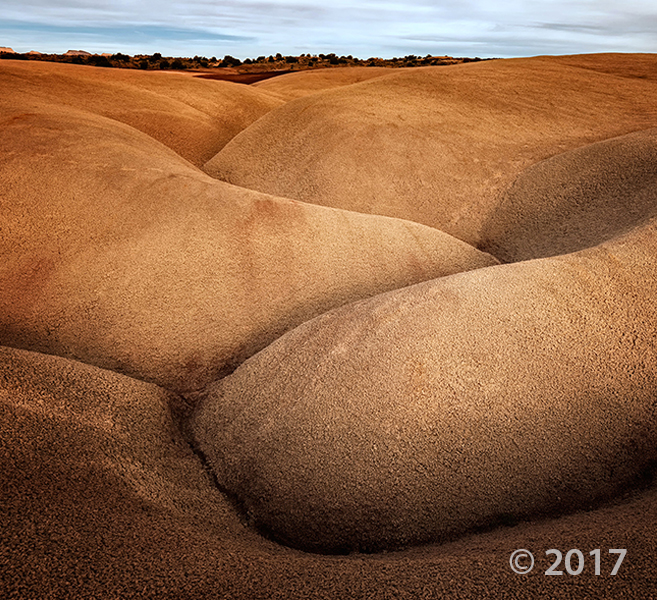
Caineville Badlands, Wayne County
Photographer: Gregg Beukelman © 2017
The view from North Caineville Mesa reveals convoluted patterns eroded into the Blue Gate Member of the Cretaceous-age Mancos Shale. The reddish deposits are remnants of a landslide sourced from the Emery Sandstone Member of the Mancos Shale.

Check out our latest geologic mapping field review of the Torrey 7.5’ Quadrangle, Wayne County, Utah. The review is open to the public, and will be held April 1, 2016. Find more info HERE.

Wishing our Tuesday was spent out there! The weather just gets nicer and nicer by the day. What Utah places do you want to explore this year?

Capitol Reef National Park, Wayne County, Utah
Photographer: Tyler Knudsen; © 2015
Fluted crimson walls of Jurassic-age Entrada Sandstone rim Cathedral Valley in the remote northern part of Capitol Reef National Park. The near-vertical Entrada walls owe their existence to the overlying white Curtis Formation that serves as a protective cap rock.


Cathedral Valley Overlook, Capitol Reef National Park, Wayne County, Utah
Photographer: Gregg Beukelman; © 2015
Light-brown sandstone of the Jurassic-age Curtis Formation caps the underlying reddish siltstone of the Entrada Formation in Cathedral Valley. In places, only boulders remain of the resistant cap rock as the Curtis Formation slowly weathers away.

Fall is upon us and October is just around the corner. If there were a Pumpkin Spice Geology, maybe it would look a little like this photo. What do you think? We’re in the Fall spirit here at the UGS!
Chocolate Drops, Maze District of Canyonlands National Park, Wayne County, Utah
Photographer: Tyler Knudsen; © 2015

Another weekend already?? Well we’re not complaining! Who’s got plans to get out into Utah geology this weekend?
Capitol Reef National Park, Wayne County, Utah
Photographer: Adam McKean
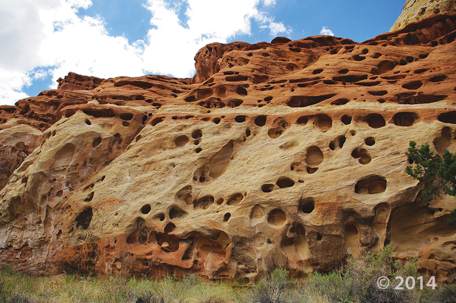
Erosion pockets in Wingate Sandstone, Cohab Canyon, Capitol Reef National Park, Wayne County.
![]()
The Utah Geological Survey (UGS) is a division of the Utah Department of Natural Resources. Several specialized programs comprise the UGS: Data Management, Energy & Minerals, Geologic Hazards, Geologic Information & Outreach, Geologic Mapping, Groundwater & Wetlands, and Paleontology.