
Entrada Sandstone in Cathedral Valley, Capitol Reef National Park, Wayne County, Utah
Photographer: Tyler Knudsen; © 2014
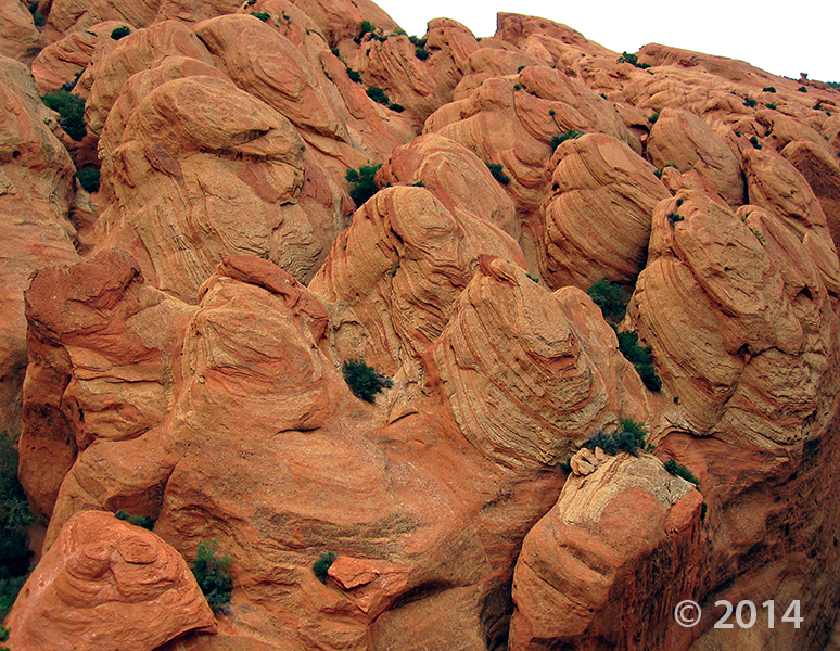
Entrada Sandstone in Cathedral Valley, Capitol Reef National Park, Wayne County, Utah
Photographer: Tyler Knudsen; © 2014


Not everyone grows up with this kind of doll house! We’re having southern Utah geology day dreams today.
The Doll House, Maze District of Canyonlands National Park, Wayne County, Utah
Photographer: Tyler Knudsen; © 2014
mnn.com
Named for its thousands of bizarre, goblin-like rock formations, Utah’s Goblin Valley State Park is a hidden gem in the San Rafael Desert. The goblins, known scientifically as “hoodoos,” were formed through the gradual erosion of Entrada sandstone, which was deposited about 170 millions years ago when the area was situated next to an ancient sea.
 What a photo for Monday, Happy Cinco de Mayo, everyone!
Waterpocket Fold, Capitol Reef National Park, Wayne County, Utah
Photographer: Ken Krahulec; © 2012
 Bentonite Hills, east of Capitol Reef National Park, Wayne County, Utah
Photographer: Tyler Knudsen; © 2012
Black volcanic boulders litter colorful but seemingly lifeless badlands formed in the Brushy Basin Member of the Late Jurassic Morrison Formation. Moisture-sensitive swelling clays, formed by the alteration of volcanic ash, allow little vegetation to take root.
 Canyonlands National Park, San Juan and Wayne Counties, Utah
Photographer: Rich Emerson; © 2012
Uplift of the Colorado Plateau has caused the Green River to entrench its meandering path into the relatively soft rocks of the Permian-age Organ Rock Shale. At Soda Springs Basin, vertical cliffs of the more-resistant White Rim Sandstone cap the Organ Rock Shale 400 feet above the river.
 Factory Butte, Wayne County, Utah
Photographer: Stevie Emerson; © 2012
The Muley Canyon Sandstone Member of the Cretaceous-age Mancos Shale forms a protective cap at the top of Factory Butte, allowing it to tower 1,500 feet above badlands of the easily erodible Blue Gate Shale Member. These rocks record the existence of an inland sea covering much of Utah around 90 million years ago.

Happy Saint Patrick’s Day! This photo may not be green, but I-rish I was there!
Caineville, Wayne County, Utah
Photographer: Robert Ressetar; ©2011
Deltaic sandstone of the Emery Member caps the Blue Gate Member of the Mancos Shale, deposited in a sea during the Cretaceous Period, Caineville, Wayne County.
 Capitol Reef National Park, Wayne County, Utah
Photographer: Stevie Emerson
The Fremont River cuts through the Waterpocket Fold, Capitol Reef National Park, Wayne County.
 Capitol Reef National Park, Wayne County, Utah
Photographer: Tyler Knudsen
Sheer walls of Jurassic-age Wingate Sandstone loom over a barn and orchards of historic Fruita in Capitol Reef National Park, Wayne County.
![]()
The Utah Geological Survey (UGS) is a division of the Utah Department of Natural Resources. Several specialized programs comprise the UGS: Data Management, Energy & Minerals, Geologic Hazards, Geologic Information & Outreach, Geologic Mapping, Groundwater & Wetlands, and Paleontology.