Tag Archive for: utah

Now that’s nothing to sneeze at!

smithsonianmag.com

With his latest work, photographer John Fowler brings a whole new meaning to the term “navel gazing.” This mosaic image, captured in late April, showcases a unique landform sometimes known colloquially as the Cosmic Navel—essentially a giant sandy pothole in Utah’s Grand Staircase-Escalante National Monument.

READ MORE

Needles District, Canyonlands National Park, San Juan County, Utah Photographer: Adam Hiscock; © 2014

POTD 5-5-15 Needles District Canyonlands

Needles District, Canyonlands National Park, San Juan County, Utah
Photographer: Adam Hiscock; © 2014


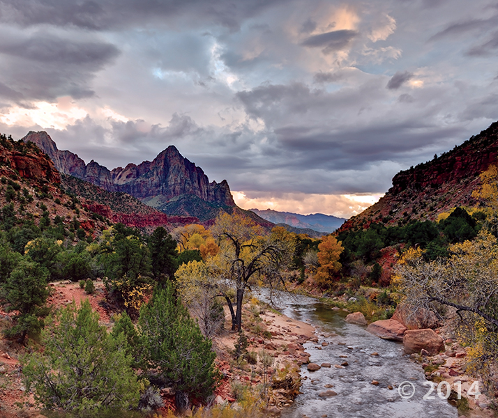
The Watchman (6,545 feet), composed of Jurassic-age Navajo Sandstone, stands guard over the southern entrance to Zion Canyon. The canyon has been carved by the North Fork Virgin River, which has eroded downward thousands of feet through the Navajo and underlying Kayenta and Moenave Formations. Zion National Park, Washington County, Utah Photographer: Gregg Beukelman; © 2014

POTD 4-28-15 Zion Watchman

Zion National Park, Washington County, Utah
Photographer: Gregg Beukelman; © 2014

The Watchman (6,545 feet), composed of Jurassic-age Navajo Sandstone, stands guard over the southern entrance to Zion Canyon. The canyon has been carved by the North Fork Virgin River, which has eroded downward thousands of feet through the Navajo and underlying Kayenta and Moenave Formations.

Some of you may have caught this story—a happy note to start your Tuesday with. If you or someone you know is going out to the Spiral Jetty, be sure to let them know about these tar pits, and the risk they may pose, especially to children and pets!

fox13now.com

On a recent spring day, I traveled to a remote northern shoreline of the Great Salt Lake to shoot video of the Spiral Jetty, not knowing I would end up shooting video of a bizarre event that would play out nearby.

READ MORE

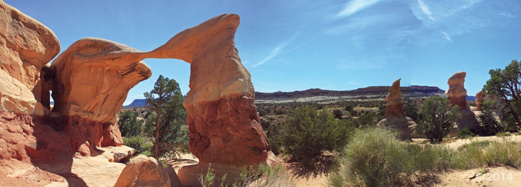
Metate Arch is sculpted by weathering and differential erosion of two sandstone layers along the contact of the Gunsight Butte and overlying Cannonville Members of the Jurassic-age Entrada Sandstone. The arch is about 17 miles southeast of Escalante, just east of the Straight Cliffs. Metate Arch, Devils Garden Outstanding Natural Area, Garfield County, Utah Photographer: Ken Krahulec; © 2014

POTD 4-21-15 Devils Garden Metate Arch

Metate Arch, Devils Garden Outstanding Natural Area, Garfield County, Utah
Photographer: Ken Krahulec; © 2014

Who participated in The Great Utah ShakeOut? If you missed out, you can always pick a time with family or friends to make sure that you know what to do in the event of an earthquake.

deseretnews.com

At 10:15 a.m. Thursday, Utahns all across the state — from elementary children to state officials — took cover and held on.

READ MORE

Erosion has exposed and sculpted Jurassic-age sedimentary rocks in the southern San Rafael Swell. Near Goblin Valley State Park, towering Wild Horse Butte comprises the Morrison and Summerville Formations (top cliff layers), Curtis Formation (middle slope layer), and Entrada Sandstone (bottom reddish layer). San Rafael Swell, Emery County, Utah Photographer: Taylor Boden; © 2014

POTD 4-14-15, San Rafael Swell

San Rafael Swell, Emery County, Utah
Photographer: Taylor Boden; © 2014

Erosion has exposed and sculpted Jurassic-age sedimentary rocks in the southern San Rafael Swell. Near Goblin Valley State Park, towering Wild Horse Butte comprises the Morrison and Summerville Formations (top cliff layers), Curtis Formation (middle slope layer), and Entrada Sandstone (bottom reddish layer).

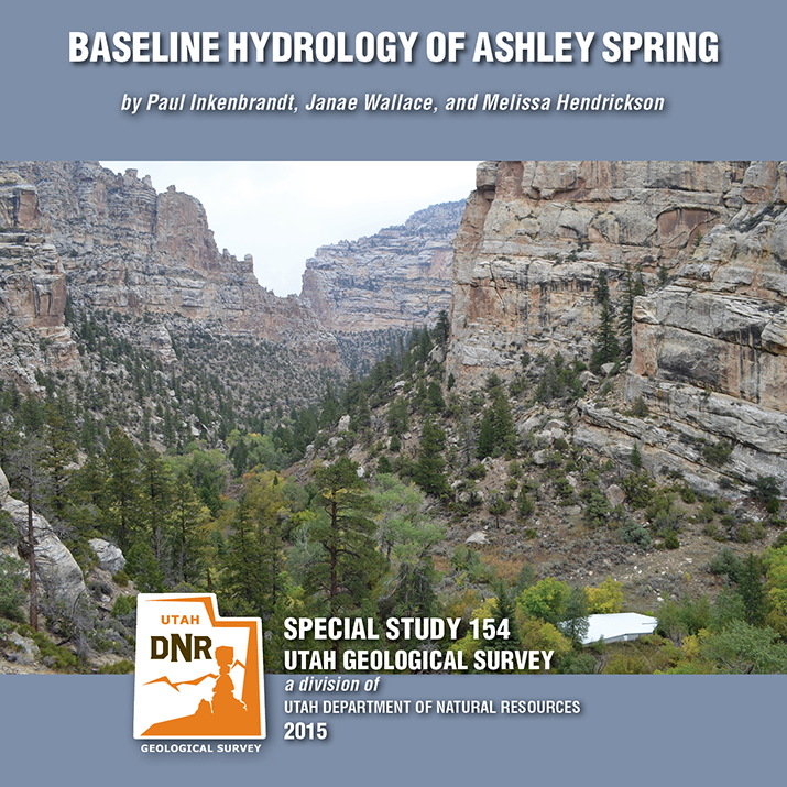
SS-154 Baseline Hydrology of Ashley Spring

By: Paul Inkenbrandt, Janae Wallace, and Melissa Hendrickson

Ashley Spring is an important water supply for most of the residents in the Vernal area of Uintah County, Utah. The Geological Survey conducted a study to determine the baseline flow paths and water chemistry of the aquifer systems that provide water to the spring. Ashley Spring water is of high quality, which does not vary long term. A Substantial part of the water emanating from Ashley Spring has been in the groundwater system less than one week, originating as recharge at areas along Dry Fork where water seeps into sing and fractures. This CD contains a 54-page report and appendices.

GET IT HERE

deseretnews.com

Drop, cover and hold on. More than 700,000 Utahns will be participating in a statewide earthquake drill Thursday for the annual Great Utah ShakeOut, an initiative to help people and organizations practice how to protect themselves in the event of a major earthquake.

READ MORE

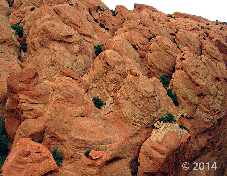
Entrada Sandstone in Cathedral Valley, Capitol Reef National Park, Wayne County, Utah Photographer: Tyler Knudsen; © 2014

POTD 4-7-15 Capitol Reef National Park

Entrada Sandstone in Cathedral Valley, Capitol Reef National Park, Wayne County, Utah
Photographer: Tyler Knudsen; © 2014