Tag Archive for: utah

On June 4th the Utah Geological Survey embarked on the 2015 Administrative Professionals Geologic Field Trip. This year our group started off early at Bonneville Seabase in Tooele Valley, the Intermountain West’s spot to SCUBA and snorkel year-round amongst tropical marine fish. Our excellent tour guide, Ron, postponed the daily morning fish feeding until we arrived (thanks Ron!).   Seabase is three bays fed by natural warm springs with a chemistry that approximates seawater. Water temperatures are in the 70s and 80s and water depths up to 62 feet.   Although no one in our group went diving or snorkeling, we delighted in watching the colorful fish and putting our feet in the water and having mollies nibble our toes.

Next we headed south to the Stockton Bar, a world class geomorphic feature first interpreted by legendary geologist Grove Karl “GK” Gilbert in USGS Monograph 1, 1890. Geologist Mark Milligan explained that this feature signifies one of the largest and best-preserved shoreline remnants of Ice Age Lake Bonneville.  Waves and currents transported sand and gravel to create a bar connecting South Mountain to the Oquirrh Mountains about 18,000 years ago when Lake Bonneville reached its highest level.

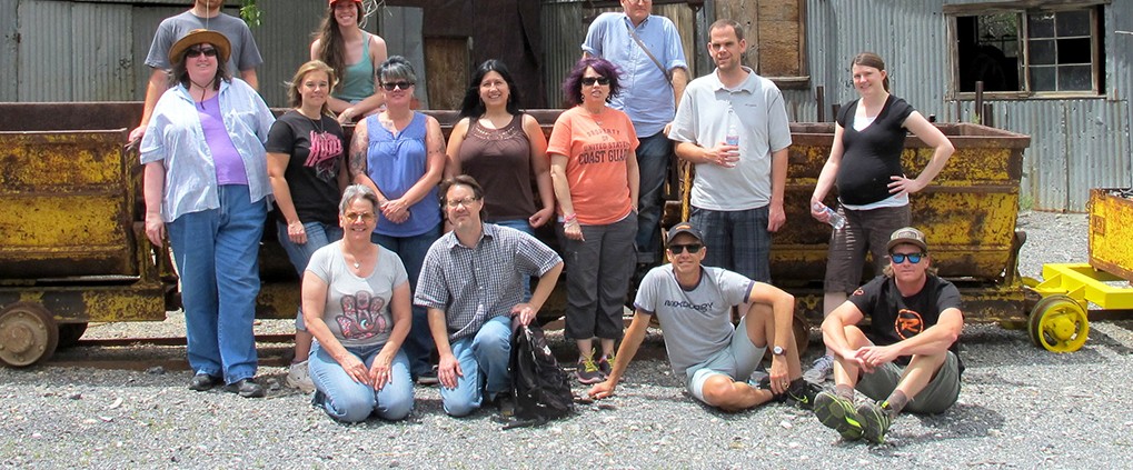
Continuing south our final stop was the former mining town of Ophir, nestled in a beautifully craggy and forested canyon. We were greeted by the Ophir mayor, Walt Shubert, and his wife Betty. Reynold “Ren” Willie, decorated retired geoscience teacher, Utah historian, Ophir native, and son of the superintendent of the Lark, Ophir, Gold Hill, and Hidden Treasure Mines, gave us a marvelous and memorable tour of the town. Ophir has preserved many of the old buildings and mining paraphernalia from the time it was a boomtown. From the 1860s to 1900, Ophir produced millions of dollars in silver, lead, and zinc; at one time reaching a population of 6,000 people.   Ophir was a perfect place to conclude our informative day in the field.

Beautiful and Historic Ophir Canyon
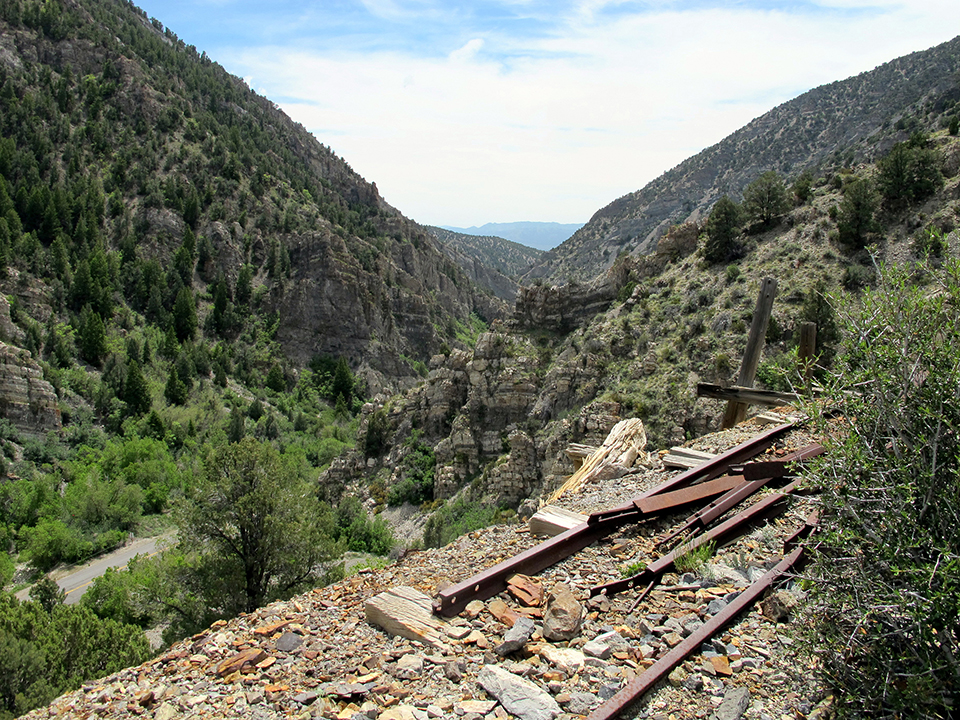
Mining relicts in scenic Ophir Canyon.


Mark at Stockton Bar
Mark explains the origin and significance of the Stockton Bar (flat feature in background).


Looking at the tropical fish
Observing the tropical marine fish at Bonneville Seabase.


Mollie Pedicure
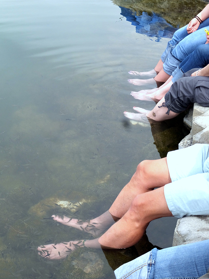
Soaking our feet and getting a “Mollie Pedicure” at Bonneville Seabase.


Ophir Group
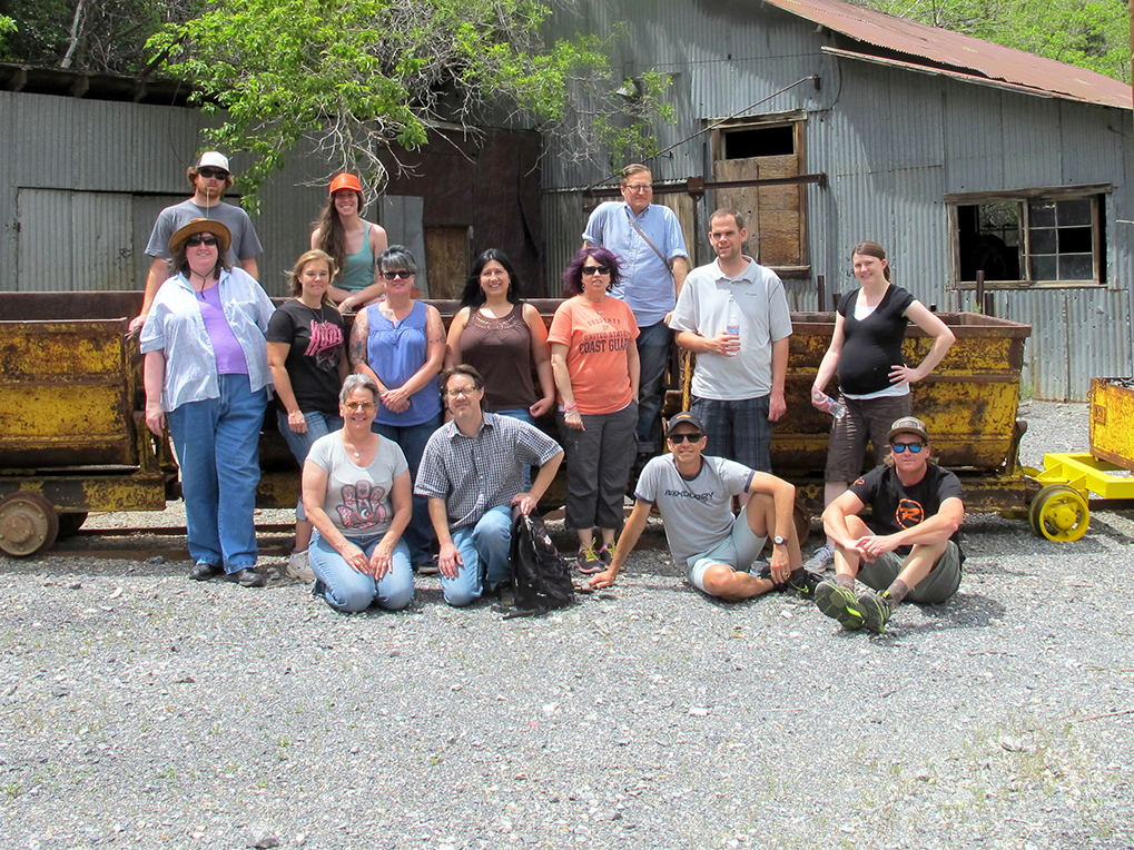
The UGS poses in front of ore carts at historic Ophir.


Ren Willie Ophir
Ren Willie presenting the history of Ophir.

ksl.com

Dinosaurs went extinct long ago, but it is still possible to feel like you’re walking in their footsteps.

READ MORE

ksl.com

With the summer blockbuster “Jurassic World” opening in theaters, there’s plenty of opportunity to be entertained — or frightened — by dinosaurs.

READ MORE

fox13now.com

FOX 13 News has featured several videos of flash floods and other weather phenomenon from David Rankin over the years, but he says his latest video represents the pay off from two years of planning and waiting. The footage was shot Saturday north of Lake Powell, near Big Water, Utah.

READ MORE

Delicate Arch, Arches National Park, Grand County, Utah Photographer: Sonja Heuscher; © 2014

We had to turn our air conditioning on this weekend—it’s getting hot! Cool down with this photo while we thaw out our spectacular Utah Geology.

POTD 6-2-15 Delicate Arch, Arches

Delicate Arch, Arches National Park, Grand County, Utah
Photographer: Sonja Heuscher; © 2014

Dig into this with your morning jolt!

good4utah.com

They’ve been buried for tens of millions of years and now dozens of dinosaurs are being unearthed on BLM land in Utah.

READ MORE

livescience.com

In the south-central part of Utah, a 100-mile-long (161 kilometers) formation, dubbed Waterpocket Fold, has created a landscape that is not only spectacular to view but is also a geological treasure for research and study.

READ MORE

The view through North Window arch in The Windows Section of Arches National Park reveals snow-covered sandstone spires and fins of the Jurassic-age Entrada Sandstone. The spires and fins result from weathering and erosion along parallel fractures, or joints, in the rock. Arches National Park, Grand County, Utah Photographer: Sonja Heuscher; © 2014

POTD 5-26-15 Arhces National Park

Arches National Park, Grand County, Utah
Photographer: Sonja Heuscher; © 2014

The view through North Window arch in The Windows Section of Arches National Park reveals snow-covered sandstone spires and fins of the Jurassic-age Entrada Sandstone. The spires and fins result from weathering and erosion along parallel fractures, or joints, in the rock.

Maybe some of you have seen the new movie “San Andreas.” So what could we expect to happen in the event of a giant earthquake on the San Andreas Fault? Read more in this article to find out.

smithsonianmag.com

A giant earthquake will strike California this summer. Skyscrapers will topple, the Hoover Dam will crumble and a massive tsunami will wash across the Golden Gate Bridge. Or at least, that’s the scenario that will play out on the big screen in San Andreas.

READ MORE

Like California, Utah is also earthquake country. One of the best forms of preparation is educating yourself and your family on what to do in the event of an earthquake. For more information on what you can do, see Putting Down Roots, or visit www.bereadyutah.gov.

Newspaper Rock petroglyph panel along Indian Creek, San Juan County, Utah Photographer: Adam Hiscock; © 2014

POTD 5-19-15 Newspaper Rock Petroglyph

Newspaper Rock petroglyph panel along Indian Creek, San Juan County, Utah
Photographer: Adam Hiscock; © 2014