ksl.com
ZION NATIONAL PARK — Nine hikers were temporarily trapped Tuesday morning after a rockfall on the Hidden Canyon Trail in Zion National Park, officials said.
ksl.com
ZION NATIONAL PARK — Nine hikers were temporarily trapped Tuesday morning after a rockfall on the Hidden Canyon Trail in Zion National Park, officials said.
by Jessica J. Castleton, Ben A. Erickson, and Emily J. Kleber
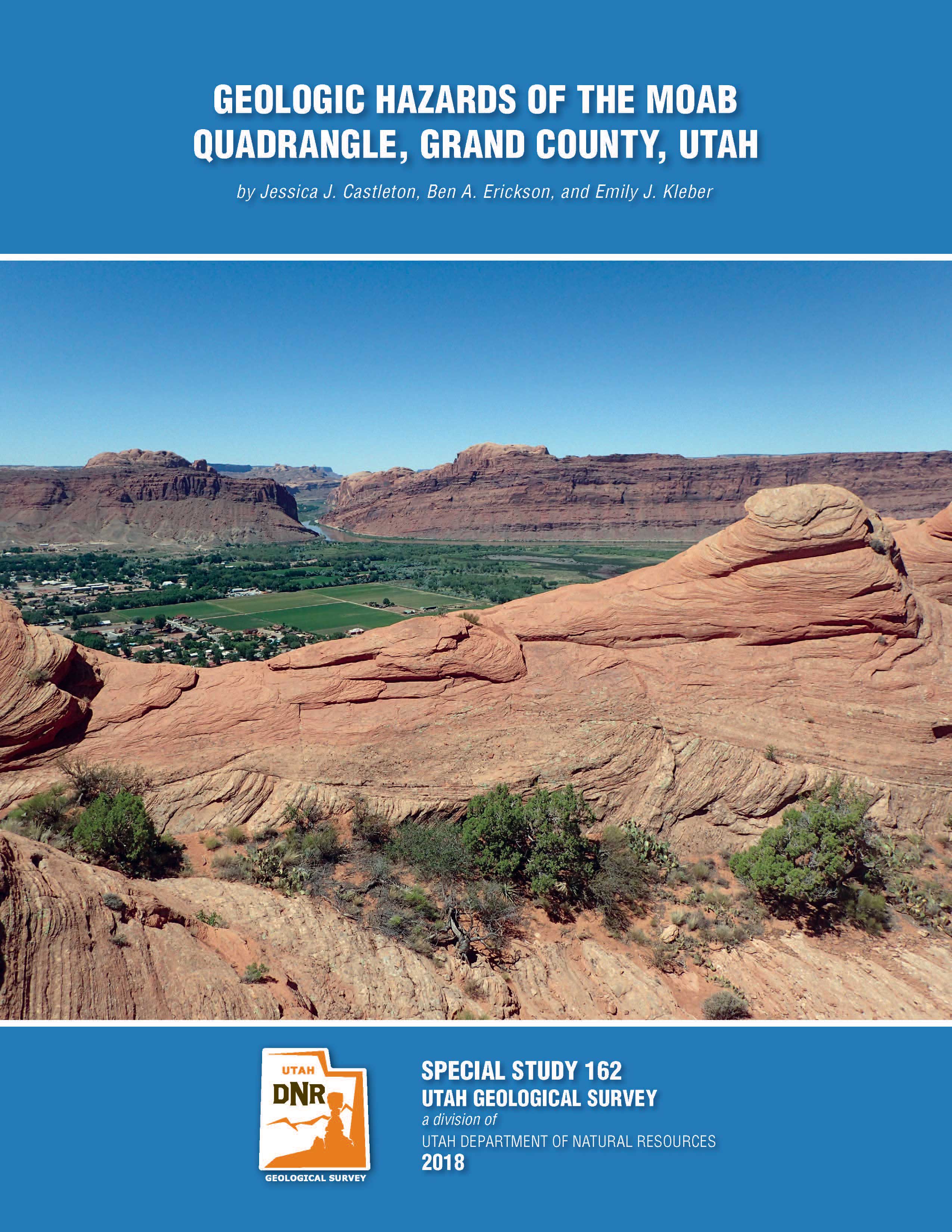
The Moab quadrangle is located in the south-central portion of Grand County, Utah. Currently, the area is experiencing rapid development and population growth, that is expected to continue for the foreseeable future. As urbanization expands into areas less suited for development, geologic hazards become of increasing concern in the planning, design, and construction of new facilities and infrastructure. This geologic-hazard investigation of the Moab quadrangle incorporates available geologic, hydrologic, soil, and geotechnical information to identify where geologic hazards may exist, and where detailed, site-specific, geotechnical/geologic-hazard investigations are necessary to protect health, welfare, and safety. This study provides maps and information for 13 geologic hazards: shallow groundwater, salt tectonics-related ground deformation, flooding, landsliding, rockfall, radon gas potential, collapsible soil, expansive soil and rock, corrosive soil and rock, soluble soil and rock, piping and erosion, wind-blown sand, and shallow bedrock. The maps are an aid for general planning to indicate where site-specific geotechnical/geologic-hazard investigations are necessary. The accompanying report describes the hazards and provides background information on data sources and the nature and distribution of hazards and potential mitigation measures.
good4utah.com
RIVERDALE, Utah (News4Utah) Some Riverdale homes are closer than ever to falling off the edge of a steep bluff. New measurements taken this week show it’s likely to happen sooner rather than later.
kutv.com
(KUTV) — On Sunday afternoon, two visitors were injured by a rockfall at Zion National Park.
ksl.com
ST. GEORGE — An earthquake rattled Wayne County Tuesday.
The temblor, measuring 3.5 magnitude, was centered about 2.5 miles west northwest of Loa and occurred at 2:26 p.m. No damage or injuries were reported.
seattlepi.com
Friday marks the 318-year anniversary of one of the greatest earthquakes on record along the Pacific Coast – the estimated 9.2 “Cascadia” quake that struck just off our coast on Jan. 26, 1700. To coincide with the anniversary, NOAA and the Pacific Tsunami Warning Center have released a computer model depiction of how the devastating ensuing tsunami raced across the Pacific Ocean.
deseretnews.com
While hurricanes were devastating Texas, Florida and Puerto Rico, fires were wreaking havoc in California and other global natural disasters were delivering widespread destruction, some here in Utah expressed relief to live in a place where we do not face such devastating natural hazards.
deseretnews.com
Over the past weeks, we have witnessed a chain of disasters that would seem to be almost once-in-a-lifetime events. Mother Nature’s destructive power leaves us humbled and awed. We stand as nothing before its fury.
kutv.com
Three minutes after road crews in northern Idaho closed down Highway 95, a massive landslide took over the road.
earthsky.org
April 10, 2013. On this date – four years ago today – a towering wall of dirt and rocks gave way and crashed down the side of Bingham Canyon mine in Utah. The landslide was one of the largest in the history of North America. University of Utah researchers later reported that the landslide – which moved at an average of almost 70 mph (113 kph) and reached estimated speeds of at least 100 mph (160 kph).
![]()
The Utah Geological Survey (UGS) is a division of the Utah Department of Natural Resources. Several specialized programs comprise the UGS: Data Management, Energy & Minerals, Geologic Hazards, Geologic Information & Outreach, Geologic Mapping, Groundwater & Wetlands, and Paleontology.