Cedar Canyon, MP8 Landslide Complex, Iron County
Updated June 22, 2023
A landslide in Cedar Canyon, first documented in 1906, has shown signs of new movement. This area, about eight miles east of Cedar City, contains the “MP8 landslide complex” that consists of several overlapping landslides of various ages and activity levels. It is located in the deepest and narrowest part of Cedar Canyon where Coal Creek is actively eroding and undermining the canyon walls as part of the natural canyon-widening process. Factors contributing to movement of this landslide complex include the presence of notoriously weak Cretaceous-age rock units; extensive, now-abandoned underground coal mine workings; slope modifications for the construction of SR-14; and heavy snowpack.
Large landslides in this complex destroyed significant parts of SR-14 in 1989 and 2011. Since the reconstruction of SR-14 in 2012, persistent, relatively minor slumping and cracking of the roadway near the east flank of the 2011 slide have occurred, requiring regular road maintenance.
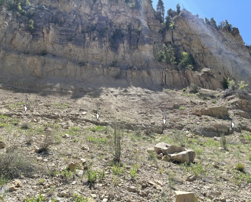
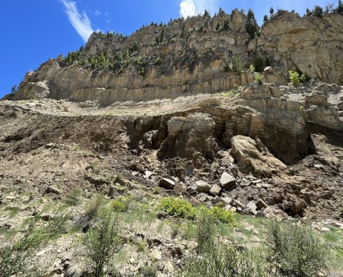
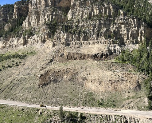
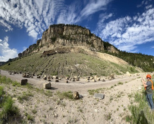
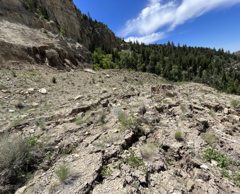
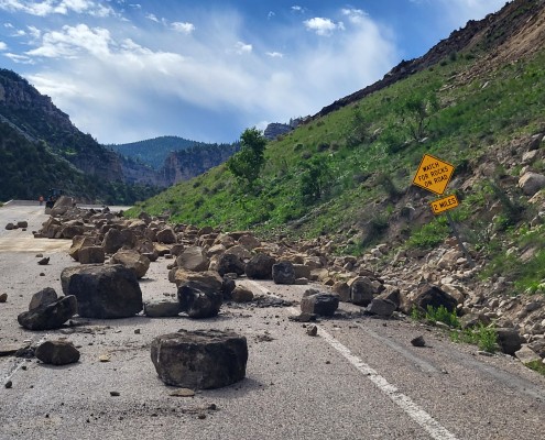
The most recent movement of the MP8 landslide complex was discovered during a routine visit in spring 2023 with the observation of a new 4- to 5-foot-high scarp on the west margin of the complex. On June 21, 2023, a landslide occurred at the observed new scarp, expanding the scarp from 4 to 5 feet in vertical displacement to over 50 feet. The newly-formed landslide covers an area of nearly six acres above SR-14. The landslide caused large rockfall boulders to fall on and cover the highway which was closed temporarily.
Landslide Type: Rotational
Learn about types of landslides
Size: The MP8 landslide complex is about 3,500 feet wide and 1,000 feet long. The significant, newly formed scarp near the west margin of the complex is nearly 1,000 feet wide and has over 50 feet of vertical displacement. The newly-formed landslide covers an area of nearly six acres.
Special Conditions: The landslide complex is rooted in the weak, clay-rich, Cretaceous-age Naturita Formation and Tropic Shale. There are also several thousands of feet of room-and-pillar coal mine workings beneath the slope that were sealed off several decades ago.
Damages: Ongoing, relatively minor slumping and laterally-displaced pavement near the east margin of the landslide complex has made SR-14 uneven and rough. The slide plane on the west margin of the landslide complex is likely deep-seated and may be daylighting below SR-14. The June 21, 2023, landslide caused large rockfall boulders to cover the road with minor damages. The debris had to be cleared, but the highway was reopened within the day.
Status: Active


