GeoSights: Desert Mountain, Juab County, Utah
by Jackson Smith
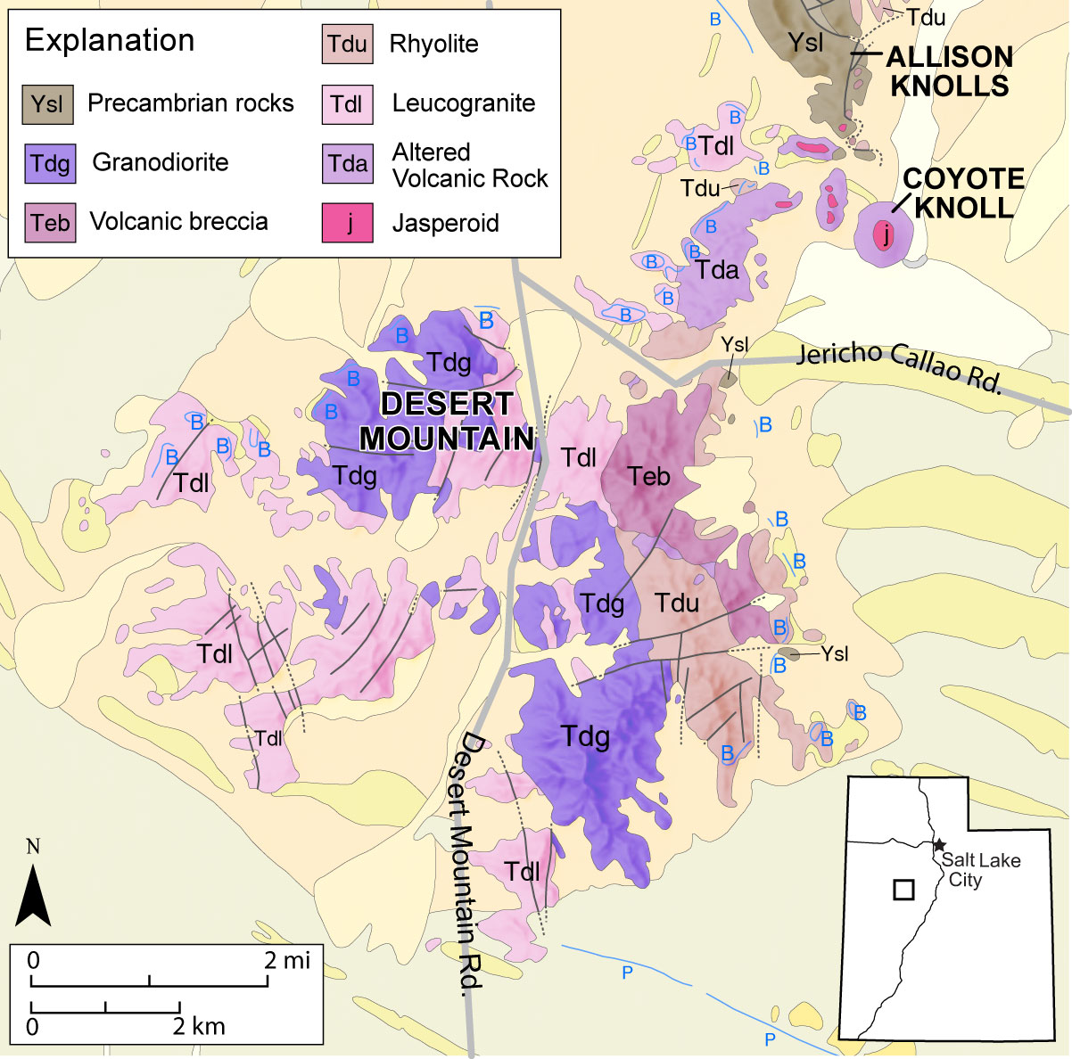
Simplified geologic map of the Desert Mountain area. Blue lines labeled “B” are Lake Bonneville shorelines and heavy black lines are faults. Modified from Pampeyan, 2005.
Desert Mountain is a cluster of isolated peaks in Juab County, roughly 25 miles north of Delta, Utah. Located in the Tintic-Deep Creek mineral belt of the Basin and Range Province, the area is known to rock climbers for its granitic outcrops, but most others are unaware of this fascinating and fantastic geologic site.
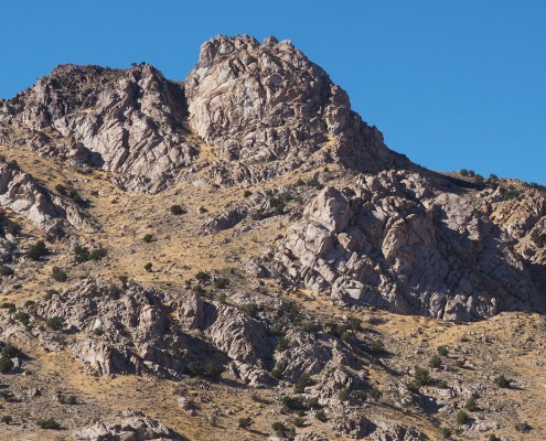
Desert Mountain is a small solitary range that echoes fiery volcanic eruptions and ancient magmatic upheaval from long ago and is now a quiet, remote monument of that geologically violent time. The range is composed of igneous rocks including granite, rhyolite, and tuff, as well as a few sparse outcrops of Precambrian-age sedimentary rocks. Only a few scientific research studies have been conducted on Desert Mountain, but based on the most recent studies, the area is believed to be the remnants of an ancient volcanic caldera. A caldera forms when a volcano empties a large amount of its magma chamber in an enormous eruption, causing the volcano to collapse inwardly and form a circular bowl-shaped depression.
About 30 to 40 million years ago during the Eocene to Oligocene Epochs, the Desert Mountain area became a center of magmatic activity when a large body of magma intruded into the Earth’s crust. Crustal rocks in the area consisted of Precambrian-age sedimentary rocks and Eocene-age igneous rocks from a previous episode of intrusion that likely occurred just prior to the one that created the Desert Mountain caldera. The precise timing of this previous intrusion is not certain, but you can see it today as the dark-crystalline granitic rock (granodiorite) covering widespread areas of the Desert Mountain Range. The newer intrusion of magma erupted as a sticky, low-silica rhyolitic lava flow, some of which can now be seen just off the Jericho Callao Road before reaching Desert Mountain Pass. A nearby stratovolcano also erupted around this time expelling andesitic lava, as evidenced by andesitic rocks found at Desert Mountain today.
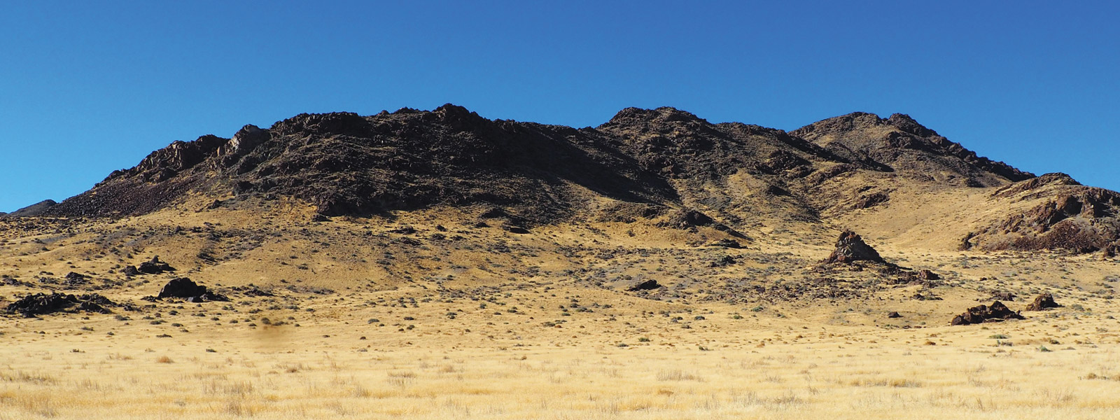
Approximately 18,000 years ago, waves etched the Bonneville Shoreline near the base of Desert Mountain. The shoreline is the flat area just below the dark outcrops of volcanic rock that erupted explosively when the caldera was formed.
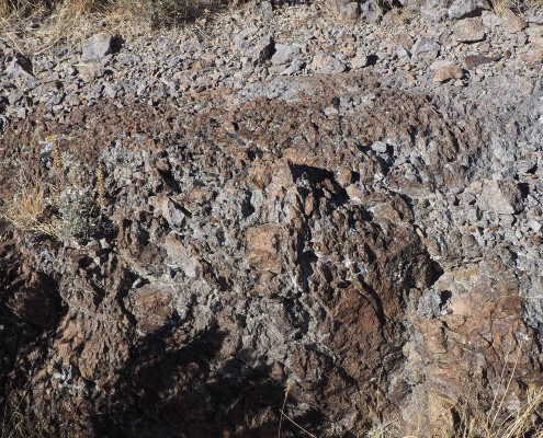
After emplacement of the magma chamber and the eruption of the rhyolitic lava, a huge, cataclysmic eruption occurred at Desert Mountain ejecting volcanic ash, blocks, and rock fragments. These deposits (pyroclastic rhyolite) can be seen today all over the eastern side of the Desert Mountain Range. At this point, the magma chamber had emptied so much of its contents in such an enormous eruption that its roof collapsed, forming a volcanic breccia, which is a thick chaotic assemblage of rocks consisting of fragments of the Precambrian-age sedimentary rock and igneous rocks within a matrix of volcanic material. This volcanic breccia is also prevalent on the eastern side of Desert Mountain Range.
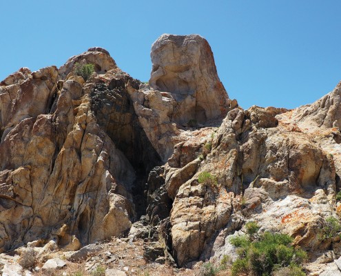
Following the collapse, the leftover magma rose upwards below the bottom of the caldera and cooled into a “resurgent dome” of light-colored granite, called leucogranite, that makes up most of Desert Mountain today. As the magma began to cool, fractures and fissures formed, allowing hotter, still molten, magma from below to rise and fill the voids. These thin vertical sheets cooled to create dikes containing an igneous rock called aplite. These sugary-textured, white aplite dikes locally contain cavities that feature large grains of quartz, feldspar, and mica. Juxtaposed with the older and much darker volcanic and granitic rocks, the leucogranite of Desert Mountain and the white aplite dikes are distinct and unmistakable.
Hot fluids associated with the resurgent magma circulated through the caldera and altered the volcanic rocks. This process helped to create clay and rocks enriched in silica, like jasperoid. This geothermal fluid also helped create small ore deposits of predominantly silver and copper that were last mined in the first half of the twentieth century, with a total value of under $20,000 (modern metal prices).
A final, comparatively small pulse of magma intruded the leucogranite of Desert Mountain, cutting through it in many places to form what appear to be very dark lamprophyre dikes that offer a striking contrast in color to the lighter granite that they cut through.
Over the past 17 million years, tectonic forces have been pulling apart the Earth’s crust between Utah’s Wasatch Range and California’s Sierra Nevada Mountains, an area called the Basin and Range Physiographic Province. This westward-directed extension and thinning has led to dramatic changes in topography, creating north-south-trending, fault-bounded valleys and mountain ranges. The extension and movement along local faults have slowly exhumed and tilted the Desert Mountain area eastward so that the extruded volcanic rocks lie east of the once buried granitic intrusion.
Around 30,000 years ago, ancient Lake Bonneville covered much of western Utah and parts of Idaho and Nevada. By about 18,000 years ago, when the lake had grown to its largest size, the highest part of Desert Mountain would have appeared as a peninsula connected by a small isthmus to the higher land to the northwest near Coyote Knoll. The shorelines of Lake Bonneville are still visible around the mountain range’s flanks at an elevation of approximately 5,170 feet.
* Special thanks are owed to Professor Eric Christiansen from Brigham Young University, who aided my understanding of Desert Mountain’s geology and is currently researching the Desert Mountain area.
How to Get There
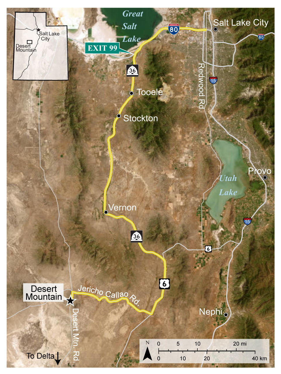
From Salt Lake City, drive west on Interstate 80 to exit 99 and take State Route 36 south towards Tooele. Drive for 66 miles, passing through Tooele, Stockton, and Vernon. Turn right onto U.S. Route 6 and drive south for 15.3 miles. Turn right (west) onto Weiss Highway/Jericho Callao Road. Drive for 22.5 miles (the road will turn from pavement to dirt/gravel after about 6.5 to 7 miles). Take the left fork towards Desert Mountain Pass and drive for 1.5 miles to Desert Mountain.
Coordinates: 39.7815°N, -112.5945°W


