

Rochester Panel Rock Art Site, Emery County, Utah
Photographer: Michael Vanden Berg; © 2014
Petroglyphs carved into Ferron Sandstone, Rochester Panel Rock Art Site, Emery County.
Rochester Panel Rock Art Site, Emery County, Utah
Photographer: Michael Vanden Berg; © 2014
Petroglyphs carved into Ferron Sandstone, Rochester Panel Rock Art Site, Emery County.
nationalgeographic.com
From fantastical to frightening, the animals of the Cambrian Period—beginning about 540 million years ago—tantalize the imagination. And they just keep getting weirder.
ksl.com
Authorities are looking for a vandal after a set of dinosaur tracks northeast of Moab, Utah was found filled with plaster.
good4utah.com
Good 4 Utah’s Adam Carroll visited Red Fleet State Park, just seven miles north of Vernal in Uintah County.
Called a “mini Lake Powell” by locals, the park’s lake winds through red cliffs, similar to those found at Lake Powell.
Many people don’t go for just the lake. People can hike, swim or canoe over to 200 million year old dinosaur tracks.
Check out the report above to learn more about the dino tracks at the park.
smithsonianmag.com


Notch Peak, Millard County, Utah
Photographer: Mark Milligan; © 2014
Banded white marble and quartz augen (eyeshaped crystals) in gray argillite, Notch Peak, Millard County.
fox13now.com
Utah is one of the best places to find and study dinosaur fossils. In fact, dinosaur fossils are so abundant here it had many scientists wondering, “Why Utah?”
nationalgeographic.com
More than two decades after dinosaurs crashed the electric fences in Jurassic Park, the fourth installment in the series—Jurassic World—has once again delivered hapless tourists to the claws and jaws of genetically engineered monsters. But even though everyone knows this is science fiction, headlines and high-profile articles about de-extinction have let fiction stalk a little closer to reality.

We woke up on the right side of the bedrock today!
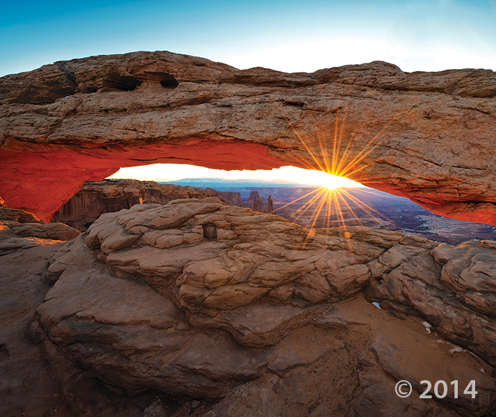
Canyonlands National Park, San Juan County, Utah
Photographer: Gregg Beukelman; © 2014
Mesa Arch, in the Island in the Sky District of Canyonlands National Park, formed as surface water pooled and eventually eroded through bedrock at the mesa’s edge. As the sun rises, its rays reflect off the 800-foot-high cliff of Jurassic-age sedimentary rock below the arch, bathing the bottom of the arch in an orange glow.
On June 4th the Utah Geological Survey embarked on the 2015 Administrative Professionals Geologic Field Trip. This year our group started off early at Bonneville Seabase in Tooele Valley, the Intermountain West’s spot to SCUBA and snorkel year-round amongst tropical marine fish. Our excellent tour guide, Ron, postponed the daily morning fish feeding until we arrived (thanks Ron!). Seabase is three bays fed by natural warm springs with a chemistry that approximates seawater. Water temperatures are in the 70s and 80s and water depths up to 62 feet. Although no one in our group went diving or snorkeling, we delighted in watching the colorful fish and putting our feet in the water and having mollies nibble our toes.
Next we headed south to the Stockton Bar, a world class geomorphic feature first interpreted by legendary geologist Grove Karl “GK” Gilbert in USGS Monograph 1, 1890. Geologist Mark Milligan explained that this feature signifies one of the largest and best-preserved shoreline remnants of Ice Age Lake Bonneville. Waves and currents transported sand and gravel to create a bar connecting South Mountain to the Oquirrh Mountains about 18,000 years ago when Lake Bonneville reached its highest level.
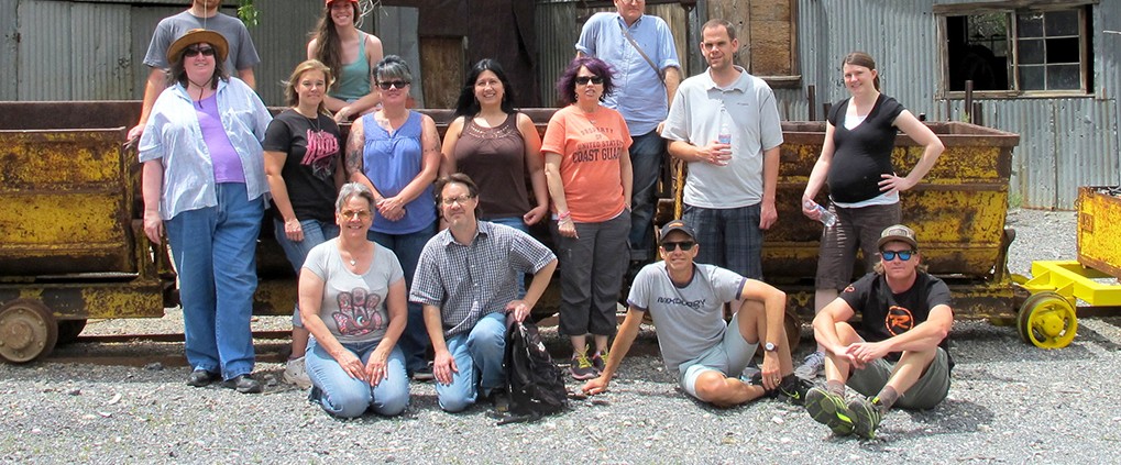
Continuing south our final stop was the former mining town of Ophir, nestled in a beautifully craggy and forested canyon. We were greeted by the Ophir mayor, Walt Shubert, and his wife Betty. Reynold “Ren” Willie, decorated retired geoscience teacher, Utah historian, Ophir native, and son of the superintendent of the Lark, Ophir, Gold Hill, and Hidden Treasure Mines, gave us a marvelous and memorable tour of the town. Ophir has preserved many of the old buildings and mining paraphernalia from the time it was a boomtown. From the 1860s to 1900, Ophir produced millions of dollars in silver, lead, and zinc; at one time reaching a population of 6,000 people. Ophir was a perfect place to conclude our informative day in the field.
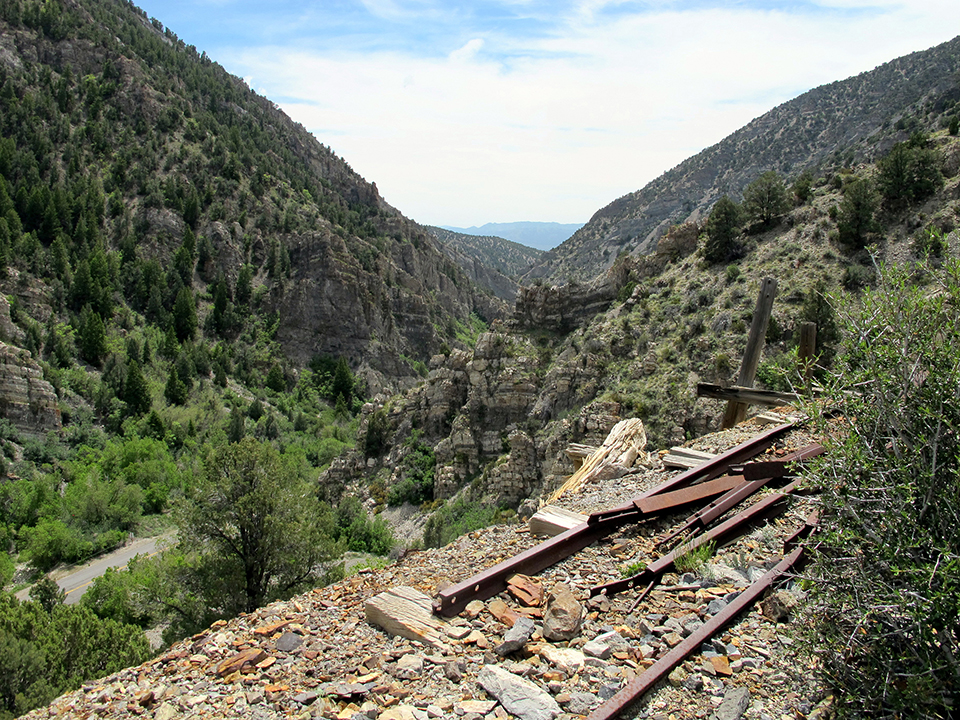
Mining relicts in scenic Ophir Canyon.

Mark explains the origin and significance of the Stockton Bar (flat feature in background).

Observing the tropical marine fish at Bonneville Seabase.
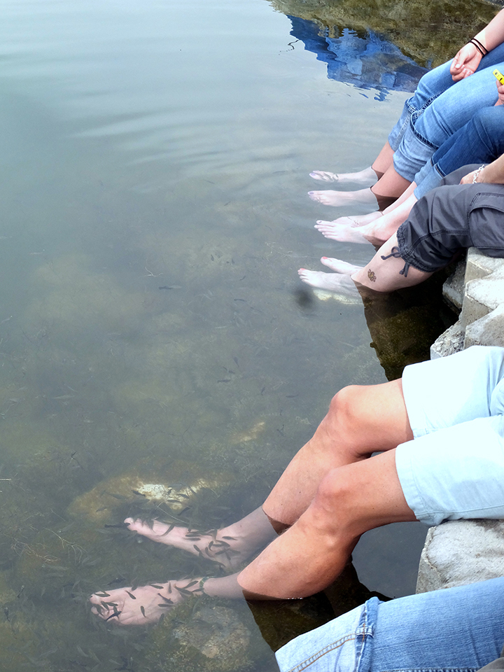
Soaking our feet and getting a “Mollie Pedicure” at Bonneville Seabase.
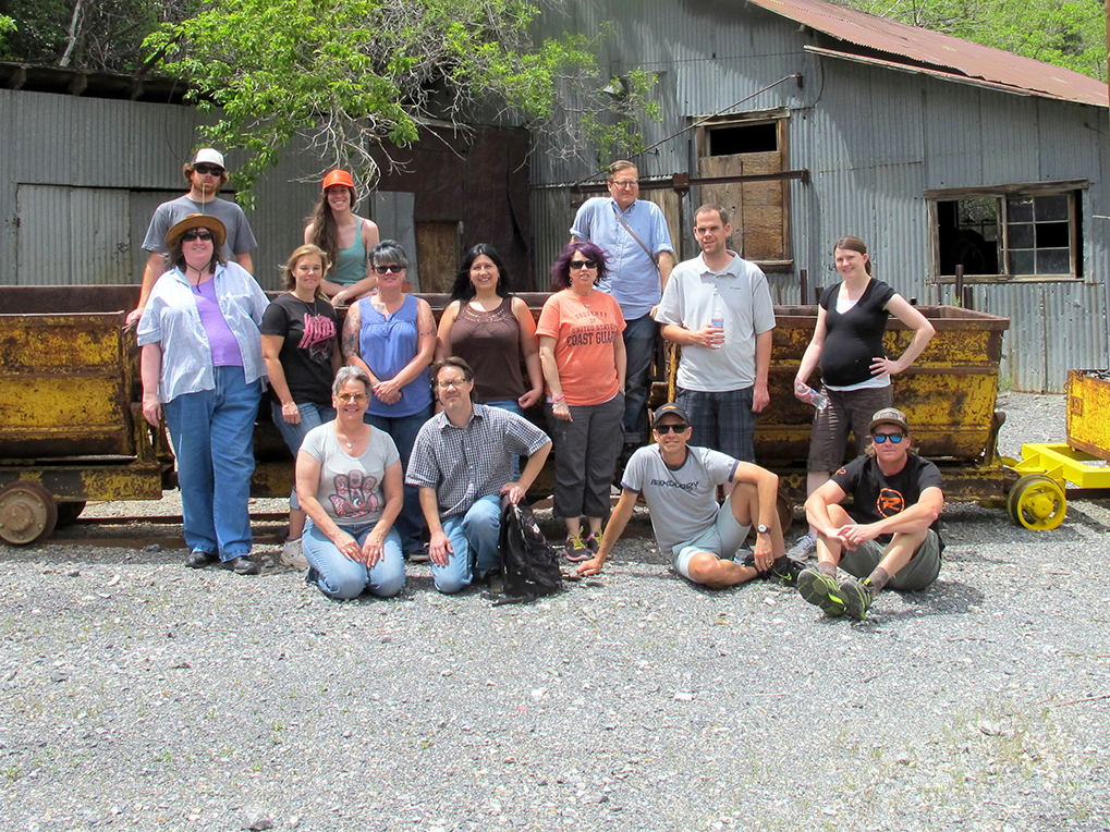
The UGS poses in front of ore carts at historic Ophir.

Ren Willie presenting the history of Ophir.
![]()
The Utah Geological Survey (UGS) is a division of the Utah Department of Natural Resources. Several specialized programs comprise the UGS: Data Management, Energy & Minerals, Geologic Hazards, Geologic Information & Outreach, Geologic Mapping, Groundwater & Wetlands, and Paleontology.