• Facebook
  • X
  • Instagram
  • LinkedIn
  • Rss
  • Pinterest
  • Youtube
Utah Geological Survey
  • Maps & Publications
    • Maps
      • Geologic Map Portal
      • Geologic Maps
      • Hazard Maps
      • Geophysical Maps
      • Energy & Mineral Maps
      • Groundwater & Wetlands Maps
      • Topographic Maps
      • Interactive Maps
    • Interactive Maps
      • Geologic Map Portal
      • GeoSights
      • Utah Geologic Hazards Portal
      • Utah Core Research Center Inventory
      • Utah Geochronology Database
      • Utah Mineral Resources
      • Utah Wetlands
    • Publications
      • New Maps & Publications
      • Survey Notes
      • GeoData Archive System
      • Natural Resources Map & Bookstore
      • UGS Library Catalog
    • Data & Databases
      • Aerial Imagery
      • Analytical Data
      • CVM & Geophysical Data
      • Energy and Mineral Statistics
      • Lidar Elevation Data
      • GeoData Archive System
  • Energy & Minerals
    • Energy & Minerals
      • Hydrocarbons
      • Coal
      • Metals
      • Industrial Minerals
      • Geothermal Resources
      • Carbon Capture, Utilization, & Storage
    • Information and Maps
      • Energy & Mineral Publications
      • Energy & Mineral Statistics
      • Energy News
      • Energy & Mineral Interactive Maps
    • Quick Links
      • Utah’s Energy Resources Web Experience
      • Utah’s Energy Landscape
      • Annual Mining Report
      • Critical Minerals of Utah
      • Utah Core Research Center
  • Groundwater & Wetlands
    • Groundwater
      • Hydrologic Cycle
      • Groundwater and Aquifers
      • Groundwater Quality
      • Groundwater Levels
    • Wetlands
      • Wetlands in Utah
      • Wildlife and Plants
      • Functions and Values
      • Health and Restoration
      • Wetlands on Private Land
    • Information and Maps
      • Groundwater and Wetlands Publications
      • Groundwater Level Data Portal
      • Utah Wetlands Interactive Map
      • Wetland Plant Application
  • Hazards
    • Hazards
      • Earthquakes
      • Landslides
      • Flooding
      • Problem Soils and Rocks
      • Volcanoes
    • Hazard Assistance
      • Local Governments and Other Agencies
      • Emergency Response
      • Homebuyers and Real Estate Agents
      • School Site Evaluations
      • Consultants and Design Professionals
    • Information and Maps
      • Hazard Maps & Publications
      • Paleoseismology of Utah Series
      • Workshops and Short Courses
      • Costs of Geologic Hazards
      • Program Projects
    • Resources
      • Aerial Imagery
      • CVM and Geophysical Data
      • GeoData Archive System
      • Utah Earthquake Working Groups
      • Utah Geochronology Database
      • Utah Geologic Hazards Portal
  • Popular Geology
    • Popular Geology
      • Rocks & Minerals
      • Geologic History
      • Dinosaurs & Fossils
      • Great Salt Lake & Lake Bonneville
      • Landforms
      • Ice Age
      • Earthquakes, Landslides, & Other Hazards
      • Volcanoes
      • Energy & Mineral Resources
    • For Teachers
      • Teaching Kits
      • Earth Science Week
      • Multimedia & Downloads
      • Teacher’s Corner Articles
      • Speakers for the Classroom
      • Field Trip Resources
      • Teacher Workshops
    • Popular Resources
      • GeoSights Tour
      • Glad You Asked Articles
      • Survey Notes
      • Interactive Maps
      • Rockhounding Resources
      • Fossil Localities Guide
      • Natural Resources Map & Bookstore
  • About
    • About Us
      • UGS Programs
      • Staff Directory
      • Latest News
      • UGS Board
      • Natural Resources Map & Bookstore
  • Search
  • Menu Menu

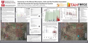
SSA-Poster-Reduced 2 Forge

April 24, 2017
Share this entry
  • Share on Facebook
  • Share on X
  • Share on WhatsApp
  • Share on Pinterest
  • Share on LinkedIn
  • Share on Tumblr
  • Share on Reddit
  • Share by Mail
https://geology.utah.gov/wp-content/uploads/ugs-logo-large.png 0 0 Utah Geological Survey https://geology.utah.gov/wp-content/uploads/ugs-logo-large.png Utah Geological Survey2017-04-24 07:59:292017-04-27 13:27:33SSA-Poster-Reduced 2 Forge

Subscribe to Blog via Email

Enter your email address to subscribe to this blog and receive notifications of new posts by email.

Join 218 other subscribers

Recent Posts

  • DNR Names New State Geologist and Utah Geological Survey Director April 17, 2025
  • Press Release: Utah Geological Survey Launches 2025 Calendar of Utah Geology November 27, 2024
  • UGS Hosts Earth Science Week November 6, 2024
  • Weather stations throughout the state measure water movement from land to air October 15, 2024
  • New Publication: Common Wetland Plants of Utah’s Central Basin and Range Ecoregion September 18, 2024

X Feed

My Tweets
POPULAR POSTS & PAGES
LEARN MORE ABOUT THE UTAH GEOLOGICAL SURVEY


The Utah Geological Survey (UGS) is a division of the Utah Department of Natural Resources. Several specialized programs comprise the UGS: Data Management, Energy & Minerals, Geologic Hazards, Geologic Information & Outreach, Geologic Mapping, Groundwater & Wetlands, and Paleontology.

About UGS | UGS Board | Locations | Staff Directory

QUICK LINKS
PUBLICATIONS LIBRARY LATEST NEWS ASK A GEOLOGIST CONTACT WEBMASTER

DNR | Nondiscrimination & Accessibility | Utah.gov | Careers | Disclaimer | Privacy Policy

CONTACT INFORMATION

Staff Directory

1594 West North Temple, Suite 3110
Salt Lake City, Utah 84116

801-537-3300 (phone)
801-537-3400 (fax)

Mailing Address:
PO BOX 146100
Salt Lake City, Utah 84114

HOURS

Monday through Friday,
8 a.m. to 5 p.m.

© Copyright - Utah Geological Survey - State of Utah
  • Facebook
  • X
  • Instagram
  • LinkedIn
  • Rss
  • Pinterest
  • Youtube
Scroll to top