

Goosenecks State Park, San Juan County, Utah
Photographer: Marshall Robinson; © 2014
Goosenecks of the San Juan River from Goosenecks State Park, San Juan County.
Goosenecks State Park, San Juan County, Utah
Photographer: Marshall Robinson; © 2014
Goosenecks of the San Juan River from Goosenecks State Park, San Juan County.

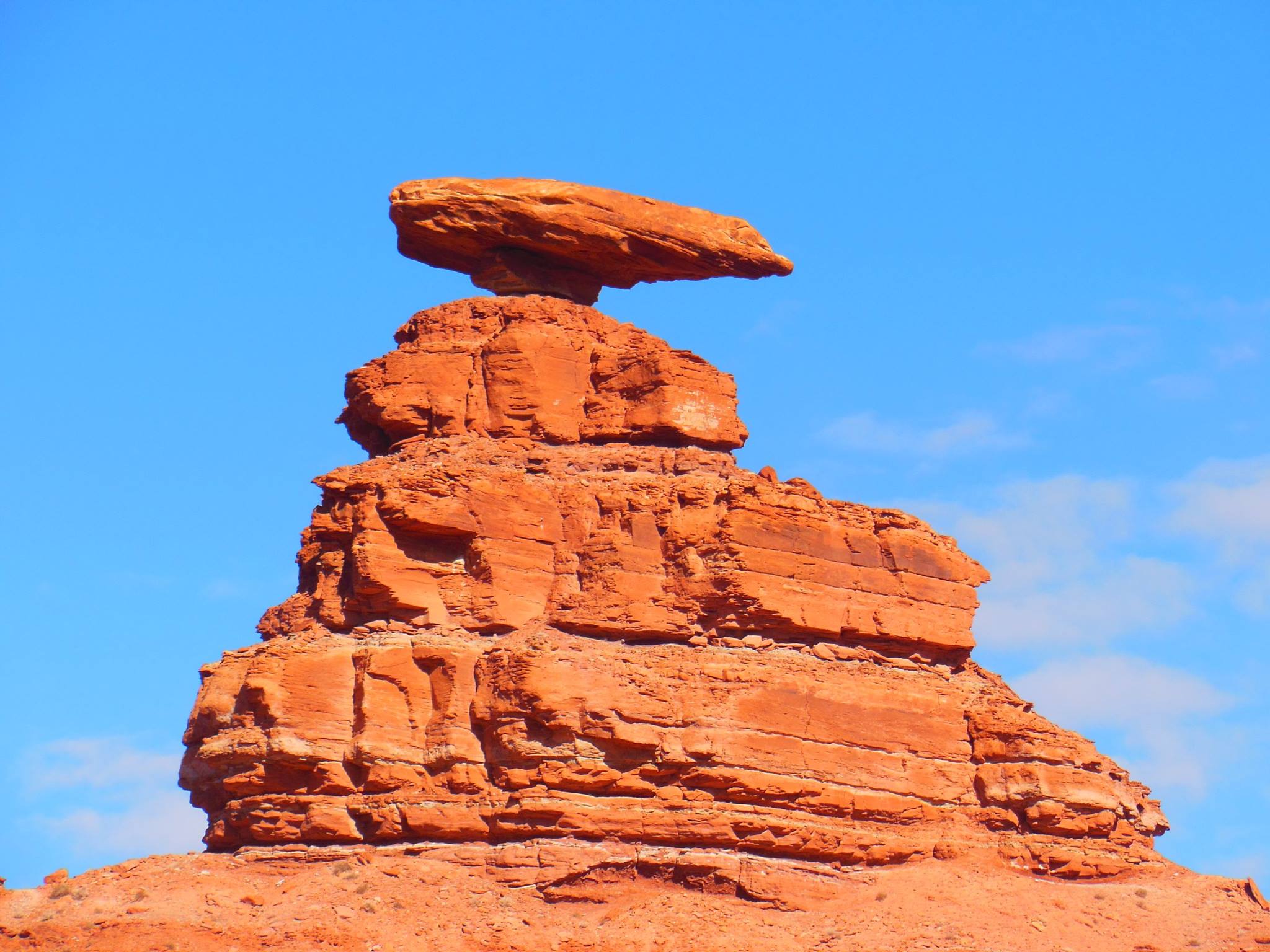
Hats off to a new year! Let’s celebrate with a new round of “Spot the Rock.” Anyone have an inkling where these rocks are mingling? Post your guesses below, and we’ll reveal the answer next week!
Photo by: Jeremy Harwood
UPDATE: Location Revealed!
Our friends were “spot” on guessing last week’s “Spot the Rock”! This photo shows Mexican Hat, the famous sombrero-shaped rock perched in the Halgaito Formation. The Halgaito and Honaker Trail Formations appear as red and greenish-gray ribbons on the western flank of the Raplee anticline. Farther south on this route, the rock ribbons take on a scalloped appearance that is due to differential erosion of the soft and hard rocks; the softer Halgaito is wearing away from the crest of the anticline.

By: Paul Inkenbrandt
The City of Millville, located in a prime location for aquifer storage and recovery (ASR), is having issues with elevated nitrate in the Glenridge well, a public water supply sourced from the Cache Valley principal aquifer. To alleviate high nitrate, the city performed an initial injection and pumping test using the Glenridge well. Millville injected water from Garr Spring, another public water supply source of which they own water rights, into the Glenridge well for one week at a rate of 500 gallons per minute. They then pumped the well while monitoring geochemistry to determine the effects on the Cache Valley principal aquifer system. The pre-injection nitrate concentration in the Glenridge well was 7.65 mg/l nitrate as nitrogen, and the nitrate concentration after pumping more than 172% of the volume of water injected was 6.52 mg/l nitrate as nitrogen. There is likely some dispersion of the injected spring water via advection in the aquifer.


Colorado River, Grand County, Utah
Photographer: Adam Hiscock; © 2014
Late-winter ice still clings to the Colorado River near Big Bend, north of Moab. Boulders of Jurassic-age Wingate Sandstone and Triassic-age Chinle Formation line the banks of the river, eroded from the cliffs and ledges cut by the river as it has incised its channel over millions of years.
washingtonpost.com
Gray-green plateaus and rock formations in a palette of fiery oranges and browns take up much of the landscape on the 400-mile drive from St. George, Utah, to Dinosaur National Monument. Arid and sprawling, it’s not the subtropical terrain that made up the late Mesozoic era, but that didn’t stop the 5-year-old aspiring paleontologist in the back seat from imagining a hungry allosaurus or herd of sauropods pounding across the land in search of dinner.

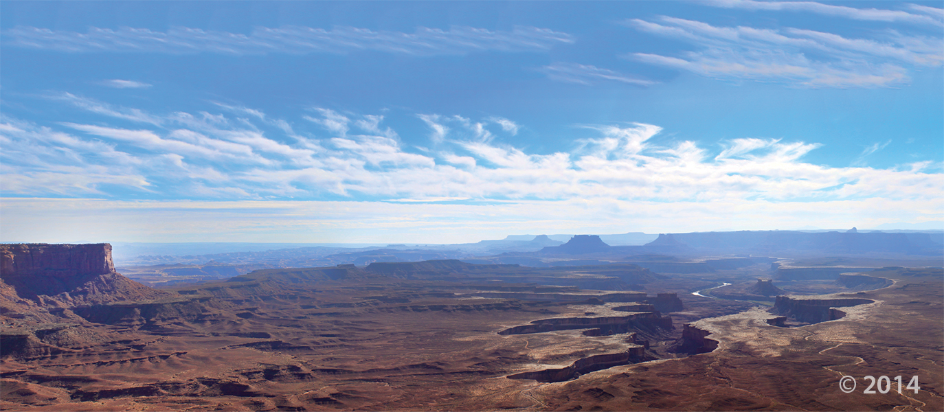
Island in the Sky District, Canyonlands National Park, San Juan County, Utah
Photographer: Stevie Emerson; © 2014
sltrib.com
The Stonegate subdivision seems like a great place to settle down and raise kids. But a dank secret lurks under its sprawling lawns.

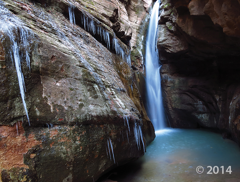
Zion National Park, Washington County, Utah
Photographer: Tyler Knudsen; © 2014
One of numerous slot canyons carved into Jurassic-age Navajo Sandstone in Zion National Park, Bear Trap Canyon is particularly dark and narrow. With little sunlight penetrating to the canyon floor, snow and ice often linger well into spring.
What are Utah’s Arches trying to tell us? Read more in this article about an arch’s “song” that scientists are looking at.
bbc.com
These geological wonders adorn the Colorado Plateau in the southwestern US – not to mention the desktop wallpapers of countless computers worldwide.
While the weather has been warm, and there’s not a lot of snow or ice around, it’s a great time of year to look at the Ice Age animals of Utah. Did you know that Great Salt Lake is the remnant of Ice Age lake, Lake Bonneville? Read more about this different age in Utah in our “Popular Geology” subjects HERE.
![]()
The Utah Geological Survey (UGS) is a division of the Utah Department of Natural Resources. Several specialized programs comprise the UGS: Data Management, Energy & Minerals, Geologic Hazards, Geologic Information & Outreach, Geologic Mapping, Groundwater & Wetlands, and Paleontology.