Tag Archive for: utah
Great Salt Lake may ebb and flow, however its current low levels give impetus to talk about water use, and how to use it more wisely in the desert. Andrew Rupke, a minerals specialist here at UGS, joins the conversation in this article. Check it out!
deseretnews.com
Not many states have a defining natural feature that locals actually discourage visitors from seeing.

Hey friends, we’ve finally made way with our new website! Visit geology.utah.gov to see our new look. Though, as most technical endeavors, we’ve encountered some difficulties. Switching the URLs erased our subscription list, and those who subscribed to our “New Blog,” you will have to re-subscribe. We apologize for the inconvenience, but we hope you’ll forgive us when you see this pretty picture of Utah geology.
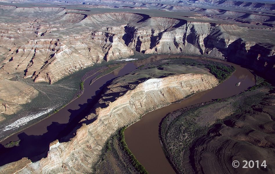
Desolation Canyon, Uintah County, Utah
Photographer: Adam Hiscock; © 2014
The Green River forms a dramatic “gooseneck” near Sand Wash in upper Desolation Canyon. The river has incised into rocks of the Douglas Creek and Parachute Creek Members of the Tertiary-age Green River Formation, which comprises sediments that accumulated in ancient Lake Uinta.
ksl.com
New technology is available to Utah information systems that will facilitate faster decision-making and improve management for government and businesses across the state.
Looking for somewhere fun to go in Utah this weekend? You don’t even have to leave home! Check out our GeoSights virtual tour page to find some of Utah’s coolest places!

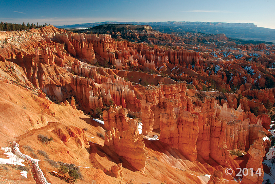
Bryce Canyon National Park, Garfield County, Utah
Photographer: Danielle Lehle; © 2014
This soil might just look like some crusty dirt. However it’s the crust on the dirt that makes this soil so very important. Tread lightly through this “Glad you Asked” article on soil crusts to find out more!


Arches National Park, Grand County, Utah
Photographer: Gregg Beukelman; © 2014
Turret Arch viewed through North Window arch in The Windows Section of Arches National Park. The arches formed as the result of erosion through weak parts of sandstone fins composed of Jurassic-age Dewey Bridge Member of the Carmel Formation and Slick Rock Member of the Entrada Sandstone.
Have you ever been on an outdoor adventure when you found yourself faced with some kind of geological feature, only you weren’t sure which one? ..It looks like Paul Bunyan’s Woodpile, but is this it?..
Check out our “Glad You Asked” article where you can learn more about how Geographic Names came to be officially recognized, and explore the online database of where these places are located!
LEARN MORE ABOUT THE UTAH GEOLOGICAL SURVEY
![]()
The Utah Geological Survey (UGS) is a division of the Utah Department of Natural Resources. Several specialized programs comprise the UGS: Data Management, Energy & Minerals, Geologic Hazards, Geologic Information & Outreach, Geologic Mapping, Groundwater & Wetlands, and Paleontology.
QUICK LINKS
CONTACT INFORMATION
Staff Directory1594 West North Temple, Suite 3110
Salt Lake City, Utah 84116
801-537-3300 (phone)
801-537-3400 (fax)
Mailing Address:
PO BOX 146100
Salt Lake City, Utah 84114
HOURS
Monday through Friday,8 a.m. to 5 p.m.