

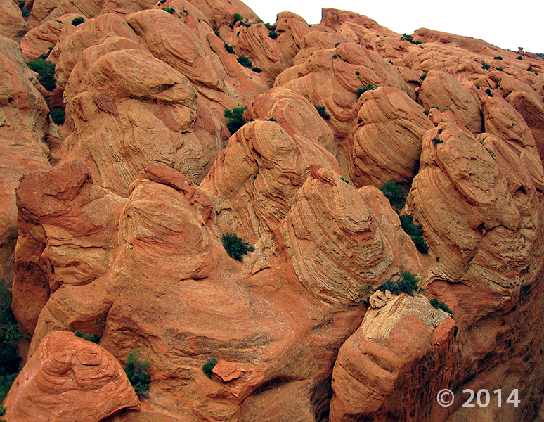
Metate Arch, Devils Garden Outstanding Natural Area, Garfield County, Utah
Photographer: Ken Krahulec; © 2014
Metate Arch, Devils Garden Outstanding Natural Area, Garfield County, Utah
Photographer: Ken Krahulec; © 2014


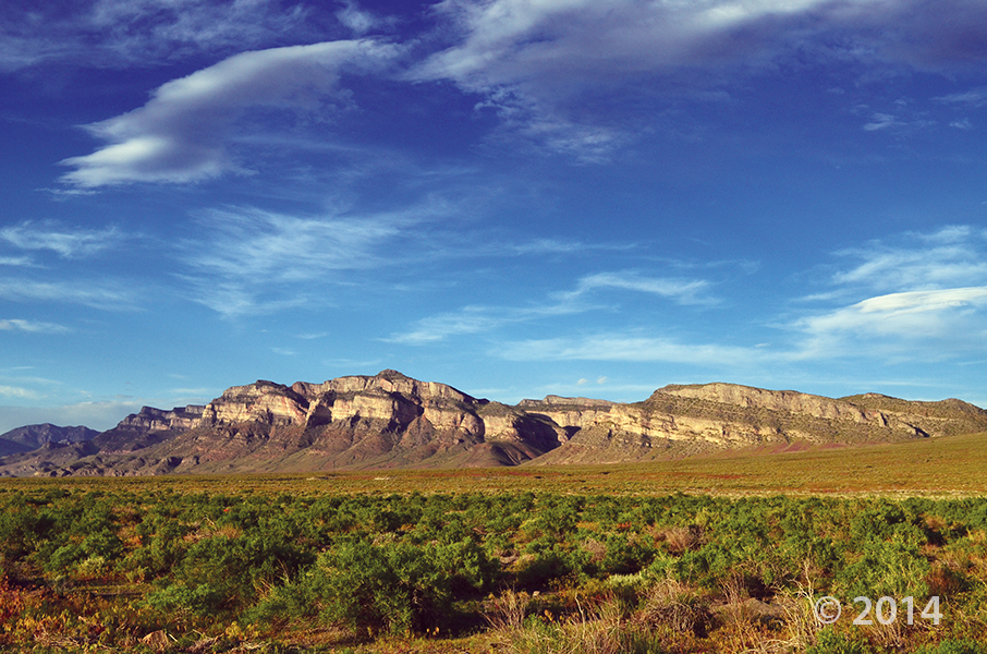
San Rafael Swell, Emery County, Utah
Photographer: Taylor Boden; © 2014
Erosion has exposed and sculpted Jurassic-age sedimentary rocks in the southern San Rafael Swell. Near Goblin Valley State Park, towering Wild Horse Butte comprises the Morrison and Summerville Formations (top cliff layers), Curtis Formation (middle slope layer), and Entrada Sandstone (bottom reddish layer).
deseretnews.com
A Colorado River ferry operator named Arthur Chaffin created quite a stir more than half-a-century ago in 1949 when, armed solely with his camera, he set off from his cabin in Hite to a remote place in the Utah outback he’d known about for years he called Mushroom Valley.

Entrada Sandstone in Cathedral Valley, Capitol Reef National Park, Wayne County, Utah
Photographer: Tyler Knudsen; © 2014


Not everyone grows up with this kind of doll house! We’re having southern Utah geology day dreams today.
The Doll House, Maze District of Canyonlands National Park, Wayne County, Utah
Photographer: Tyler Knudsen; © 2014

The shallow waters of Bridger Bay, on the northwestern tip of Antelope Island in the southern arm of hypersaline Great Salt Lake, support extensive microbial carbonate formation, especially in the north-northeast portion of the bay near Egg Island. Lake levels in the fall of 2014 were near 60-year lows (as low as 1278.1 m [4193.3 ft] AMSL, compared to the near-term historic average of about 1280 m [4200 ft]), giving unprecedented access to the microbial structures. Characterizing the microbialites of Bridger Bay, including facies delineation and aerial extent, can inform interpretations of similar deposits in the ancient rock record (e.g., Eocene Green River Formation), including potential petroleum reservoirs.
Music:
Headphone Activist – The Rainforest.
soundcloud.com/headphoneactivist
www.facebook.com/HPABeats

Do you think playgrounds are boring? Are you getting sick of the same old swing and slide? Well check out this playground—it rocks!
Devils Playground is not your typical playground at the park, but a playground of granitic rock weathered into fantastic forms and eerie shapes. Located on Bureau of Land Management and state land, Devils Playground is a relatively unknown geologic curiosity found in a remote region of northwestern Utah.
Devils Playground consists of Tertiary-age (approximately 38 million years old) granitic rock formed from a cooling magma body that intruded overlying Paleozoic (400 to 300 million years old) sedimentary rocks. Known as the Emigrant Pass pluton, this intrusion covers an area of approximately 10 square miles in the southern part of the Grouse Creek Mountains.

House Range, Millard County, Utah
Photographer: J. Lucy Jordan; © 2014
Where’s winter? On the upside, today feels a little like this photo—it is gorgeous out there. The mid-week peak is here with another weekend on the way. Who’s got outdoor adventures in their forecast??

This photo shows another way that #UtahGeology can really knock you off of your feet. Don’t forget your sea legs as you look out over the vast sea of geology!

San Rafael Swell and Henry Mountains from Temple Mountain, Emery County, Utah
Photographer: Paul Kuehne; © 2014

Hey friends, we’ve finally made way with our new website! Visit geology.utah.gov to see our new look. Though, as most technical endeavors, we’ve encountered some difficulties. Switching the URLs erased our subscription list, and those who subscribed to our “New Blog,” you will have to re-subscribe. We apologize for the inconvenience, but we hope you’ll forgive us when you see this pretty picture of Utah geology.
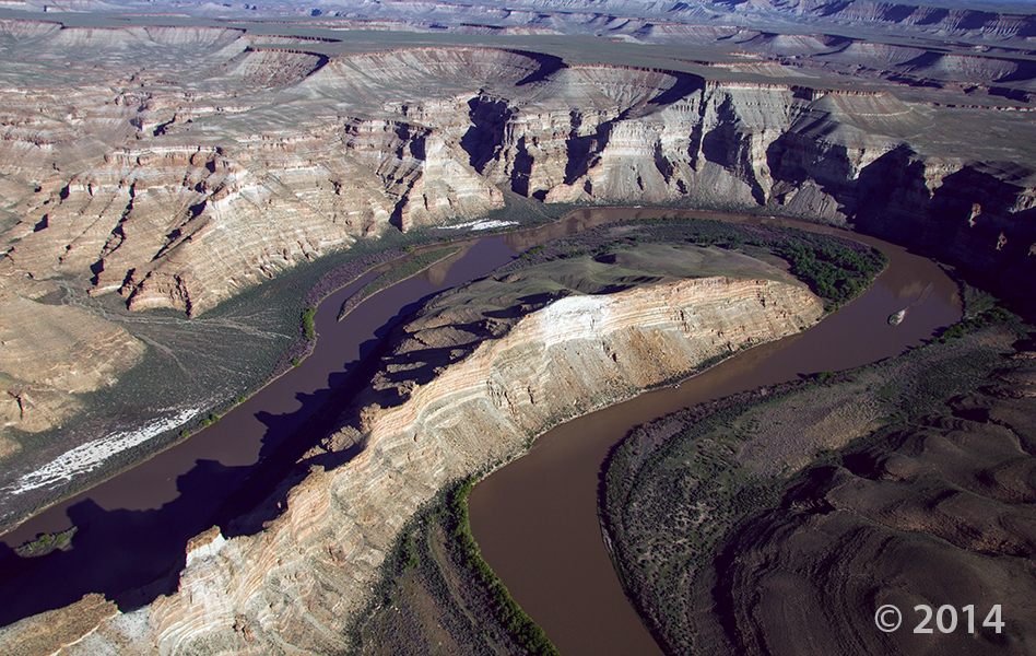
Desolation Canyon, Uintah County, Utah
Photographer: Adam Hiscock; © 2014
The Green River forms a dramatic “gooseneck” near Sand Wash in upper Desolation Canyon. The river has incised into rocks of the Douglas Creek and Parachute Creek Members of the Tertiary-age Green River Formation, which comprises sediments that accumulated in ancient Lake Uinta.
![]()
The Utah Geological Survey (UGS) is a division of the Utah Department of Natural Resources. Several specialized programs comprise the UGS: Data Management, Energy & Minerals, Geologic Hazards, Geologic Information & Outreach, Geologic Mapping, Groundwater & Wetlands, and Paleontology.