

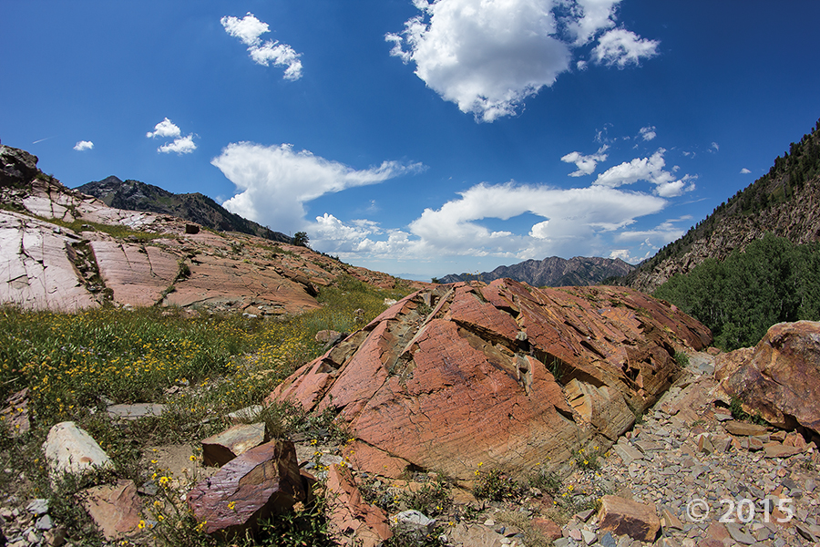
Bells Canyon, Wasatch Range, Salt Lake County, Utah
Photographer: Jim Davis; © 2015
Lower Bells Canyon Reservoir and glacially sculpted Bells Canyon, Wasatch Range, Salt Lake County.
Bells Canyon, Wasatch Range, Salt Lake County, Utah
Photographer: Jim Davis; © 2015
Lower Bells Canyon Reservoir and glacially sculpted Bells Canyon, Wasatch Range, Salt Lake County.

An afternoon escape—

San Rafael Swell, Emery County, Utah
Photographer: Mark Milligan; © 2015
Small cave-like features called tafoni pockmark the walls of a slot canyon in the southern San Rafael Swell, Emery County.


State Route 20, Garfield County, Utah
Photographer: Bob Biek; © 2015
Pinnacles eroded from Tertiary-age lava flow breccia along State Route 20, Garfield County.


Duchesne River, Duchesne County, Utah
Photographer: Rich Emerson; © 2015
Little Deer Creek cascades over sandstone ledges of the Precambrian-age Hades Pass unit of the Uinta Mountain Group into Cataract Gorge on the Duchesne River, Duchesne County.

I know there’s snow up in the Wasatch today, but the valley sure feels as nice as this photo!
Big Cottonwood Canyon, Wasatch Range, Salt Lake County, Utah
Photographer: Adam Hiscock; © 2015
Glacially scoured and polished quartzite of the Precambrian-age Big Cottonwood Formation near Lake Blanche, Big Cottonwood Canyon, Wasatch Range, Salt Lake County.

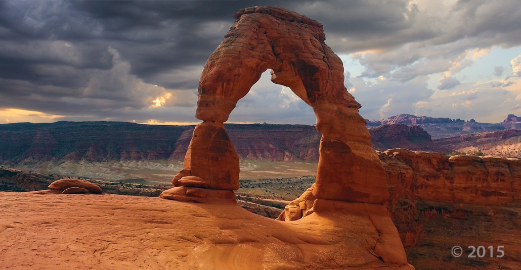
Delicate Arch, Arches National Park, Grand County, Utah
Photographer: Marshall Robinson; © 2015
Delicate Arch, a 65-foot-tall natural arch in Arches National Park, Grand County, is composed of Jurassic-age sandstone including the Slick Rock Member of the Entrada Sandstone (base and pedestals) and Moab Member of the Curtis Formation (bridge).

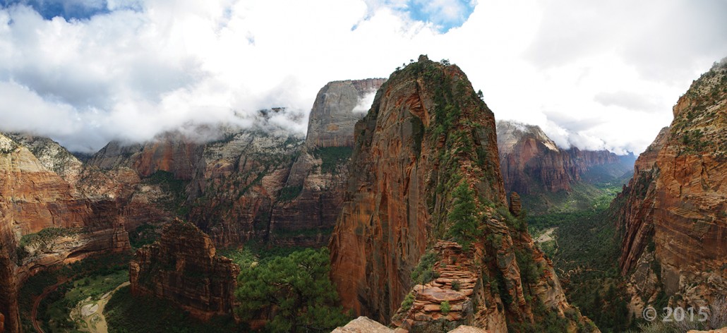
Zion National Park, Washington County, Utah
Photographer: Adam McKean; © 2015
Towering 1,488 feet above the canyon floor, Angels Landing is a joint-controlled resistant fin of Jurassic-age Navajo Sandstone, carved out by the incised North Fork Virgin River. A popular, but steep and exposed, hiking trail guides park visitors along the sheer fin to inspiring views of Zion Canyon.

Congratulations to Tyler Knudsen for receiving UGS’s 2015 Employee of the Year Award!

Tyler’s geologic hazard and mapping knowledge are formidable, his computer skills are impressive, and he keeps up-to-date on the latest technologies. He produces many high quality studies, one of which recently received national accolades. He responds quickly to geologic hazard events and interacts well with the media. His knowledge of southwestern Utah geology is impeccable, which he enthusiastically shares with the public through blogs and local newspapers. He is wholly reliable, easy to be around, and a joy to work with. These special talents make him an essential member of our Cedar City office.

Wishing our Tuesday was spent out there! The weather just gets nicer and nicer by the day. What Utah places do you want to explore this year?

Capitol Reef National Park, Wayne County, Utah
Photographer: Tyler Knudsen; © 2015
Fluted crimson walls of Jurassic-age Entrada Sandstone rim Cathedral Valley in the remote northern part of Capitol Reef National Park. The near-vertical Entrada walls owe their existence to the overlying white Curtis Formation that serves as a protective cap rock.


Wasatch Range from northern Goshen Valley, Utah County, Utah
Photographer: J. Lucy Jordan; © 2015

The Utah Geological Survey (UGS) is a division of the Utah Department of Natural Resources. Several specialized programs comprise the UGS: Data Management, Energy & Minerals, Geologic Hazards, Geologic Information & Outreach, Geologic Mapping, Groundwater & Wetlands, and Paleontology.
1594 West North Temple, Suite 3110
Salt Lake City, Utah 84116
801-537-3300 (phone)
801-537-3400 (fax)
Mailing Address:
PO BOX 146100
Salt Lake City, Utah 84114
Monday through Friday,
8 a.m. to 5 p.m.
![]()