Tag Archive for: UGS

Great Salt Lake’s North Arm is a little salty, even for Great Salt Lake. The Union Pacific railroad causeway is a factor in the build-up of salt crust in the north arm. The Railroad will be starting a bridge-building project to replace a part of the causeway, mitigating some of the water flow issues. Two of our geologists here at the UGS talk about the salt build up and how it’s affected the North Arm.

ksl.com

One of the strangest and most striking places in Utah — an enormous oddity that scientists say was created accidentally by human engineering — is getting a bit of a remodeling job.

READ MORE

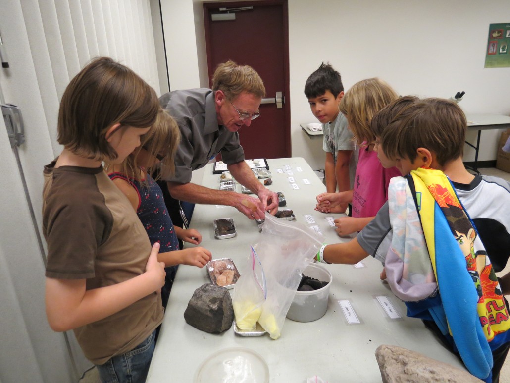
The annual Earth Science Week celebration at the UGS this October was a success in large part due to a record number of volunteers.  Fifty-one outside volunteers, from institutions and organizations such as The University of Utah, Weber State University, Brigham Young University, Utah Valley University, Westminster College, NOAA, Utah Department of Environmental Quality, Rockhounders Outreach for Community Knowledge, Association for Women Geoscientists, Utah Geological Association, and Utah Friends of Paleontology, joined the UGS to educate Utah’s youth through hands-on Earth science activities. We deeply appreciate the volunteer’s contributions! More than 700 elementary school students participated in this year’s Earth Science Week.

Rick Allis Earth Science Week Mineral Testing

Utah Geological Survey Director, Rick Allis, teaches students about Mineral Testing.

Cane Creek anticline and the Colorado River, Grand County, Utah Photographer: Rebekah Stimpson; © 2015

A view to drink in over your lunch time daydream.

POTD 10-27-15

Cane Creek anticline and the Colorado River, Grand County, Utah
Photographer: Rebekah Stimpson; © 2015


Another feature on our recently released 2016 Calendar of Utah Geology. If you haven’t looked yet, check it out!

suindependent.com

The Utah Geological Survey, which provides timely scientific information about Utah’s geologic environment, resources, and hazards, released its 2016 calendar of Utah geology. The Utah Geological Survey 2016 calendar features some of Utah’s most rarely seen vistas as photographed by UGS staff as they travel the state researching and studying these geologic wonders.

READ MORE

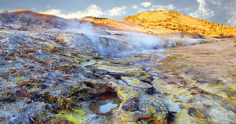
Someone dropped a box of yellow crayons in this hot water. Now, the algae and sulfur crystals can’t stop coloring! Just kidding, there’s no crayons in this natural color field.

10-20-15

Roosevelt Hot Springs Geothermal Area, Beaver County, Utah
Photographer: Mark Milligan; © 2015

Yellow sulfur crystals and various colors of bacteria and algae give these hissing steam vents and bubbling pools an otherworldly look. This landscape is a recent and evolving phenomenon resulting from changing groundwater levels associated with nearby geothermal power generation.

Pine Valley Mountains, Washington County, Utah Photographer: Nikki Simon; © 2015

POTD 10-13-15 Pine Valley Mountains Washington County

Pine Valley Mountains, Washington County, Utah
Photographer: Nikki Simon; © 2015

ironcountytoday.com

On Sept. 28, the Utah Department of Natural Resources celebrated the opening of its new Southwest Regional Complex in Cedar City.

READ MORE

Hey everyone! We’ve got two field reviews of new geologic mapping are coming your way. One trip will cover the Willard Quadrangle, the other will cover the Salt Lake City North and Baileys Lake Quadrangles. Please see the images for more information.

Field Review of New Geologic mapping Field Review of New Geologic mapping

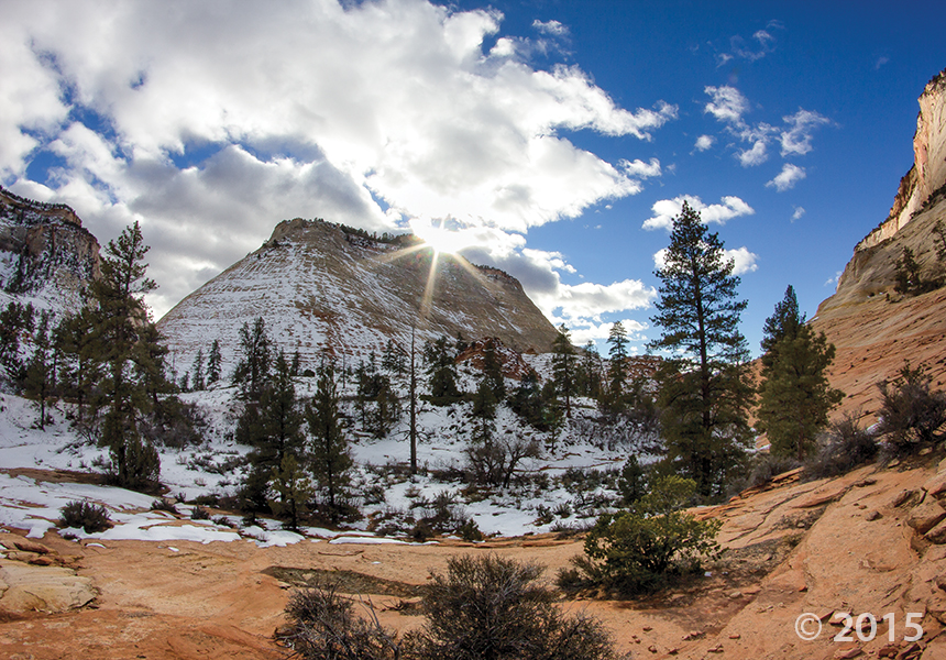
Snow highlights cross-bedding on the sides of buttes and mesas along the Clear Creek drainage on the east side of Zion National Park. Cross-beds in the nearly 2,000-foot-thick Jurassic-age Navajo Sandstone formed in ancient sand dunes and reflect changing wind directions as the sand was being deposited. Zion National Park, Kane County, Utah Photographer: Adam Hiscock; © 2015

The mornings are becoming a little crisper, and night comes a little quicker. It won’t belong before we see this scene!

POTD 10-6-15 Zion National Park, Kane County

Zion National Park, Kane County, Utah
Photographer: Adam Hiscock; © 2015

Snow highlights cross-bedding on the sides of buttes and mesas along the Clear Creek drainage on the east side of Zion National Park. Cross-beds in the nearly 2,000-foot-thick Jurassic-age Navajo Sandstone formed in ancient sand dunes and reflect changing wind directions as the sand was being deposited.

Earth Science Week is in full swing at the Utah Geological Survey this week. Who else has Earth Science Week plans??

Stream Table Earth Science Week ESW 2

Stream Table Earth Science Week ESW