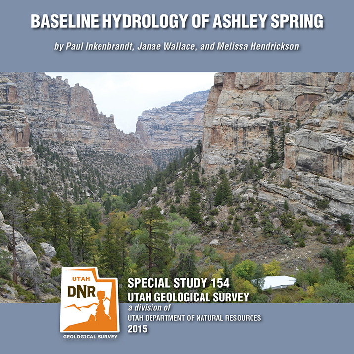
Tag Archive for: UGS

SS-154 Baseline Hydrology of Ashley Spring

By: Paul Inkenbrandt, Janae Wallace, and Melissa Hendrickson

Ashley Spring is an important water supply for most of the residents in the Vernal area of Uintah County, Utah. The Geological Survey conducted a study to determine the baseline flow paths and water chemistry of the aquifer systems that provide water to the spring. Ashley Spring water is of high quality, which does not vary long term. A Substantial part of the water emanating from Ashley Spring has been in the groundwater system less than one week, originating as recharge at areas along Dry Fork where water seeps into sing and fractures. This CD contains a 54-page report and appendices.

GET IT HERE

Happy Friday! Take a minute to enjoy Discovery Canada’s short on our Paleontologists here at the Utah Geological Survey and their work on the nearly 9-ton fossil block containing a family of Utahraptor. See James Kirkland, Scott Madsen, Don DeBlieux, and help from others as they unravel their Utahraptor puzzle.

discovery.ca

SEE IT HERE

Entrada Sandstone in Cathedral Valley, Capitol Reef National Park, Wayne County, Utah Photographer: Tyler Knudsen; © 2014

POTD 4-7-15 Capitol Reef National Park

Entrada Sandstone in Cathedral Valley, Capitol Reef National Park, Wayne County, Utah
Photographer: Tyler Knudsen; © 2014

M-271DM Map Santa Clara Quadrangle

By: Grant C. Willis and Janice M. Hayden

The Santa Clara 7.5′ quadrangle is in the northwestern part of the St. George basin in southwestern Utah, and includes Santa Clara and Ivins Cities, and colorful Red Mountain and Snow Canyon State Park. Movement on an underlying thrust fault created a variety of faults, joints, deformation shear bands, and brecciated rock in Triassic and Jurassic strata in many areas. Remnants of six Quaternary basalt flows cap ridges and benches, forming classic inverted valleys, and form lava cascades in Snow Canyon State Park. The young Santa Clara flow cascaded through Snow Canyon and flooded across broad benches, forming scenic black terrain that contrasts sharply with red-brown to near-white sandstone cliffs. Landslides, rock falls, swelling clays, and other geology and related flooding and debris flow hazards have caused extensive damage in recent years and present increasing challenges as growth and development continue. “Blue Clay” of the Chinle Formation has been at the root of significant damage to roads, buildings, and infrastructure.

GET IT HERE

The Doll House, Maze District of Canyonlands National Park, Wayne County, Utah Photographer: Tyler Knudsen; © 2014

POTD 3-24-15, doll house, Canyonlands

Not everyone grows up with this kind of doll house! We’re having southern Utah geology day dreams today.

The Doll House, Maze District of Canyonlands National Park, Wayne County, Utah
Photographer: Tyler Knudsen; © 2014

kutv.com

A 125-million-year-old fossil was delivered to Thanksgiving Point’s Museum of Ancient Life in Lehi, nearly 15 years after a graduate student discovered the dinosaur site.

READ MORE

A BIG BIG “Thanks” to Cross Marine Projects of American Fork for helping us move our nearly 9-ton Utahraptor fossil block from our UGS headquarters in Salt Lake City down to Thanksgiving Point’s Museum of Ancient Life in Lehi today.

Stikes Block SLC to Thanksgiving Point 1 Stikes Block SLC to Thanksgiving Point 2 Stikes Block SLC to Thanksgiving Point 3 Stikes Block SLC to Thanksgiving Point 4 Stikes Block SLC to Thanksgiving Point 5

March 17, 2015

Utahraptor fossil stikes block 3

Utahraptor fossil stikes block 2

Utahraptor fossil stikes block 1

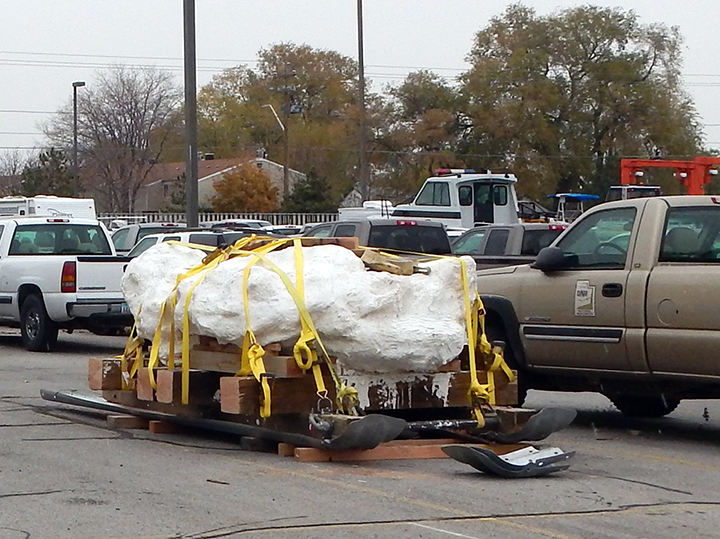
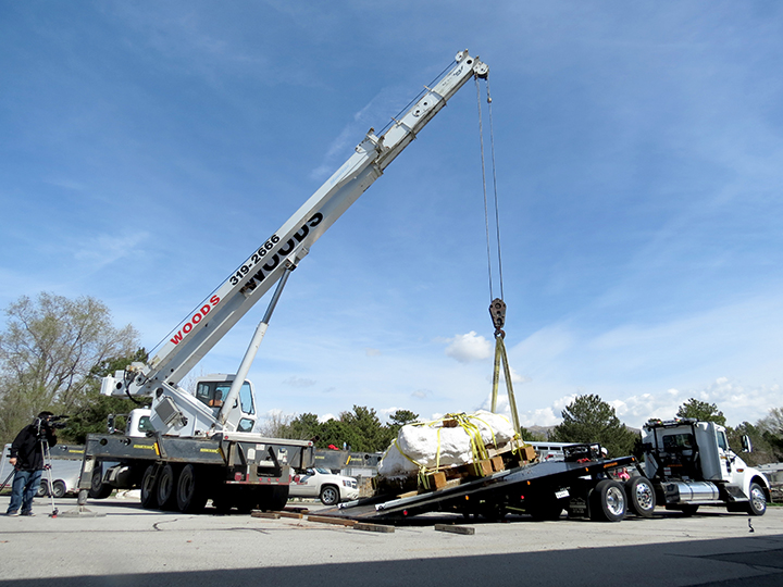
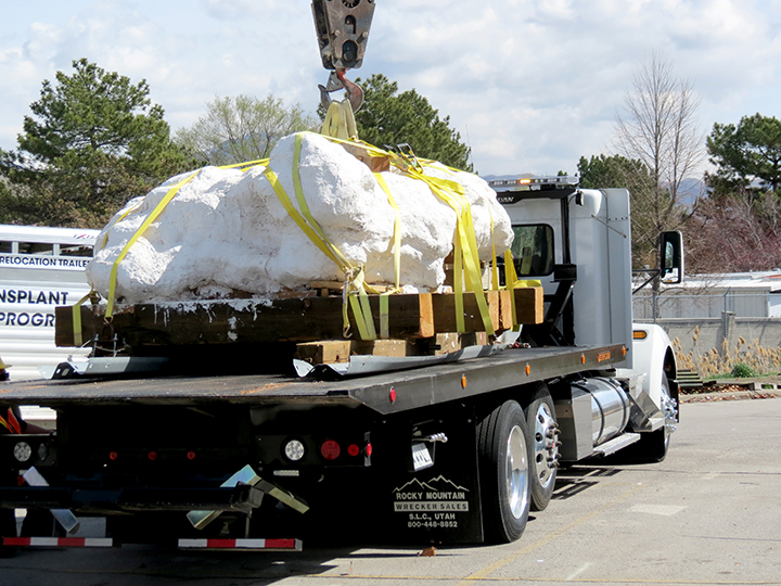
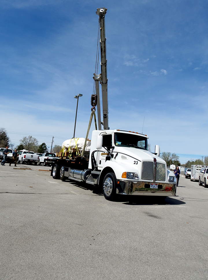
Salt Lake City – March 17, 2015 – The Utah Geological Survey (UGS) has signed an agreement with Thanksgiving Point Institute to extract and prepare the fossils of a pack of Utahraptors encased in a nine-ton sandstone block.

Utahraptors are the oldest known dromaeosaurids, or bird-like therapod dinosaurs. They resemble Steven Spielberg’s Velociraptor from the movie Jurassic Park, but are much larger and believed to be a more ferocious predator.

On Wednesday, March 18th, Cross Marine Projects of American Fork will generously donate their services to relocate the sandstone block from the Utah Department of Natural Resources (DNR) in Salt Lake City to Thanksgiving Point’s Museum of Ancient Life in Lehi. Upon securing the necessary funding, one of the world’s top micropreparators, UGS geologist Scott Madsen, and his colleagues may spend up to five years preparing the fossils in the museum’s paleo lab, begining as early as May.

The museum’s paleo lab has a public observation room and will be equipped with video microscopes to feed video footage into the museum. This public access will give museum visitors an educational opportunity to see firsthand the extensive detail and care paleontologists use to prepare fossils.

“This will allow museum guests to see real science happening in real time,” stated Rick Hunter, Thanksgiving Point paleontologist. “We fully expect to learn much more about raptor behavior and the growth stages from juvenile to adult in Utahraptor. This is going to be huge for paleontology.”

“Thanksgiving Point has the only paleo lab in the region suitable to work on such a large block,” said James Kirkland, UGS State Paleontologist. “This discovery has the best preserved and most complete Utahraptor skeletons ever found. Normally we’d break a large discovery like this into smaller blocks. But this one is so rich with intertwined skeletal remains that we couldn’t split it without hitting skeleton.”

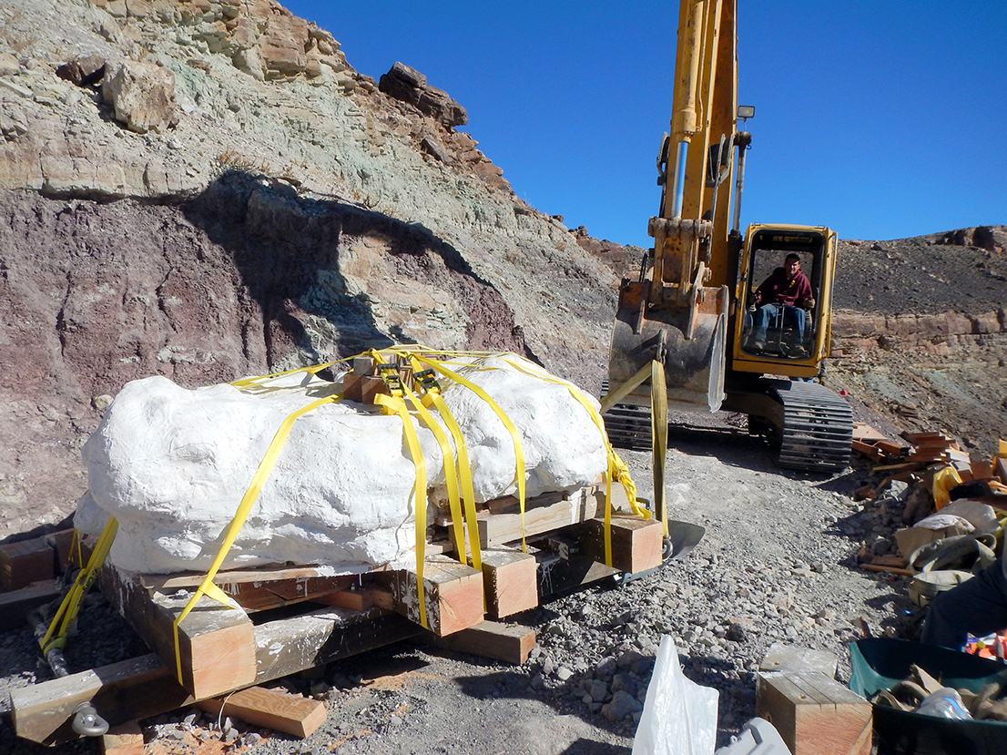
Preliminary analysis of the 125 million year old sandstone indicates the block contains the remains of at least six, and possibly many more, Utahraptors, including one adult, four juveniles, and one baby. Preservation within the block appears exceptional, lending to the hope that details such as feather impressions may be preserved. Bones of at least two iguanodont dinosaurs were also discovered within the sandstone block, leading Utah paleontologists to believe the Utahraptors were hunting when they became mired in quicksand, buried, preserved, and fossilized.

UGS paleontologists originally extracted the mega-block from the Stikes Quarry, which is located on Utah State land in east-central Utah, north of Arches National Park. Matt Stikes, a former graduate student at Northern Arizona University, discovered the site and reported it to the UGS in 2004. Last year Cross Marine Projects donated their services to recover the nine-ton block from its steep hillside location and move it to DNR. All fossils within the block are owned by the State of Utah and after preparation, their final repository will be with the Natural History Museum of Utah.

Media Contact
Mark Milligan
Utah Geological Survey
801-537-3326 (office)
markmilligan@utah.gov

MP 15-2DM, Hogup Bar Quadrangle, Box Elder

By: Daren T. Nelson and Paul W. Jewell

The Hogup Bar quadrangle is located southeast of Park Valley, Utah, and west of the northwest arm of Great Salt Lake. Late Pleistocene Lake Bonneville sediments and related shorelines dominate the landscape, and record the transgression and regression of Lake Bonneville. Surficial deposits overlie Tertiary basalt and Permian-Pennsylvanian sedimentary bedrock.

GET IT HERE

OFR-638 Insert, Open File Repot, Honeyville Quadrangle

By: Kimm N. Harty and Adam P. Mckean

This 1:24,000-scale surface fault rupture map of the Honeyville quadrangle shows potentially active faults and special-study areas for the Brigham City and Collinston segments of the Wasatch fault zone mapped using primarily 0.5-meter digital LiDAR data acquired in 2013 and 2014. Fault traces were also mapped using black and white stereographic and oblique aerial photographs and previous published sources for the Wasatch fault zone and parts of the West Cache fault zone contained on the Honeyville quadrangle.

GET IT HERE