wral.com
A researcher at North Carolina State University has recovered a clutch of rare dinosaur eggs from cliffs in Utah.
wral.com
A researcher at North Carolina State University has recovered a clutch of rare dinosaur eggs from cliffs in Utah.
San Rafael Swell, Emery County
Photographer: Don DeBlieux © 2017
Clam trace fossils on a fallen sandstone block of the Brushy Basin Member of the Jurassic-age Morrison Formation.
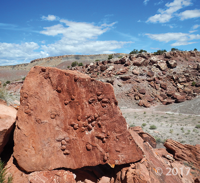
Bottleneck Peak, San Rafael Swell, Emery County
Photographer: Nikki Simon © 2016

San Rafael Swell near Muddy Creek, Emery County
Photographer: Scott Madsen © 2016

Colorful, rounded slopes are typical of the Brushy Basin Member of the Jurassic-age Morrison Formation. Clayey bentonite beds in the Morrison often have a distinctive “popcorn” weathering texture resulting from expansion of the clay minerals when they get wet.
UGS has received an exciting new core donation from Whiting Oil & Gas. It’s from four wells near the northern end of the San Rafael Swell with core from the Moenkopi Formation.
Contact the Utah Core Research Center for additional information.


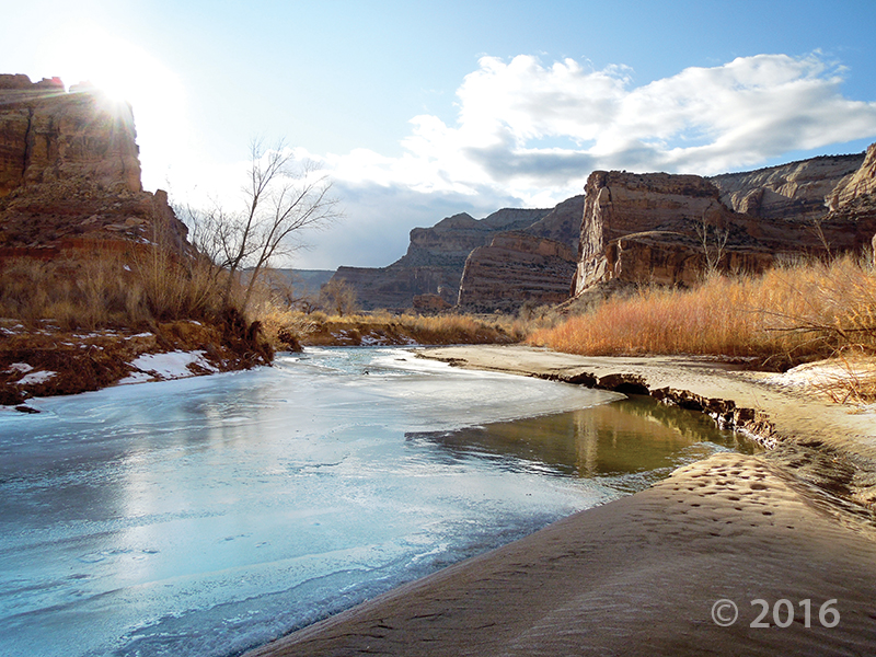
Little Grand Canyon of the San Rafael River, Emery County, Utah
Photographer: Zach Anderson; © 2016
Short days and low winter sun cause ice to form along the San Rafael River where it cuts through the west flank of the San Rafael Swell. The 1,100-foot-deep canyon exposes the Jurassic-Triassic-age Glen Canyon Group along the cliffs and ledges of the canyon walls.

An afternoon escape—

San Rafael Swell, Emery County, Utah
Photographer: Mark Milligan; © 2015
Small cave-like features called tafoni pockmark the walls of a slot canyon in the southern San Rafael Swell, Emery County.

Utah geology views for days.

Sid’s Mountain Wilderness Study Area, San Rafael Swell, Emery County, Utah
Photographer: Adam Hiscock; © 2015


San Rafael Swell, Emery County, Utah
Photographer: Taylor Boden; © 2014
Erosion has exposed and sculpted Jurassic-age sedimentary rocks in the southern San Rafael Swell. Near Goblin Valley State Park, towering Wild Horse Butte comprises the Morrison and Summerville Formations (top cliff layers), Curtis Formation (middle slope layer), and Entrada Sandstone (bottom reddish layer).

This photo shows another way that #UtahGeology can really knock you off of your feet. Don’t forget your sea legs as you look out over the vast sea of geology!

San Rafael Swell and Henry Mountains from Temple Mountain, Emery County, Utah
Photographer: Paul Kuehne; © 2014

The Utah Geological Survey (UGS) is a division of the Utah Department of Natural Resources. Several specialized programs comprise the UGS: Data Management, Energy & Minerals, Geologic Hazards, Geologic Information & Outreach, Geologic Mapping, Groundwater & Wetlands, and Paleontology.
1594 West North Temple, Suite 3110
Salt Lake City, Utah 84116
801-537-3300 (phone)
801-537-3400 (fax)
Mailing Address:
PO BOX 146100
Salt Lake City, Utah 84114
Monday through Friday,
8 a.m. to 5 p.m.
![]()