
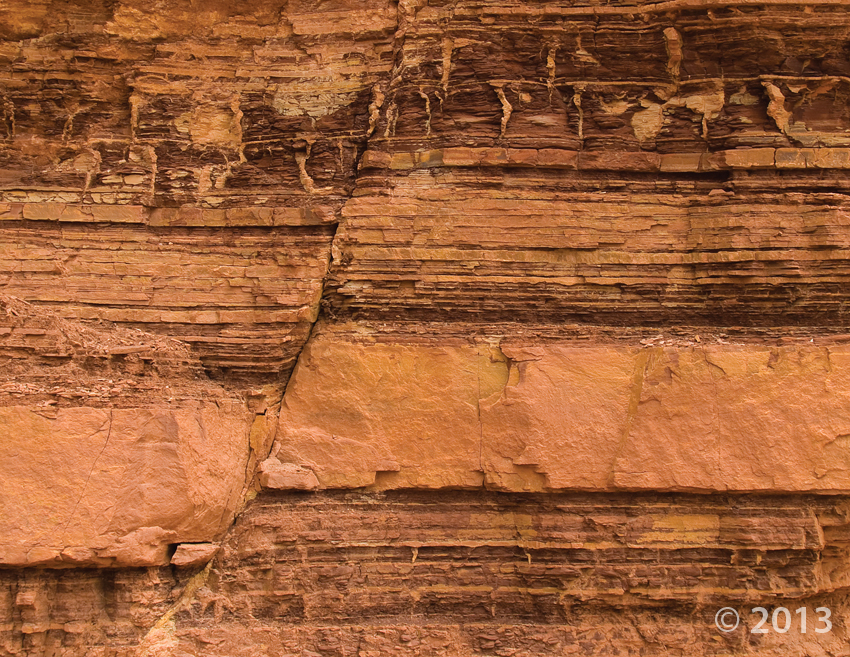
Small fault in the Moenkopi Formation, San Rafael Swell, Emery County, Utah
Photographer: Michael Vanden Berg; © 2013
Small fault in the Moenkopi Formation, San Rafael Swell, Emery County, Utah
Photographer: Michael Vanden Berg; © 2013
 San Rafael Swell, Emery County, Utah
Photographer: Robert Ressetar; © 2013
Window Blind Peak rises to an elevation of 7,030 feet in the interior of the San Rafael Swell. The resistant Triassic to Jurassic-age Wingate and Navajo Sandstones form, respectively, the massive lower cliffs and the upper pinnacle.
 San Rafael Swell, Emery County, Utah
Photographer: Robert Ressetar; © 2013
Triassic-age sedimentary rocks in the San Rafael Swell, Emery County.
 San Rafael Swell, Emery County, Utah
Photographer: Stephanie Earls; © 2012
Draw rock art panel, San Rafael Swell, Emery County.
 Buckhorn Wash, San Rafael Swell, Emery County, Utah
Photographer: J. Buck Ehler; ©2011
Petroglyphs etched into a Navajo Sandstone cliff, probably about 1,000 years ago in Buckhorn Wash, San Rafael Swell, Emery County.
 Mesas, buttes, and canyons in the east-central area of the San Rafael Swell, Emery County, Utah.
Photographer: Tom Chidsey
 Goblin Valley State Park, Emery County, Utah
Photographer: Keith Beisner
At Goblin Valley State Park on the southeast side of the San Rafael Swell, morning sun gives Wild Horse Butte an ethereal glow. The butte exposes all four geologic units present in the park: the Entrada Sandstone and Curtis, Summerville, and Morrison Formations. These strata record profound changes in Utah’s geography during Middle and Late Jurassic time, including the existence of coastal sand dunes, inundation by a shallow inland sea, and then uplift, erosion, and sediment deposition in stream channels and flood plains.
 San Rafael Swell, Emery County, Utah
Photographer: Taylor Boden
Boulders of Cretaceous-age Ferron Sandstone, eroded from the top of a distant butte, have come to rest on the Cretaceous-age Mancos
Shale on the west flank of the San Rafael Swell.

Head of Sinbad, San Rafael Swell, Emery County
Photographer: J. Buck Ehler
Dutchman Arch guards the path to Devil’s Racetrack, a popular recreation trail in the San Rafael Swell. Named after a local Dutch cattleman, the arch is composed of the Jurassic-age Wingate Sandstone deposited in ancient sand dunes.

The Utah Geological Survey (UGS) is a division of the Utah Department of Natural Resources. Several specialized programs comprise the UGS: Data Management, Energy & Minerals, Geologic Hazards, Geologic Information & Outreach, Geologic Mapping, Groundwater & Wetlands, and Paleontology.
1594 West North Temple, Suite 3110
Salt Lake City, Utah 84116
801-537-3300 (phone)
801-537-3400 (fax)
Mailing Address:
PO BOX 146100
Salt Lake City, Utah 84114
Monday through Friday,
8 a.m. to 5 p.m.
![]()