While this photo is a throwback to colder seasons, we cannot deny the stunning #UtahGeology present. This crisp, cold picture is worth a thousand hand warmers—that’s how the saying goes, right?

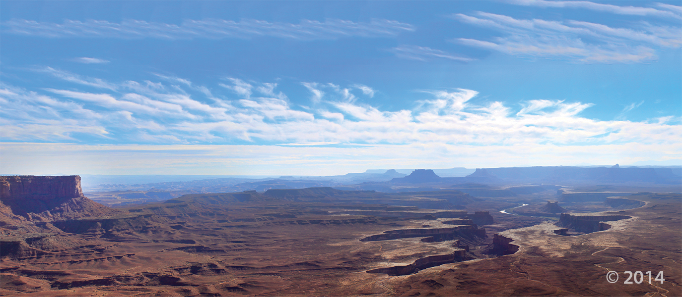
Dead Horse Point State Park, San Juan County, Utah
Photographer: Gregg Beukelman; © 2014
The Colorado River loops around the Gooseneck between Dead Horse Point State Park and distant cliffs of the Island in the Sky District of Canyonlands National Park. The river has carved and exposed nearly flat-lying Jurassic to Pennsylvanian-age sedimentary strata of the Colorado Plateau.