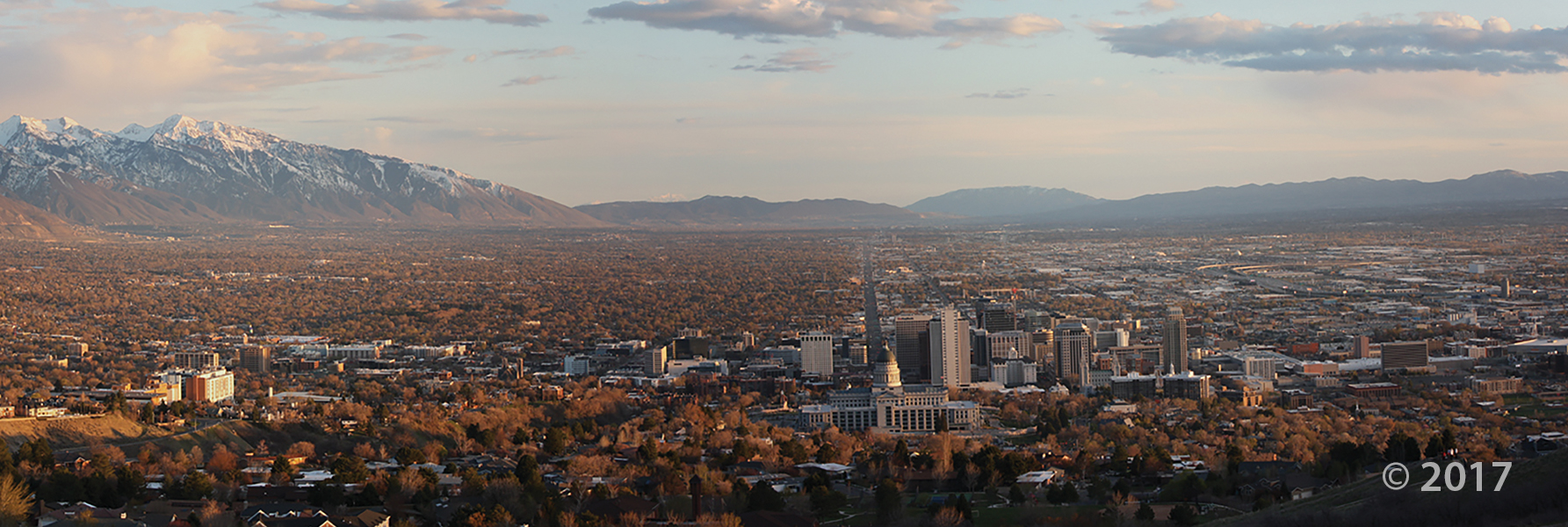
Salt Lake Valley from Ensign Peak, Salt Lake County.
Photographer: Mike Hylland © 2017
Salt Lake Valley from Ensign Peak, Salt Lake County.
Photographer: Mike Hylland © 2017
We know that most of you probably know about Saturday’s earthquake near Tooele by now. Here are some more in depth articles on the event.
“This one just seemed to come all on its own. Just one event. It doesn’t really have too much to do with the likelihood of future earthquakes,” –Keith Koper
deseretnews.com
Seismologists at the University of Utah are calling Saturday night’s earthquake a “minor” event.
Experts, residents react to earthquake that shook Salt Lake Valley
fox13now.com
The U.S. Geological Survey reported a magnitude 3.2 earthquake just a few miles northeast of Tooele on Saturday night.
kcpw.org
You wouldn’t know it from experience, but the Wasatch Front is one of the most seismically at risk areas in Utah and in the Intermountain West. Scientists are looking at thousands of years of earthquake history to learn more about the hazard we face. Kim Schuske has this story.
ksl.com
Scientists have discovered evidence of four big earthquakes that rocked the Salt Lake Valley long before pioneers arrived — and they’re not on the well-known Wasatch Fault on the East Bench.
Geologists are getting their first good look at the West Valley Fault zone, just west of the Salt Lake International Airport. They’ve wanted to dig trenches in the area for years.
“We suspected that there had been numerous earthquakes in this region,” said Chris DuRoss of the Utah Geological Survey.
The West Valley Fault zone is actually comprised of a dozen different fractures. They lie roughly between Redwood Road and 5600 West from about 1700 North to 4800 South. But since at least the 1980s the area on the margins of the Great Salt Lake has been too soggy to dig.
Over the last decade the shrinking lake receded several miles from the fault zone, and the water table has dropped. Now that the Utah Geological Survey has been able to dig three trenches, the water table is visible 10 feet below the surface.
Recently geologists had their first look underground, and it confirms their suspicions. The horizontal layers of sediment show clear signs of being broken by fault movements. It’s clear evidence of four big earthquakes in the last 15,000 years.
RELATED ARTICLES
sltrib.com
deseretnews.com
 GROUND-WATER QUALITY CLASSIFICATION FOR THE PRINCIPAL BASIN-FILL AQUIFER, SALT LAKE VALLEY, SALT LAKE COUNTY, UTAH
Janae Wallace and Mike Lowe
This CD contains a report (15 pages + 64-page appendices) and three plates (maps at 1:75,000 scale), all in PDF format, that address ground-water quality in Salt Lake Valley’s basin-fill aquifer and provide recommendations for water-resource management and land-use planning. The maps are described in detail in the report and show total-dissolved-solids concentration, ground-water quality classes, and potential contaminant sources.
CD (15 p. + 64 p. appendices, 3 pl.)
OFR-560……….$19.95

The Utah Geological Survey (UGS) is a division of the Utah Department of Natural Resources. Several specialized programs comprise the UGS: Data Management, Energy & Minerals, Geologic Hazards, Geologic Information & Outreach, Geologic Mapping, Groundwater & Wetlands, and Paleontology.
1594 West North Temple, Suite 3110
Salt Lake City, Utah 84116
801-537-3300 (phone)
801-537-3400 (fax)
Mailing Address:
PO BOX 146100
Salt Lake City, Utah 84114
Monday through Friday,
8 a.m. to 5 p.m.
![]()