Tag Archive for: geology

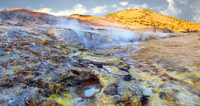
Someone dropped a box of yellow crayons in this hot water. Now, the algae and sulfur crystals can’t stop coloring! Just kidding, there’s no crayons in this natural color field.

10-20-15

Roosevelt Hot Springs Geothermal Area, Beaver County, Utah
Photographer: Mark Milligan; © 2015

Yellow sulfur crystals and various colors of bacteria and algae give these hissing steam vents and bubbling pools an otherworldly look. This landscape is a recent and evolving phenomenon resulting from changing groundwater levels associated with nearby geothermal power generation.

Pine Valley Mountains, Washington County, Utah Photographer: Nikki Simon; © 2015

POTD 10-13-15 Pine Valley Mountains Washington County

Pine Valley Mountains, Washington County, Utah
Photographer: Nikki Simon; © 2015

Hey everyone! We’ve got two field reviews of new geologic mapping are coming your way. One trip will cover the Willard Quadrangle, the other will cover the Salt Lake City North and Baileys Lake Quadrangles. Please see the images for more information.

Field Review of New Geologic mapping Field Review of New Geologic mapping

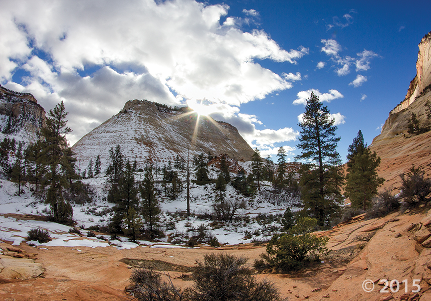
Snow highlights cross-bedding on the sides of buttes and mesas along the Clear Creek drainage on the east side of Zion National Park. Cross-beds in the nearly 2,000-foot-thick Jurassic-age Navajo Sandstone formed in ancient sand dunes and reflect changing wind directions as the sand was being deposited. Zion National Park, Kane County, Utah Photographer: Adam Hiscock; © 2015

The mornings are becoming a little crisper, and night comes a little quicker. It won’t belong before we see this scene!

POTD 10-6-15 Zion National Park, Kane County

Zion National Park, Kane County, Utah
Photographer: Adam Hiscock; © 2015

Snow highlights cross-bedding on the sides of buttes and mesas along the Clear Creek drainage on the east side of Zion National Park. Cross-beds in the nearly 2,000-foot-thick Jurassic-age Navajo Sandstone formed in ancient sand dunes and reflect changing wind directions as the sand was being deposited.

Earth Science Week is in full swing at the Utah Geological Survey this week. Who else has Earth Science Week plans??

Stream Table Earth Science Week ESW 2

Stream Table Earth Science Week ESW

A spectacular look at the geology in southern Utah—a lasting display of nature’s effect on rock.

livescience.com

Southwest of Moab, Utah, is an area of the American Southwest that is truly a showcase of geology. Check out these stunning images of one of the most geologically and biologically rich environments in North America.

READ MORE

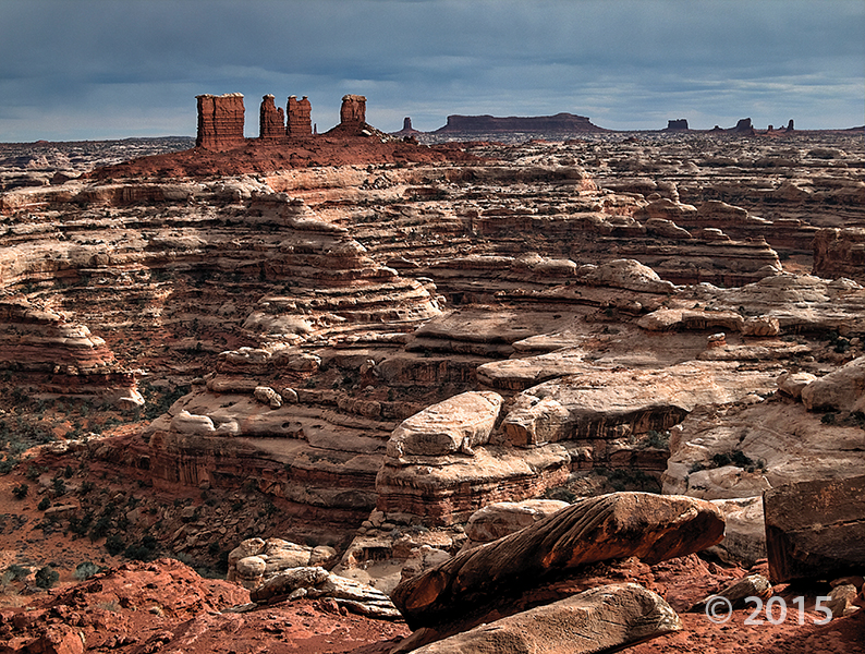
Chocolate Drops, Maze District of Canyonlands National Park, Wayne County, Utah Photographer: Tyler Knudsen; © 2015

Fall is upon us and October is just around the corner. If there were a Pumpkin Spice Geology, maybe it would look a little like this photo. What do you think? We’re in the Fall spirit here at the UGS!

9-29-15

Chocolate Drops, Maze District of Canyonlands National Park, Wayne County, Utah
Photographer: Tyler Knudsen; © 2015

If you missed it a couple of weeks ago, here is an article outlining the paleoseismic study some of our UGS geologists helped with on a trench.

nextcity.org

Not far from I-215 in Salt Lake City, near the airport, a deep trench cuts through the earth. Though it looks like a sewer repair project, there’s nothing down here but dirt. And dirt, to the trained eye, can reveal quite a bit about a city’s future.

READ MORE

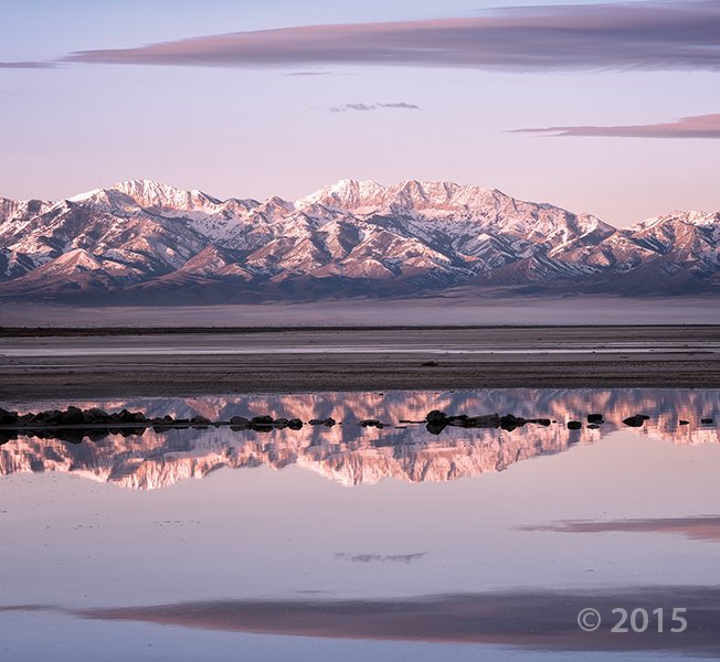
Alpenglow illuminates the glacially sculpted Stansbury Mountains as seen from the shores of Great Salt Lake. Deseret Peak (11,031 feet), the leftmost high summit, is the range’s highest peak and is underlain by Cambrian-age Prospect Mountain Quartzite. Stansbury Mountains, Tooele County, Utah. Photographer: Gregg Beukelman; © 2015

Have a wonderful weekend, everyone!

POTD 9-25-15 Stansbury Mountains Tooele County

Stansbury Mountains, Tooele County, Utah
Photographer: Gregg Beukelman; © 2015

Alpenglow illuminates the glacially sculpted Stansbury Mountains as seen from the shores of Great Salt Lake. Deseret Peak (11,031 feet), the leftmost high summit, is the range’s highest peak and is underlain by Cambrian-age Prospect Mountain Quartzite.

2016 Calendar_Cover_sm

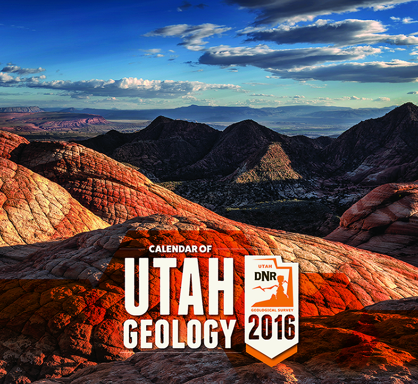
The Utah Geological Survey 2016 Calendar of Utah Geology has arrived. The calendars are on sale for $4.95 each or $4.25 for orders of 10 or more at the Natural Resources Map & Bookstore, 1594 West North Temple in Salt Lake City.

The photos are taken by staff members who are often on assignment in some of the most intriguing areas of the state.

GET IT HERE!

© 2016