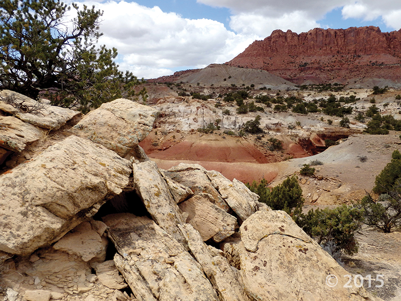
Cathedral Valley Overlook, Capitol Reef National Park, Wayne County, Utah
Photographer: Gregg Beukelman; © 2015
Light-brown sandstone of the Jurassic-age Curtis Formation caps the underlying reddish siltstone of the Entrada Formation in Cathedral Valley. In places, only boulders remain of the resistant cap rock as the Curtis Formation slowly weathers away.