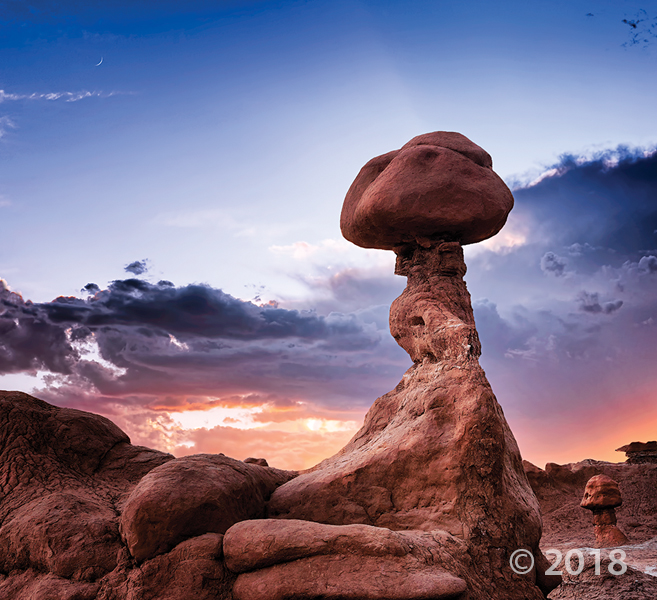
Goblin Valley State Park, Emery County
Photographer: Gregg Beukelman © 2018
Weathering and erosion of the Jurassic-age Entrada Sandstone forms a fantastic array of stone structures locally referred to as “goblins.”
Goblin Valley State Park, Emery County
Photographer: Gregg Beukelman © 2018
Weathering and erosion of the Jurassic-age Entrada Sandstone forms a fantastic array of stone structures locally referred to as “goblins.”
NEW PUBLICATION
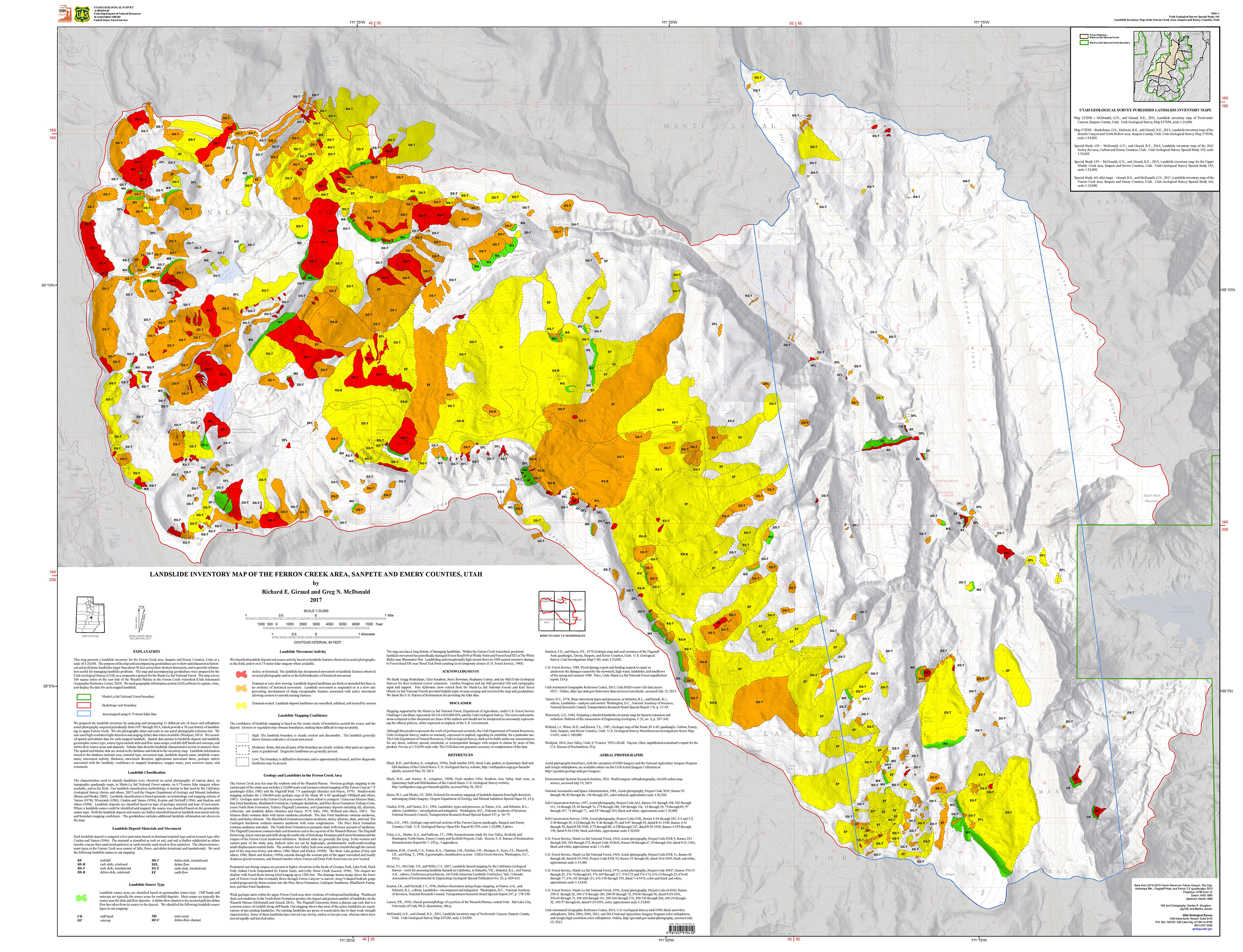
Landslide Inventory Map of the Ferron Creek area, Sanpete and Emery Counties, Utah
By: Richard E. Giraud and Greg N. McDonald
This map presents a landslide inventory for the Ferron Creek area, Sanpete and Emery Counties, Utah, at a scale of 1:24,000. The purposes of the map and accompanying geodatabase are to show and characterize landslides areas and to provide information useful for managing landslide-related issues. Spatial and tabular data for each landslide are stored in the geodatabase and linked to the inventory map. Landslide information in the geodatabase includes: area, material type, movement type, landslide deposit name, landslide source name, movement activity, thickness, movement direction, approximate movement dates, geologic unit associated with landsliding, confidence in mapped boundaries, mapper, peer reviewer, and general comments.
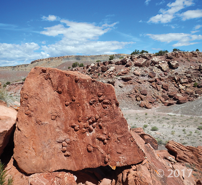
San Rafael Swell, Emery County
Photographer: Don DeBlieux © 2017
Clam trace fossils on a fallen sandstone block of the Brushy Basin Member of the Jurassic-age Morrison Formation.
sltrib.com
Few places on earth offer geology as interesting as that found in Utah. From the Colorado Plateau to the basin and range of the West Desert to the Wasatch Front, the earth on display is almost unmatched in its variety.
Bottleneck Peak, San Rafael Swell, Emery County
Photographer: Nikki Simon © 2016

San Rafael Swell near Muddy Creek, Emery County
Photographer: Scott Madsen © 2016

Colorful, rounded slopes are typical of the Brushy Basin Member of the Jurassic-age Morrison Formation. Clayey bentonite beds in the Morrison often have a distinctive “popcorn” weathering texture resulting from expansion of the clay minerals when they get wet.
sltrib.com
Cleveland-Lloyd Dinosaur Quarry • About 148 million years have passed since dozens of corpses of meat-eating dinosaurs were deposited here, just north of the San Rafael Swell and about 30 miles southeast of Price.
ecprogress.com
The Bureau of Land Management Price Field Office is offering a special opportunity for young scientists and their families to interact with professional paleontologists at work in the Cleveland-Lloyd Dinosaur Quarry.

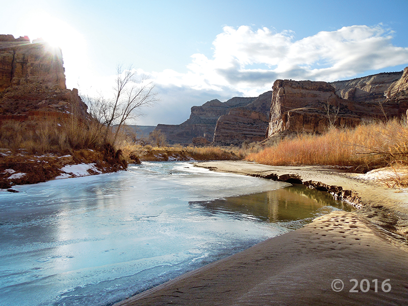
Little Grand Canyon of the San Rafael River, Emery County, Utah
Photographer: Zach Anderson; © 2016
Short days and low winter sun cause ice to form along the San Rafael River where it cuts through the west flank of the San Rafael Swell. The 1,100-foot-deep canyon exposes the Jurassic-Triassic-age Glen Canyon Group along the cliffs and ledges of the canyon walls.

An afternoon escape—

San Rafael Swell, Emery County, Utah
Photographer: Mark Milligan; © 2015
Small cave-like features called tafoni pockmark the walls of a slot canyon in the southern San Rafael Swell, Emery County.
![]()
The Utah Geological Survey (UGS) is a division of the Utah Department of Natural Resources. Several specialized programs comprise the UGS: Data Management, Energy & Minerals, Geologic Hazards, Geologic Information & Outreach, Geologic Mapping, Groundwater & Wetlands, and Paleontology.