
Utah geology views for days.

Sid’s Mountain Wilderness Study Area, San Rafael Swell, Emery County, Utah
Photographer: Adam Hiscock; © 2015
Utah geology views for days.
Sid’s Mountain Wilderness Study Area, San Rafael Swell, Emery County, Utah
Photographer: Adam Hiscock; © 2015


Rochester Panel Rock Art Site, Emery County, Utah
Photographer: Michael Vanden Berg; © 2014
Petroglyphs carved into Ferron Sandstone, Rochester Panel Rock Art Site, Emery County.


San Rafael Swell, Emery County, Utah
Photographer: Taylor Boden; © 2014
Erosion has exposed and sculpted Jurassic-age sedimentary rocks in the southern San Rafael Swell. Near Goblin Valley State Park, towering Wild Horse Butte comprises the Morrison and Summerville Formations (top cliff layers), Curtis Formation (middle slope layer), and Entrada Sandstone (bottom reddish layer).

This photo shows another way that #UtahGeology can really knock you off of your feet. Don’t forget your sea legs as you look out over the vast sea of geology!

San Rafael Swell and Henry Mountains from Temple Mountain, Emery County, Utah
Photographer: Paul Kuehne; © 2014

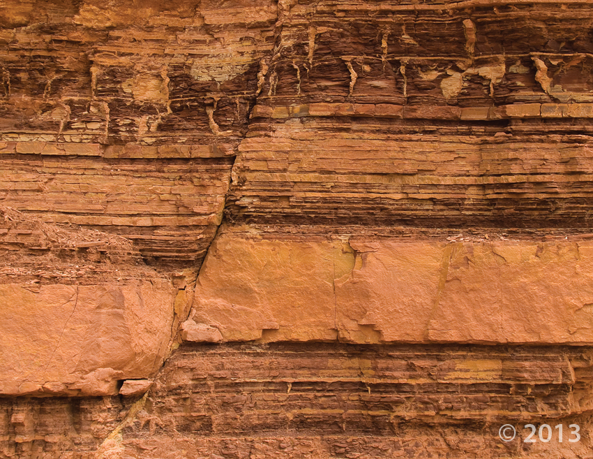
Small fault in the Moenkopi Formation, San Rafael Swell, Emery County, Utah
Photographer: Michael Vanden Berg; © 2013
 San Rafael Swell, Emery County, Utah
Photographer: Robert Ressetar; © 2013
Window Blind Peak rises to an elevation of 7,030 feet in the interior of the San Rafael Swell. The resistant Triassic to Jurassic-age Wingate and Navajo Sandstones form, respectively, the massive lower cliffs and the upper pinnacle.
 San Rafael Swell, Emery County, Utah
Photographer: Robert Ressetar; © 2013
Triassic-age sedimentary rocks in the San Rafael Swell, Emery County.
 Little Wild Horse Canyon, Emery County, Utah
Photographer: Gregg Beukelman; © 2012
Navajo Sandstone in Little Wild Horse Canyon, Emery County.
 San Rafael Swell, Emery County, Utah
Photographer: Stephanie Earls; © 2012
Draw rock art panel, San Rafael Swell, Emery County.
 Goblin Valley State Park, Emery County, Utah
Photographer: Stevie Emerson; © 2012
Sandstone hoodoos at Goblin Valley State Park, Emery County.
![]()
The Utah Geological Survey (UGS) is a division of the Utah Department of Natural Resources. Several specialized programs comprise the UGS: Data Management, Energy & Minerals, Geologic Hazards, Geologic Information & Outreach, Geologic Mapping, Groundwater & Wetlands, and Paleontology.