
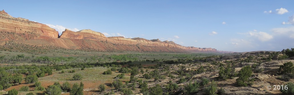
POTD July 12, 2016: Kolob Canyons, Zion National Park, Washington County, Utah.
Photographer: Paul Inkenbrandt; © 2016
POTD July 12, 2016: Kolob Canyons, Zion National Park, Washington County, Utah.
Photographer: Paul Inkenbrandt; © 2016

Wilson Health Springs and the Deep Creek Range, Tooele and Juab Counties
Photographer: Rich Emerson; © 2016

Newfoundland Mountains, Box Elder County, Utah
Photographer: Adam Hiscock
Ordovician-age Eureka Quartzite at the top of Desert Peak contrasting with dark colored shale and carbonate rocks of the southern Newfoundland Mountains.

Comb Ridge, San Juan County, Utah
Photographer: J. Lucy Jordan; © 2016


Gooseberry Mesa, Washington County, Utah
Photographer: J. Lucy Jordan; © 2016
Sunset on Gooseberry Mesa shines golden light on cliffs of Triassic-age Shinarump Conglomerate and the underlying slope-forming Moenkopi Formation. White cliffs and peaks in the distance are thrones and temples of Zion National Park, formed of Jurassic-age Navajo Sandstone.


Alstrom Point, Kane County, Utah
Photographer: Marshall Robinson; © 2016
Lake Powell’s Gunsight Bay as seen from Alstrom Point, Kane County.


Happy Canyon, Garfield County, Utah
Photographer: Gregg Beukelman; © 2016
Just above its confluence with the Dirty Devil River, Happy Canyon deeply and abruptly cuts and sculpts the White Rim Sandstone of the Permian-age Cutler Formation.


Wasatch Range east of Layton, Davis County, Utah
Photographer: Ken Krahulec; © 2016

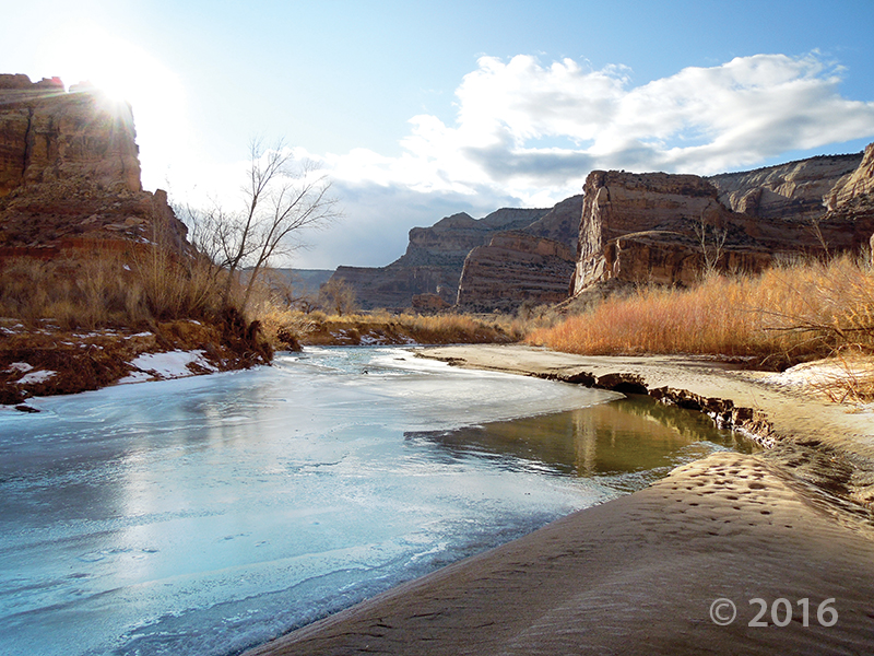
Little Grand Canyon of the San Rafael River, Emery County, Utah
Photographer: Zach Anderson; © 2016
Short days and low winter sun cause ice to form along the San Rafael River where it cuts through the west flank of the San Rafael Swell. The 1,100-foot-deep canyon exposes the Jurassic-Triassic-age Glen Canyon Group along the cliffs and ledges of the canyon walls.


Bells Canyon, Wasatch Range, Salt Lake County, Utah
Photographer: Jim Davis; © 2015
Lower Bells Canyon Reservoir and glacially sculpted Bells Canyon, Wasatch Range, Salt Lake County.
![]()
The Utah Geological Survey (UGS) is a division of the Utah Department of Natural Resources. Several specialized programs comprise the UGS: Data Management, Energy & Minerals, Geologic Hazards, Geologic Information & Outreach, Geologic Mapping, Groundwater & Wetlands, and Paleontology.
1594 West North Temple, Suite 3110
Salt Lake City, Utah 84116
801-537-3300 (phone)
801-537-3400 (fax)
Mailing Address:
PO BOX 146100
Salt Lake City, Utah 84114
Monday through Friday,
8 a.m. to 5 p.m.
![]()