Our latest issue of Survey Notes is here!
Find articles on the salt crust on Great Salt Lake’s north arm, the geothermal project near Milford, Utah and more among our regular featured columns.

Our latest issue of Survey Notes is here!
Find articles on the salt crust on Great Salt Lake’s north arm, the geothermal project near Milford, Utah and more among our regular featured columns.
Geologic map of Dugway Proving Ground and adjacent areas, Tooele County, Utah.
By: Donald L. Clark, Charles G. Oviatt, and David Page
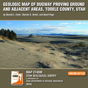
Dugway Proving Ground is an expansive military installation that covers parts of the southern Great Salt Lake Desert and Government Creek Basin, and the southern Cedar Mountains, Wildcat Mountain, Granite Peak, and northern Dugway Range. The ranges contain Paleozoic marine sedimentary rocks about 28,000 feet (8540 m) thick, excepting Granite Peak- a Late Jurassic granitic intrusion. The southern Cedar Mountains volcanic field contains Eocene intermediate to silicic rocks, while the rhyolitic Sapphire Mountain lava flow is Miocene. Paleozoic rock packages are distributed among at least three thrusts sheets of the Sevier fold-thrust belt (Cretaceous to Eocene). Regional extension since about 20 million years ago has broken the area into basins and ranges along high-angle normal faults. Quaternary surficial deposits originated from the Bonneville lake cycle, and alluvial, eolian, and mixed environments. A unique feature is the Old River Bed and associated delta complex at its northern terminus, related to surface- water overflow and goundwater discharge from the Sevier basin to the Great Salt Lake basin between about 15,000 and 10,000 years ago. The delta was occupied by prehistoric humans.

By: James C. Coogan and Jon K. King
The Ogden 30’x60′ quadrangle covers the populous Wasatch Front near Ogden, Utah, and the adjacent Wasatch Range, and extends eastward into Wyoming near Evanston, Wyoming. It covers parts of the Ogden, Weber, and upper and lower Bear River drainages. The Ogden quadrangle is economically important because of the gas and oil fields on the east margin of the map area, the cement plant near Devils Slide, numerous sand and gravel operations, water resources, and recreational interests.

By: Thomas C. Chidsey, Jr.
This report (241 pages of text, 187 figures, 30 tables, and 21 appendices) presents the shale-gas potential of the Mississippian-Pennsylvanian Manning Canyon Shale/Doughnut Formation and the Pennsylvanian Paradox Formation (Chimney Rock, Gothic, and Hovenweep shales) of central and southeastern Utah, respectively. Shale beds within these formations are widespread, thick, buried deep enough to generate dry gas (or oil in some areas of the Paradox Basin), and sufficiently rich in organic material and fractures to hold significant recoverable gas reserves. This study provides a detailed evaluation of these potential shale-gas reservoirs including (1) drilling history, (2) identification and mapping/ correlating the major shale intervals, (3) characterization of the geologic, petrographic, geochemical, and petrophysical rock properties of those reservoirs from cores, (4) burial histories and organic maturation models, and (5) descriptions of outcrop analogs. Collectively, this study delineates the areas with the greatest gas potential (“sweet spots”) and offers recommendations for the best completion practices to develop these targeted shale-gas reservoirs.


By:Hellmut H. Doelling and Paul A. Kuehne
The Steves Mountain quadrangle in central Utah spans the southernmost Wasatch Plateau and northernmost Fish Lake Plateau and is crossed by Interstate 70. Late Cretaceous to late Eocene strata are folded westward on the west flank of the Wasatch monocline, and are cut by generally north-tranding horsts and grabens, including the Water Hollow fault zone in the eastern part of the quadrangle. Large landslides and slope creep are common on several incompetent units.


By: Paul A. Kuehne and Hellmut H. Doelling
The Gooseberry Creek quadrangle in central Utah covers the northwestern end of the Fish Lake Plateau. The Gooseberry Road, a popular scenic link between Interstate 70 and the Fish Lake Recreation Area, traverses the quadrangle; climbing to over 10,000 feet in elevation, it is one of the highest paved highways in the state. Late Cretaceous to late Eocene strata dip gently westward, are cut by several steep normal faults, and are folded into the west-facing Wasatch monocline near the west side of the quadrangle. Oligocene volcanic rocks of the Marysvale volcanic field extend into the southern part of the quadrangle. Rock glaciers, large landslides, colluvium, and alluvium are common.


By:Tracey J. Felger, David M. Miller, Victoria E. Langenheim, and Robert J. Fleck
The Kelton Pass SE and Monument Peak SW 7.5′ quadrangles (NW Utah) are located entirely within southern Curlew Valley, which drains south into Great Salt Lake, and extends north into Idaho. Bedrock exposures form the Wildcat Hills and two small shield volcanoes. Exposed rocks and deposits are Permian to Holocene in age and include sandstone of the Permian Oquirrh Formation, tuffaceous sedimentary rocks of the Miocene Salt Lake Formation, Pliocene basaltic and dacitic lava flows, Pleistocene rhyolite and basalt, and Pleistocene and Holocene surficial deposits of alluvial, lacustrine, and eolian origin. Structures related to the Miocene Raft River detachment fault and Basin and Range extension also are present. New geophysical data and interpretations and new geochronology data for volcanic units improved insight into the tectonic and volcanic evolution of the area.


Geologic Map of The Donkey Flat Quadrangle, Uintah County, Utah
By: Paul H. Jensen, Douglas A. Sprinkel, Bart J. Kowallis, and Kent D. Brown
The Donkey Flat quadrangle is less than 10 miles north-northeast of Vernal, Utah, along the south flank of the Uinta Mountains in Uintah County. It includes Red Fleet State Park and is crossed by U.S. Highway 191 (a National Scenic Byway). The geology is well exposed and uncomplicated, making a dramatic landscape with thick sandstone cliffs and varicolored to drab gray slopes. The quadrangle’s namesake, Donkey Flat, is a one of several geomorphic surfaces mantled by piedmont gravel deposits.


By: Gregg S. Beukelman, Ben A. Erickson, and Richard E. Giraud
This map represents a landslide inventory of part of the Sixmile Canyon and North Hollow area, Sanpete County, Utah, at a scale of 1:24,000. The map covers 42 square miles on the west side of the Wasatch Plateau and includes parts of the Sixmile Creek and North Hollow-Twelvemile Creek Hydrologic Units. The map and accompanying geodatabase show and characterize landslides and provide information useful for managing landslide-related issues. Spatial and tabular data for each landslide are stored in the geodatabase and linked to the inventory map. Landslide information in the geodatabase includes: area, material type, movement type, landslide deposit name, landslide source name, movement activity, thickness, movement direction, approximate movement, dates, geologic unit(s) associated with landsliding, confidence in mapped boundaries, mapper, peer reviewer, and general comments. This CD contains geographic information system (GIS) files in ESRI file geodatabase and shapefile formats. Specialized GIS software is required to use the GIS files.


Edited By: William R. Lund
This publication presents four investigations that provide new geologic and paleoseismic data on the Washington fault zone in southwestern Utah and northwestern Arizona. (1) New 1:24,000-scale geologic mapping shows the location and length of young surface ruptures and the relative ages of displaced surficial deposits along the fault zone. Based on the mapping, the former Northern section of the fault zone has been subdivided into the Fort Pearce and Washington Hollow sections. (2) A paleoseismic trenching investigation of a scarp on a latest Quaternary alluvial fan in Arizona that provides information on paleoearthquake timing, displacement, and recurrence for the Fort Pearce section, which traverses the St. George metropolitan area. (3) Trace element and major oxide geochemical correlation and radiometric dating of volcanic flows displaced across the fault that provide early to middle Quaternary vertical slip-rates for the Fort Pearce and Sullivan Draw sections of the fault.. (4) A geotechnical investigation that provides information on fault locations, paleoearthquakes, and displacement no the Fort Pearce section. These investigations show the Fort Pearce section of the Washington fault zone has experienced at least two surface-faulting earthquakes in the Holocene and a minimum of five earthquakes in the past ~68 ka.
![]()
The Utah Geological Survey (UGS) is a division of the Utah Department of Natural Resources. Several specialized programs comprise the UGS: Data Management, Energy & Minerals, Geologic Hazards, Geologic Information & Outreach, Geologic Mapping, Groundwater & Wetlands, and Paleontology.